


Mauna Kea, elevation 13,804' is the tallest mountain of Hawaii and all of Polynesia. It's significance as a mountain is unparalleled in the US, save for Denali. My interest in hiking Mauna Kea in the winter was obvious- it would be my 46th state high point (my 45th was Iowa) and seasonal travel prices are lower. However, getting information on the internet about the hike was highly irritating and full of unnecessary backgrounds, fluff and ads. So, I wrote this post to give any other highpointers or hikers a distilled, frill-free take on climbing Mauna Kea.
This post is for experienced hikers and peakbaggers who are comfortable getting to hard-to-reach places and know all the basics of wilderness travel. You can find plenty of other posts on the internet about pricy tours and guides who will get you to the top. This is strictly about hiking.
Getting to Mauna Kea
Getting to Mauna Kea can be easy or hard, depending on your budget and travel flexibility. I flew to Kona International Airport on the leeward (western) side of the island and stayed in nearby Kona. Some people fly in to Hilo and it doesn't make much of a difference from an access standpoint. You must rent a car- there's no public transportation or taxi service to the trailhead. Driving from Kona to the trailhead involves some sinuous mountain roads but nothing too scary. Saddle Road, which connects Hilo to Kona, is basically an interstate highway. Its neither challenging nor scary.
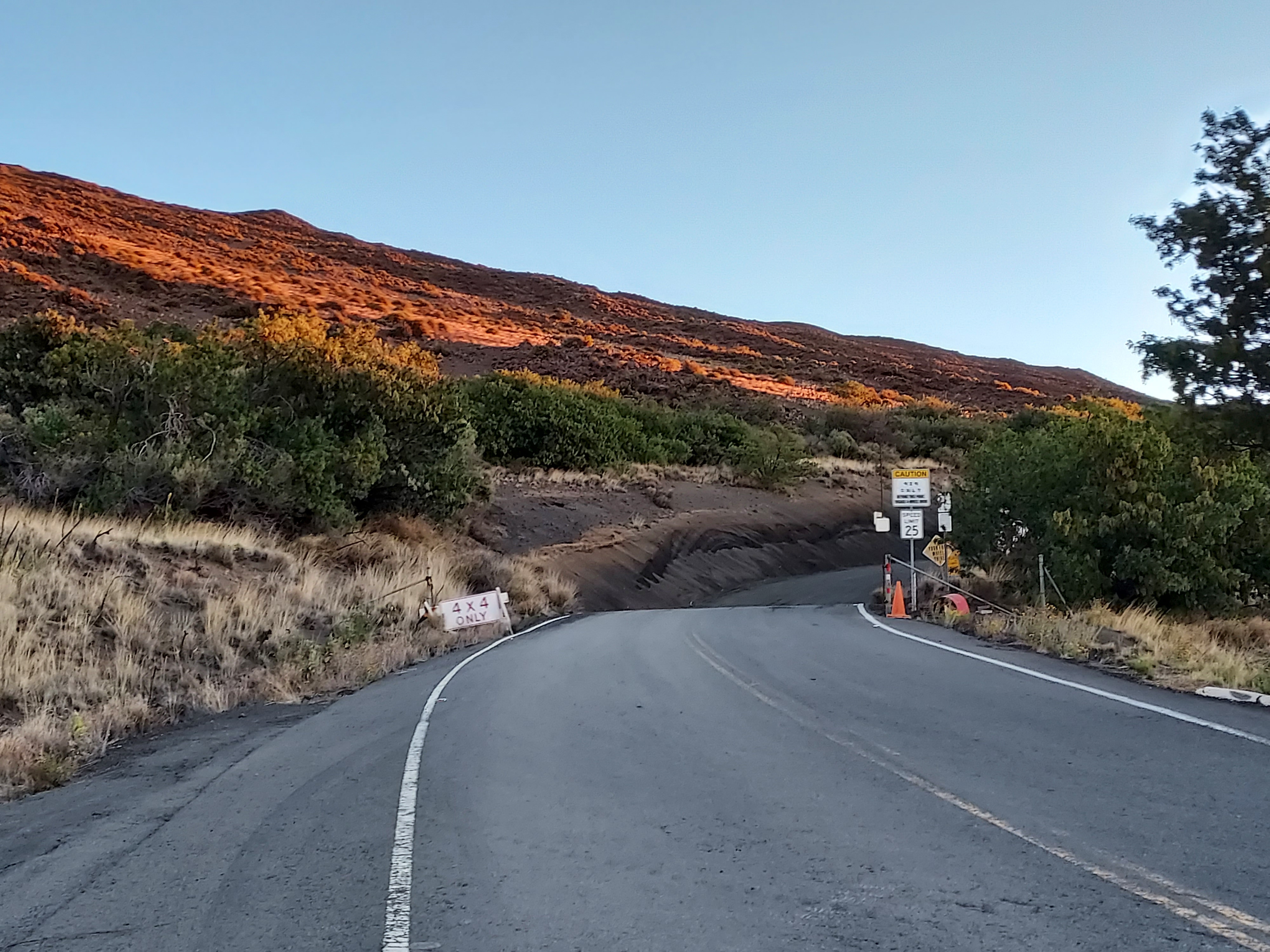
Mauna Kea Access Road is nearly halfway between Hilo and Kona. Its easy to miss if you're not looking for it. To get to the trailhead, drive 6.2 miles up the road to the Mauna Kea Information Center. Its steep but paved the entire way. There's plenty of parking. There are also porta-pottys and water. Rangers staff the station and guard the road between at least 4AM and sunset, if not longer. You must check in with the rangers prior to hiking.
Some words about access, trail closures and rangers.
Peakbaggers and experienced hikers will find Mauna Kea highly unique and very tightly monitored. Both the summit and mountain as a whole have extraordinary religious and cultural significance to Native Hawaiians which requires far more tact and discretion than your usual highpoint. The Mauna Kea hike is far more intensely controlled than similar highpoints or destination hikes such as Half Dome, Mount Whitney or Mount Rainier. Read the room while you're up there.
The presence of rangers on Mauna Kea is notably more pronounced than on any other hike I've experienced. When I began my ascent at 6 am, I was greeted by no fewer than a half dozen rangers near the visitor center. They had cordoned off the summit road (accessible by vehicles) and were meticulously checking in every traveler. Although they were friendly, helpful, and extremely knowledgeable, they maintained a firm stance on specific regulations protecting the area.
Before you can start the hike, there's a mandatory 30-minute waiting period. During this time, you're required to complete a register detailing your planned activities. This register must then be presented to the rangers, who will brief you on all applicable rules and regulations. It appeared to me that this process also serves as an opportunity for the rangers to assess preparedness, and they do not hesitate to strongly discourage those who seem unready from proceeding.
The trail itself is free and public. One of the very kind rangers told me the trail doesn't ever *technically* close unless they are actively involved in invasive animal control (I don't know the frequency). But the trail is open even during Kona Lows and snowstorms. I don't advise going up in those conditions and you will almost certainly be sternly and vehemently advised against travel when conditions are extremely stormy or windy.
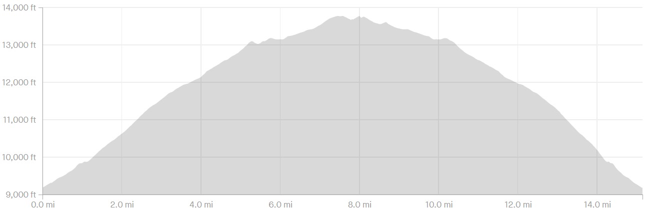
The distance of the hike varies. The way I did it was 15 miles which included hiking up and down the trail, visiting Lake Waiau and poking around the summit road. A straight out-and-back hike of only the summit is closer to 13 miles.
Here's my map-
Weather, Seasons ect.
Weather on the trail and summit is unpredictable. The Center for Mauna Kea Stewardship publishes detailed and accurate weather forecasts on a daily basis. As the drive and hike both ascend through multiple completely different biomes, weather on the summit can be much worse (or better) than weather at lower altitudes. Mauna Kea is actually the driest place in Hawaii though also the windiest. Its not advised to hike when the windspeed is greater than 50mph.
Seasons are unpredictable on Mauna Kea as well. I traveled in the winter which is a little higher risk- there's more wind and it snows every year. I scheduled a 3-day window to ensure I could get a summit day in. Kona Lows are a real hazard of long-term planning a Mauna Kea in the winter. They are major, tropical storm-like features that range in occurrence. Sometimes they happen multiple times per year, other times they go entire winters without them. If you come during a Kona Low- just forget about any hike of Mauna Kea. It'd be like hiking Mt Rainer or Mt Whitney in an atmospheric river.
There's absolutely no shade on this hike. When its sunny, you're practically hiking in a cold desert - not unlike hiking in Joshua Tree or Eastern Oregon in the winter.
Trip Report and Field Notes on Hiking Mauna Kea in the Winter
I didn't get the earliest start but I was on the trail by 630am. At the beginning, the trail is somewhat lush, by high altitude standards. Shrubby plants and trees covered the landscape and the trail was fairly clear. The first 1-2 miles were quite steep, however. There's absolutely no way of acclimating the same way you would for Colorado summits, hence you just deal with the challenges of altitude as you go.
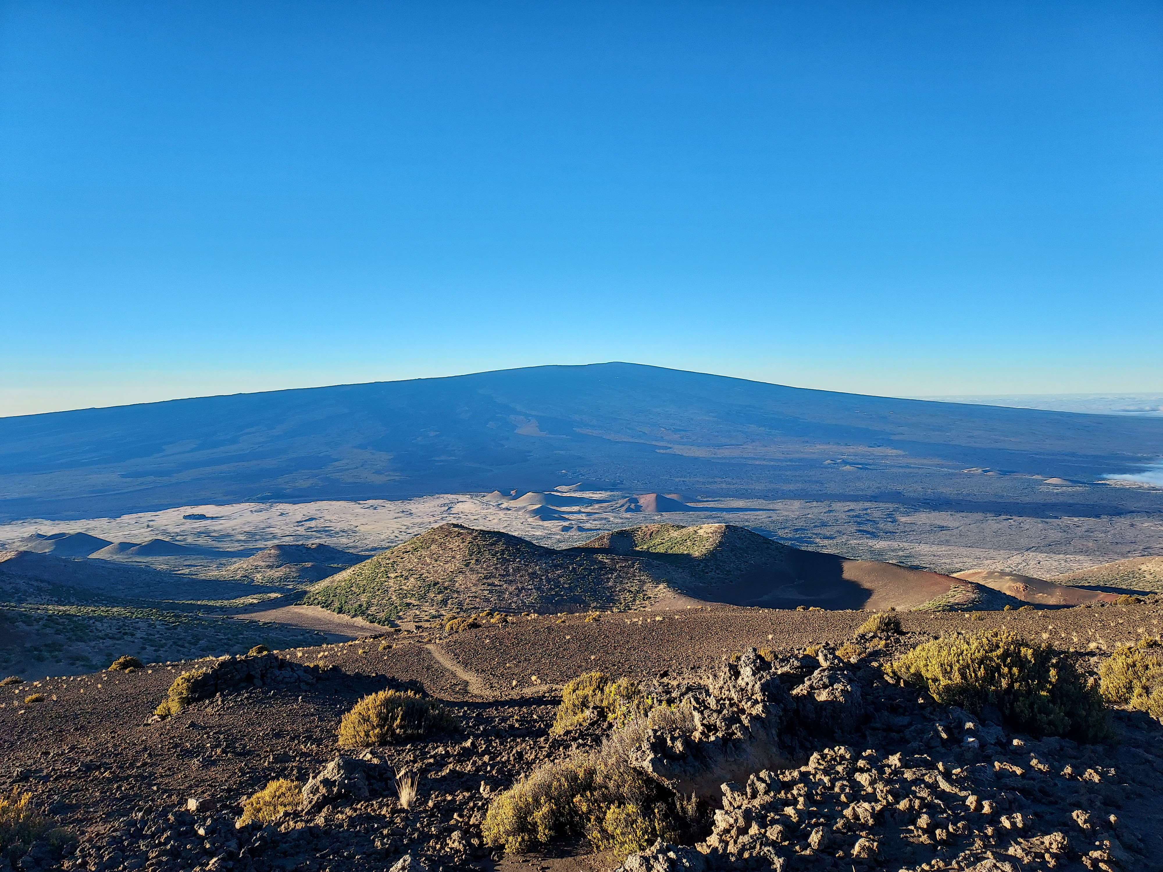
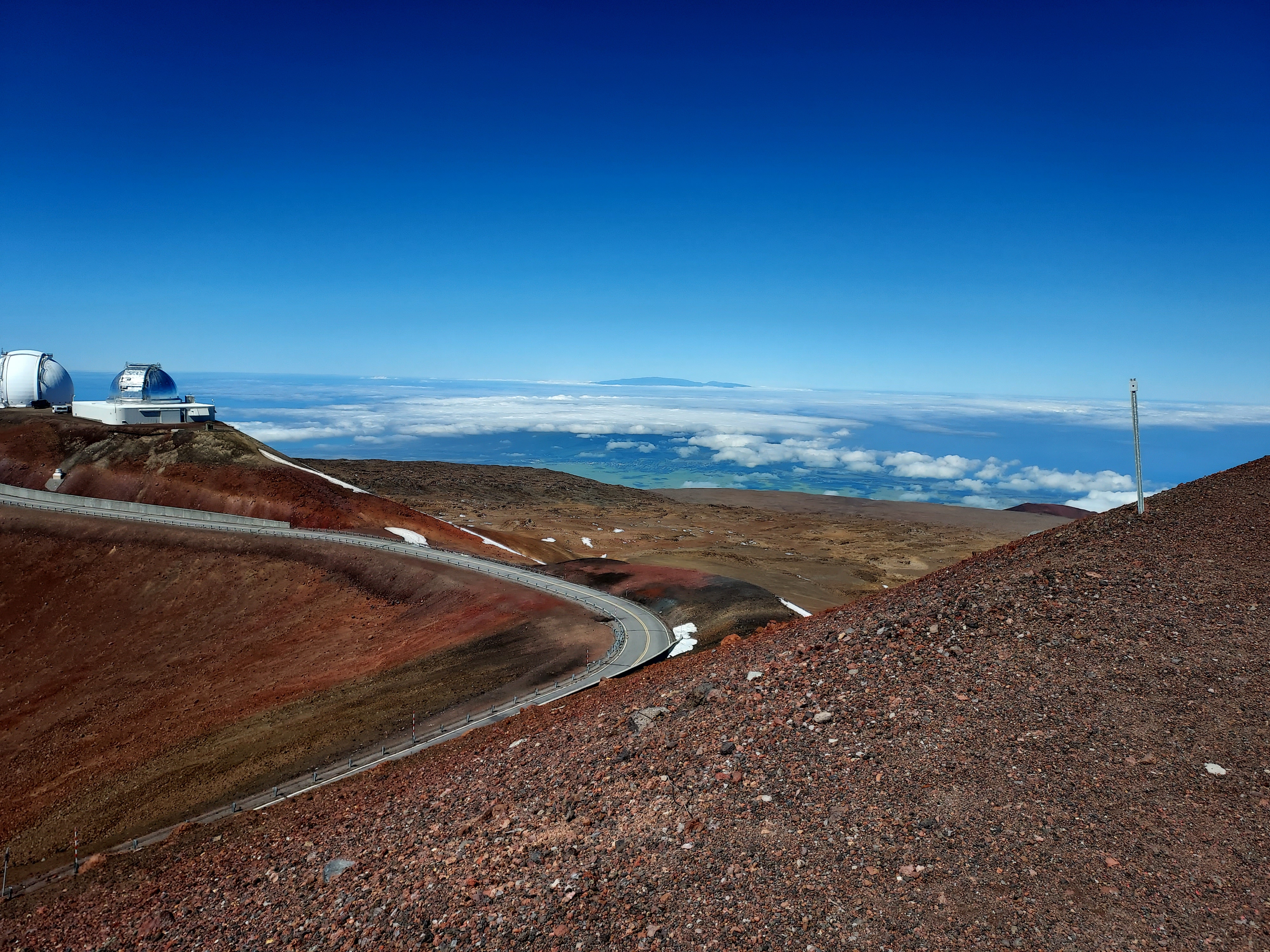
Past about 1.3 miles or 10,000', the landscape is completely devoid of visible life. Its a moonscape. Though the flora and fauna are not the main draws of the hike, views are extraordinary. Mauna Loa's incomprehensibly colossal summit looms to the south. Hualālai, the third tallest summit on the island, rose prominently over the undercast to the west.
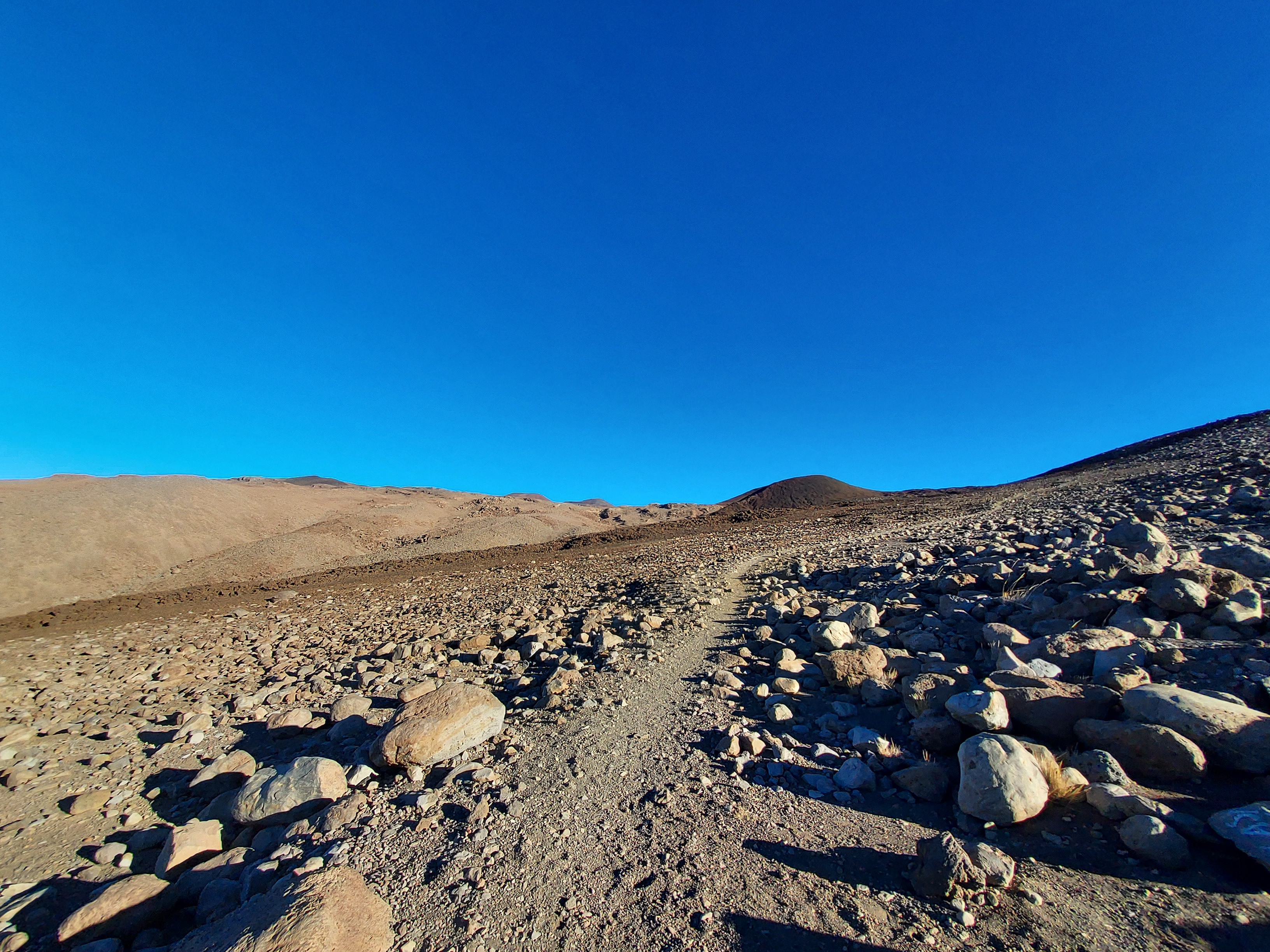
Over the next 2-4 miles between just above the treeline and Lake Waiau, the trail is less steep. Over the rocky landscape, the trail is more ambiguous. Small steep poles are driven into the ground to keep you on track. If it were foggy or cloudy, the trail could be impossible to follow without a map/compass and GPS. I could see inexperienced hikers becoming easily lost.
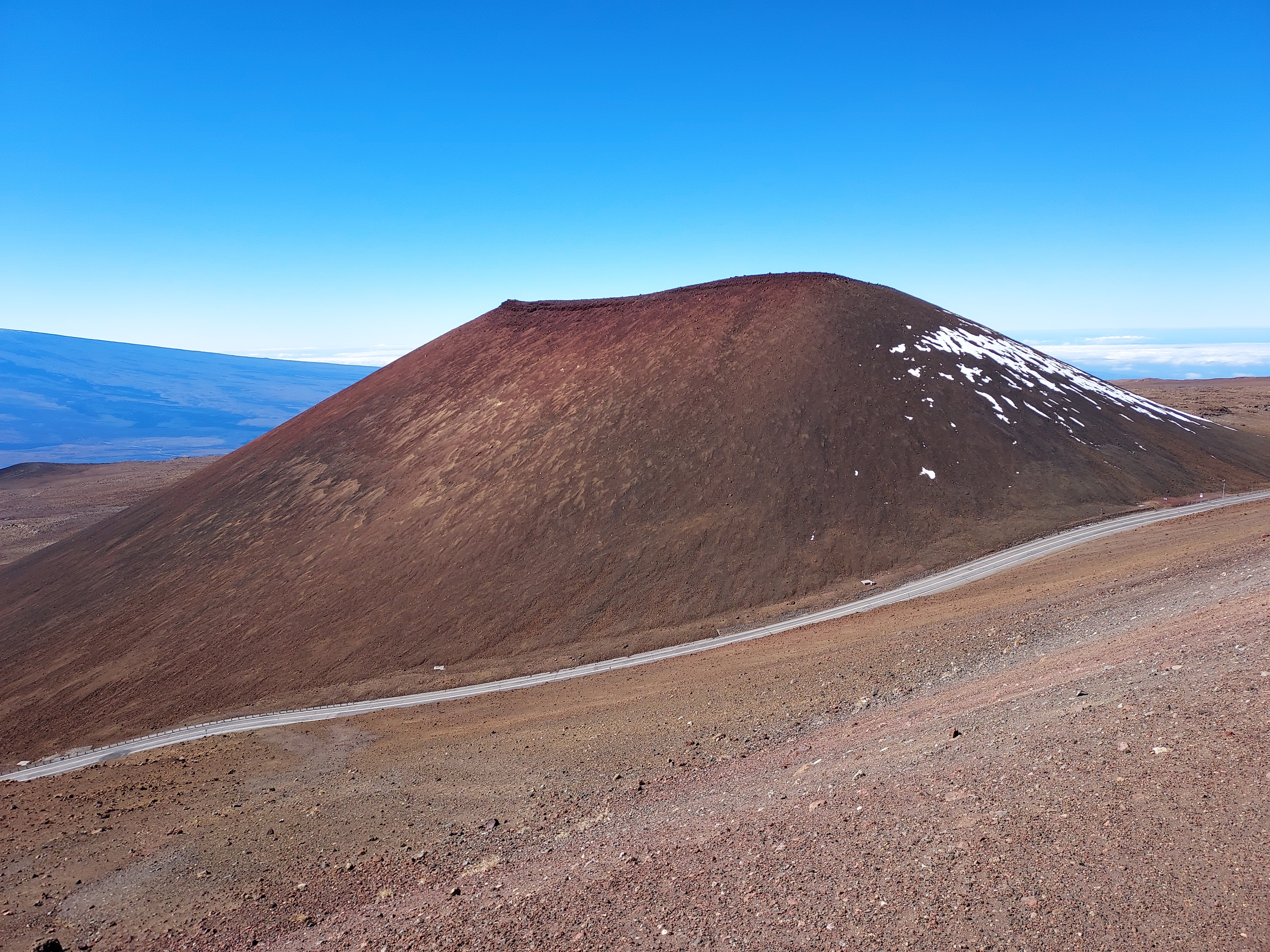
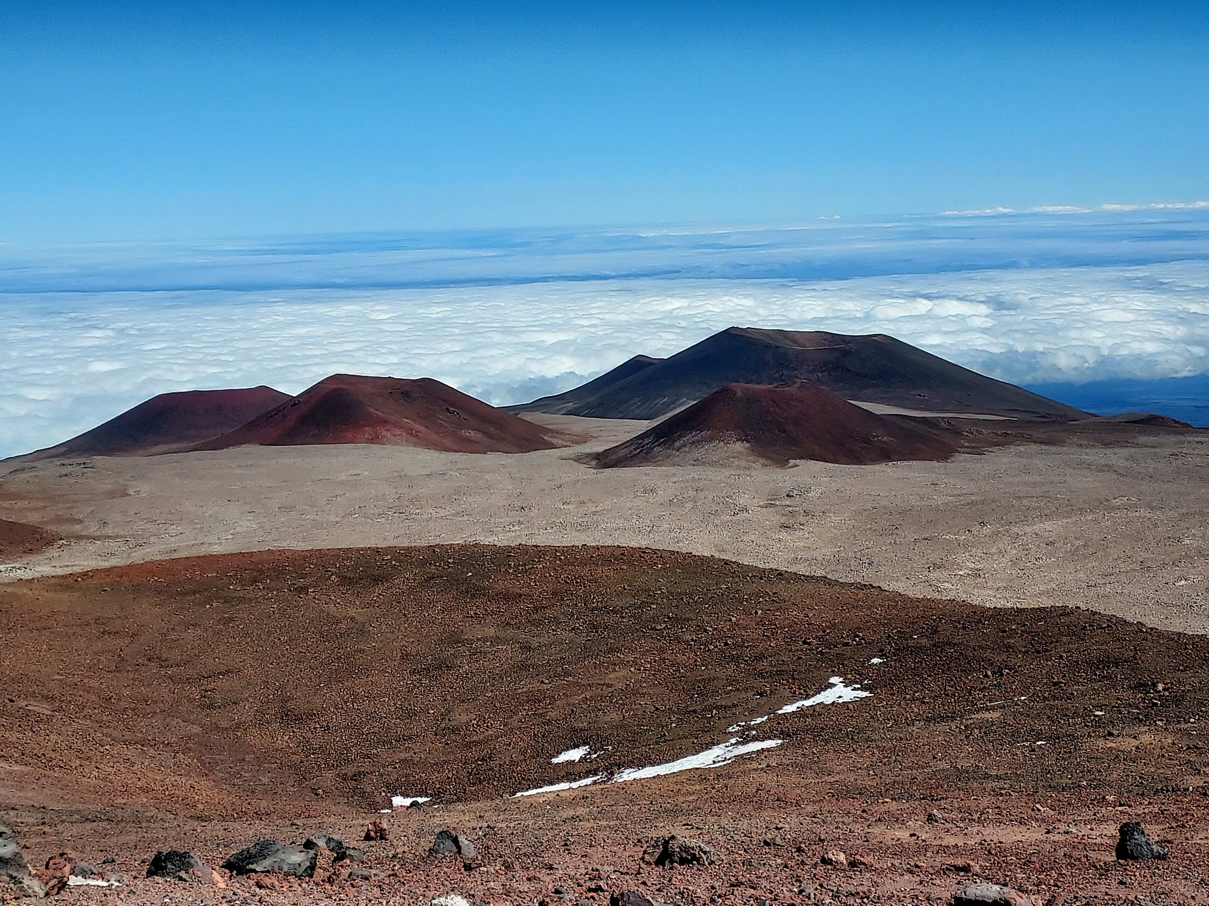
At about 5.2 miles from the trailhead and an altitude of 13,000', there's a well marked turnoff for Lake Waiau. This is the highest lake in Hawaii and one of the highest lakes in the entire US (Pacific Tarn in Colorado is higher). The lake, like Mauna Kea, is sacred to Native Hawaiians and going in the lake is strictly prohibited. I enjoyed the 1/2 mile side trip to a nearby vantage point. Its worth the extra effort.

After the lake, the trail continues on another 0.8 miles through a relatively flatter section before joining the summit road. Going right took me the most direct way to the summit. It was steep and there's not much in the way of a pedway on the road. I kept my eyes peeled.
Mauna Kea's Summit and Considerations
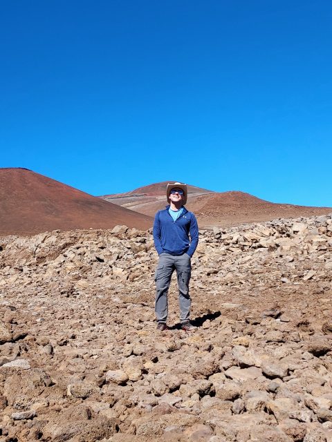
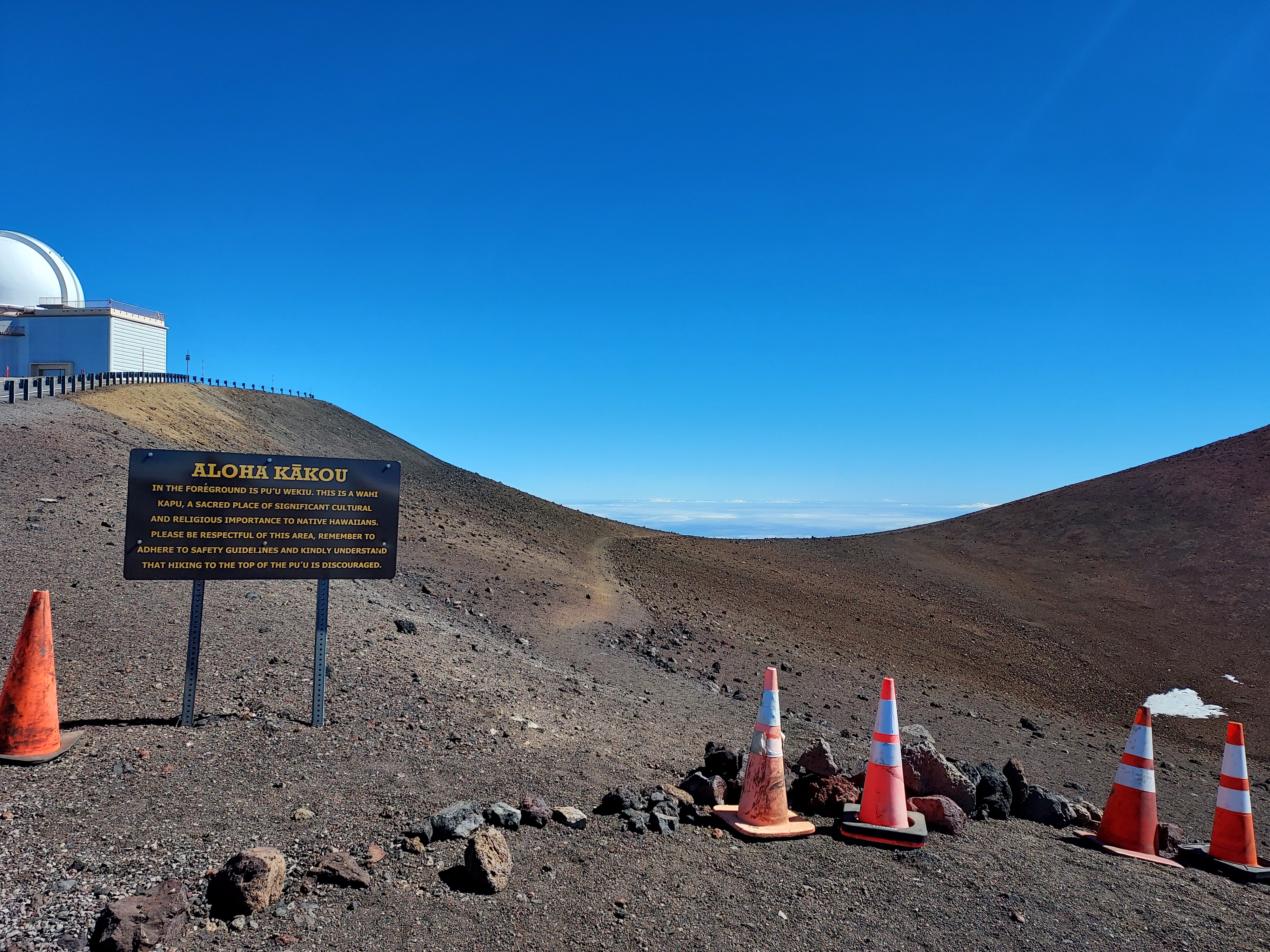
Many peakbaggers want to stand on the true highpoint of a summit. This is not advised on Mauna Kea for several reasons. The highest permissible point is a mere 10-12' lower than the high point. The highpoint itself is very actively monitored and summiting is strongly prohibited out of respect to Native Hawaiians. As much as I'd love to stand on the high point, I felt content standing on the most permissible, slightly lower high point. I advise you do the same. If anything, this helps keep the mountain unrestricted to hikers and future peakbaggers.
Should peakbaggers consider the mountain successfully summited even if they refrain from trespassing on the highest point of Mauna Kea? I argue in favor. The final stretch to the summit lacks technical challenges that would hinder climbers. Moreover, numerous mountains worldwide have their true summits left undisturbed out of respect for local traditions. The solitary ascent of Machapuchare, a notably sacred and challenging peak in the Himalayas, serves as an iconic example of such reverence.
Descent
Most peakbaggers prefer descending on their own two feet. I simply hiked the trail back to the parking lot. However some hikers chose to hike the road back. This is slightly shorter and easier. Finally, you can almost certainly hitch a ride back down, either with a ranger or other drivers.
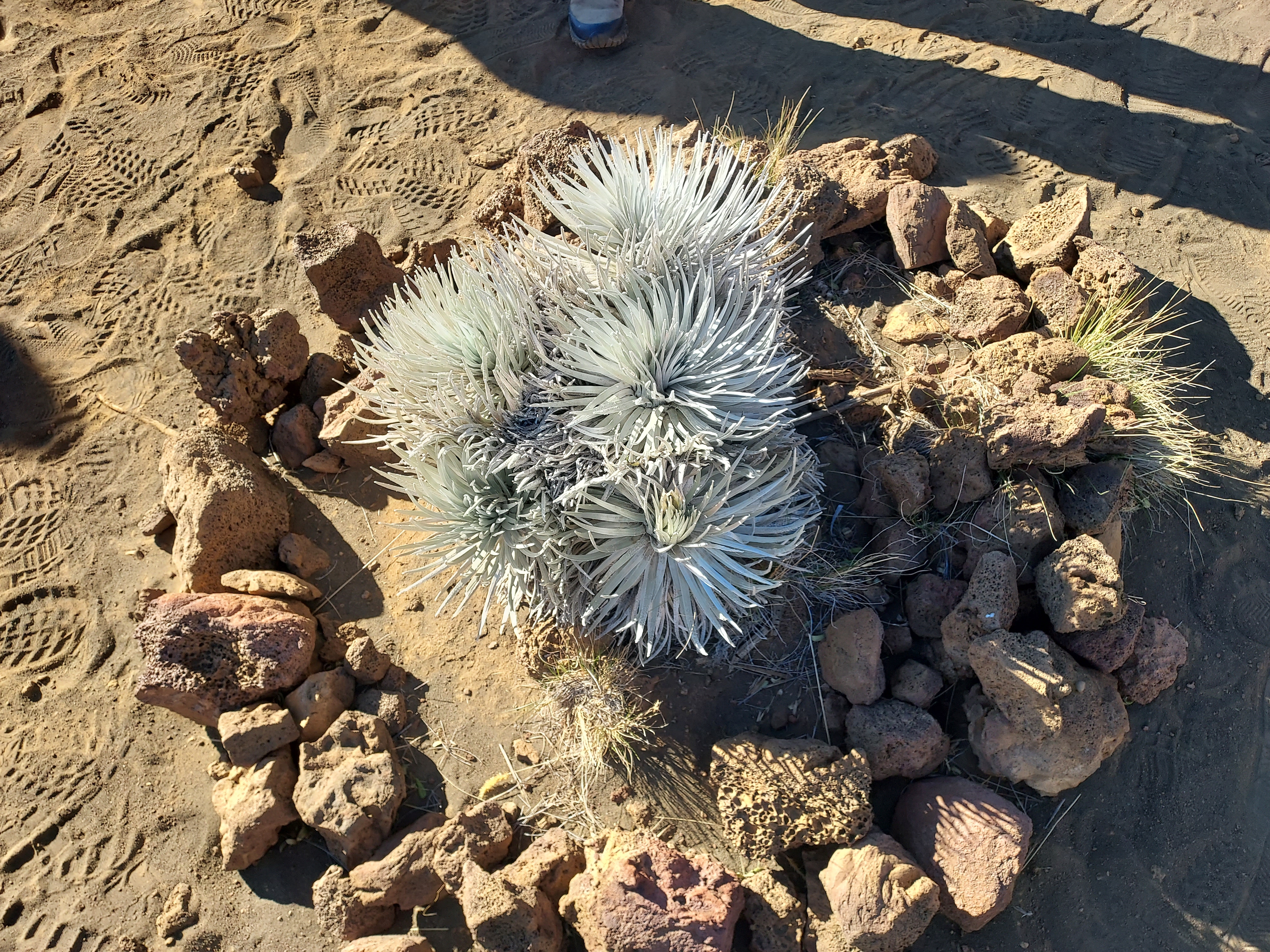
One final thing worth seeing is the Mauna Kea silversword, a highly endangered but unique plant only found on the big island. Two examples can be seen on a short walk from the parking area.
Hope this post was helpful and straightforward for other hikers and peabaggers. Happy trails!

No Comments