


After doing Grays/Torreys combo, the DeCaLiBron and Mt Quandary, I set my sights on the Sawatch Range with a climb of Mt Massive in October. This is the third tallest summit in the contiguous US and the second tallest summit in Colorado at an altitude of 14,429'. It had been a while since I was last in this area. I took a grand roadtrip in 2011 to attend nursing school and along the way I hiked Mt Elbert, the nearby state highpoint. It was surreal returning here after many years, now well along in my career and the path I first started long ago. On that trip I noted the beautiful and imposing summit of Mt Massive and hoped to climb it some day. This trip was my chance.
Mt Massive is well covered on famous sites such as 14ers.com and Summitpost. The intention here is to cover my trip report and field notes, especially for a late season, pre-winter hike.
Getting to the Trailhead and Route Selection
Much of my decision making on this trip was driven by ease of access to the trailhead. While I wished for a climb of Mt Harvard, the road to get there is very rough and I didn't want to chance a rental car on that road. Mt Massive has a very good access road that any vehicle can make. The description from 14ers.com is perfect. The road starts paved then becomes very good dirt. Note past the trailhead, the road becomes a classic hard 4x4 road to North Halfmoon Creek trailhead.
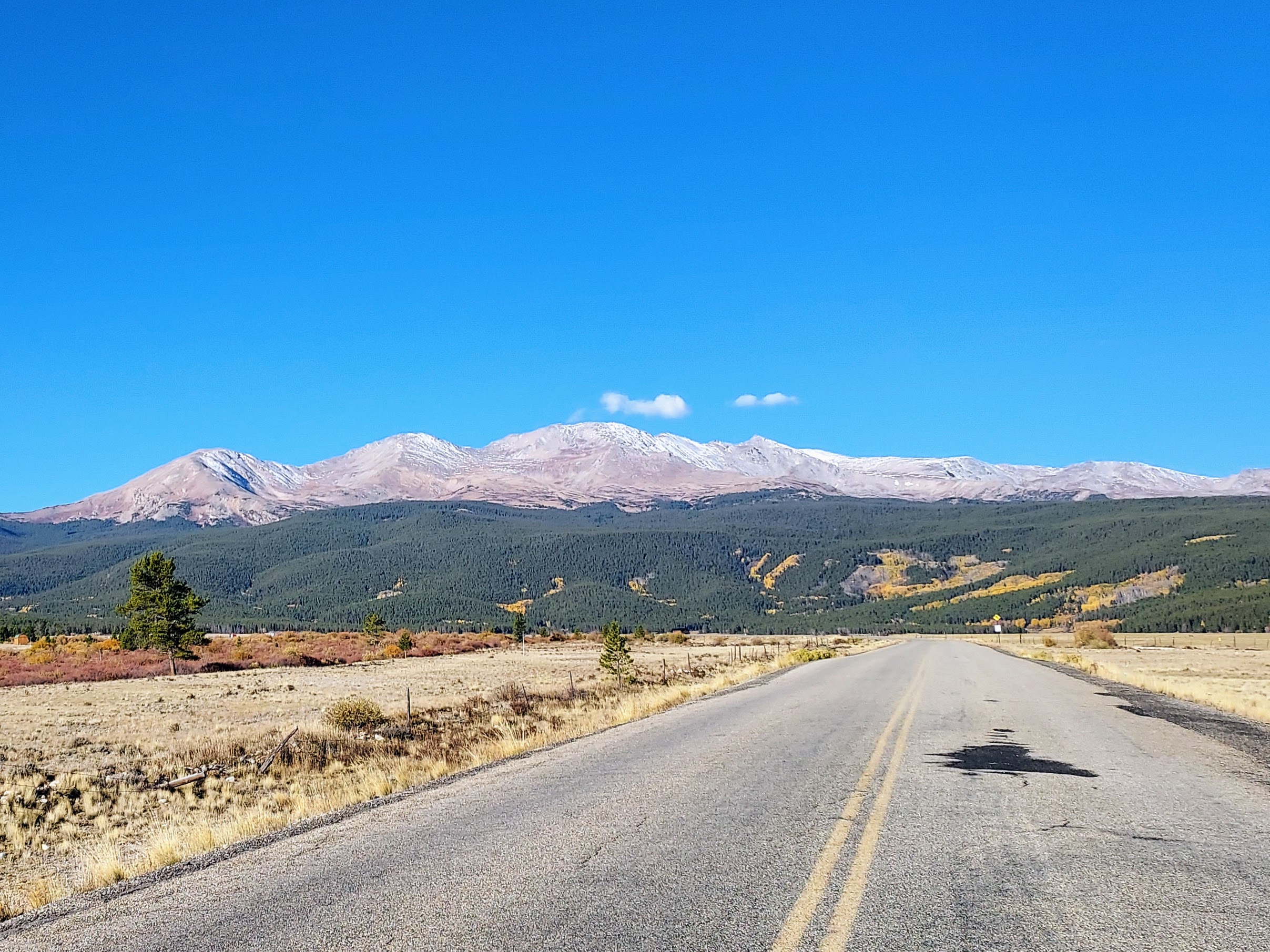
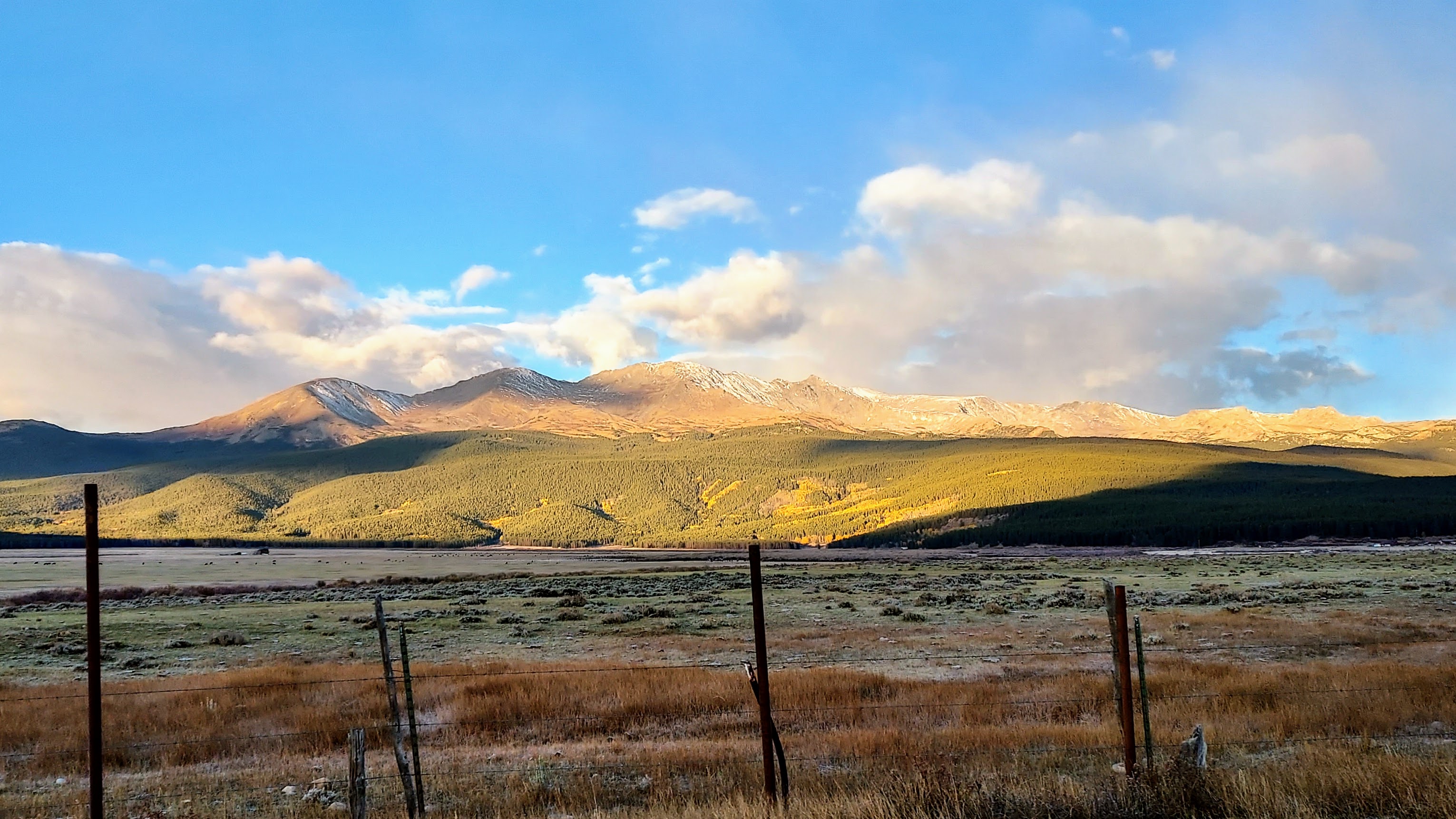
Halfmoon Road goes from just south of Leadville in the Upper Arkansas River Valley straight through the narrow gorge separating Mt Massive and Mt Elbert. The road was in fantastic shape in October 2023. Concievably any vehicle could make it to the trailhead here. Along the way there are dozens if not 50+ primitive camping sites. There's a few established campgrounds as well. The area is utterly delightful. At this time of year, there was hardly a soul back there either.
I settled on the Eastern Slopes route as it seemed the best for distance and altitude. Midway through I decided on a loop including the considerably steeper but more picturesque Southwest Slopes route then walked the 4-wheel drive road back to the car. Here's my route-
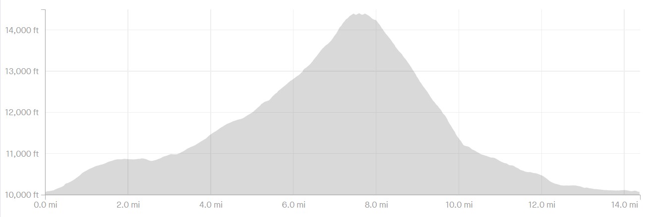
In terms of stats-
- Distance: 14.4 miles
- Altitude Gain: 4,500'
- Starting altitude: 10,077'
- Difficulty: Class I for 95%, short bursts of Class II on the upper reaches
- Time: 8.5 hours total
- Route Finding Difficulty: Easy
Here's the altitude and distance according to Strava:
Mt Massive in October Trip Report
Trailhead to Treeline
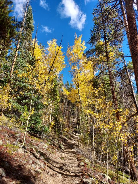
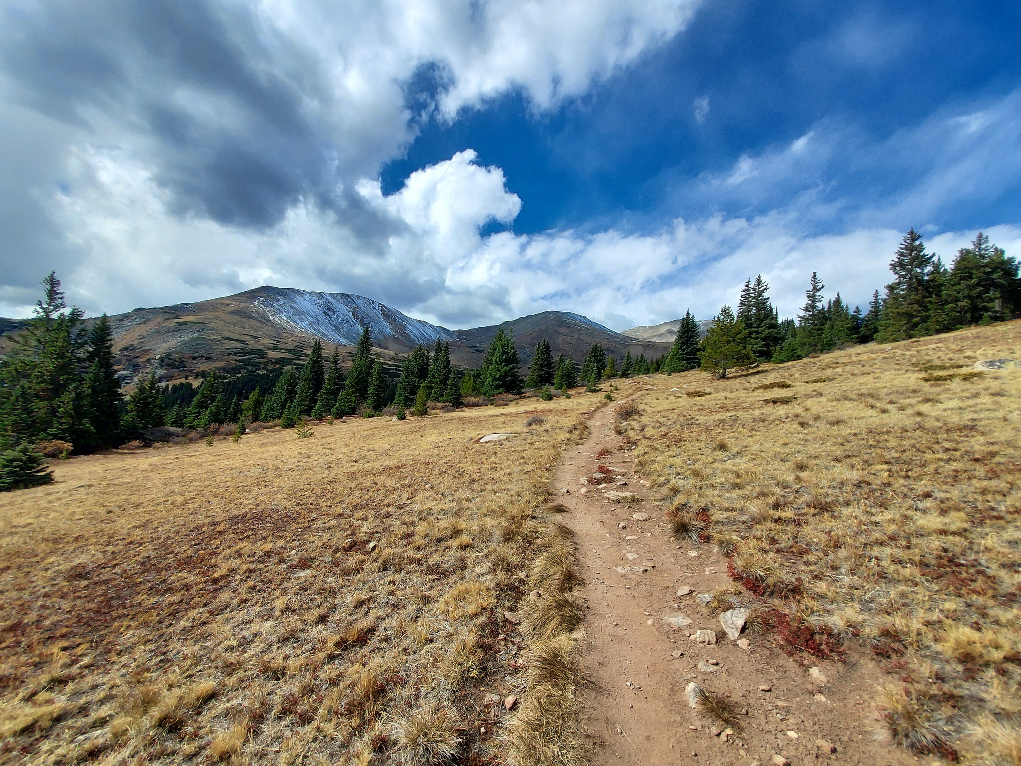
Starting from the Mt Massive trailhead parking lot, I took the Colorado Trail for 3.3 miles through the woods. This section was pleasant and easy. The trail is entirely shaded and the aspens were in peak foliage. There were occasional views of the Upper Arkansas River Valley but it was mostly closed-in forest. I gained 1,000' in the first section. At 3.3 miles, I took an obviously marked left turn for the proper Mt Massive Trail.
From there, the trail became decidedly steeper and more exposed to the elements. At approximately 4.3 miles and 11,700' I rose above treeline and Mount Massive's massif was visible. I still had a long way to go.
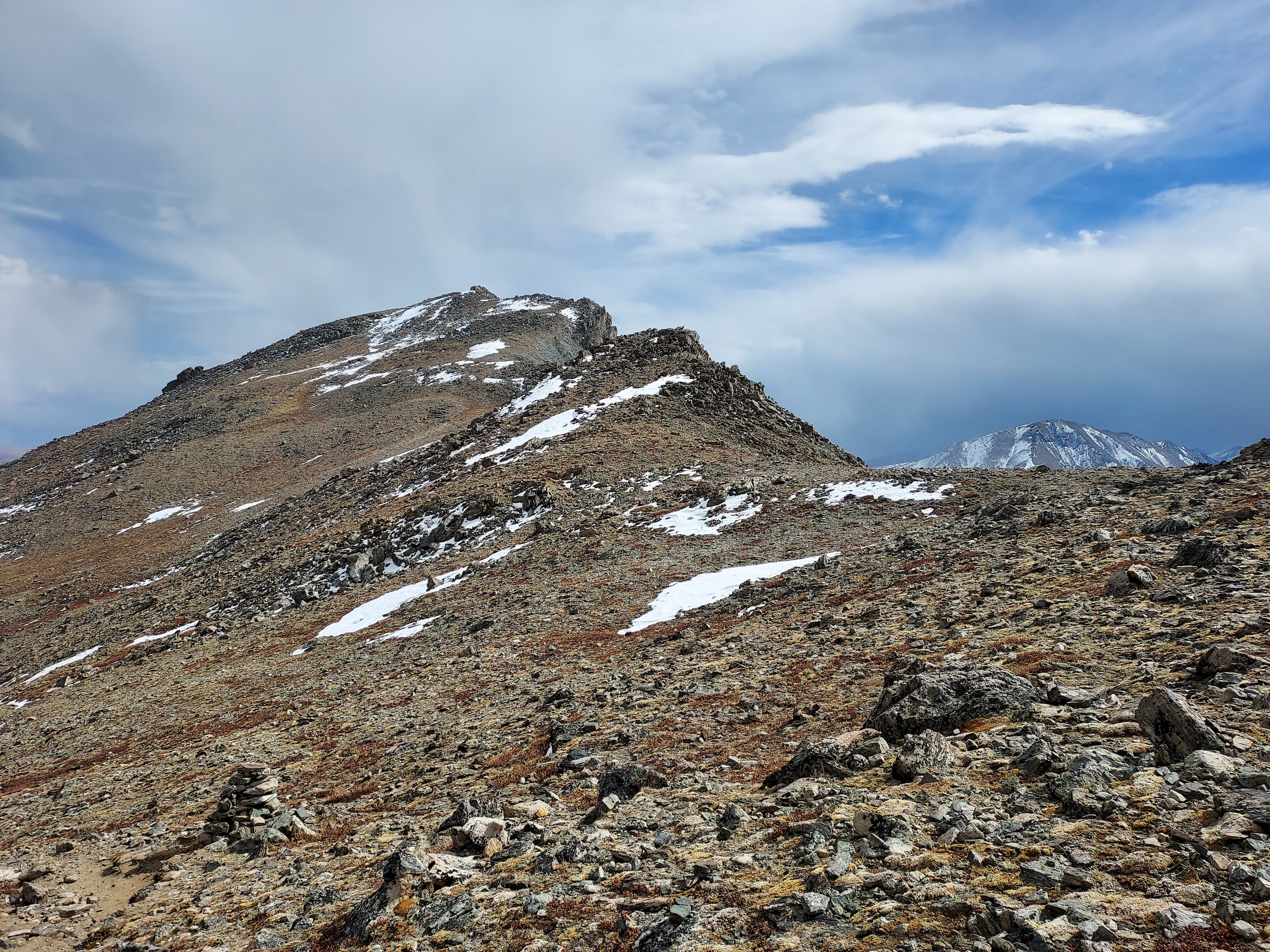
Treeline to Summit: Pikas and Ptarmigans
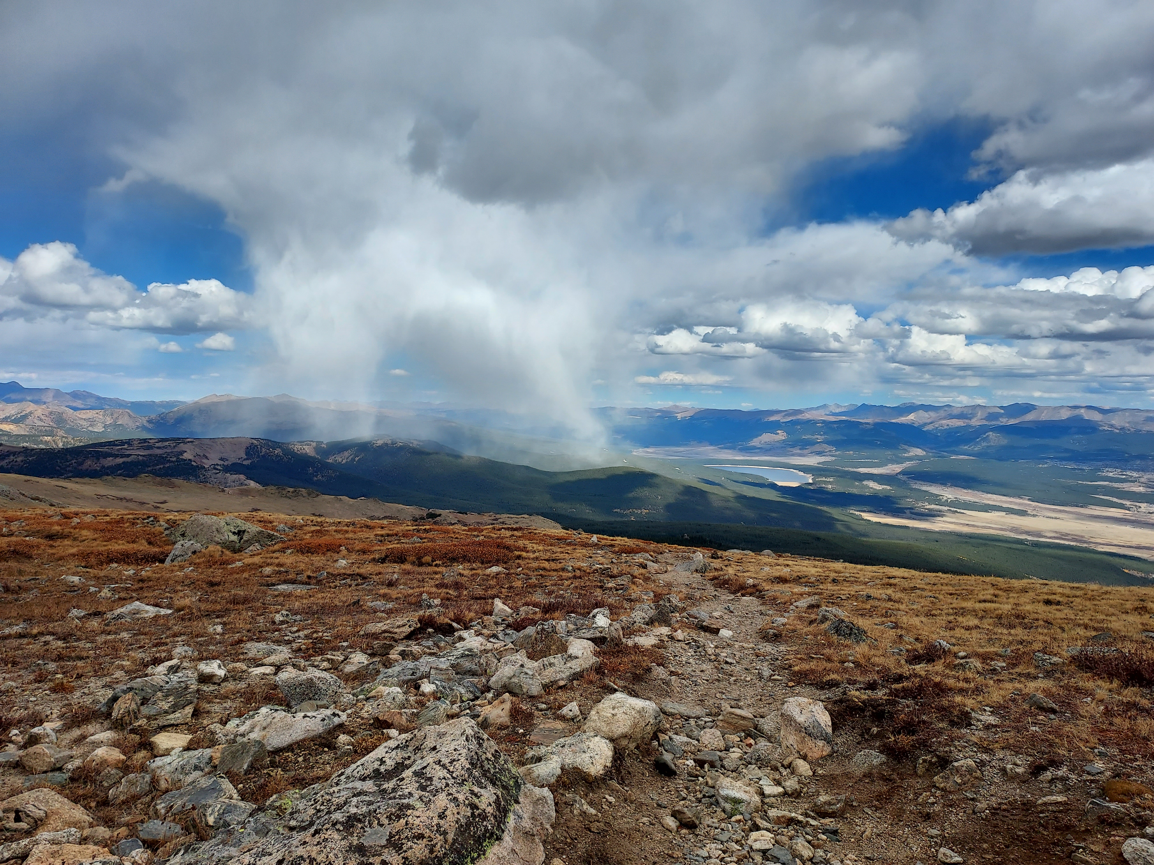
Covering the three-mile ascent from treeline to the ridgeline involved a demanding climb of 2,600 feet in elevation. Amidst the continuous uphill challenge, a few remarkable moments stood out. First, there were light snow flurries, which added a touch of playfulness to the ascent and provided a picturesque backdrop for my photographs. Then, the pikas, small rabbit-like creatures with distinctive squeaks, became a constant companion as I ascended into higher elevations. While they are as ubiquitous as city pigeons in alpine regions, their presence embodies the rugged beauty of the high country.
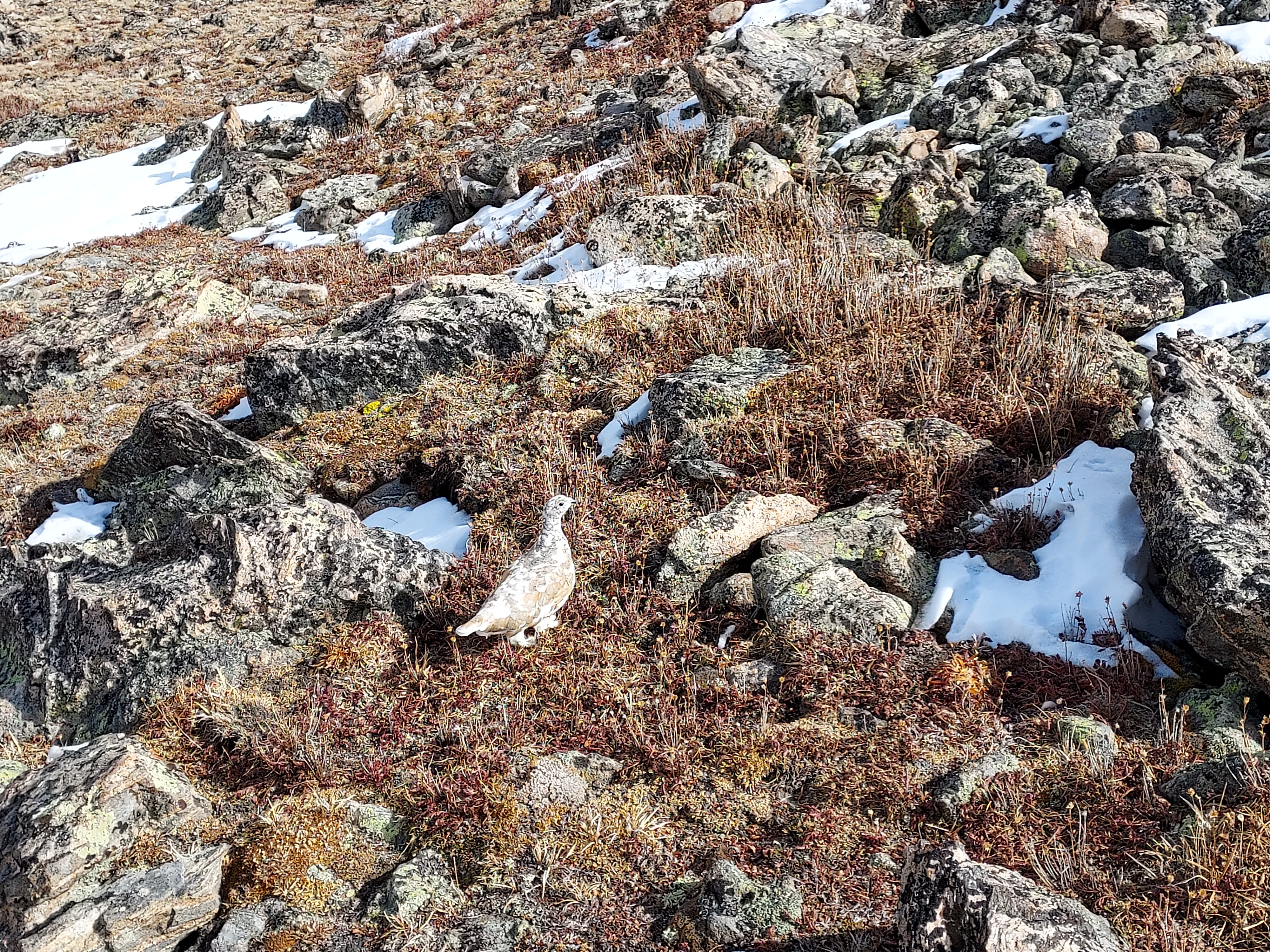
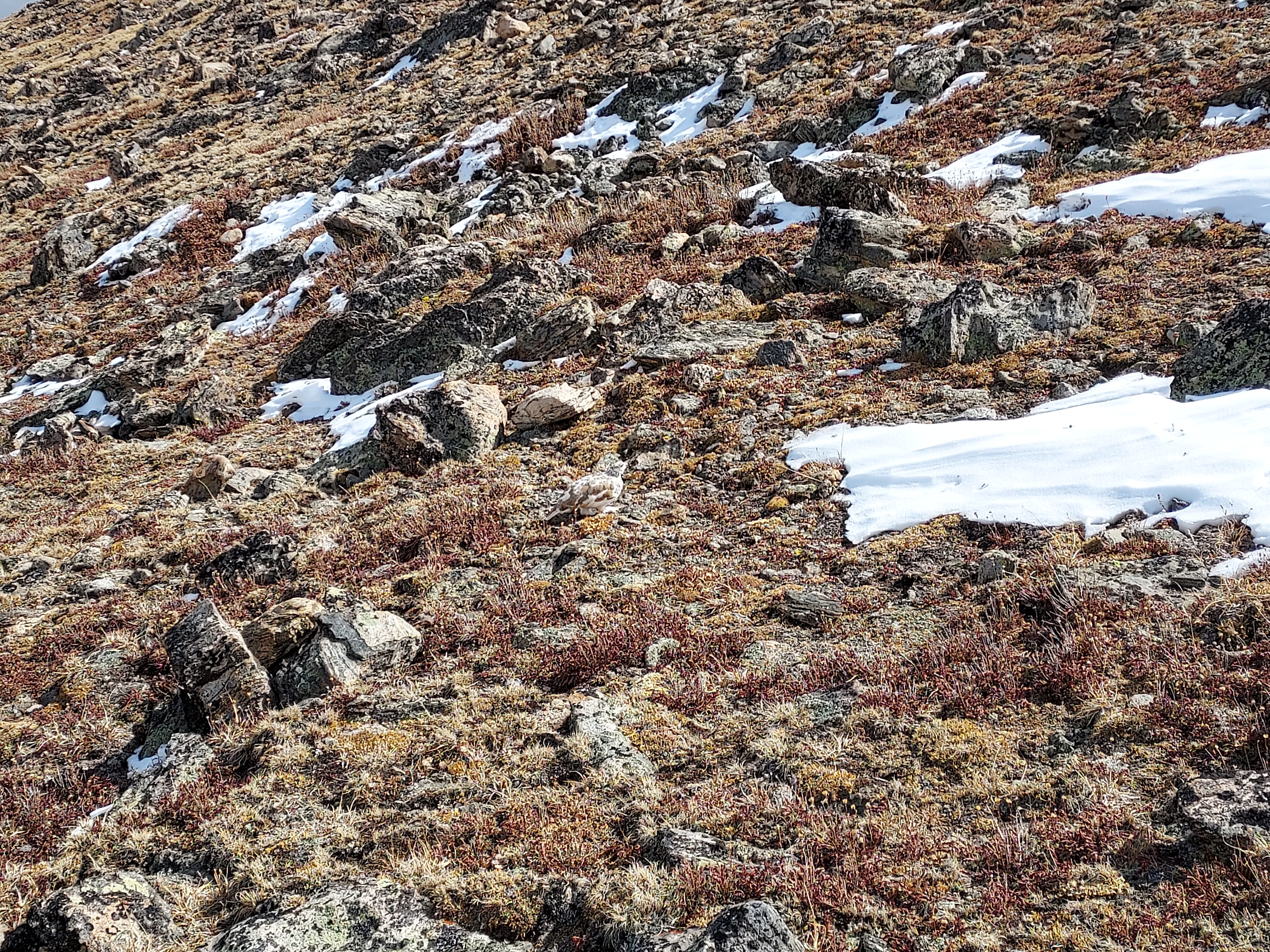
Finally, I spotted a flock of white-tailed ptarmigans. These birds, while not uncommon at very high altitudes, are relatively scarce in Colorado as a whole, mainly inhabiting the extreme alpine areas of the Rockies. Their remarkable seasonal molting and cryptic plumage make them challenging to spot, even in photographs. These extraordinary birds added a touch of intrigue to the hike.
I gained the ridgeline which is at an altitude of 14,200'. The work was hardly over. Although scarcely 0.4 miles from the summit, there was a lot of scrambling and up-and-downs between. This section took at least a half an hour to negotiate. But soon enough I was on the summit, standing tall on the third highest mountain in the lower 48 and, consequently, the third highest mountain I've ever climbed. The distance was 7.6 miles from trailhead to summit. Threatening weather forced a hasty departure.

Descent via Southwestern Slopes
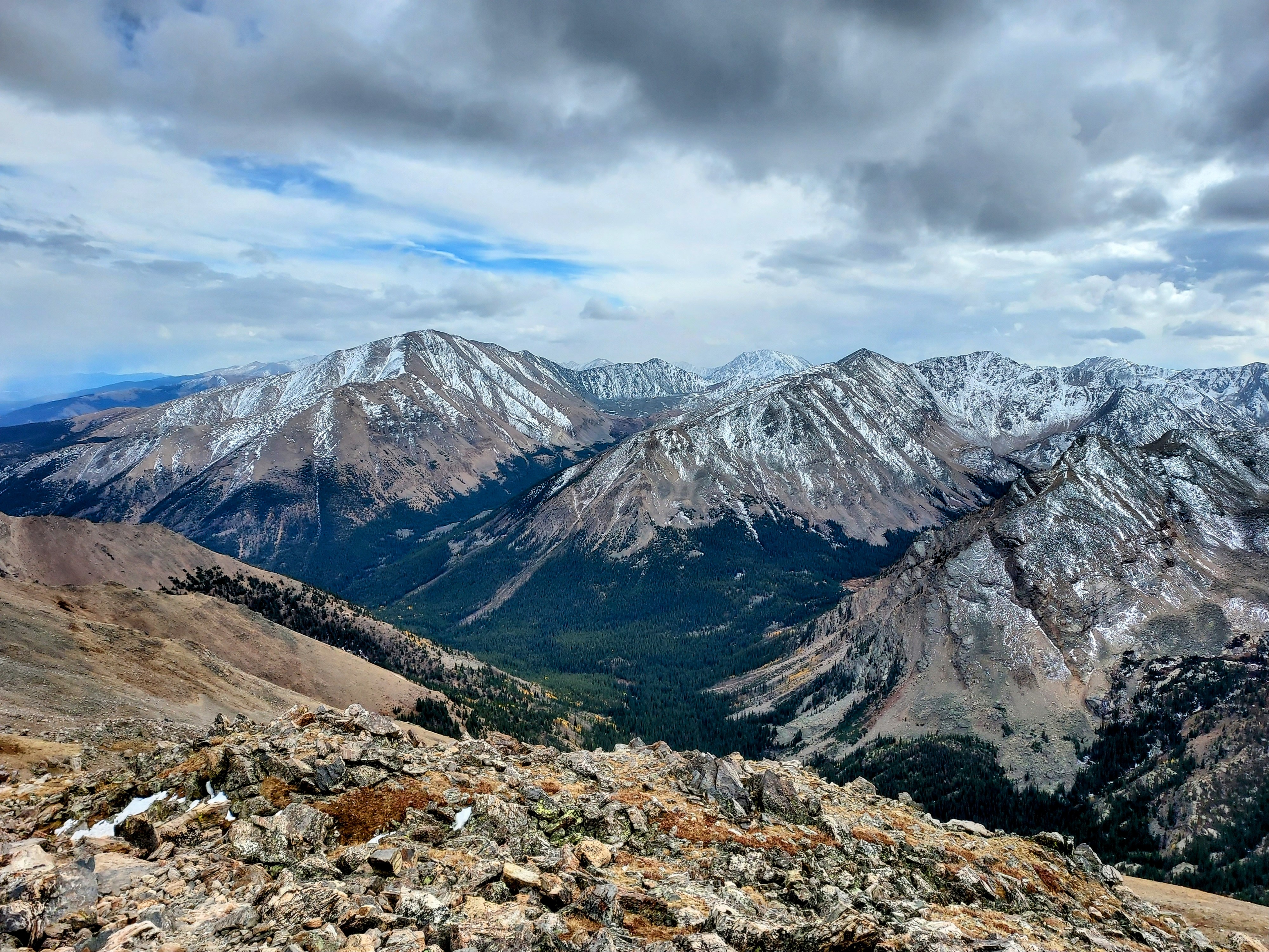
I opted for a different route on my descent, seeking some variety in the journey. While not part of my initial plan, I encountered another hiker on this path who spoke highly of the Southwestern Slopes route. Additionally, it promised a relatively straightforward road walk upon descending into the valley. I followed the ridgeline for 0.4 miles and soon spotted cairns marking the alternative route.
From a photography perspective, the descent provided stunning vistas. I had a bird's-eye view of the central Sawatch Range, with the imposing northern face of Mt. Elbert in the foreground, all blanketed in snow, creating a picturesque scene.
From a hiker's point of view, it took a toll on my joints. The descent, mostly class I to mild class II, was harsh on my knees and ankles due to the rocky terrain. While not necessarily faster or easier, the breathtaking views more than compensated for the strain. The trail meandered with numerous switchbacks and minimal relief, dropping 3,000 feet in approximately 2.2 miles. Upon reaching the intersection with the North Half Moon Lakes trail, the path became gentler.
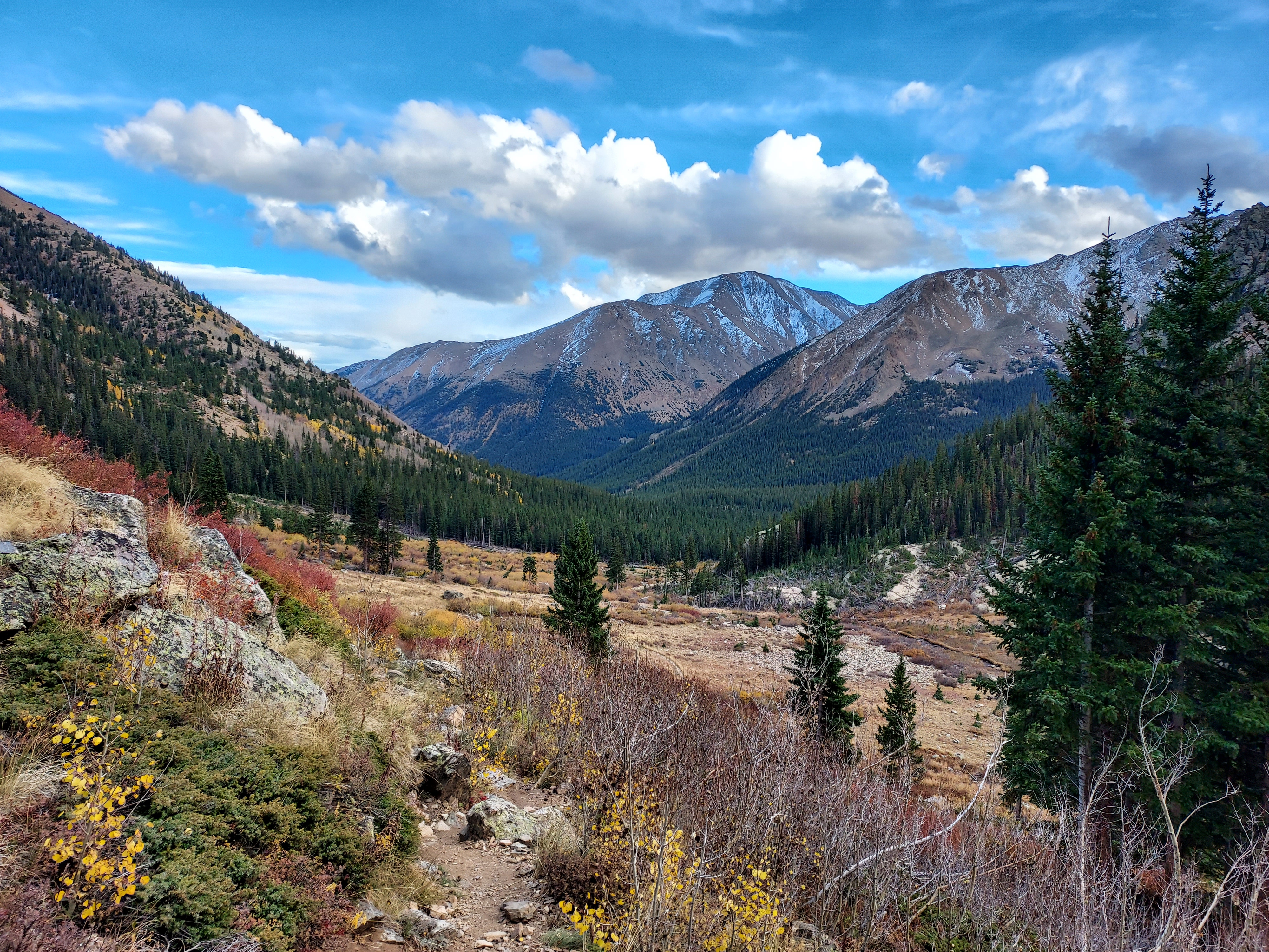
Following the intersection, the trail descended another 800 feet over 1.6 miles, and the route was straightforward with no navigational issues. Subsequently, it transitioned into a 2.6-mile road walk with minimal elevation change, leading me back to the trailhead.
Overall this was a great hike. Mt Massive receives much less visitors than its slightly higher and more famous neighbor. The crowds were further curtailed by the season - glad I caught it with a window of favorable late season weather.

No Comments