


Berryessa Peak is one of the more far flung major summits of the Bay Area. Its been a tempting summit for a few years now; its fairly prominent, its certainly in wilderness and it makes several peakbagging lists. But, I had trouble justifying driving 2 hours just for a single summit, thinking that I'd prefer going somewhere outside of the Bay Area with that kind of time. But alas, shelter in place has narrowed my range. So, late May was a perfect time to climb this mountain. Here's my directions and guide for this 15.0 mile hike.
For anyone interested from a stats standpoint, Berryessa Peak is 3,057' and the most topographically prominent mountain in Yolo County with 1,377' of prominence. The summit straddles Napa and Yolo Counties and ranks high in altitude and topographic prominence for both. Berryessa Peak is on the Sierra Clubs SF Bay Area Nifty Ninety List and Western States Climbers' California Coastal Peaks List.
Getting to Berryessa Peak's Trailhead
Berryessa Peak lies in a rather interesting patchwork of BLM land and private land with public easements. These days, access is free and unrestricted but Berryessa Peak's main trail was previously on some significant stretches of private land. I'm sure some altruistic folks worked hard opening up this glorious summit to the public.
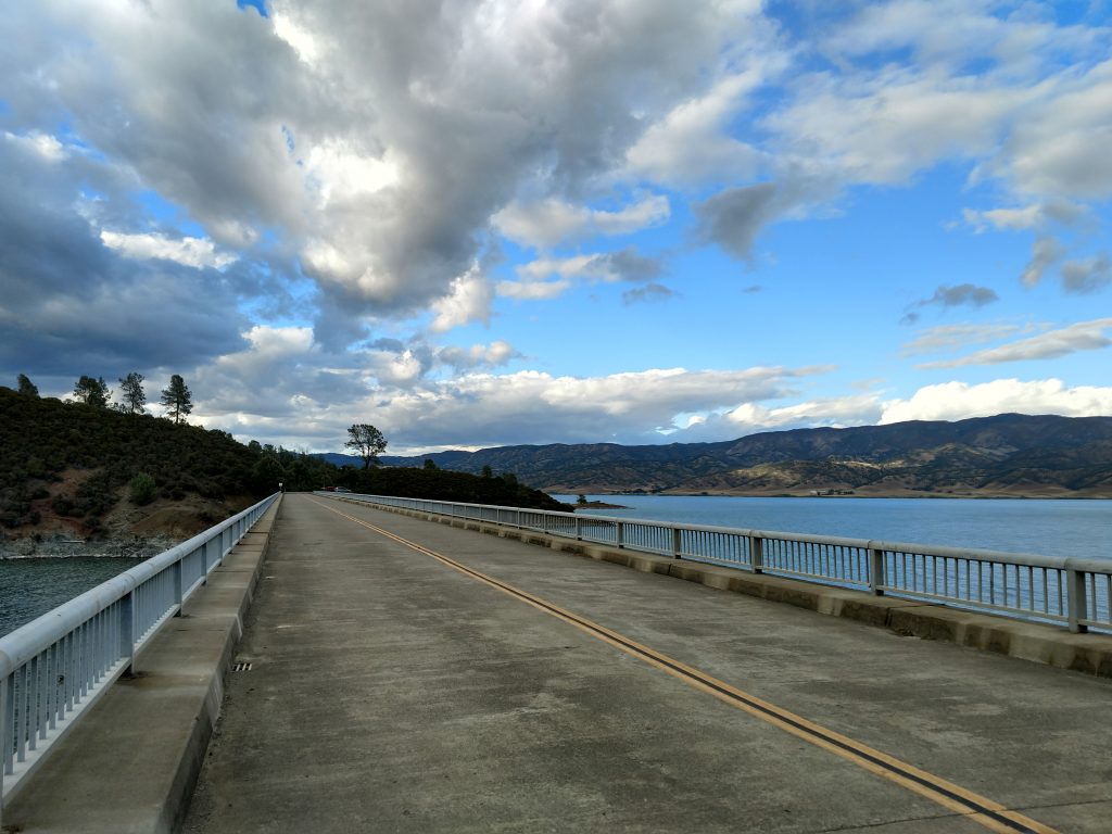
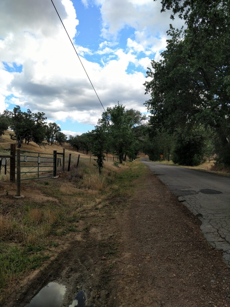
Google Maps will likely get you to the trailhead if you plug in this point (link to the trailhead). The roads to the main traihead are all paved and in generally good shape up until the last mile or so. Its about 1 hour and 45 minutes to 2 hours from nearly every place in the Peninsula, South Bay and East Bay. The last 1/4th of the trip involves a splendid drive through twisty mountain roads and the shoreline of Lake Berryessa. Once at the trailhead, park on the side of the road.
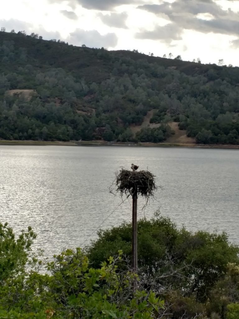
Also, as of 2020, there were many large Osprey nests on the telephone poles on the Northwestern shore of Lake Berryessa:
Berryessa Peak: Trailhead to Fence Crossing
Before hitting the trail, be prepared for a long day. My GPS indicated I traveled 15.0 miles by the end of the day with 3,100' of altitude gain. The trailhead is 560' and the altitude of Berryessa Peak is 3,057'. There's plenty of up and down in between as well. Three and a half liters of water plus 2 full meals and snacks was just enough for me.
There's some great resources online for trail maps- here's the best from yolo hikers. I've also included my route and waypoints below on Google Maps.
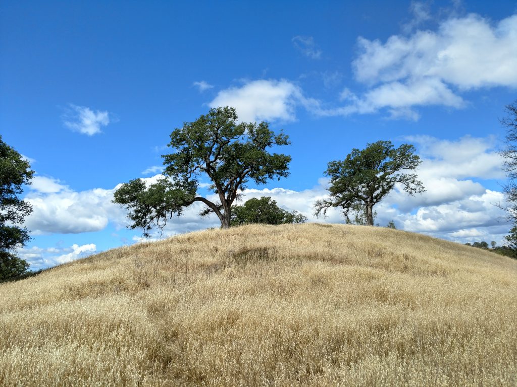
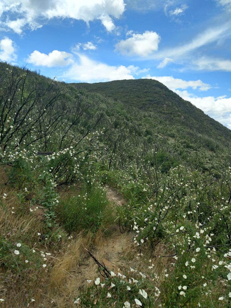
From the trailhead, enter through the hiker's gate and proceed 1.6 miles along a somewhat overgrown ranch road. Along the way, there's some glorious interior live oaks and blue oaks which are emblimatic of the California Oak Savanna. At 1.6 miles, there's a junction and a small, metal post indicating a right turn to stay on the "BPT" (Berryessa Peak Trail).
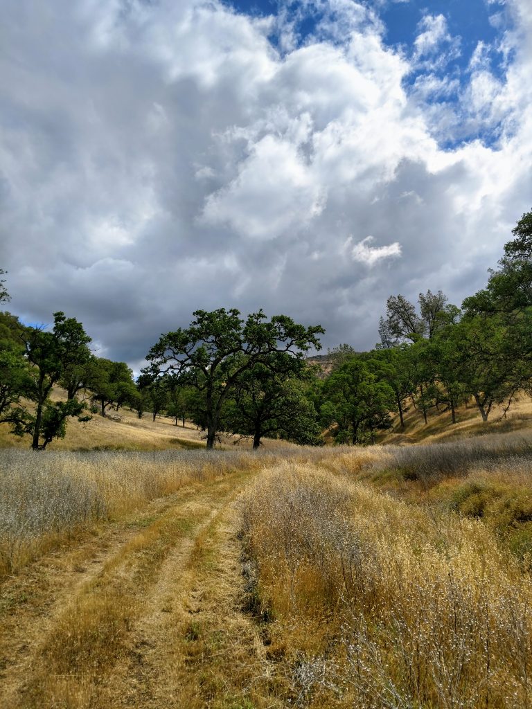
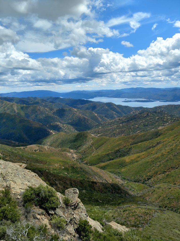
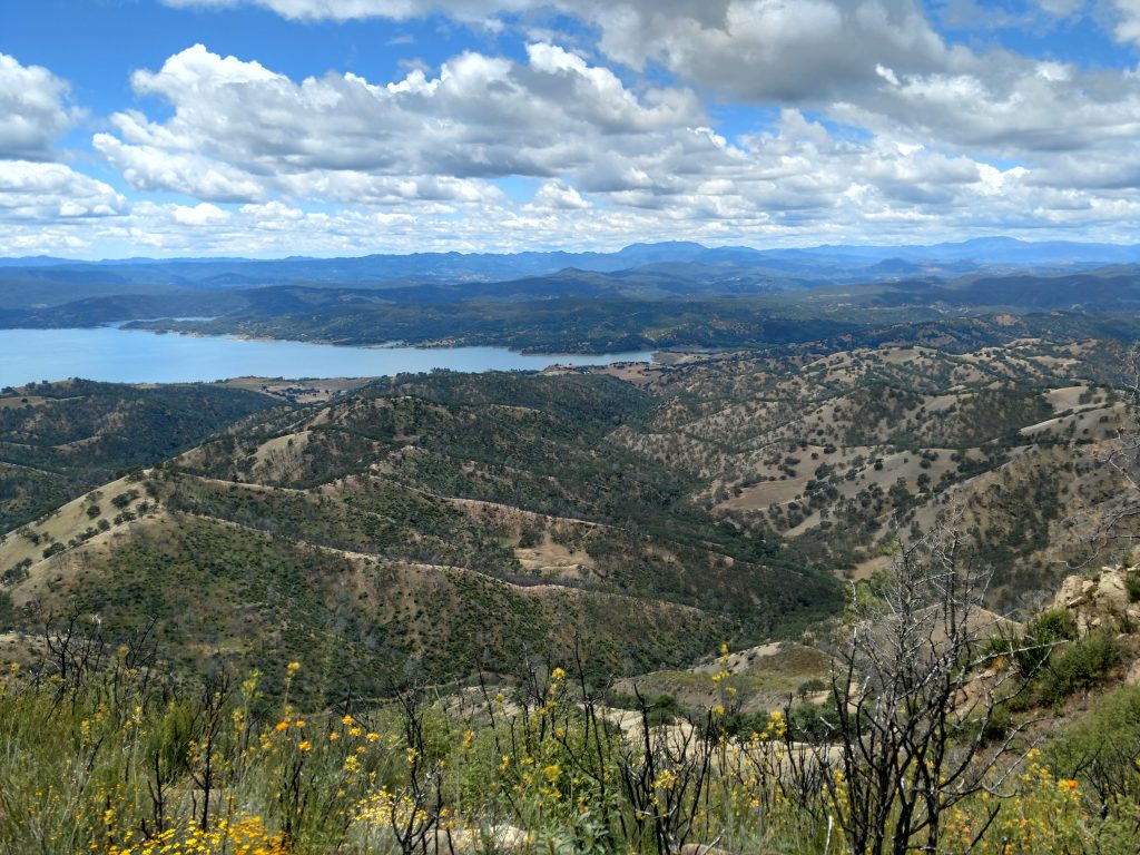
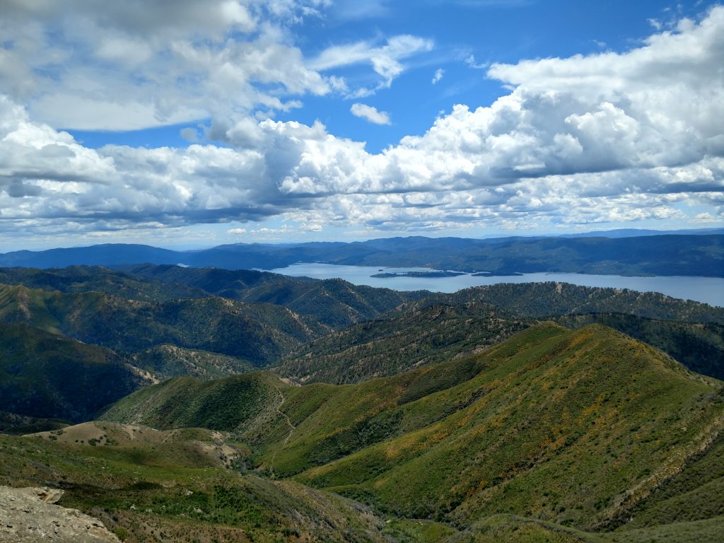
The next 1.5 miles after the intersection involve nearly 1,000' of altitude gain but with ever expanding views of the North Coast Ranges. At some point Mt St Helena and Cobb Mountain become plainly visible. Additionally Lake Berryessa's size becomes apparent and the summit of Cedar Roughs is visible on the other side of the lake.
At times, brushy grasses encroached heavily on the trail making me thankful I wore long pants in spite of the heat. I'm sure this is a continuous issue any time of year.
After 3.1 miles of hiking, the trail arrives abruptly at a fence marking private property with public easement permitting further travel.
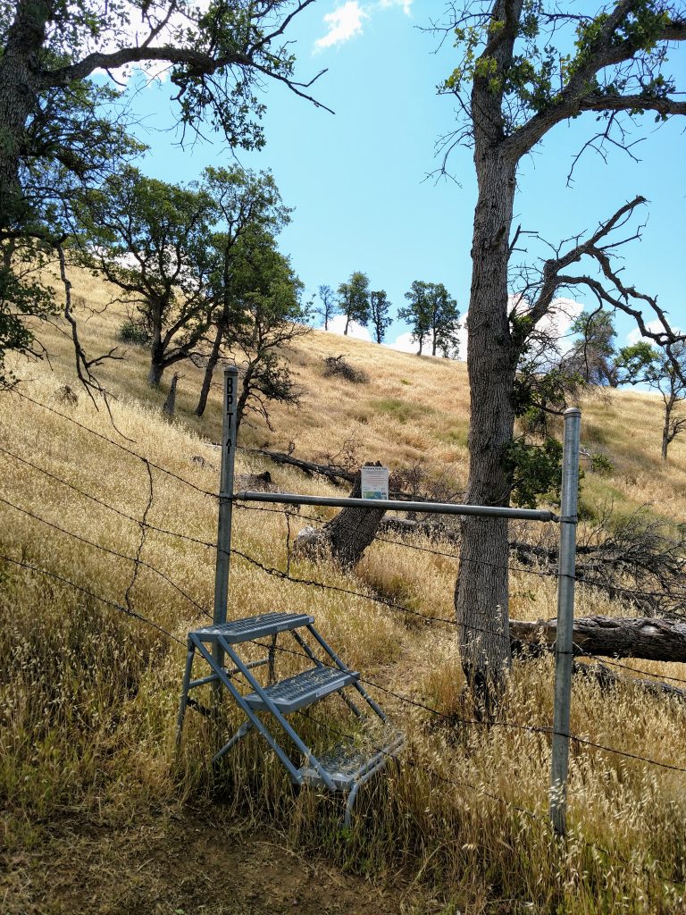
Berryessa Peak; Fence Crossing to Dirt Road
Its mostly overgrown single-track for the next 2.9 miles. The rigorous ascent is broken by a descent into Green Canyon and some sections that feel like a practical bushwhack.
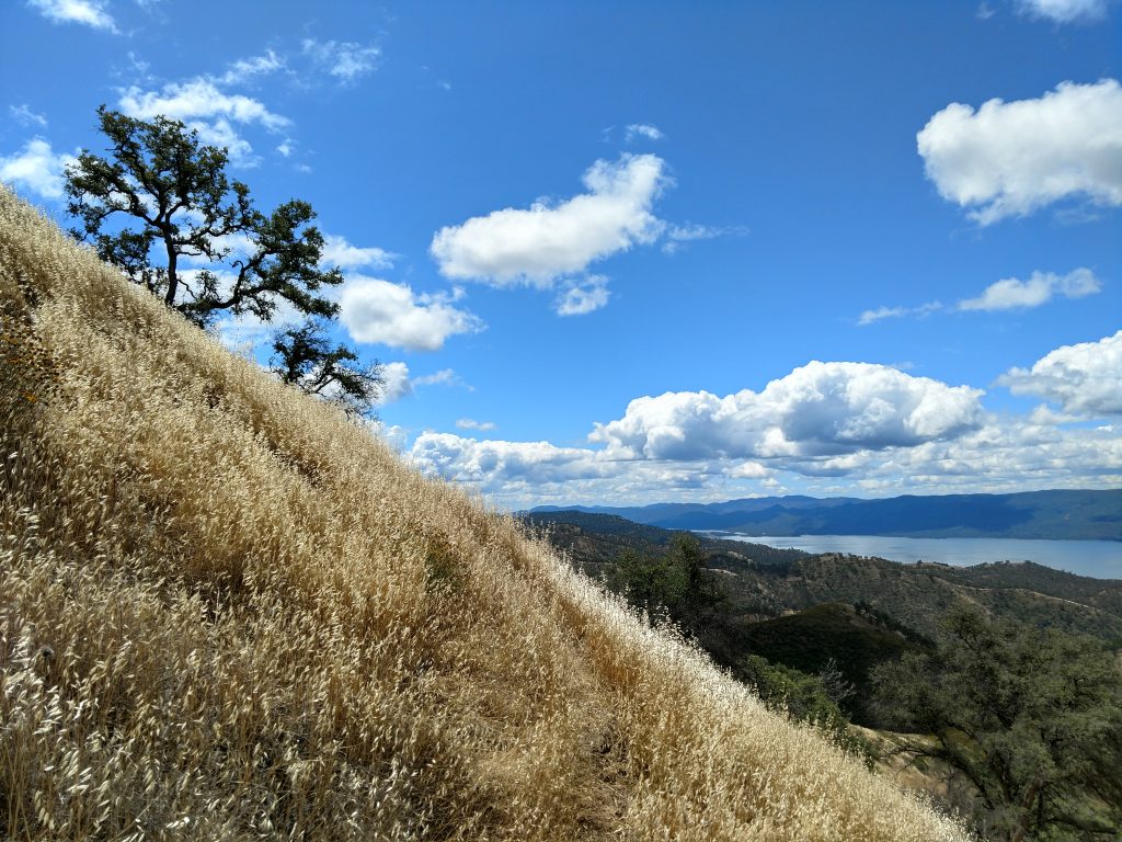
From the Fence Crossing, the trail continues its steep ascent along the hillside and the actual summit periodically comes into view. Tall radio towers and satellite communicates unambiguously mark the summit from a distance. At about 3.8 miles and an altitude of roughly 2,200', the trail crests before a descent and this is the halfway point.
Take stock of how the hike's been going as the second half is more difficult and with almost no shade.
From the halfway point, the trail descends into Green Canyon. Its a bit disheartening; every foot of altitude lost must be regained on the way to Berryessa Peak, then done again on the return route. Altogether, the trail descends 330' over 1.0 mile into a lush canyon.
On the other side of the canyon, there's fields of morning glories followed by a steep ascent through tunnels of manzenita. This is not particularly enjoyable.
The climb out of the canyon is another 1.2 miles with 900' of gain. Eventually the scrub becomes less thick and there's great views of the ridgeline. After the gain, there's a brief descent 100' descent over 0.2 miles until the trail intersects with the main access road. Mark this spot carefully in your mind or phone; its unsigned and easy to miss in fading light.
Berryessa Peak: Access road to Summit
The last 1.2 miles and ~450' of gain to the summit are comparatively easy. The road is well maintained and its not nearly as steep as the previous 3/4ths of the way.
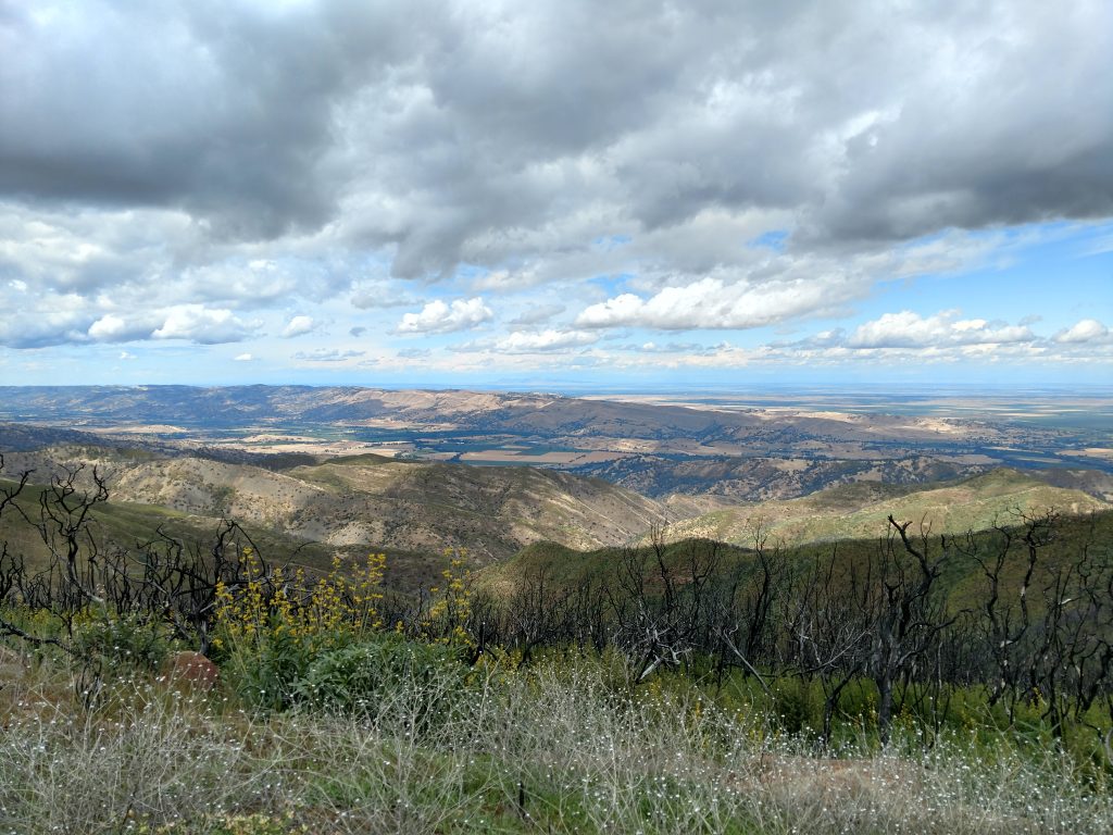
The summit itself is littered with radio towers but the views are outstanding. Its a unique spot for observing the transition of the relatively lush Coast Ranges to the arid but fertile interior valleys. On clear days, the taller summits of Snow Peak to the North and the distant Sierra Nevada range is visible. Any effort getting to this far flung summit is well rewarded.
I found the Benchmark at the top but no summit register.
The Descent
There's not much that needs to be said about the descent but I made a few notes.
First, the junction with the access road and the Berryessa Peak Trail is easy to miss. There's a small cairn but nothing else obvious denoting the junction. Fortunately I didn't miss it but I imagine any amount of fog, rain or dim lighting would make it indistinguishable.
The descent felt like as much work as the ascent due to the ups-and-downs and uneven footing. I foolishly rolled my ankle and paid for it over the next week with swelling and pain. Take careful steps.
When I finally made it back to the car, over 7 hours had elapsed which is consistent with what most hikers of decent shape take on this hike. My mileage turned out to be 15.0 exactly. I saw nobody else on the trail and doubt many people come up this way in general.
That's a wrap! Berryessa Peak is a worthwhile challenge for any avid hiker or peakbagger. Hope this report helps.

No Comments