


Hot Springs Mountain is the tallest mountain within San Diego County. While San Diego itself is sunny, temperate and densely populated, the mountains towering the city to the East hide dense forests often unexplored, even by locals. There's many reasons to climb mountains out here but of course, I had to tag the high point. Here's my trip report and guide.
Hot Springs Mountain, General Information
Hot Springs mountain rises to 6,526' and is the highest point of several small mountain ranges in Eastern San Diego County. It lies in a profoundly remote part of the county and is rarely hiked except by motley county high pointers. The mountain is part of the Los Coyotes Indian Reservation and an entry fee of 10 dollars is required for visitors. A dirt road leads from the campground to the summit. I'm not aware of any recent reports of people being allowed to drive to the summit.
Getting to the Trailhead
From the West, drive to Warner Springs, California. This is a beautiful drive from the San Diego area and involves delightfully twisted and scenic mountain roads. Warner Springs has some amenities and a gas station for final supplies. Cell Phone coverage drops off almost instantly outside of Warner Springs.
Here are the directions from Warner Springs to the trail head. It took me about 20 minutes and the road to the Reservation's entrance is in excellent shape.
As required, I stopped at the entrance and checked in with the Tribal Police. They run your license and ID and accept the 10 dollar fee. They gave me a map and excellent directions to the Hot Springs Mountain trailhead. I came on a weekend but call ahead if coming on a weekday as the station might not be staffed.
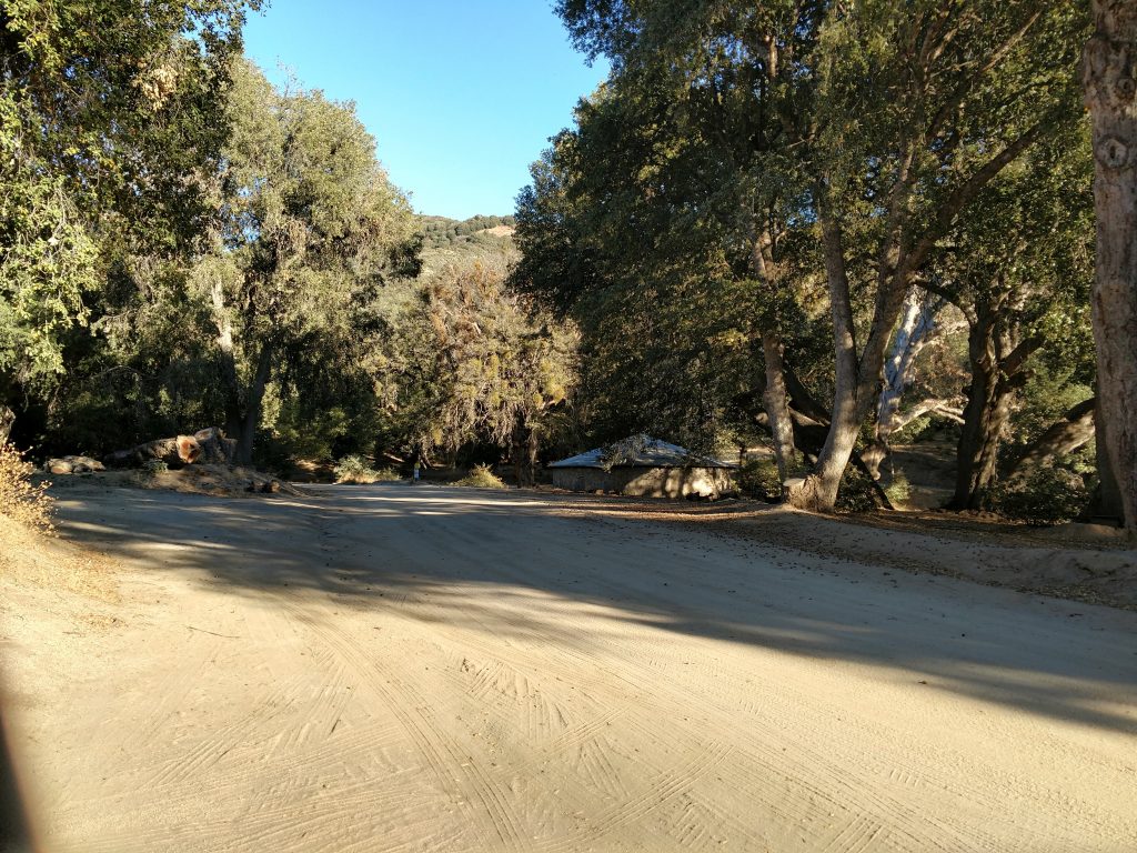
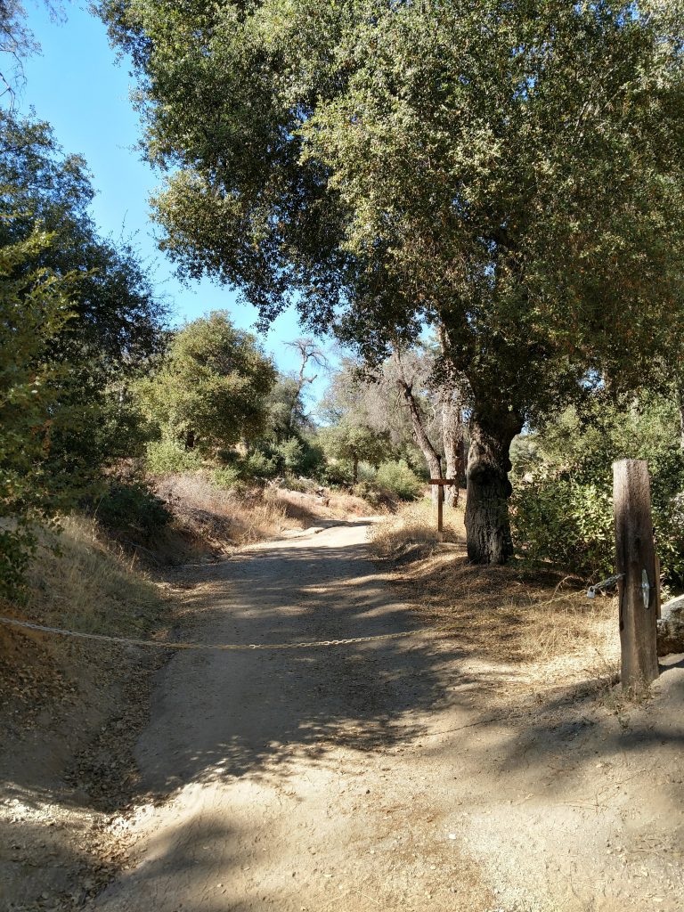
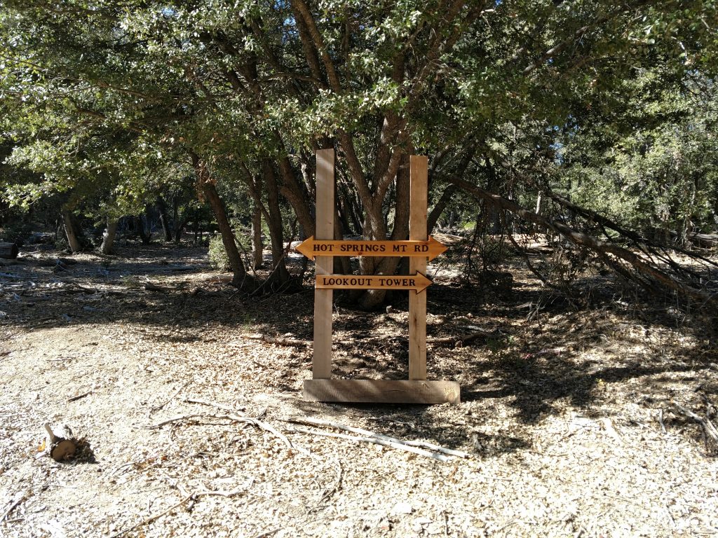
From the entrance, I drove 2.6 miles on the main road to the campground and intersection of Camino San Ignacio Road and Suket Road. I parked well off the side of the road and found the gate that prevents further vehicular travel. Here's my hiking and area map:
Hot Springs Mountain Hike
The trail to the summit is almost entirely on the road, except for the final scramble. My statistics were as follows:
- Distance: 10.1 miles (round trip)
- Duration: 3 hours, 26 minutes
- Average Speed: 2.9 mph
- Trailhead Elevation: 4,543 feet
- Maximum Elevation: 6,535 feet
- Total climb: 2,435 feet
- Elevation loss (on ascent): ~150 feet
From the trailhead, the hike begins with a grueling ascent from the valley. There's not a lot of shade either. On a gloriously temperate day in November, this section was rather easy but I imagine hot summer days make it brutal. The altitude gain is continuous for the first 2.5 miles until intersecting with the signed Hot Springs Mountain road.
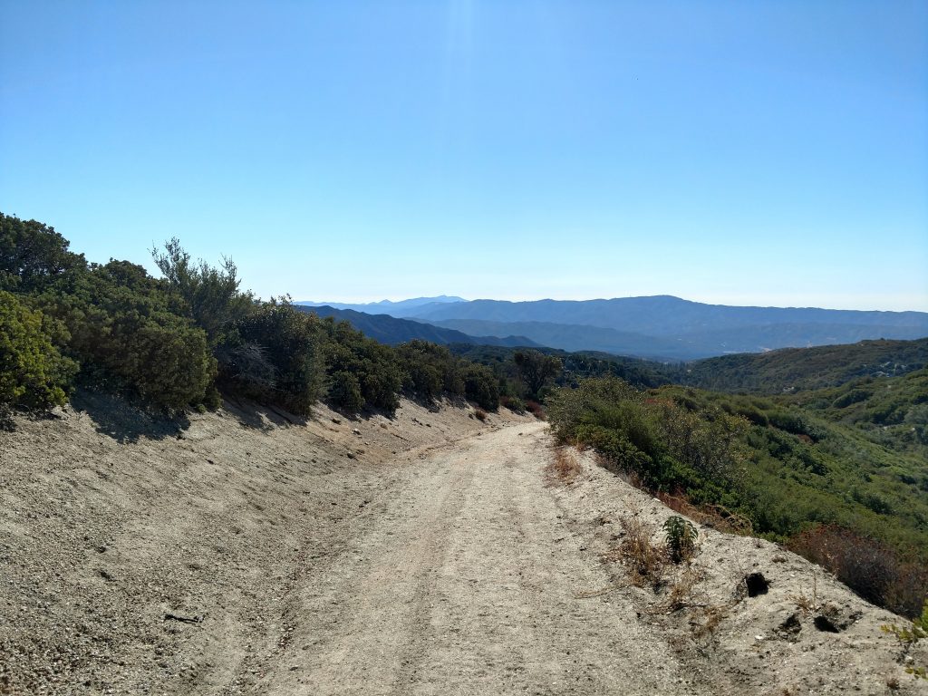

The first 2.0 miles are no doubt the most difficult of the hike. My GPS informed me I gained nearly 1,500' of altitude on that section! Thankfully, the road/hike flattens out for the next 1.7 miles. The forest gets very dense in this section too.
After 4.5 miles of hiking and with just 0.5 miles to the summit, the road gets very steep again. I think this is the only part of the hike where the summit becomes visible. The road terminates at a wide clearing near the old fire tower.
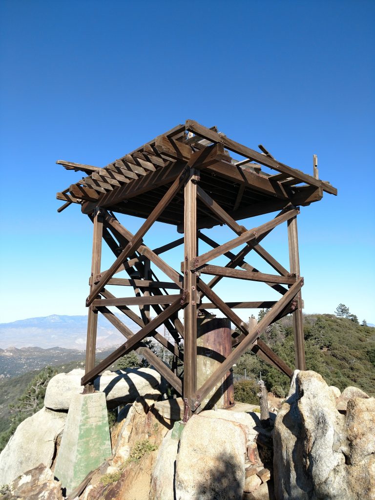
Final Scramble to Hot Springs Mountain's peak
So this is important- the fire tower is NOT the highpoint. The highpoint is obscured by the forest and can't be seen from where the road terminates. If you want to tag it, head Northeast from the clearing, into the brush and follow a flagged trail to the summit block.
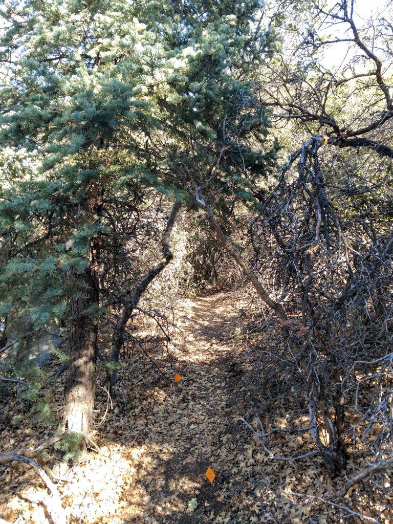
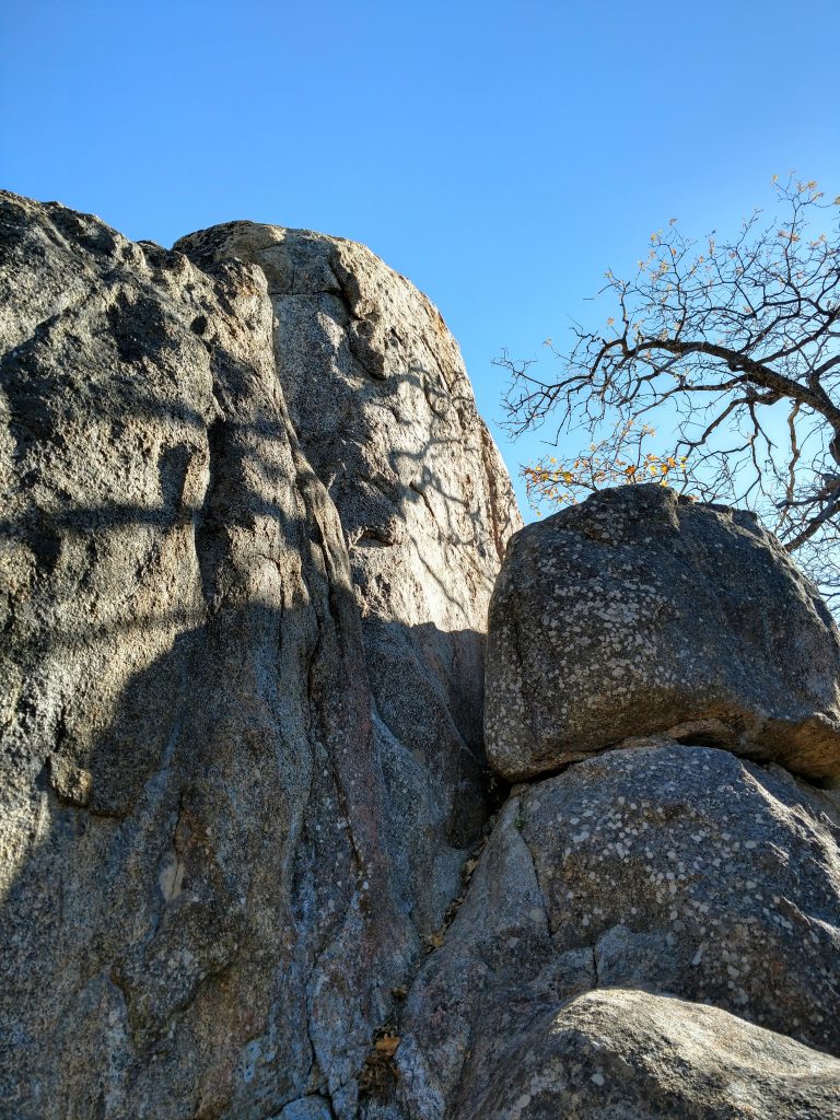
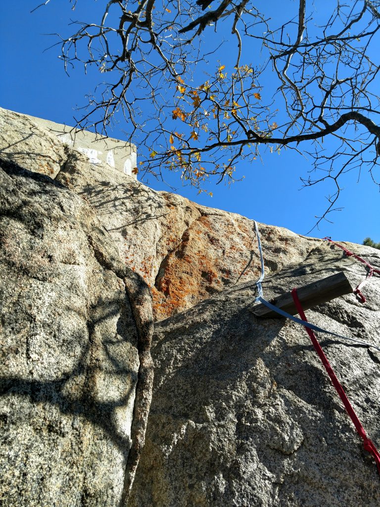
After about a quarter mile of this herd path, the summit block comes into view. The summit register is below the summit block and somebody's left a ton of webbing for the final scramble. I found a nice route that didn't involve much scrambling at all just to the left of the webbing (2nd photo above). There's some poured concrete at the top for whatever reason.
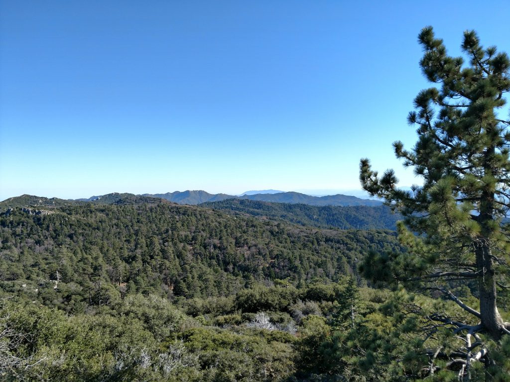
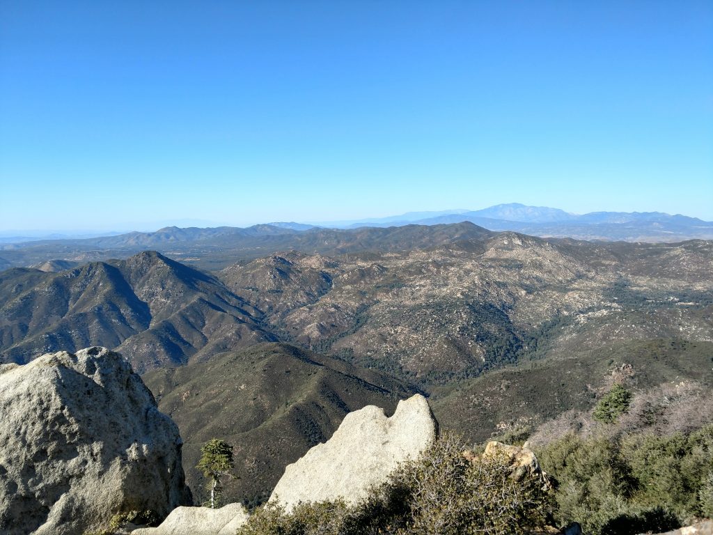
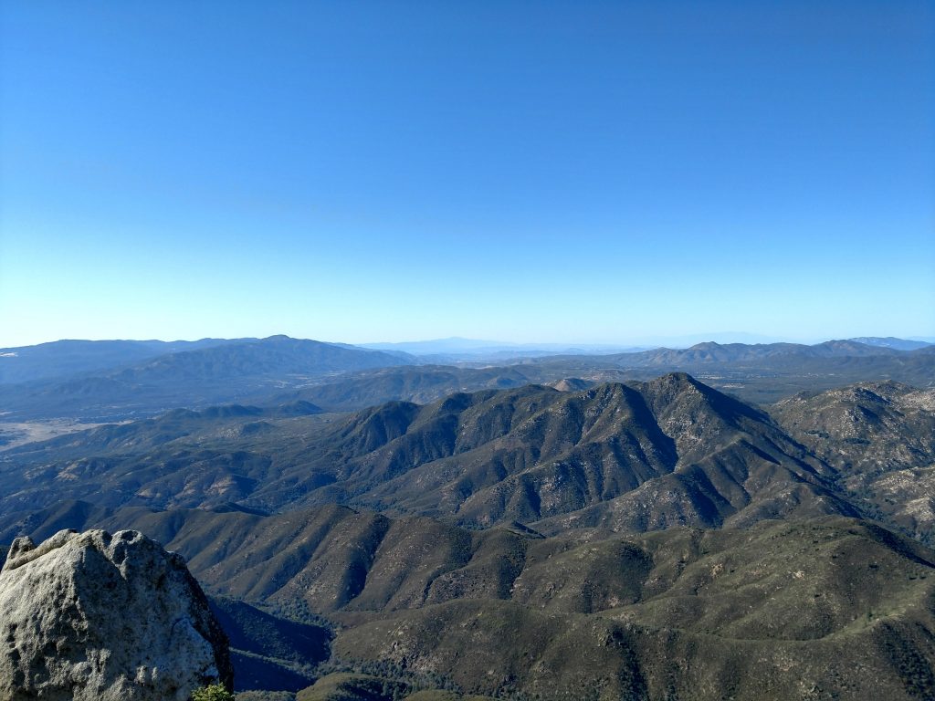
At the summit, hundred mile views existed in every direction. I could see the Salton Sea, Mt San Jacinto, the Santa Rosa Mountains and Toro Peak, the Pacific Ocean and hundreds of other summits. Its an outstanding experience-
After signing the summit register and eating lunch, I began my way down which took about an hour and a half. I had no trouble with directions given how straightforward the road is. I didn't see anyone except for a person walking some dogs about a mile from the trailhead. For such a prominent summit, only a very few number of people actually make it out here.

No Comments