


Black Mesa is the highest mountain in the surprisingly rugged state of Oklahoma. Its an 8.0 mile hike across the desert with moderate difficulty.
In my quest to climb all of America's 50 State Highpoints, I left from the Rocky Mountains and drove across the high plains to Black Mesa, Oklahoma. This was highpoint #42 for me! I was surprisingly unprepared for this one, both in terms of hiking and driving. So here's a trip report and a few pointers should you repeat what I did.
Here's an area map that illuminates the immediate vicinity of the hike and some driving tips:
Getting to Black Mesa Trailhead.
Black Mesa is far from any major metro area. Google Maps also doesn't typically take the best route if you plug it in.
If coming from the West (Colorado, New Mexico), I think its best by NM-426 to Kenton, Oklahoma. Don't try Highway 160 unless you want a large detour (like I did!). Google Maps will recommend 160 and a network of poorly marked and poorly maintained dirt roads on questionably public land.
If coming from the North (Kansas, Colorado), set directions to Springfield, CO and then head South on Highway 385 to Boise City, Oklahoma. Then head West on OK-325 to Kenton, OK.
If coming from the East or South (Texas, Oklahoma), simply set directions to Boise City, then follow OK-325 west to Kenton.
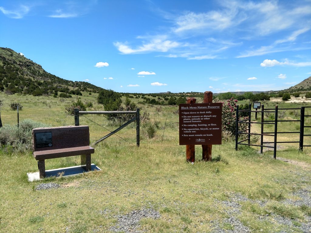
From Kenton, just before "downtown", look for signs pointing to Black Mesa. An unnamed but well traveled and paved road departs from the highway and heads North for 4.9 miles to the parking lot on the Left. Its hard to miss.
Hiking Black Mesa
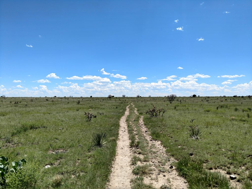
Hope you got here early! Hiking Black Mesa involves an 8.2 mile round trip hike across the desert. There's no shade nor services but the mix of high plains, expansive views and the unique desert environment creates a magical trip. There's not much of Oklahoma that looks like this outside of the Panhandle! Enjoy it.
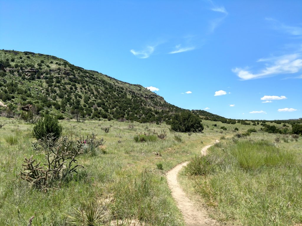
The initial 2 miles of the trail are relatively flat and across open grazing land. I ran into several herds of cattle, none of whom cared or moved for a lonely hiker. For the most part, the trail was well established and easy to follow so taking a few detours around the cattle wasn't difficult.
There's a bench in the shade with about each mile. Several signs otherwise point the way- I'm sure less experienced hikers probably got lost at some point, prompting the signs
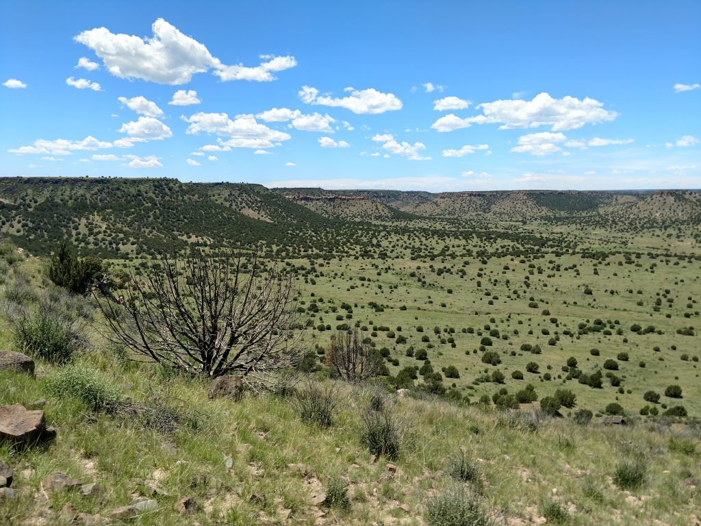
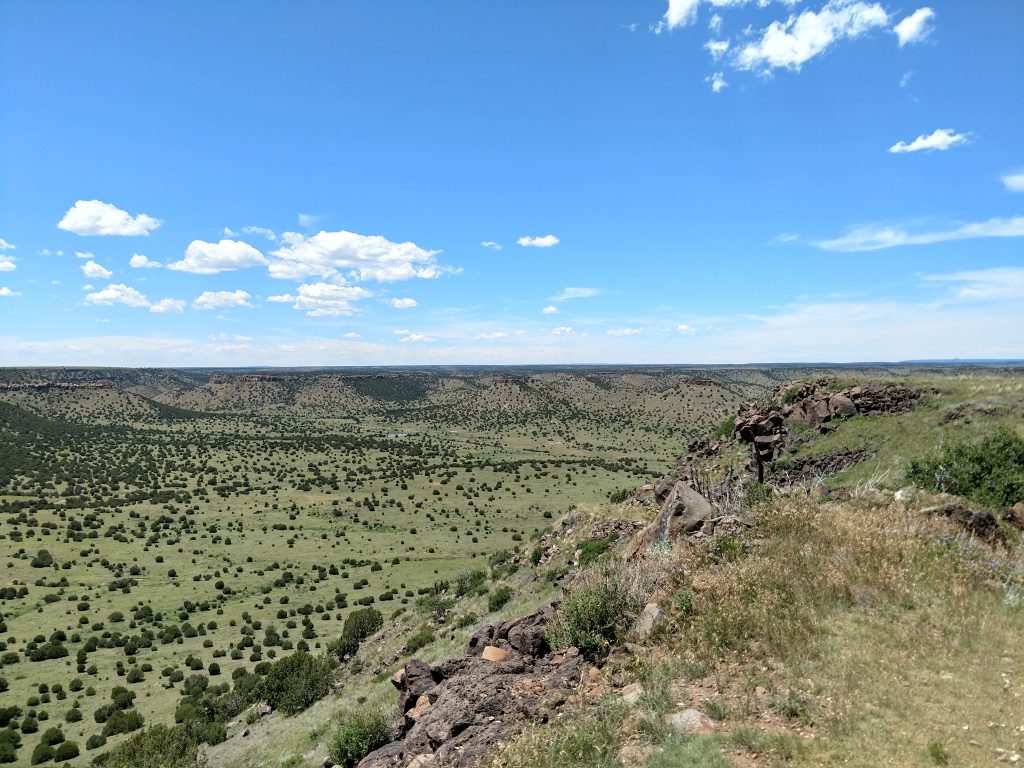
Between miles 2 and 3, the trail ascends sharply to get to the mesa top. Its actually quite grueling! Talk plenty of water and breaks for this section. Each step is rewarded with ever expanding views of the high plains.
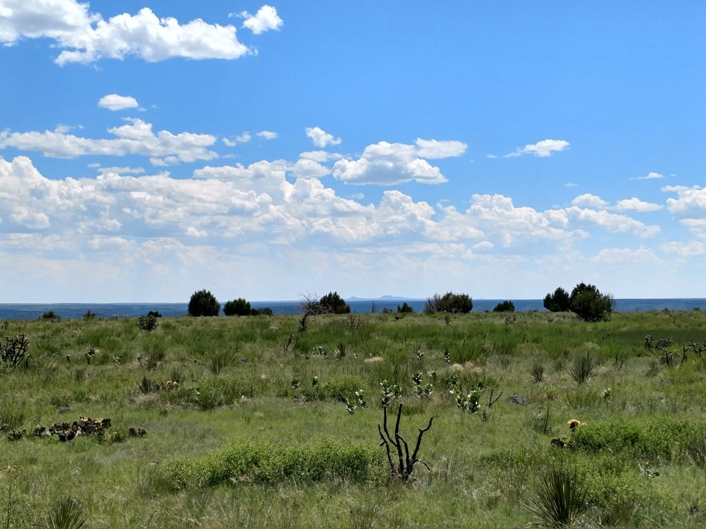
The final mile is pancake flat atop Black Mesa. The horizon becomes parallel with the sky and if it weren't for a few distant buttes, its hard to tell how quickly you're moving. Towards the high point, the cliffs of the mesa come into view and you can see for fifty-something miles in nearly every direction.
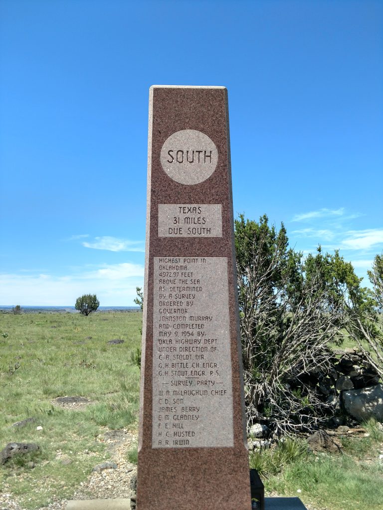
Black Mesa Summit
A large obelisk marks the highest natural point in the State of Oklahoma. There's all kinds of fun facts and statistics on the marker as well as a summit registry. Most of the signers were Oklahomans admiring the topography of their state. A few were high-pointers like myself who were half to three quarters of the way through. Nobody indicated that this was their last highpoint.
I loved the view at the top. I saw well into the beginnings of the Rockies and some very isolated buttes that looked fun to climb. Its a shame most people never make it to this glorious corner of the high plains!
Return the way you came to get back to the parking lot. There are no other established trails in this section of the park.
Other Sights in far Western Oklahoma
I didn't have much time the day I visited but there's a few other interesting tidbits and knickknacks of the area. The first is the extremely dark and clear night skies. The stars in Western Oklahoma are unparalleled anywhere else in the state or area.
There's dinosaur tracks just 5 minutes from the parking lot. Such markings aren't uncommon for this part of the country but nevertheless, its a very easy way to see a Jurassic world!
Nearby the dinosaur tracks is the Tri-State Marker where Oklahoma, Colorado and New Mexico meet. Its a neat photo opportunity.
Finally, the town of Kenton, Oklahoma has become a welcoming destination for highpointers and has the nearest lodging and services for all of us ramblers. I sure wish I had more time to spend in the area!

No Comments