


Mt Peale is the highest summit in Utah that's not in the Unita Range. Its also the second most prominent mountain in Utah and the 23rd most prominent summit in the lower 48. Part of the isolated La Sal Range, it rises over 8,000' over nearby Moab.
The La Sal Mountain Range and the highpoint of Mt Peale are incredibly picturesque. Mt Tukuhnikivatz, Mt Laurel and Mt Mellenthin comprise a cirque of summits in the central part of the range offering alpine adventures near the deserts of Moab.
Though not nearly the altitude of the Unitas to the North, they rise sharply from the desert floor. When the desert is soaring into triple digits, the La Sals are often below freezing.
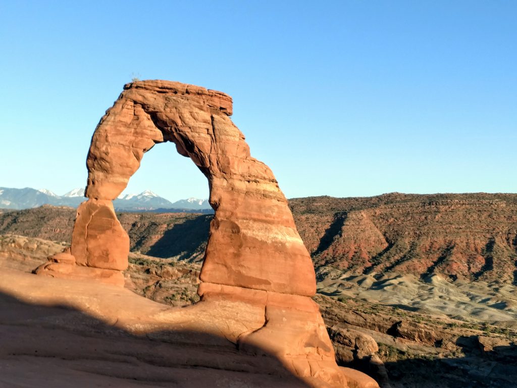
Moab is a perennial destination for me. Had I all the time and resources in the world, I'd spend several months of the year using Moab as a basecamp. On this most recent road trip, I decided to climb Mt Peale, the highpoint of the La Sals and the lofty summit framed by nearly everyone's photos of Delicate Arch.
Mt Peale Driving Approaches
The most classic route up Mt Peale is a class I-II route from La Sal Pass, near Medicine Lake. It utilizes a dirt road variously described as high clearance and also people somehow make it up in standard cars. In any case, with this very, very wet year (2019), even my high clearance Subaru couldn't make it up this route- too many water crossings and lingering snow. The rangers recommended a "severely modified" 4x4 to make it up this time of year but perhaps later in the summer or early fall the road will be easier to access.
So, the option at that point was an approach from the North, near Geyser Pass and the La Sal Winter Sports parking area. From Moab, I drove Southeast on US Route 191 to Old Airport road and turned left. This road passes a construction company and Ts with La Sal Loop Road. I drove this paved road 11.5 miles, gaining substantial altitude until FR-0071, also known as Geyser Pass Road. This is a graded dirt road that is easily cleared by nearly every vehicle. After 4.5 miles of driving this switch-back road, I arrived at the Winter Sports Parking Area which is apparently plowed and accessible all year! I drove past this parking area another 1.0 mile and turned right on the still good-quality Gold Basin Road. I parked about 0.4 miles up this road near Gold Basin Ridgeline.
Here's a map of where I parked and what route I took:
Mt Peale Approach: Gold Basin Ridge
On a topographic map, Gold Basin Ridge looks like the most straightforward means of ascent to Mt Peale. However from the road, the ridgeline's beginning is indistinguishable. My starting altitude was just below 10,000'
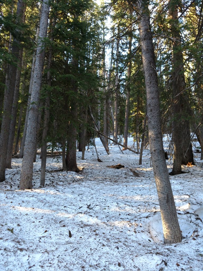
I packed for a very long day out and prepared for an unexpected night on the slopes given the length of this approach. From there, I used my GPS to weave my way up the very dense forests of Gold Basin Ridge. This was neither fun nor pretty. Even in the early morning, the snow was soft, the mud was deep and I post-holed everywhere. Underbrush was quite thick as well. More than a few profanities were uttered as I slogged at a 0.5 mile per hour pace.
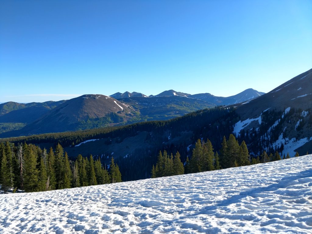
Perhaps around 10,500'-11,000', the snow became sufficiently cold and paced that I popped on the snowshoes and increased my pace. The woods cleared slightly as well and the climb was far more enjoyable.
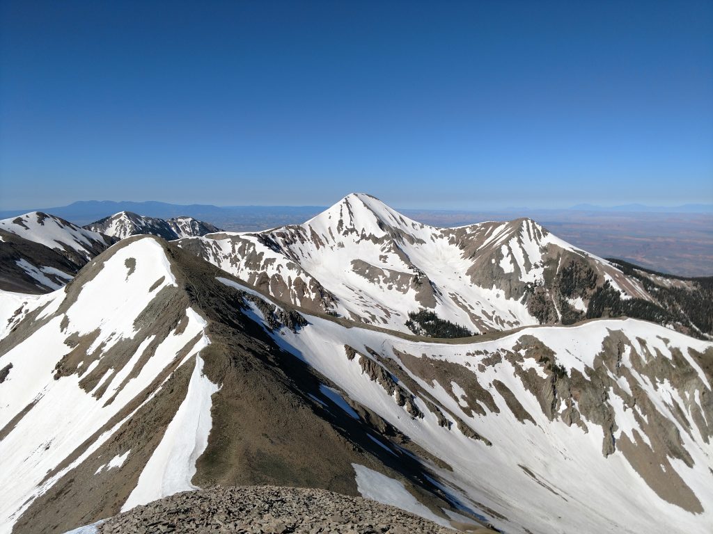
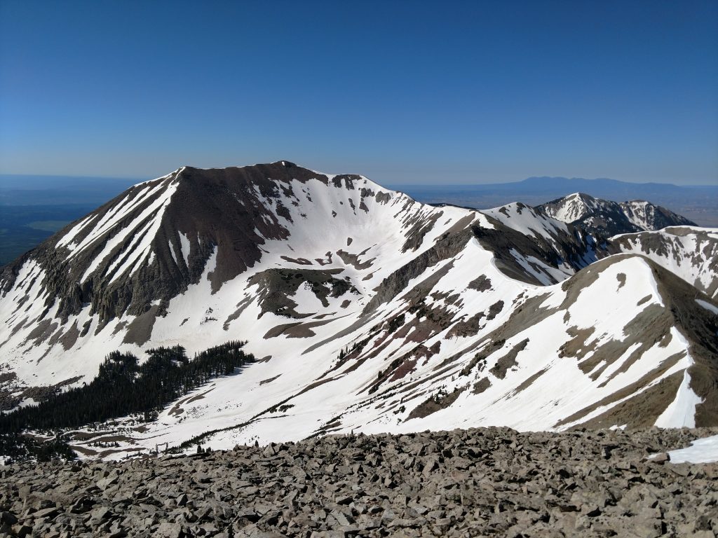
As the trees thinned and the views expanded, I found myself at 11,700' and near an unmarked antenna; perhaps a monitor for backcountry skiers? It was a good spot to take stock of my progress. Gold Basin Ridge takes a dog leg here and terminates at the summit of Mt Laurel, 12,271'. This is more of a sub-peak as it's prominence doesn't exceed 300'. To my left or North was Mt Mellenthin, another summit I considered climbing. Mt Peale was obscured by the ridgeline. But the picturesque and pyramidal Mt Tuk loomed over Gold Basin. Its profile was outstanding though I clearly had a long ways to go.
Mt Mellenthin and Mt Laurel
I made great time up to this point so I decided to bag Mt Mellenthin and Mt Laurel. The former is a summit in its own right and requires a short but steep scramble up talus. I departed from Gold Basin Ridge at a point where I was eye-level with the saddle between Mt Mellenthin and Mt Laurel. I skirted around the sloped, took a brief break at the saddle and ascended.
From the saddle, Mt Mellenthin's route looks nasty but I found a well-established route that involved minimal exposure and backsliding. It wasn't too difficult at all.
Mt Mellenthin is 12,645' and rather flat-topped. I had outstanding views of Moab, Castle Valley and the Northern La Sals including Mt Waas. A fine side trip!
I finally saw the day's destination, Mt Peale. Its whaleback summit rose from the ridgeline connecting it and Mt Tuk. I found no evidence of a summit register at the top but took a few victory photos in case Mt Peale eluded me. It was so close in distance but so far in effort.
I slithered down to the saddle and re-ascended until I stood atop Mt Laurel. The top was underwhelming compared to the other three summits but it provided a great vantage point of the ridgeline connecting Laurel with Mt Peale and Mt Tuk.
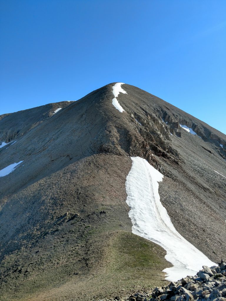
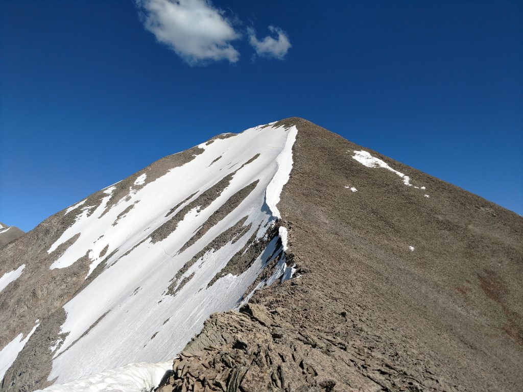
Mt Peale from Mt Laurel
It took several hours to cross the ridgeline connecting Mt Peale and Mt Laurel. There's some minor, tedious scrambling between the two. I didn't think it very technical but the talus and mix of wet snow slowed my pace. At mid-morning, I stood at the saddle just below the high point.
I saw evidence of several ski-mountaineers and wished I had that freedom and gear. However I didn't see any evidence that people climbed Mt Peale from La Sal Pass.
In June of 2019, I had excellent snow cover up the final ridgeline of Mt Peale and attained the summit at around 1PM. I had lunch along with several jealous marmots eyeing my turkey sandwich.
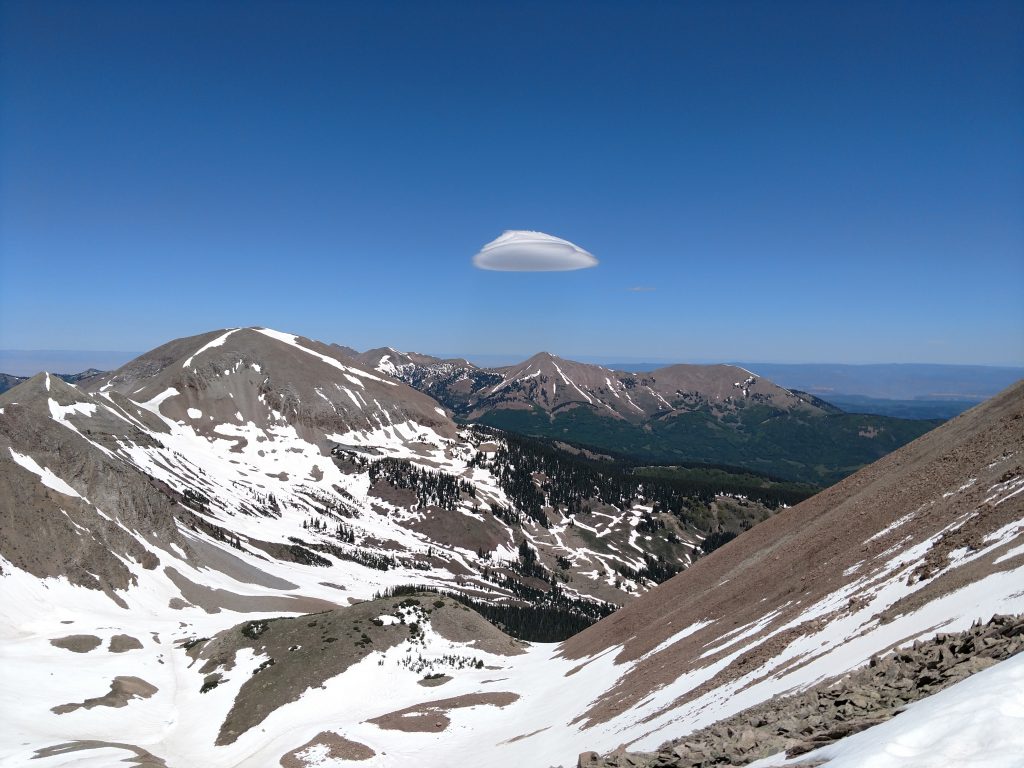
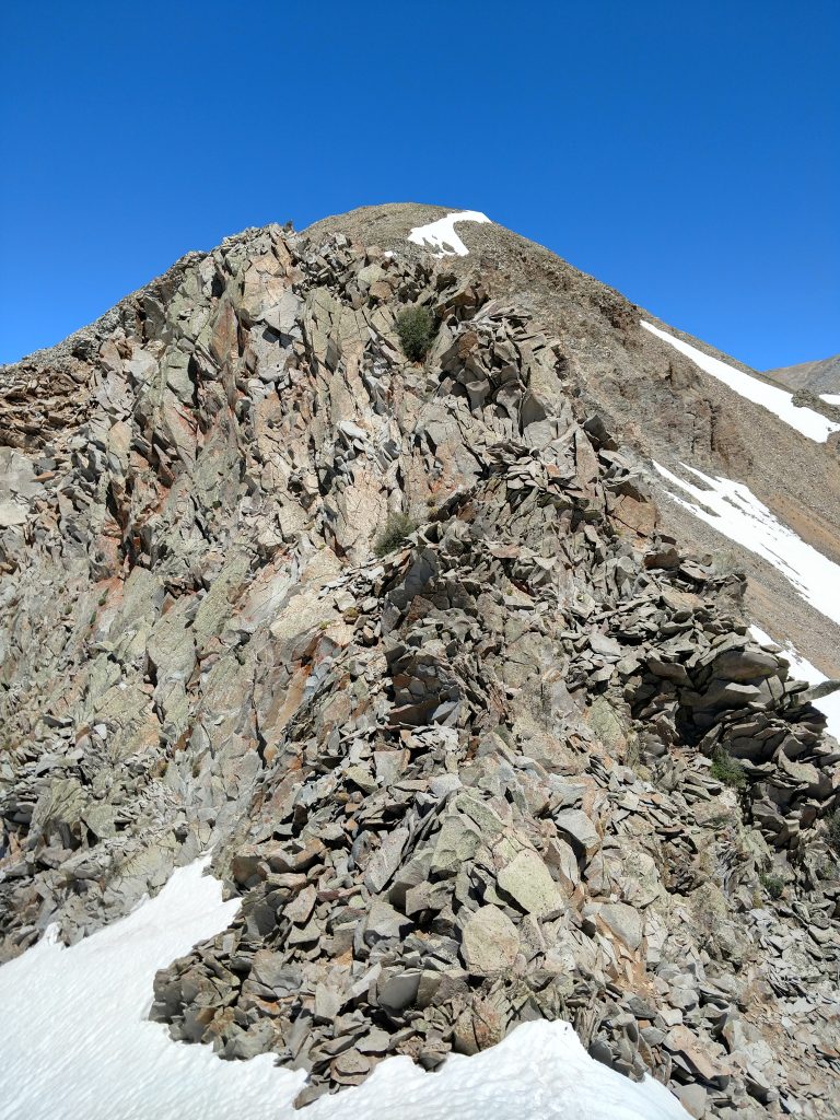
Class III Ridgeline to Mt Tukuhnikivatz
I knew before ascending that this Class III ridgeline connecting Mt Peale to Mt Tukuhnikivatz was the crux. Its not technically difficult nor is it terribly exposed by scrambling standards. Nevertheless, its sustained.
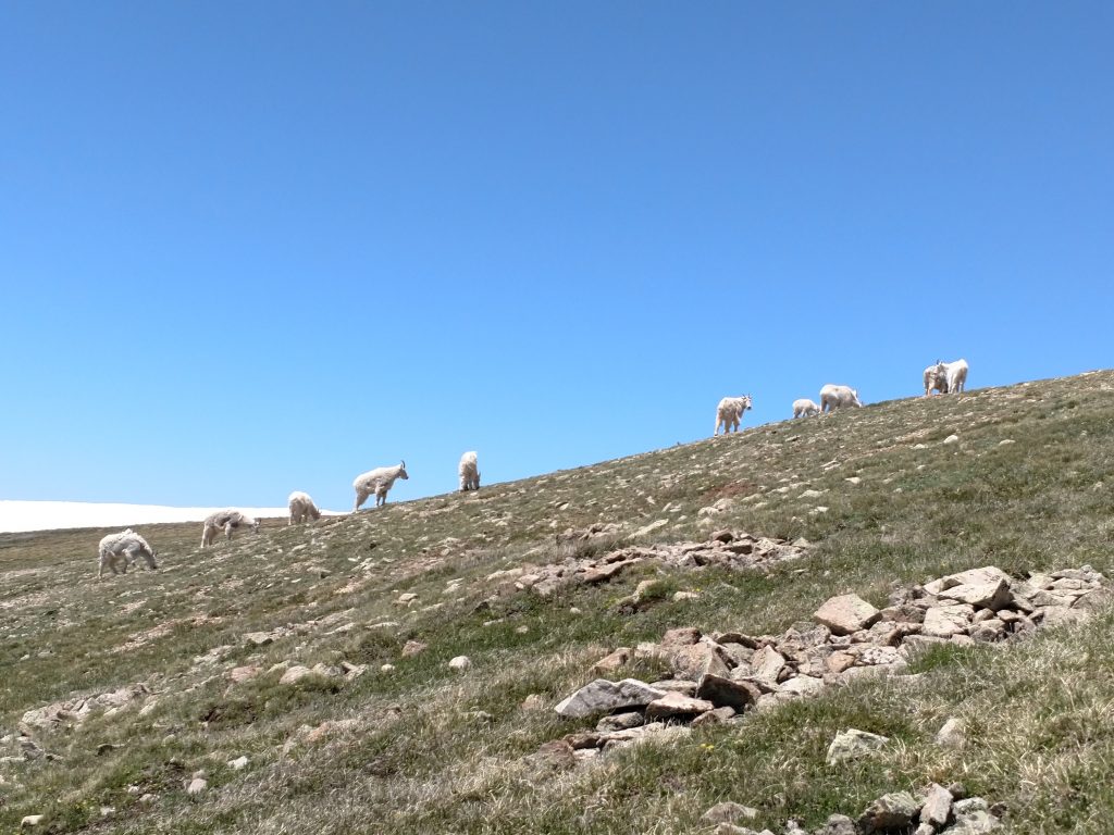
I dropped to the saddle between Mt Peale and Mt Peale's Northwest Peak. I crossed a herd of about 2 dozen mountain goats which was a first. I've seen solo mountain goats here and there but never a heard and never any of their lambs! What a sight:
From the Northwest Peak of Mt Peale, I dropped all 700 feet in altitude to the saddle. I hated losing this kind of altitude but it was the most direct way to ascend Mt Tuk.
Whatever semblance of a trail I previously had disappeared at this point. With very slow going and a lot of down climbing, I found the path of least resistance down the class three ledges. A few sections were tricky with a heavily loaded pack but all together just boots and hands were fine. I didn't think roping up would have been necessary even if I had the people and gear.
It took about an hour to negotiate this short but steep section. At the base of Mt Tuk's pyramid, I began ascending an excellent quality snow drift. This thread brought me all the way to my final summit of the day.
Mt Tukuhnikivatz was absolutely the most scenic and classic of all the mountains I climbed. Now I know why people climb it alone!
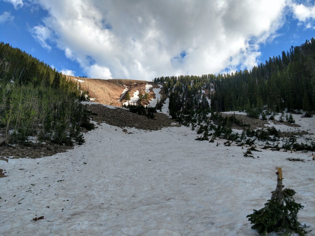
A terrible idea: descending Mt Tuk into Gold Basin
Here's a mistake I made: I went North from here and back down into Gold Basin, creating a loop. I probably should have just returned the way I came but I wanted to shave off distance. I paid for this dearly.
It was easy enough descending the North ridge to the small sub-summit noted as "Little Tuk". From here it was a class III-IV descent of 2,000' in less than half a mile. Were the conditions more winter-y it would have been nicer. But the snow was very soft and I postholed everywhere. The rocks were lose on the bare slopes. I tried using the tree cover for better descending but that was just muddy, lose and very scary. Slowly and painfully, I made it to the bottom of Gold Basin.
Interestingly, I noticed the massive remains of a rockside/avalanche:
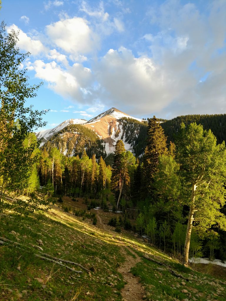
Gold Basin back to Car
At the bottom of Gold Basin, when it started flattening out, I had another challenge. I had to cross a very swollen Brumley Creek. I barefooted it up to my knees in icewater. Once on the other side, it was a straight shot back to Gold Basin Road
There's a small trail that leads out of a bare part of the valley to the terminus of Gold Basin Road. I found it without trouble. Once on Gold Basin road, I made my way back to the car. Though the whole day was solitude for me, Gold Basin Road had no less than 100 campers by the time I made it back to the car. Didn't know it was so busy
At the end of the day, I used every single piece of non-technical mountaineering gear I had: Mountaineering boots, snow shoes, ice axe, crampons, microspikes, heavy mountaineering gaiters and poles. My pack must have weighted over 35 pounds. But here's to another successful ascent of several La Sal Range summits (and a bit of a sufferfest).

No Comments