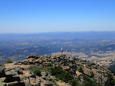
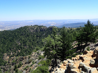
Mt St Helena is the tallest mountain in the San Francisco Bay Area. At 4,342' it is one of the rare coastal summits that receives measurable snow in the winter. A true classic for any hiker in the region
 |
| The summit views of Mt St Helena |
Boy is it ever refreshing to be surrounded by mountains again! The summits of the coastal ranges of California are not very tall compared to the sierras and transverse ranges of the state. However they are far more lush and the views are no less phenomenal. I decided to kick off my peakbagging of the state by hiking Mt St Helena
This is a very popular summit to hike, especially in the summer months. In addition to it's lofty summit, Bubble Rock is accessed by the trail and is a classic rock climbing destination. Solitude is not always abundant here but the trail does offer almost continuous panoramas of the Napa Valley.
Here's a trail map-
Robert Louis Stevenson State Park is where the parking area is. I came at about 8:30 on a Saturday and the parking lot was practically overflowing. Thankfully I was able to get a spot but I would caution anyone with arriving too late in the morning. People tend to start clearing out again around 12-1 so an afternoon may be more fortunate for parking.
The trail itself is actually not very obvious from the parking area. An unmarked double-wide dirt track leads away from the highway to a picnic area and clearing. From here, there is an actual sign that says "Mt St Helena, 5 miles". That's really one of the only directions provided by signage.
Enjoy the shaded forest in the first mile of the trail- you won't encounter it again in the 4 miles afterwards that lead to the summit. The trail switches back and fro before coming to a monument to Robert Louis Stevenson. Shortly thereafter the trail comes to it's first major overlook. This may suffice for some hikers looking for a brief out-and-back.
After the overlook, the trail comes up to the access road which will serve as the route to the top. The road is fairly straightforward from here. While the openness of the access road gives way to some fantastic vantage points, there is very little shade. Note also that there are no services or water sources from trailhead to summit.
With just a mile to go to the summit, the trail seems to arrive on the massif of the summit. Five peaks make up the mountain although only two are regularly climbed; the main summit and the east subpeak which happens to be the highpoint of Napa Valley. Thick chaparral seems to deter climbing the additional summits.
At the very top there are some radio towers but that doesn't obscure the fantastic view into the northern wilderness of the mountains. With only a few small towns visible, you would never guess such a summit is with the range of the 7.6 million people of the Bay Area.
I must have snapped several dosen photos at the top- it was wonderful
 |
| The taller, Cobb Mountain, off in the distance |
The high-point of Napa County is very easily bagged on the same hike although it is an otherwise insignificant shoulder peak of the true summit. Naturally, I couldn't resist the 10 minute detour.
Total distance was roughly 12 miles round trip. I did it easily in about 3/4 of a day and saw hikers of all experiences on the mountain. Certainly I would like to return in the winter!


No Comments