


Lake Champlain is the "forgotten" Great Lake which also drains into the St Lawrence Seaway. It is somewhat of an up and coming destination for paddling although its remoteness from any major metropolitan areas other than Burlington and Montreal means that the lake remains relatively off the radar for most paddlers.
Day: 2
Miles: 215
I've wanted to paddle across Lake Champlain essentially since moving to New England. It is a vast lake sandwiched between two of the country's most historical and iconic ranges: the Green Mountains and Adirondacks. The lake appears to be large enough to make it so that the crowds of recreational boaters are thin. Perhaps it is simply because I don't live in the area, but I've found that resources regarding paddling and non-motorized boating of Lake Champlain are few. There does appear to be a pretty substantial Lake Champlain Paddler's Trail which is similar to the Maine Island Trail in that it is run by an association and the guidebook is available to members. I would certainly have liked to have done this if I was a regular kayaker in the area but I was just passing though today. Looking at a topographic map, it appeared as if the Split Rock Mountain area would be very cliffy and gorgeous. I was not disappointed.
At about 5.5 miles in to my leisurely paddle, I had to turn back to avoid thunderstorms and worse currents. As you can see from the picture, there was so much natural beauty that it was hard to do so. Much of Champlain has been developed but this rugged reach remains a wilderness. I paddled ever so slowly though the beautiful cliffy section before making good time back to the boat launch where I started.
Again, I could be entirely mistaken, but it really seemed like the whole of Lake Champlain has not seen a great deal of kayaking and paddling. Perhaps I just came at the right time of year- after labor day but before fall starts to set in. The timing was to my advantage- temperatures were still summeresque but the crowds were not. I encountered only two sailboats and one motorized boat during my 11 mile trip. It is always nicer when you have such places all to yourself.
Read. Plan. Get Out There!
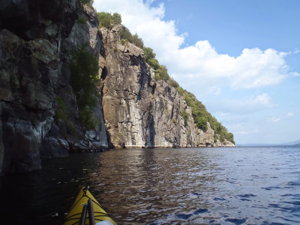 |
| The cliffs of Split Rock tower above the water |
Miles: 215
I've wanted to paddle across Lake Champlain essentially since moving to New England. It is a vast lake sandwiched between two of the country's most historical and iconic ranges: the Green Mountains and Adirondacks. The lake appears to be large enough to make it so that the crowds of recreational boaters are thin. Perhaps it is simply because I don't live in the area, but I've found that resources regarding paddling and non-motorized boating of Lake Champlain are few. There does appear to be a pretty substantial Lake Champlain Paddler's Trail which is similar to the Maine Island Trail in that it is run by an association and the guidebook is available to members. I would certainly have liked to have done this if I was a regular kayaker in the area but I was just passing though today. Looking at a topographic map, it appeared as if the Split Rock Mountain area would be very cliffy and gorgeous. I was not disappointed.
View Kayaking Lake Champlain in a larger map
Split Rock's closest boat launch is out of Westport, New York. Actually, you could also pretty easily cross the lake from the Vermont side from one of several state parks in the area. Whatever you chose, the main attraction is at the southwestern end of the park near Barn Rock and Snake Den Harbor.
Starting from Westport, I loaded up at the free boat launch and casted off. The launch has restrooms and is nearby several basic services in town. I headed in a general northeasterly direction, passing by several camps and larger estates. I believe that this area has been somewhat of a resort destination for centuries. However they tended to thin out as I got closer and closer to the park boundary. Just past Hunter Bay, I landed on the little anvil shaped area, shown above, and took lunch.
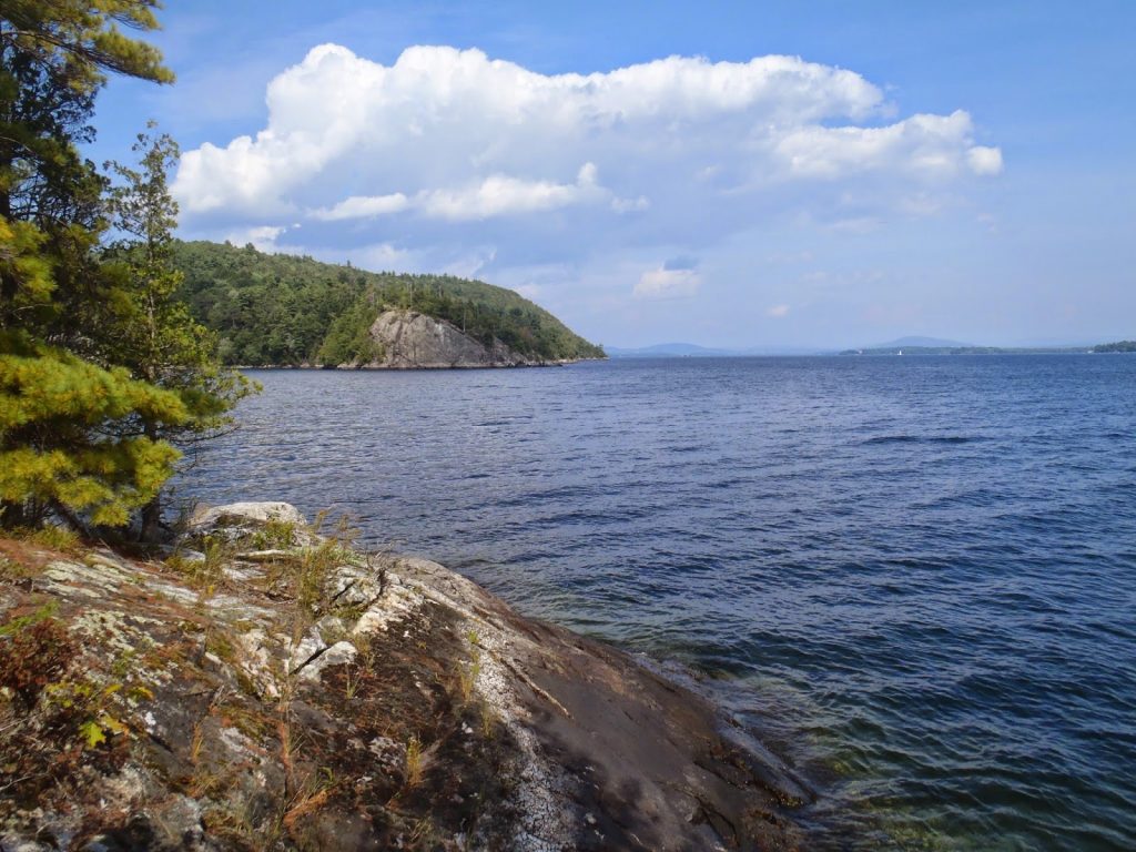 |
| A nice view on the lake |
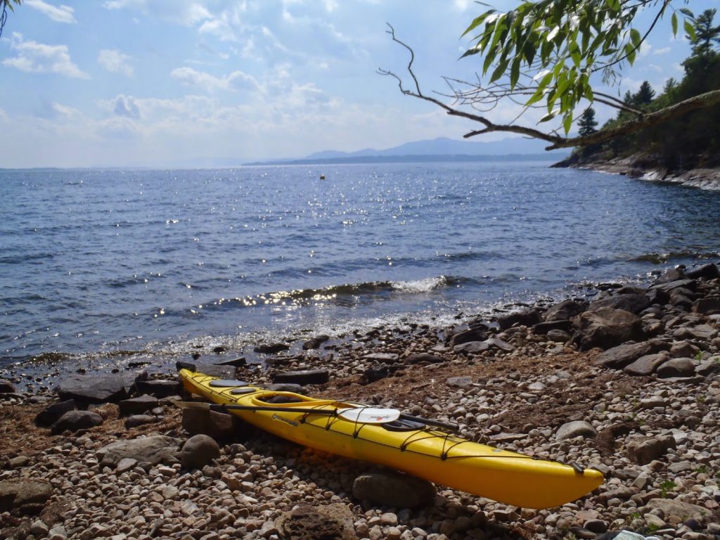 |
| Sea Lyon II is happy to not be collecting dust in the garage |
After my little "lunch rock", I headed into the marine boundary of the park and noticed a scuba diving marker for an underwater park. Apparently there is a great wreck dive here. Moving past this point, I saw Barn Rock and the Split Rock Mountain Palisades which were glorious. Towering 200 feet above and nearly vertical, these cliffs dwarfed me and my small kayak as I paddled in their shadow. Normally I paddle at a brisk pace but I slowed down and let the current carry my down. Surely I was in the perfect spot for paddling Lake Champlain.
I would have loved to have tried my hand at bouldering or doing some multi pitch climbing here. Seems like an ideal spot. Like the paddling, I am under the impression that rock climbing here isn't unheard of but it isn't exactly broadcasted either. All my road trips end up with me writing a gigantic list of things to come back for.
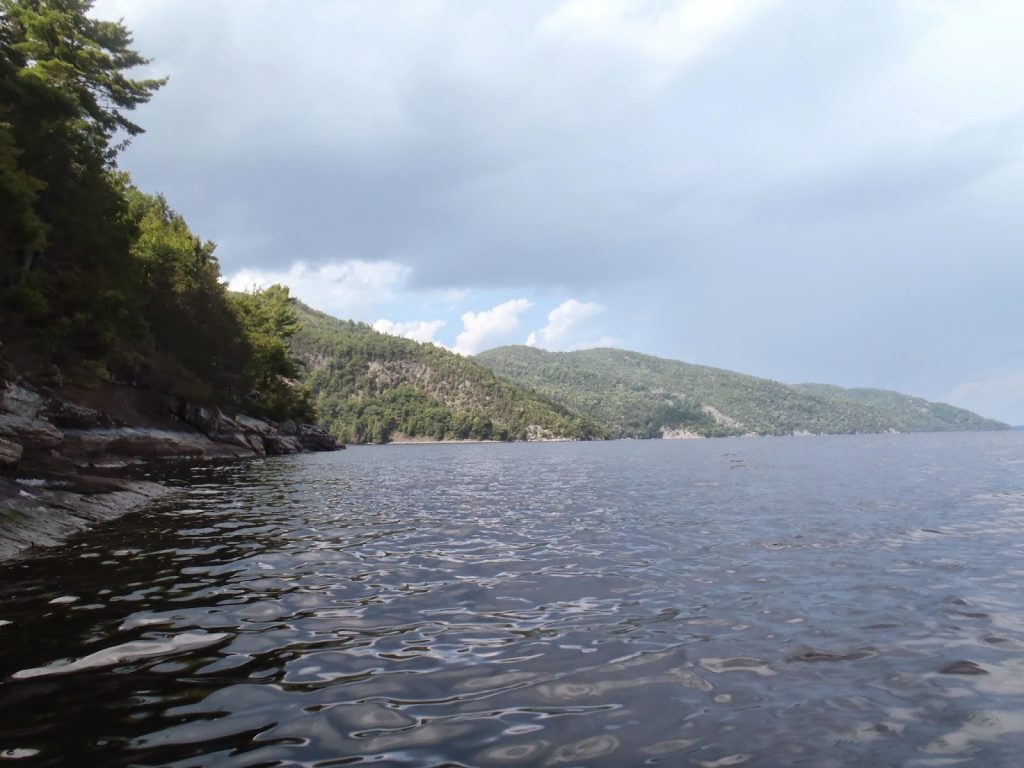 |
| The namesake mountain rises abruptly from the shore |
Again, I could be entirely mistaken, but it really seemed like the whole of Lake Champlain has not seen a great deal of kayaking and paddling. Perhaps I just came at the right time of year- after labor day but before fall starts to set in. The timing was to my advantage- temperatures were still summeresque but the crowds were not. I encountered only two sailboats and one motorized boat during my 11 mile trip. It is always nicer when you have such places all to yourself.
Read. Plan. Get Out There!

2 Comments
Tatiana
July 5, 2020 @ 14:22
Hi,
We are planning to make a similar trip this summer. How long did it take you to paddle from Westport to Split Rock Mountain? Where did you make your stop on the way? We are a family with teenagers. We have some experience with kayaking/canoeing but haven’t done really long trips before ( not more than 1-1.5 hrs one way). Thank you!
Quincy Koetz
July 12, 2020 @ 18:14
From what I recall, it took me about 1/2 a day to paddle out and back to the bulk of Split Rock Mountain. It was about 6 miles one-way and I had no wind nor currents to deal with. Generally when I’m casually paddling, I have a rate of about 2-2.5 miles per hour but if I’m more deliberate with the paddling I get up to 3-3.5 miles per hour. I think it depends on the boat you’re using as well- I had a touring kayak which cuts through the water marvelously but with a sit-on-top kayak I would expect a rate of more like 2 miles per hour and plan for the better part of a day. I don’t recall any good stopping points between Westport and Split Rock Mountain- its pretty cliffy so just keep it in mind- hope that helps! -Quincy