A classic hike of a beautiful section of the Long Trail which includes some of Vermont's highest mountains and the Breadloaf Wilderness. Includes an ascent of 2 of New England's 100 Highest Mountains as well as a great view from Mt Roosevelt.
 |
| The Breadloaf Wilderness of Green Mountains National Forest is one of the finest wildernesses in New England |
I've been on a Vermont Route 100 road trip for about half a week and it has been so wonderful. At various points in the last 3 years, I've pretty much covered every inch of Route 100 at one point or another and I've enjoyed every minute of it. This highway winds across the central portion of the state and visits nearly every highlight of the mountains. On this particular day, I was out for a hike near Hancock, Vermont. I had tried to get to the trailhead on the western side of the mountain (FR 59 aka Steam Mill Rd) but it was closed, probably due to Irene? Anyways there are several routes to the summits and another option is the Clark Brook Trail.
Numerous other options exist for hiking these summits.
Here's my map-
The trail head itself was actually easy to miss and I drove halfway up the mountain looking for it! The turnoff for it is right in Granville and is marked. You drive up the mountain, passing by a couple side roads before the road crosses Clark Brook and the trail head is just on the other side. Several informal campsites are in the area. Also, the only real place to park is just before the bridge that crosses Clark Brook.
The trail generally follows Clark Brook most of the way up until the Long Trail. It is a gentle ascent starting out until it meets the
Breadloaf Wilderness Boundary where it begins a somewhat steep ascent up to the intersection with the Long Trail. From the trailhead to the LT is about 3.0 miles. It meanders through a lovely wilderness.
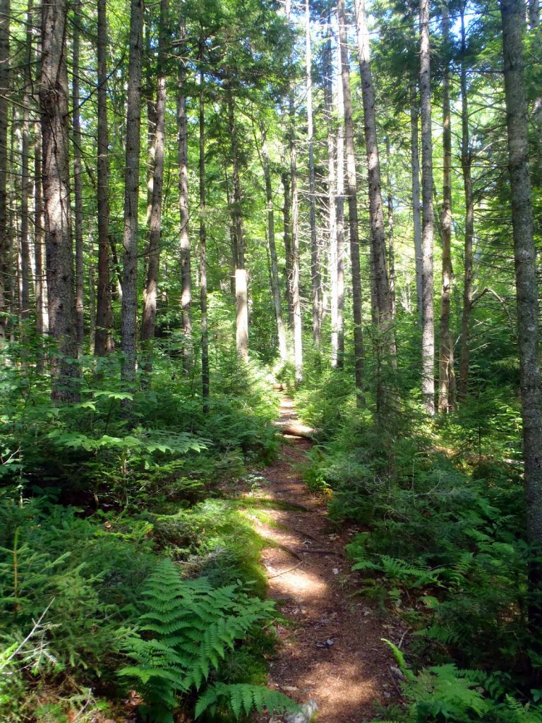 |
| Trail though the Green Mountains National Forest |
Once reaching the crest of the Green Mountains and the Long Trail, there are a few optional hikes. Many people chose to bag Mt Wilson and Breadloaf, which are on the New England 100 Highest List. Besides that, the trail along these mountains is a great way to experience the alpine environments of Vermont.
Turing left at the LT and heading South will bring you to the summit of Mt Wilson in 0.8 miles. The intersection of Clark Brook Trail and the LT is at 3,230ish feet and the summit of Mt Wilson is about 3,780' so there's still quite a bit of elevation to be gained. Just south of the summit are the ledges where there are fine views of the entire wilderness. Unfortunately, this is the only real view you get on the hike, unless you chose to bag the nearby Mt Roosevelt.
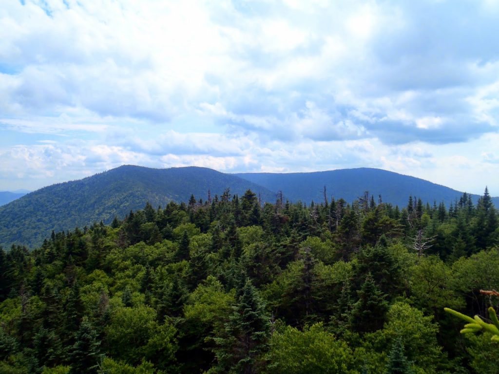
 |
| View from Mt Wilson's ledges |
After the ledges, the trail runs over the otherwise unnoticeable summit of Wilson before dropping down to the Emily Proctor Shelter on the Long Trail. It is about 0.8 miles from the summit of Mt Wilson to the summit of Breadloaf and the trail looses and gains roughly 250-300 feet of elevation. There are excellent and reliable water sources available at the Emily Proctor Shelter. After this, the trail ascends the summit of Breadloaf without many views. The summit itself is nearby the very obvious hairpin turn on the Long Trail with the highpoint only a hundred yards off the trail itself. A small cairn marks the 3,835' summit with no views. At this point, I turned back and came over Wilson one more time and down to the Clark Brook Trail turnoff
Mt Roosevelt is a summit of little importance to anyone but it does have panoramic views of both Wilson and Breadloaf as well as views to the east. It is only 0.4 miles north of the Clark Brook Trail and a gain of 200 vertical feet. It can be easily done in conjunction with the other summits and I would recommend it for those who want some great photos.
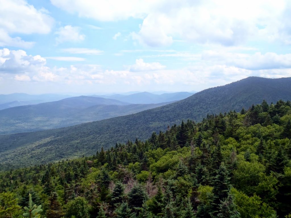
 |
| Mt Wilson is to the left, Breadloaf is to the Right. View from Mt Roosevelt |
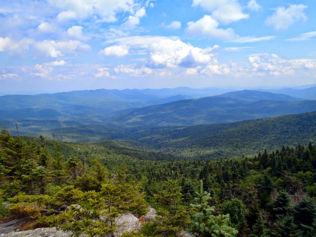
 |
| The ascent that Clark Brook Trail makes from the valley is clear from Mt Roosevelt |
 |
| A fine wilderness! |
Total distance is roughly 10 miles, out-and-back. It makes for a nice full day hike of Vermont's high peaks and a great section of the Long Trail. I would say there is little sense of going all the way up without bagging all three mountains. Whatever your pleasure, it is one of the highlights of the Green Mountains National Forest.
Read. Plan. Get Out There!


No Comments