


I'm really excited to write about Margarita Peak near the San Diego/Orange County area! This is a peak well off the beaten track and probably gets less than a dozen visitors a year. I discovered its existence through Peakbagger while searching for summits in the Santa Ana Mountains I hadn't yet climbed. I've climbed Santiago Peak and Modjeska Peak several times which are outstanding in their own right. However, while in Southern California for the holidays, I wanted a wilderness experience and Margarita Peak hit the spot.
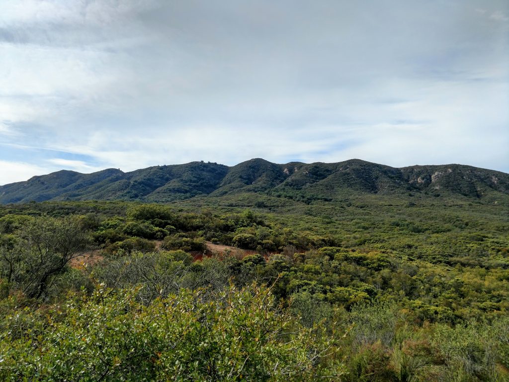
For those who don't know, the Santa Ana Mountains are the prominent range rising in the eastern boundary of Orange County. Famously picturesque Saddleback Mountain (consisting of Santiago Peak and Modjeska Peak) is visible from most anywhere in Southern California on clear days. The Santa Ana Mountains stretch from Whittier all the way to North San Diego County and altitudes generally range between 2000-3000'. They retain exceptional wilderness character considering their proximity to four major megalopolises (San Diego, Inland Empire, Los Angeles and Orange County).
Overview and Directions to Margarita Peak Trailhead
Margarita Peak is the southernmost major summit in the Santa Ana Mountains. Its situated between the Ortega Highway and Camp Pendalton, a massive Marine Corps base on the Pacific Coast. Most of the peak, except for the highpoint itself, is located in Cleveland National Forest. There are no official trails to the summit.
Getting to Margarita Peak involves navigating a network of roads through rural Riverside county. From wherever you are, take Interstate 15 to Exit 68, Clinton Keith Road. From that exit, follow these directions to the trailhead I used for my "normal car".
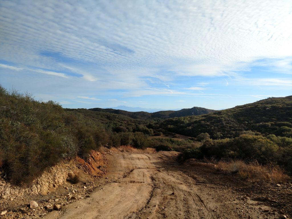
The roads are generally in good shape. Tenja Road, the main thoroughfare through the area, is paved up until this point (follow link). Tenja Road ends after 0.2 miles following where the dirt begins. I followed Margarita Road another 1.4 miles until it intersected at a "Y" with an unnamed road. I parked there and recommend parking there if you don't have a trail rated vehicle.
Cell phone coverage in the area is spotty. Use a GPS and good map. Here's my starting point and route:
Margarita Peak Hike
I started my hike at the Y intersection mentioned above. High clearance vehicles driven by experienced drivers could make it to the actual trailhead located here.
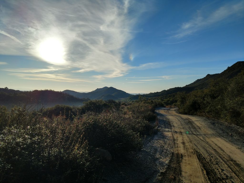
From where I started, it was an extra 3 miles of road walking to the trailhead. This had some up-and-down but was generally pleasant. I planned on following the google maps directions to the trailhead however the road shown on google maps goes through gated, private property; thankfully there's a road that goes around the private property but it added an additional 0.6 miles to the route I originally planned.
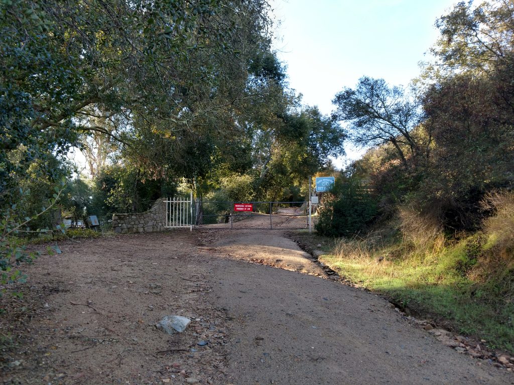
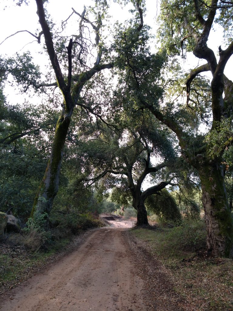
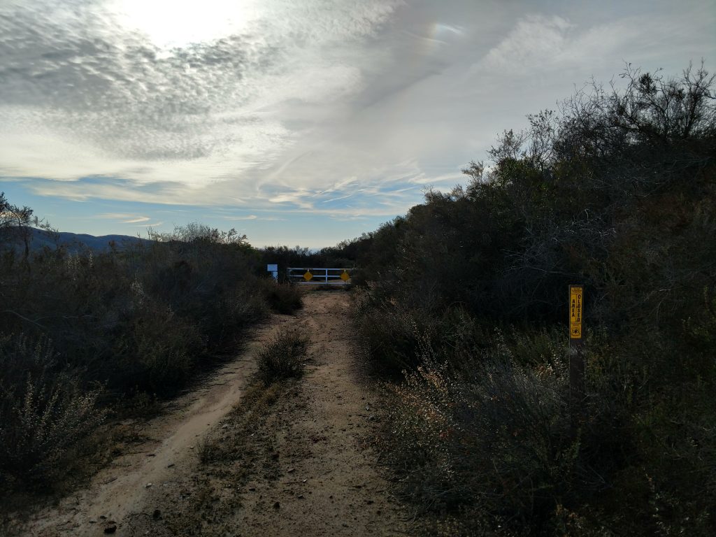
At a point exactly 3.0 miles from my car, I found the "trailhead" for Margarita Peak. It was just off to the left of the road as I was walking and made obvious by a large, white barrier gate that prevented further motorized travel. A sign marked the entrance to Margarita Preserve; at the time of my visit there was no evidence that it was private, off-limits or closed.
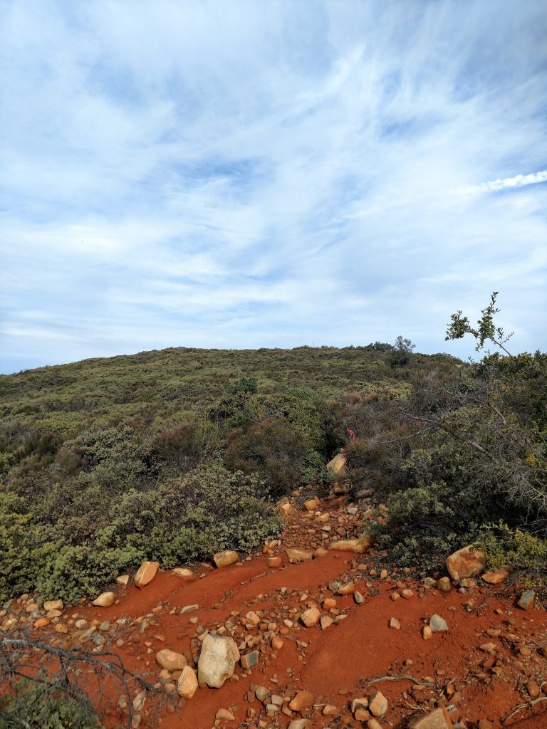
The Bushwhack up an old Fire Break
From here, I followed the remains of a decrepit fire road about 900 feet to another intersection. Here I found further signs for Margarita Peak Preserve requesting all the usual precautions for a wilderness outing.
The route from here to the summit was considerably more obscure. I recommend downloading a GPS track from Peakbagger for this hike!
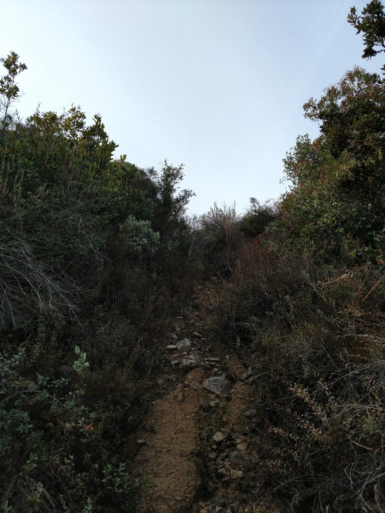
Although I never had trouble finding a clear route through the scrub, its definitely not a trail. The route up Margarita Peak is somewhere between a full bushwhack and a herd path.
For about 1/2 a mile, the trail relentlessly charges up the main ridgeline of Margarita Peak. Google Satellite made it look fairly clear, however the route is overgrown at this point. I'm glad I wore long sleeves and pants!
At a very slow pace, I gained altitude and greater views. The route I found generally headed in a uniform West by Southwest direction until hitting the ridge-line where it flattened out a bit. There's a small sub-summit just a few hundred feet from the true summit where I took a break.
False Summit to True Summit of Margarita Peak
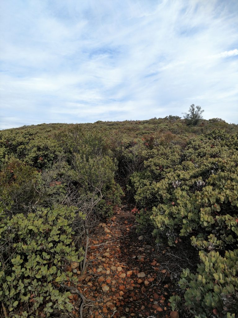
This is the crux of the hike if there was such a thing. Between the false and true summits lie a several hundred foot stretch of extremely thick scrub. Consisting mostly of manzanita, wading through such a section would be like moving through concrete. With a little searching around, I found a few cairns and found a route on the western side of the ridgeline. There's a clear cut path through the sea of thick vegitation all the way to the summit. I honestly don't think I would have made it to the top without finding this pathway.
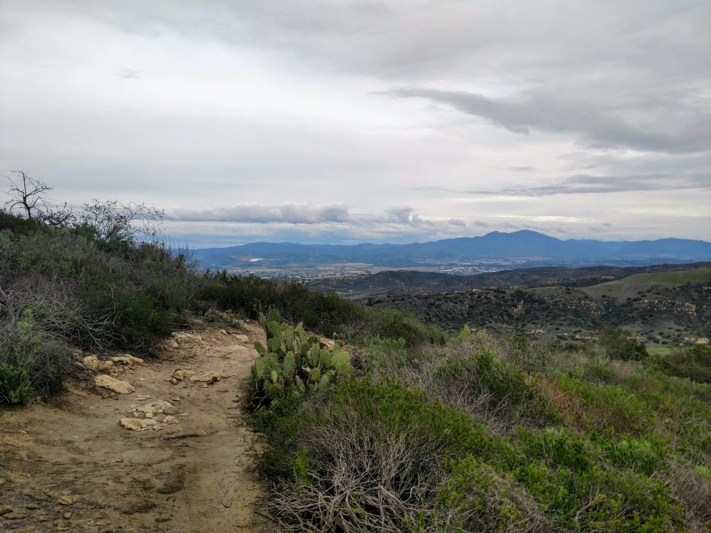
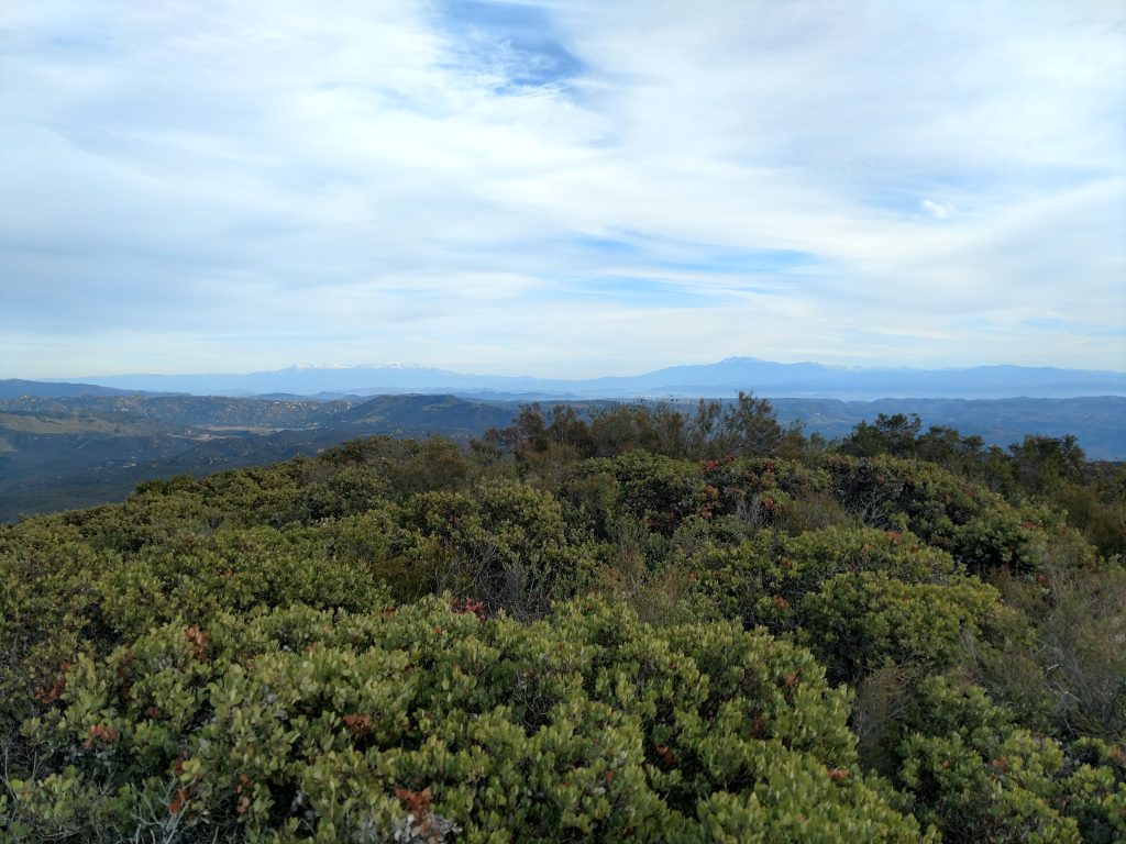
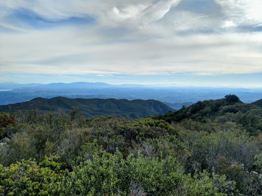
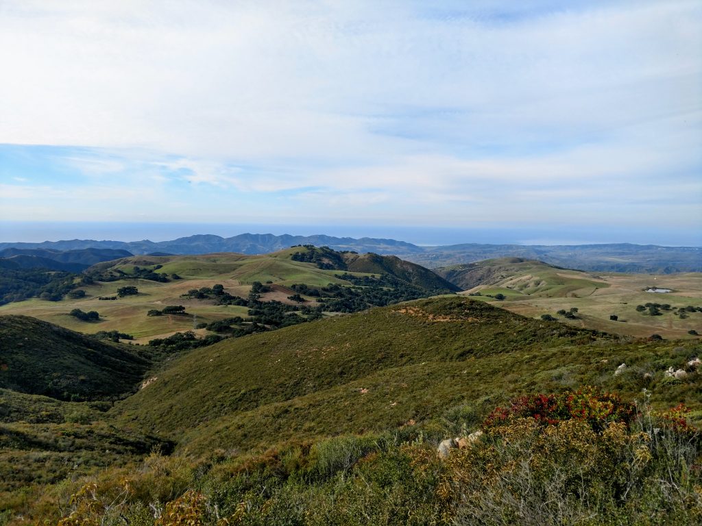
The summit itself is clear and has unobstructed views in every direction. Though I didn't have an exceptionally clear day, I could see nearly every summit in Southern California, from San Diego to the San Gabriel Mountians.
The summit marker was a simple plastic pole drilled into the ground. I didn't find any evidence of a summit register. Of course, I had the whole area to myself!
After 20-30 minutes of taking photos and trying to pick out the major summits visible from the top, I headed down Margarita Peak the same way I came. Route finding on the way down was equally difficult but having the GPS route pre-loaded saved some time.
It took about 4 1/2 hours to do the whole trail and I didn't see any other hikers. I'm glad there's still some wilderness left in the area. Of the little online literature on this summit, every report says its a "hidden gem"; I heartily agree!

No Comments