


South Baldy is a prominent summit in South-Central New Mexico and "sky island" set in the desert
As I wound my way down through Northern Arizona and New Mexico on my way to El Paso, I passed numerous small but imposing mountain ranges. Dozens of them loomed over the I-10 corridor and I wanted to explore at least one of them. After a night in Socorro and a little research, I settled on climbing South Baldy
South Baldy's altitude is 10,784′ making it fairly humble compared to summits of Northern New Mexico. However its isolation is significant and its one of the most prominent summits in New Mexico. I associate topographic prominence with fantastic views and South Baldy did not disappoint.
Directions to South Baldy Trailhead - Water Canyon
As far as I know, Water Canyon is the preferred approach for most climbing South Baldy. This is an easy trailhead to get to in spite of its isolation. From Socorro, New Mexico, drive about 15 miles West on Route 60. Water Canyon Rd is on the left and there's a forest service pull out just after the road. Hand a left and cross the cattle guard. From Route 60, its 4.7 miles to the Water Canyon Camp and parking area. You can continue up water canyon road almost to the summit but it becomes more of a jeep trail. Given the winter conditions, I parked at Water Canyon Camp and set off on foot from here. In the summer or dry conditions, most cars can make it another 2.1 miles to the South Baldy Trail #11 parking area. Here's a route map of the hike:
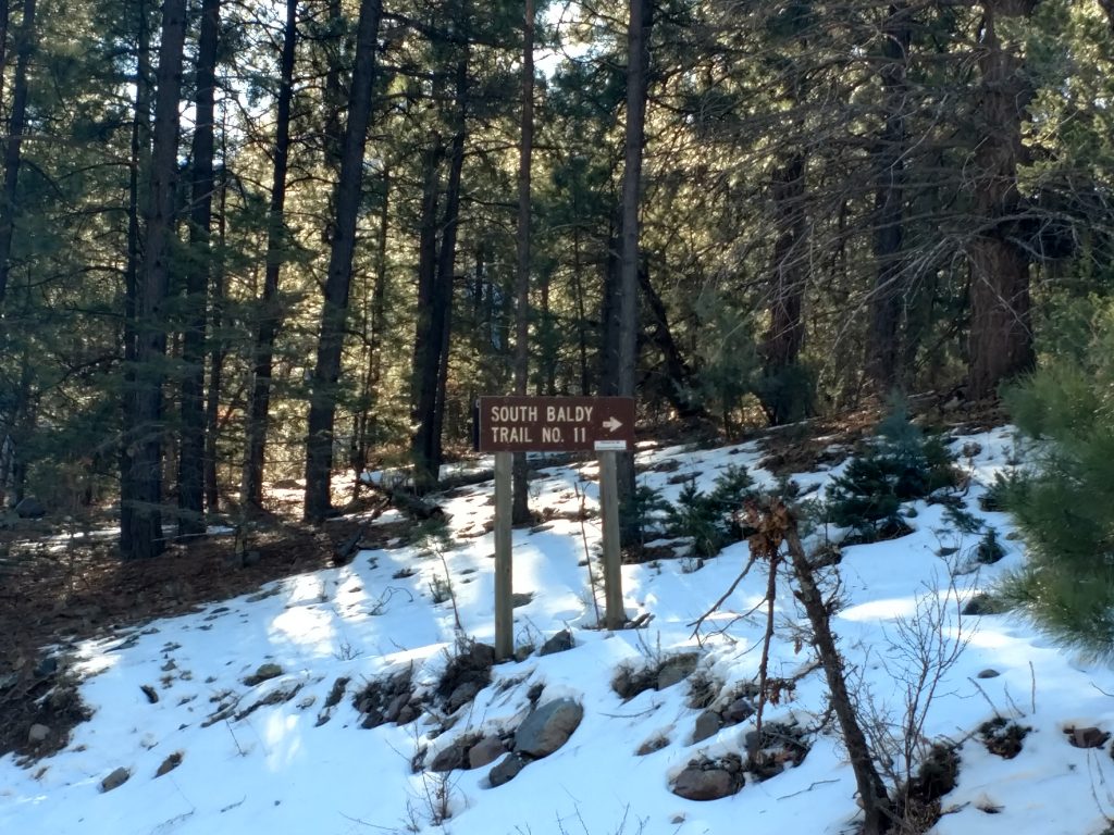
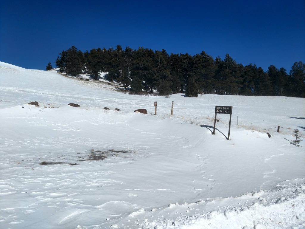
South Baldy Trail #11
After my 2.1 mile walk up the road, I found a small turnout which can accommodate 7-8 cars. I found the sign for Trail #11 which led up an obvious but unnamed canyon. In the summer, this path is well-trod but in the winter its not very obvious. Sun melts most of the snow in the upper reaches of the canyon but down in the gullies it was fairly deep. I didn't bring snowshoes which I later regretted
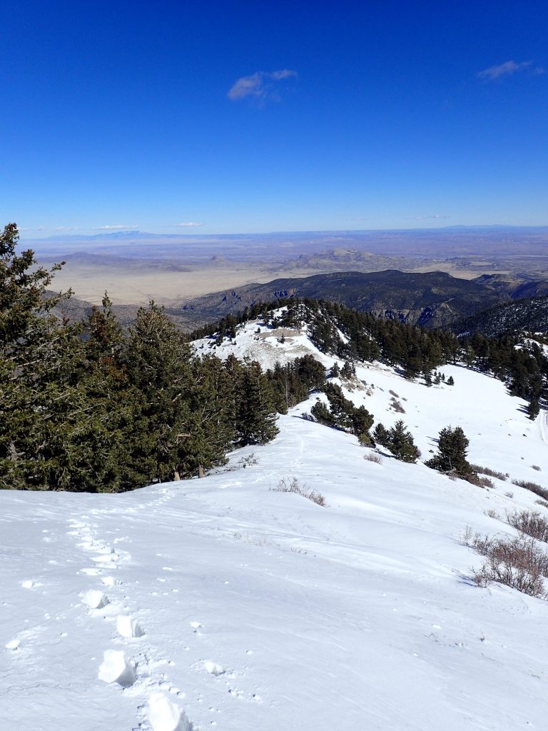
I slogged my way up the canyon and softening snow. Its steep and consistent until reaching about 9000 ft where there's a small saddle. I followed a conspicuous trail of snowshoes which abruptly terminated long before the summit. Clearly not a lot of people attempt this trail in January!
After the saddle, I basically used my GPS to find the most direct route that intersects the summit road. This was very slow going and I post-holed through waist deep snow in some sections. I finally achieved the road intersection which is just bellow the 10,000ft mark.
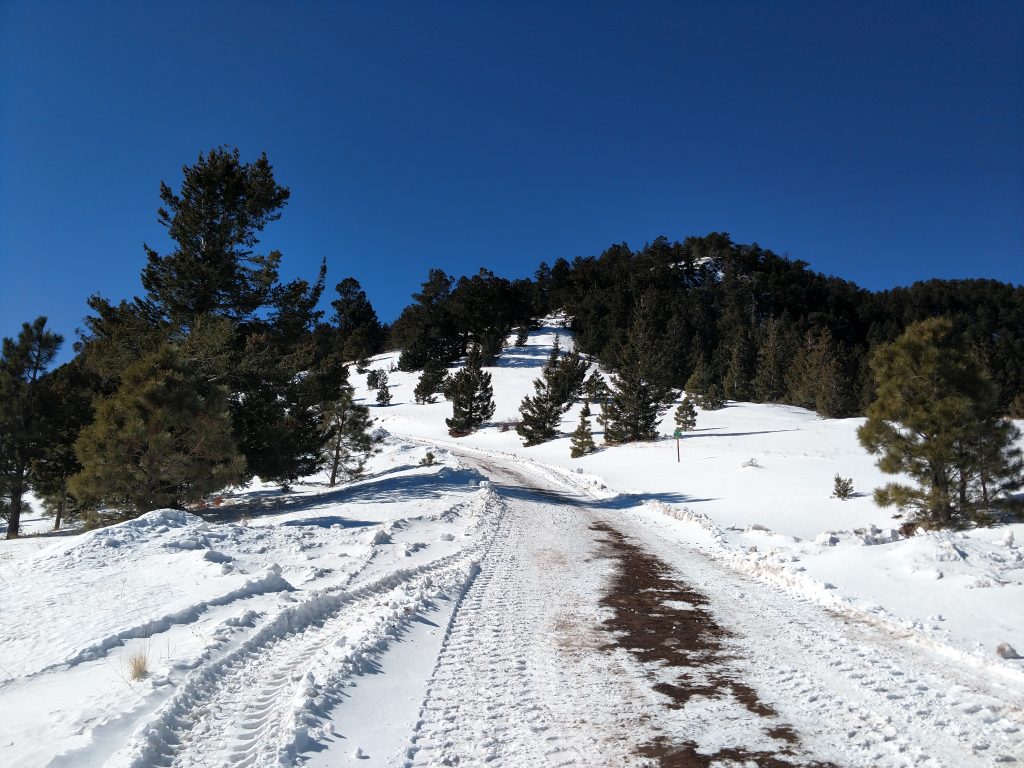
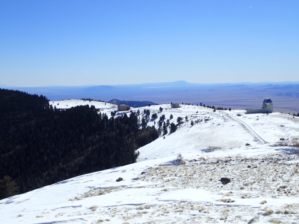
Road walk to Trail #8 and South Baldy Summit
Even in January and in a very wet winter, the road was plowed! It wasn't as plowed as a highway but fairly clear none the less. The road accesses an Observatory that is not open to the public. I guess they stay up there all season!
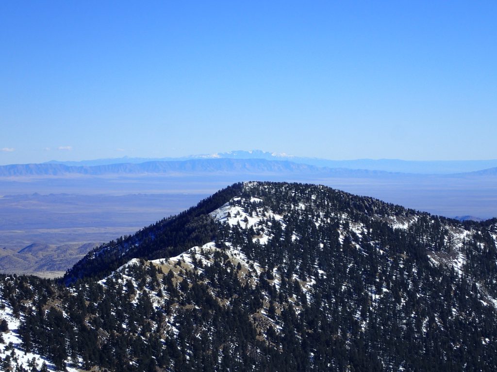
I continued on the road for less than half a mile as it made a horseshoe around a sub-peak of South Baldy. Around the bend the obvious summit came into view.
Given the winter conditions, I made a beeline to the summit, taking advantage of my crampons and relatively icy snow. There's a marked trail, labeled "Trail #8" that leads to the summit in the dry season. I couldn't see any sign of in in January other than the trailhead.
Summit of South Baldy and Trip Down
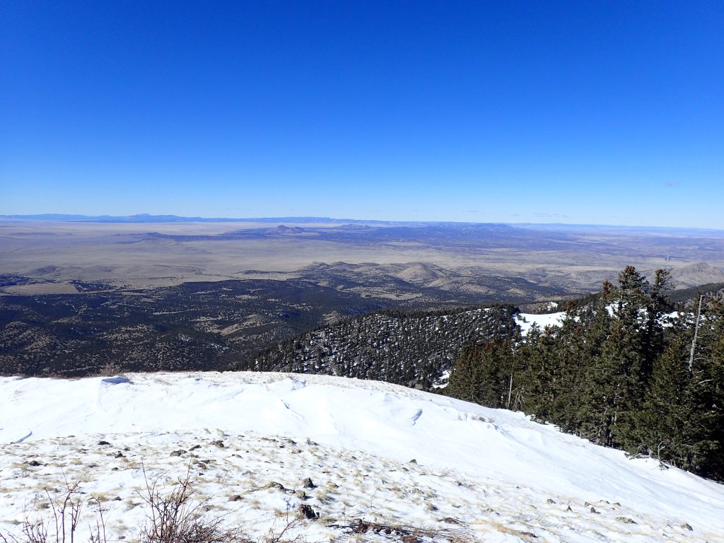
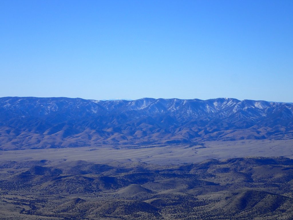
What a fantastic summit South Baldy was! Its a true sky island and certainly not unique in New Mexico. Nevertheless, the contrast of an icy, snowy summit and a hyper arid desert below was phenomenal. Views from South Baldy include the entire southern Rio Grand Valley, the Gila Wilderness to the Southwest and even Sierra Blanca which is 90 miles away. Almost nothing was obscured.
Although frigid, I spent a half an hour on the summit taking it all in. The threat of limited daylight called me off the summit and I made my way down the same path. The only section of difficulty was the completely snow-covered section between 10,000 and 9,000 ft but I found my way back with a GPS track. If you're going in the winter, I recommend a GPS given the propensity for snow to obliterate any sign of a trail.
South Baldy was the last hike I did on the first half of the trip. I spent a long weekend in El Paso and then spent another week on the road, retracing my steps but finding new adventures.

No Comments