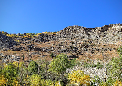
No doubt the highlight of the trip was going to be a trek through the Ruby Mountains in Nevada's beautiful Northeast. The Ruby Mountains are not famous to anyone except for a few tele-skiers and photographers. Despite overlooking Elko and Spring Creek, the peak is remote and infrequently visited.
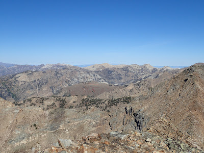
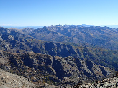 |
| Ruby Mountains as viewed from the summit of Ruby Dome |
To the untraveled, heading 250 miles West of Salt Lake City must seem unusual. After leaving the greater Wasatch Front Valley, route 80 runs 45 miles across what could likely be considered the straightest and flattest stretch of any interstate highway. Not even the roads of my now home-state of Illinois could compare to this particularly uninterrupted parallel. After crossing the Bonneville Salt Flats, the road crosses into Nevada and West Wendover, where Salt-Lakers go to sin.
From here, the road takes a starkly different tone as the pyramid of Pilot Mountain looms to the north. Wave after Wave of 10,000 and 11,000 foot mountain ranges speckle a harsh but glorious high desert. Few have ever inhabited such an arid but cold landscape. To the adventurer, however, this is one of the largest uninterrupted playgrounds of wilderness south of the artic circle.
Like its neighbors Utah and Idaho, Nevada is essentially known to the public only by its largest city. Not surprisingly, the federal government owns somewhere between 80-85% of the state (far exceeding 2nd place: Alaska). Other than the infamous Nellis Air Force Range and the Nevada Test Site (think, Area 51), most of the northern and central parts of Nevada are either under the Bureau of Land Management or the US National Forest Service. Naturally, much of those facts cause endless questions regarding conservationism and public v. private land ownership. But for budget adventurers with a hankering for unspoiled wilderness, its a perfectly legitimate reason to travel 250 miles west on Route 80.
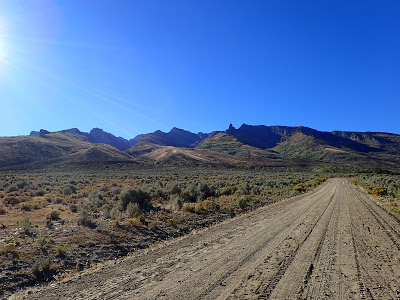 |
| The Ruby Mountains in morning glory |
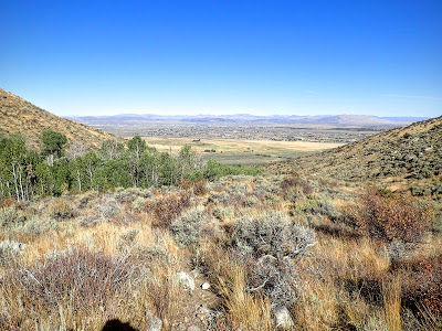
After a half dozen mountain passes and deep valleys, Route 80 dips into greater Elko. This town is massive by not-Las Vegas, Nevada standards. An unusually fast growing area, Elko would be an ideally situated place for any hiker to set up home base. The Ruby Mountains tower over the valley like a gigantic granite wave. I couldn't wait to get up there.
Here's a map of the route, which can be zoomed for more specific details. Note that it is a route and alternatives may exist-
In the fall, Quaking Aspens put off brilliant hues of yellow which vary in elevation. This magnificent display of color matches those of New England but with western subtly. There generally arent the vibrant purples, reds and oranges such as those in the high mountains of New Hampshire. Nonetheless, every imaginable shade of yellow could be observed on this hike. The complexion ranged from a olive tint at the lower elevation to a delicate goldenrod color at the 9,000 foot level. Not even the most realist of painters would have been able to capture such intricacy.
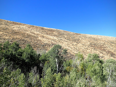
The route weaves in and out of the creek and the hiker can appreciate the scarcity of water in the high desert. Near the creek, the foliage is almost impenetrable and there's a deafening sound of insects and birds. Just a few hundred yards up the valley walls, vegetation is stunted and scarce, permeated only by proudly gnarled junipers-
 |
| Stark contrasts of flora as one travels further from the creek |
 |
| At 7,500' |
 |
| Autumn Aspen Tunnel |
 |
| The effects of autumn vary by elevation |
 |
| Subtle changes in color |
At roughly 8,000', the trail exits the aspens and ascends mostly on bare granite. Cairns help guide the way in some sections but there's evidence of numerous routes. In the late summer, the route is more beaten which can help with path finding. I could imagine that a hiker is mostly left to their own devices in the late spring and early summer.
I encountered a hidden gorge just below Griswold Lake and unintentionally captured this photo-
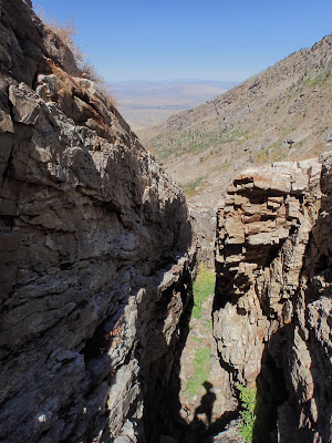 |
| Dry Gorge below Griswold Lake |
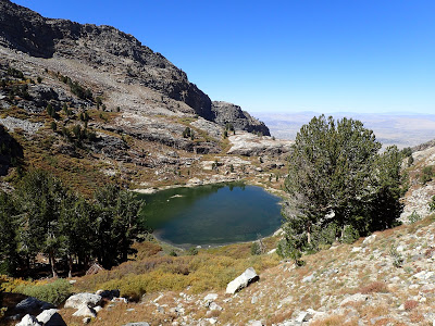
Griswold Lake stood at the bottom of an imposing cirque of mountains with the impressive headwall of Ruby Dome hovering to the south. Campsites abounded but people did not. It was an odd feeling to see such clear evidence of a regular town off to the north, yet feeling very alone in this rugged country. I had grown unaccustomed to this solitude living in downtown Chicago but it was a welcome return. At this point there was very little wind and only a few birds- an almost perfect silence.
The route rounds the eastern shore of this small tarn and quickly gains elevation on its way to the headwall. At 10,000', I crossed an unexpected plateau which was only partially evident on a 1 in = 3.95 mi topo map. It felt positively alpine now- there was no longer a trail but a route through jagged rocks. Patches of grass proved some evidence of life but it was mostly snow and scree. Springs existed well up to 10,700's and I was never far from water.
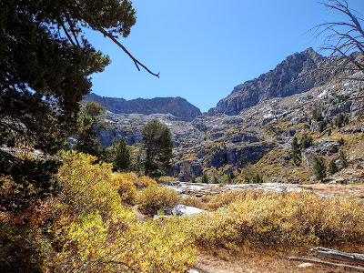 |
| Glacially carved cirque and Griswold Lake |
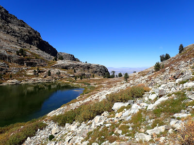 |
| Griswold Lake |
 |
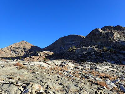
| Quickly gaining elevation to the plateau |
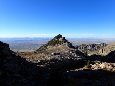 |
| Looking back on the 10,000 foot plateu and small subsidiary summits |
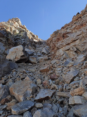 |
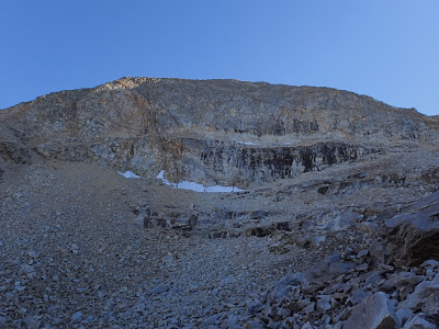
| Gully to the summit |
There are a few ways of tackling the final 1,000 vertical feet. The very obvious summit looms over a tarn with no outlet and one can either take the hidden ravine to right (west) or take the exposed ridge-line to the left (east). I chose to take the ravine to the summit which is a solid class III and might be nerve-racking to one not used to scrambling. I did not take the same route down- the ridge-line sufficed. Either will involve quite a bit of scrambling but the rock is quite stable. Note that the ravine is not obvious until just below the beginning.
Ruby Dome is just 300 vertical feet above the terminus of the ravine. Air was now noticeably thin, slowing my pace to a minimum. However this was hardly noticeable with a grand view of the Great Basin and Range.
From the summit, most of the 130-mile ruby range is visible. The dome itself is actually quite a bit removed from the main spine of the mountains which adds to is phenomenal view. There's very little room to celebrate on this knife's edge pinnacle.
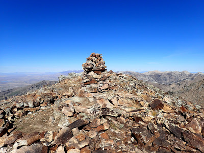 |
| A lonely cairn with no marker serves as the high point |
 |
| Looking North towards the rest of the range |
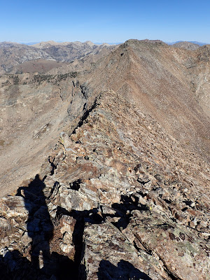 |
| The knife's edge ridgeline towards the narrow col separating Ruby Dome and the nearly identical East Peak |
 |
| Ruby Dome's headwall |
The best way down, in my opinion, is the eastern ridgeline. It offered little protection but was less steep. In the end, I would recommend ascending either the ridgeline or the ravine but only descend using the ridgeline. It added perhaps another painstaking quarter mile of rockhopping but made for a simpler descent. Other climbers may feel differently.
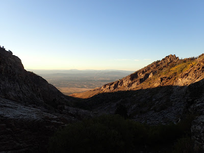
Back on the 10,000 foot plateu, the sun was already very low in the sky and I enjoyed the brilliant appenglow on the various peaks. Its a sight I've rarely seen outside of the Sierras and Rockies. Already the lights of distant Elko were beginning to twinkle but they did not interfere with the brightness of the northern Nevada night sky. As I crept back towards the trailhead, I preferred keeping my flashlight off as to not take away from the silver arc that was the Milky Way.
 |
| Last Look |
 |
| Descending in twilight |
I miss stars. For all the lovely things about living in Downtown Chicago, starry nights are an unfortunate sacrifice. Thankfully, I enjoyed them to their fullest on this dark night. It wasn't even disappointing that it took me over 14 hours to ascend this wilderness peak. I hope I return soon.
Read. Plan. Get Out There!


No Comments