"The Airline" is the rugged stretch of highway that runs from Bangor to Calias, Maine. Of all my Maine travels, it is probably my favorite drive. There are ample opportunities for short hikes and great pictures.
 |
| Near the peak of Bald Mountain, Hancock County, Maine |
After kayaking almost the entire coast of Maine and spending a bunch of time up in Eastport/Lubec and Machias, I was about ready to head home and sleep in my own bed for a while. Ahead of me was my absolute favorite drive in Maine-
"The Airline" or the stretch of Maine State Route 9 from Bangor to Calias which heads deep into the heart of rural Washington County. (I'll be damned, it even made its way into an
article in Men's Journal) The first time I drove this road was when I went up to New Brunswick for a kayak trip. I was on a tight schedule at the time but I couldn't wait to return and take the highway at a more leisurely pace. This would be my opportunity. With my Maine Gazetteer riding shotgun and not even a hint of cell phone reception, I took as much time as I could to drive back from Machias.
Here's somewhat of a rough idea of the route I took from Machias to Bucksport:
Starting in Machias, I took the connector road back up to Route 9. I would recommend at least having a half tank of gas before driving through rural Washington and Hancock counties. Its not as if there are no services, but they are few and far between! I think there is one gas station/rest stop in about 90 miles.
Right where route 9 hits Wesley, Maine, the road open up and the road crosses what seems to be a bare mesa in an ocean of pines. Its quite a change in scenery, especially if you've been driving up from Bangor. Its one of the only panoramic views on the entire route to Canada. There are plenty of opportunities to just pull over and take pictures. Cloudless skies and great swaths of evergreens made me stop for an hour-
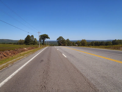 |
| Route 9 is usually as empty as a back-road |
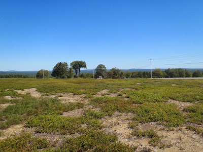 |
| Washington County, Maine |
The Maine Gazetteer is probably one of the best investments that any Maine traveler can make. Whenever I'm on these types of trips, I always look up the side trips and adventures that are in the Gazetteer. All of these hikes were listed and I wasn't disappointed. Lead Mountain was my first hike and it was one of the higher mountains in the entire region (Page 24, A-5). The turnoff is not exactly marked but it is just east of the intersection of Route 193 and Route 9. There is a trailhead and a forest service station but it is not staffed. I decided to park in the lot right off the freeway but I discovered that you can drive all the way to the trailhead. The road to the actual trailhead is just past the forest service station and to the left.
The hike is pleasant enough although mostly wooded. Anyone looking for sweeping summit views would probably want to skip this one but as for me, it was a nice walk in the woods. Total round-trip distance is roughly 5 miles. There are some directional views along the way.
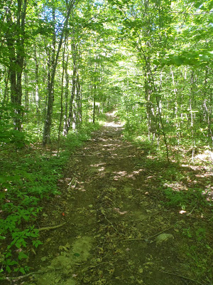 |
| Lead Mountain Trail, Maine |
Next was Little Peaked and Peaked Mountain which provided those sweeping summit views I was looking for. These are located in the hills just due east of Bangor and there are even a few neighborhoods which are somewhat strange in an otherwise vast stretch of wilderness. The trailhead was located in a little neighborhood which had grown off of fire access roads. The trailhead is clearly marked and on the map above (Gazetteer Page 24, B-1). The trail itself is very straightforward and easy to follow. Its about 2 miles round trip and once it gets towards the top, its a walk along bare granite cliffs. Its a nice, short hike and only a half an hour from Bangor-
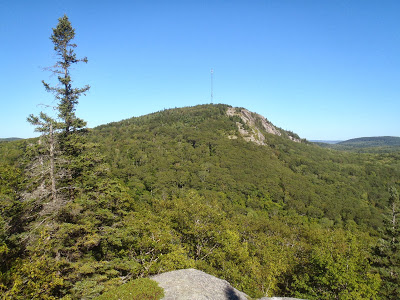 |
| View of Peaked Mountain from Little Peaked Mountain |
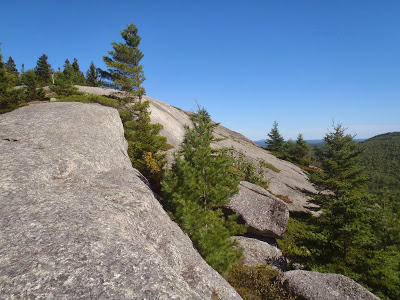 |
| Bare, granite slabs of Little Peaked Mountain |
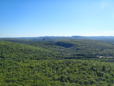 |
| The View! |
At this point, Route 9 heads into Bangor and away from the coast. The entire route actually heads on down through Central and Southern Maine and all the way though New Hampshire and Vermont. However I wanted to take the coastal route back I turned south on Route 46 and on to Bald Mountain.
There are perhaps three dozen "Bald Mountains" in Maine and this one happens to be in Dedham, Maine (Gazetteer Page 23, D-4). It used to be a ski resort apparently and this hike had the best views of the bunch. It was almost sunset when I was walking up the slope and by the time I hit the top, I could see for 50 miles. The mountains of Acadia National Park were clearly visible to the southeast as were the Appalachian Mountains to the north. Dozens of small lakes and ponds were also in view- this was one of my favorite hikes on the coast. Again, this was just about 2 miles total and just due south of Bangor.
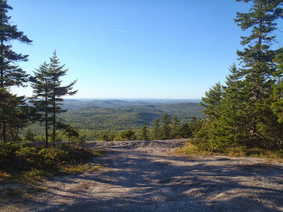 |
| View from Bald Mountain, Dedham, Maine |
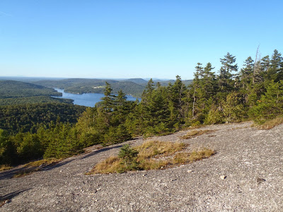 |
| Bald Mountain, Maine |
Turning south again, I made it back to the head of Penobscot Bay and the town of Bucksport. The newly famous
Penobscot Narrows Bridge was lit up and striking. I suppose its sort of Maine's Golden Gate Bridge. One of these days I'll take the elevator to the top of the bridge and visit the Penobscot Narrows Observatory.
It was an uneventful drive back from here. I crossed by Camden, Boothbay and Brunswick thinking about my recent kayak trip and eventually landed back in Portland. Although Route 9 hadn't been the focus of my entire coastal trip, it sure ended up being a nice "cherry on top". If I lived in Bangor, I'm sure I would travel this way more often.
Read. Plan. Get Out There!


5 Comments
Cochituate
April 20, 2018 @ 01:44
Cool. I’d been on this road on a regular basis from the 1950s through the 1970s. My parents drove the road driving from the Boston area to my grand parents house in Central Nova Scotia by leaving on a Friday afternoon and arriving near Windsor 18 hours later. Driving the Airline Trail in the middle of the night was often scary because of how the road dropped off on both sides into the darkness. In the fifties and sixties the only other vehicles on the road with you were enormous trucks filled with gigantic bags of potatoes and equally enormous trucks with gigantic tree logs stacked on the trailers until the sides of those trailers hovered above your car on your lane.
Darlene
May 23, 2019 @ 01:39
Wow!! Me too! We went to Digby. Rt 9 was all dirt in those days, and it was always in the middle of the night. Those logging trucks wanted to get up speed when going downhill! Mom was often frantic – screaming at Dad to pull over, but there really wasn’t anywhere on that road to pull over! My last trip was about 4-5 years ago and it was very pleasant – All paved.
Richard Auletta
August 28, 2021 @ 17:13
Calais, so-spelled, takes its name from the port of Calais, France; the American city is pronounced KAL-is.
Joe Tworkowski
May 24, 2023 @ 01:34
Rt. 9 is beautiful. One trick to make it more pleasant is stay away from Logging Trucks. #9 is full of Steep Hills and curves. Logging trucks are very heavy. When they go Up hill, they don’t have the power to keep up with Traffic. However, when they go down hill, you really don’t want to be in front of one. If you have a passenger, Binoculars are great. There is so much to see. Enjoy the flow along the continuum.
Cochituate
October 26, 2023 @ 14:34
On those middle of the night crossings, our reward when we got to KAL-is was to cross into St. Stephen, and there was a tiny coffee shop right across from the border station that stayed open for the folks that made that perilous crossing. My dad would get a cup of coffee, I got a sandwich, and my mom would go back to sleep. It was my job to keep dad company (and awake) on those marathon drives.