"Climb the mountains and get their good tidings. Nature's peace will flow into you as sunshine flows into trees. The winds will blow their own freshness into you, and the storms their energy, while cares will drop off like autumn leaves." ~John Muir
 |
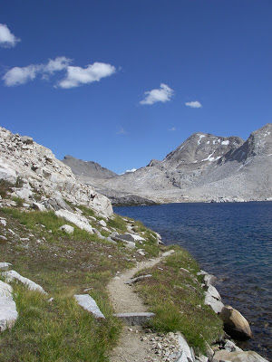
| The John Muir Trail near Muir Pass at 11,000ft |
Simply put, the John Muir Trail is California's greatest adventure. This classic backpacking trail winds its way across the spine of the Sierra Nevada Mountains in California and rarely dips below 8,000ft. It is a 211 mile long trail that goes deep into perhaps the largest unspoiled wilderness in America outside of Alaska. It is a North-South trail which travels from Yosemite to Mt Whitney in a crescendo of both elevation and scenery. I've hiked the John Muir Trail end-to-end once and hiked several sections of it on other occasions. This and the next couple of posts are my suggestions and guide to this magnificent trail
General Description
 |
| Near Donahue Pass, Yosemite National Park |
The John Muir Trail starts (or ends) in Yosemite Valley. This is the most cosmopolitan and unfortunately crowded section of the trail. It starts at the Happy Isles Trailhead which is the same trail to Half Dome. From here, it makes a long climb out of the valley and up over Donahue Pass at about 11,000ft. The trail briefly crosses over to the eastern side of the Sierras and up over Island Pass.

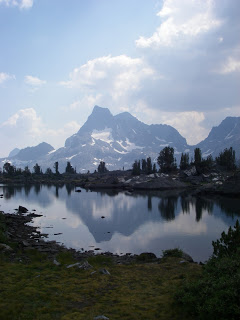
Ansel Adams Wilderness begins with the crossing of Donahue Pass and is a much more isolated section of the JMT. This goes through a particularly volcanic section of the trail near Mammoth Lakes. This section also contains some of the most beautiful lakes you can see on the trail, including Garnet Lake and Thousand Island Lake. You will briefly see the Devil's Postpile National Monument when exiting this shorter section. The Devil's Postpile is one of the world's greatest examples of columnar basalt which causes perfect hexagonal formations in the volcanic rocks.
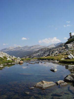
John Muir Wilderness is a beautiful stretch which includes the famous Vermillion Valley Resort, a hiker bar. This section also contains some brilliantly blue high alpine lakes such as the pictured Marie Lake, and others such as Purple Lake and Virginia Lakes. The mountain passes begin to get higher, most of them are around 10,000ft or higher.
Kings Canyon National Park is the largest section of the John Muir Trail. From the climb up to Evolution Basin and Valley, you will be in a noticibly different environment. The previous section is greatly forested; this section is almost entirely alpine and much more bare. There are stout trees and shrubby vegitation and the mountain passes are between 10,000 and 13,000ft. This also contains the greatest ascents and descents, most notably, "The Golden Staircase". It can take over 3 days to return to civilization at this point.
Lastly, Sequoia National Park will end your trip (or begin) upon the John Muir Trail. This is the highest and most isolated section. There is a slight amount of vegitation and some forests, but after crossing the 13,000ft Forester Pass, there isn't much! The hike culminates at Mt Whitney, the 14,495ft high point of the trail and the contiguous United States. The final descent is through the Mt Whitney Trail in Inyo National Forest ending at the Whitney Portal
Well, this is just an introduction to one of the greatest backpacking adventures in the country! This is part one of a four-part blog section of my guide and experience on the John Muir Trail
Want more information? I've written another post about some things that might help you on the trail-
Read. Plan. Get Out There!


No Comments