


Elliot Knob is a dominating feature in the Shenandoah Valley and has expansive views of the ridge and valleys of western Virginia. Its summit is high enough to support a small strand of alpine trees which are somewhat similar to what could be seen in upstate New York and New England
Day: 11
Miles: 1,776
It was a stifling day in the Shenandoah Valley so I knew that I needed to get up high. Two summits had caught my eye- Reddish Knob and Elliot Knob. I went with the latter because it was higher and the view seemed better but I would have really liked to have done both. Reddish Knob is also a 4,000 footer and is an excellent mountain biking trip. Another time I suppose.
My route was the pretty standard route up Elliot with an easy side trail up Hogback Mountain. Here is an excellent map, and here is the map of my route along with the optional bag-
Starting at the gated dirt road, I followed the sign and a few yellow blazes into the woods and eventually paralleled the stream which flows down the eastern side of the mountain. The trail was well marked and signed but I would recommend bringing your own topo map, just to be sure.
The trail has two major sections- a pleasant woods walk which passes by two small waterfalls and then a dirt road walk. (You cannot take a vehicle up the road). The waterfalls were not flowing this late in the summer but the area was a nice cool off! The trail climbs steadily but not too steeply. After roughly 2 miles, it pops out on the road. From here, the road walk is very steep.
What makes this hike appealing to both serious and casual hikers is the fire tower at the summit. Expansive views in every direction are possible from the fire tower. It had no "no trespassing" signs nor any indications that climbing it was not permitted.
I decided that Hogback, just to the southwest, looked enticing enough to try and I found a less-defined trail to the summit. I lost about 200' of elevation between the two mountains and was on the summit of Hogback in no time. It wasn't a particularly interesting summit and there was nothing to mark the highest elevation. Oh well, it was worth a shot.
I retraced my steps exactly and didn't have any trouble finding the signs or the yellow blazes. The trail is generally well marked and maintained. As far as the waterfalls go, during times of heavier rain, they have potential to be pretty but today they were just trickles.
The whole hike took less than 5 hours. I later headed over to Apple Orchard Mountain for another Virginia classic.
Read. Plan. Get Out There!
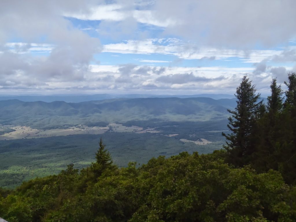 |
| The very tip of the summit supports a distinctly alpine environment |
Miles: 1,776
It was a stifling day in the Shenandoah Valley so I knew that I needed to get up high. Two summits had caught my eye- Reddish Knob and Elliot Knob. I went with the latter because it was higher and the view seemed better but I would have really liked to have done both. Reddish Knob is also a 4,000 footer and is an excellent mountain biking trip. Another time I suppose.
My route was the pretty standard route up Elliot with an easy side trail up Hogback Mountain. Here is an excellent map, and here is the map of my route along with the optional bag-
View Elliot Knob Hiking Trail in a larger map
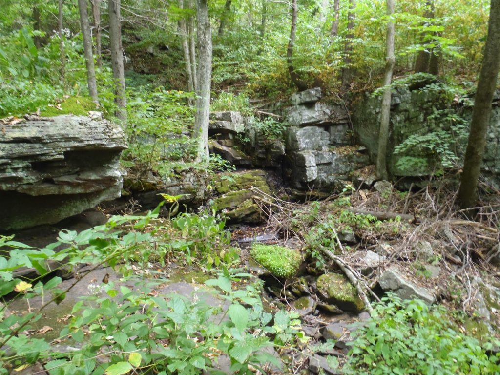 |
| At the lower elevations, the forest is dense and there are a few waterfalls |
The trail has two major sections- a pleasant woods walk which passes by two small waterfalls and then a dirt road walk. (You cannot take a vehicle up the road). The waterfalls were not flowing this late in the summer but the area was a nice cool off! The trail climbs steadily but not too steeply. After roughly 2 miles, it pops out on the road. From here, the road walk is very steep.
What makes this hike appealing to both serious and casual hikers is the fire tower at the summit. Expansive views in every direction are possible from the fire tower. It had no "no trespassing" signs nor any indications that climbing it was not permitted.
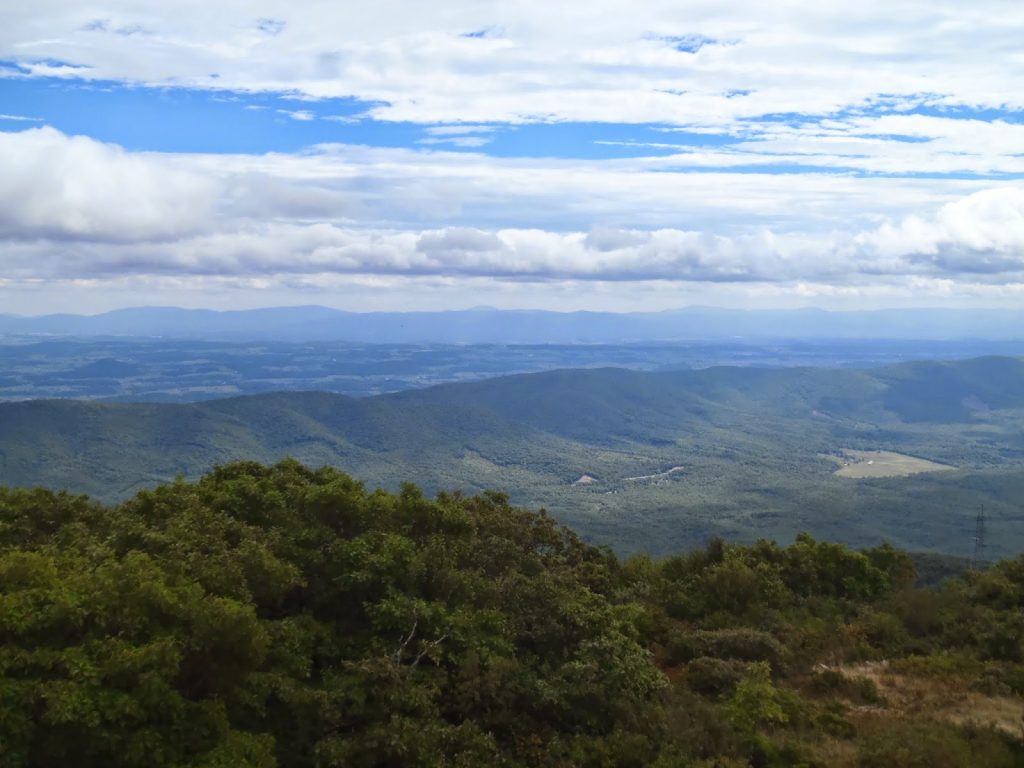 |
| One can appreciate the "Ridge and Valley" title given to the area |
I retraced my steps exactly and didn't have any trouble finding the signs or the yellow blazes. The trail is generally well marked and maintained. As far as the waterfalls go, during times of heavier rain, they have potential to be pretty but today they were just trickles.
The whole hike took less than 5 hours. I later headed over to Apple Orchard Mountain for another Virginia classic.
Read. Plan. Get Out There!

No Comments