


Black Mountain is an interesting site for both high pointers and the coal mining industry. It is one of the few state high points in the country that has been privately owned and is one of the highest privately owned mountains in the eastern US. As a state high point, it is relatively easy to bag.
Day: 15
Miles: 2,400
The saga of state highpointing has interesting history with regards to public and private land ownership. The hobby/sport has only been around since the latter half of the 20th century and is only seriously pursued by a very few number of individuals. However several of the 50 state high points are on private land which has caused some complications. While it is unsurprising to find that many of the otherwise flat Midwestern state highpoints are on private lands (farms), the Kentucky State Highpoint is the only true mountain on that list. Penn-Virginia Coal owns the summit and the nearby mine is expansive. The entire area of western Virginia and eastern Kentucky are entirely dominated by the coal industry. The fact that the state highpoint is on a swath of coal land is simply inconsequential to anyone but the occasional hiker. As of now, it appears that the true summit is safe from any massive "mountain top removal" mining. The summit's future is probably dependent upon intricate local and corporate politics which will likely remain invisible to the general public.
Environmentally, the summit has a beautiful forest of hardwoods which looks conspicuously like something from further north or in the higher Great Smokies. I haven't explored much of the state, but I would anticipate that this is a rarity.
Here's my map for reference-
As you can tell, you don't just stumble upon this mountain. It is very close to the Virginia State highpoint which makes for a nice "two-fer". I did Mt Rogers the day before and camped out at Big Stone Gap. That was actually my favorite place to camp thus far! The owner was very nice as were the other campers. I will have to come back here for some more legitimate hiking in the nearby Jefferson National Forest.
Driving up Route 160 is the only way to go. The drive is very steep and windy- motorists will have fun with this one. I thought about biking it to make it a real adventure but the road is very narrow and busy coal trucks buzz right by. I'm glad I stuck to hiking. I parked at the small pullover which I marked above. This would serve as my only view on the hike.
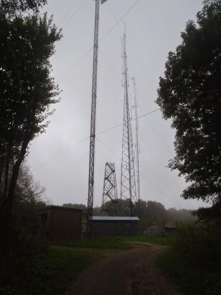
The road is simply signed as "FAA Station". The nearby FAA Long Range station is also another owner of summit land. I saw some workers on the way up as well as many ATVers. Hiking requires a permit though. You MUST download the waiver, send it to the company and keep a copy on your person as you hike. DO NOT HIKE WITHOUT IT!
The entire hike or road walk is about 3.2 miles, roundtrip. You don't see much of anything other than the forests and the radar station along the way. The summit is uninspiring-
It was an easy hike and I was down within an hour and a half. I didn't run into anyone from the coal company but I'm glad I had the waiver, just in case. That makes 21 highpoints for me! Later in the day I went to the more wild "High Knob" of the Jefferson National Forest.
Read. Plan. Get Out There!
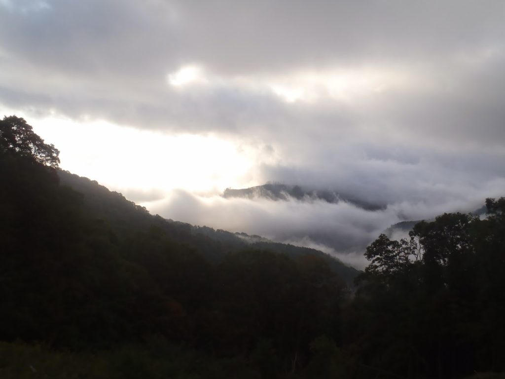 |
| View from the parking area on Black Mountain |
Miles: 2,400
The saga of state highpointing has interesting history with regards to public and private land ownership. The hobby/sport has only been around since the latter half of the 20th century and is only seriously pursued by a very few number of individuals. However several of the 50 state high points are on private land which has caused some complications. While it is unsurprising to find that many of the otherwise flat Midwestern state highpoints are on private lands (farms), the Kentucky State Highpoint is the only true mountain on that list. Penn-Virginia Coal owns the summit and the nearby mine is expansive. The entire area of western Virginia and eastern Kentucky are entirely dominated by the coal industry. The fact that the state highpoint is on a swath of coal land is simply inconsequential to anyone but the occasional hiker. As of now, it appears that the true summit is safe from any massive "mountain top removal" mining. The summit's future is probably dependent upon intricate local and corporate politics which will likely remain invisible to the general public.
Environmentally, the summit has a beautiful forest of hardwoods which looks conspicuously like something from further north or in the higher Great Smokies. I haven't explored much of the state, but I would anticipate that this is a rarity.
Here's my map for reference-
View Hiking Black Mountain, KY- State Highpoint in a larger map
As you can tell, you don't just stumble upon this mountain. It is very close to the Virginia State highpoint which makes for a nice "two-fer". I did Mt Rogers the day before and camped out at Big Stone Gap. That was actually my favorite place to camp thus far! The owner was very nice as were the other campers. I will have to come back here for some more legitimate hiking in the nearby Jefferson National Forest.
Driving up Route 160 is the only way to go. The drive is very steep and windy- motorists will have fun with this one. I thought about biking it to make it a real adventure but the road is very narrow and busy coal trucks buzz right by. I'm glad I stuck to hiking. I parked at the small pullover which I marked above. This would serve as my only view on the hike.
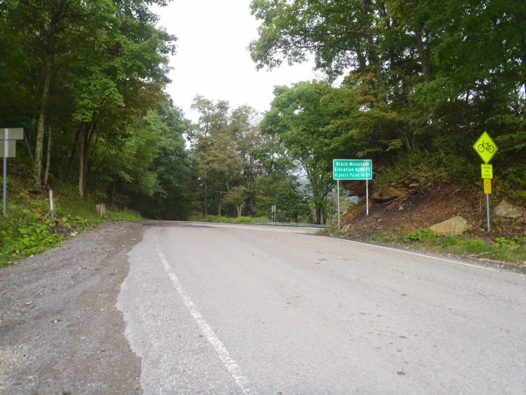 |
| The sign at the state line |
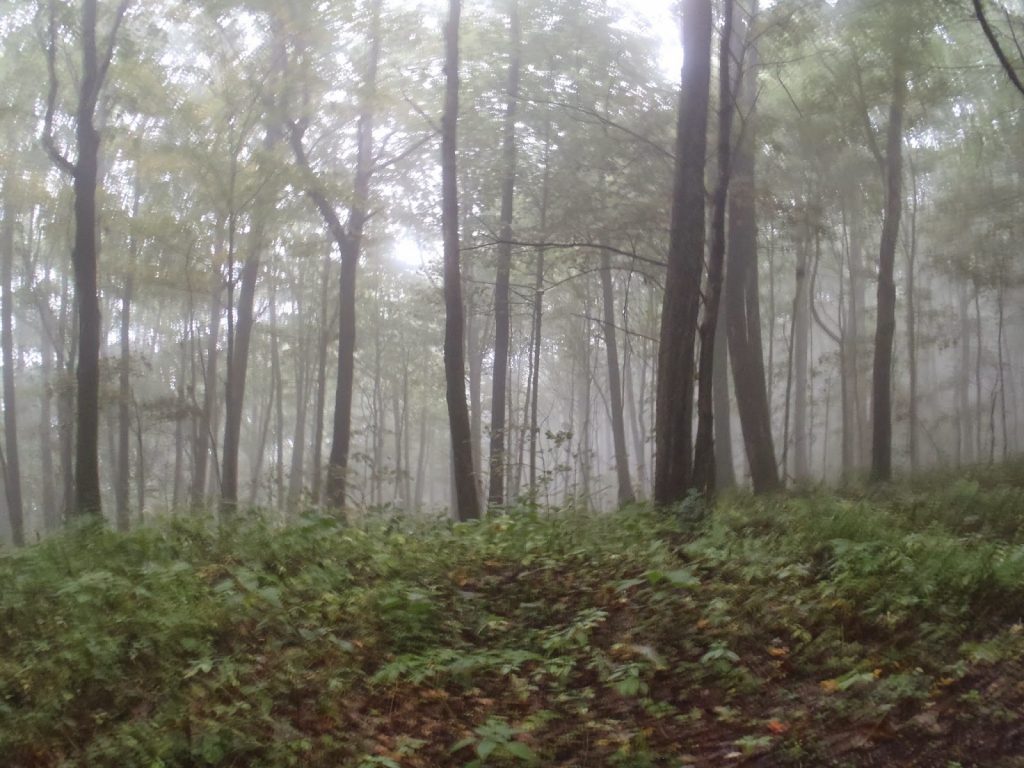 |
| Hardwood Forests near the summit |
The entire hike or road walk is about 3.2 miles, roundtrip. You don't see much of anything other than the forests and the radar station along the way. The summit is uninspiring-
 |
| Old fire tower at the summit which is not accessible. |
 |
| Yours truly, making my 21st state high point |
Read. Plan. Get Out There!

No Comments