Mt Moxie (different from Moxie Bald) is a prominent mountain in the Kennebec River highlands, nearby Route 201. It is one of New England's 50 Finest Mountains and is an exquisite and obscure hike which is curiously left out of the Appalachian Trail.
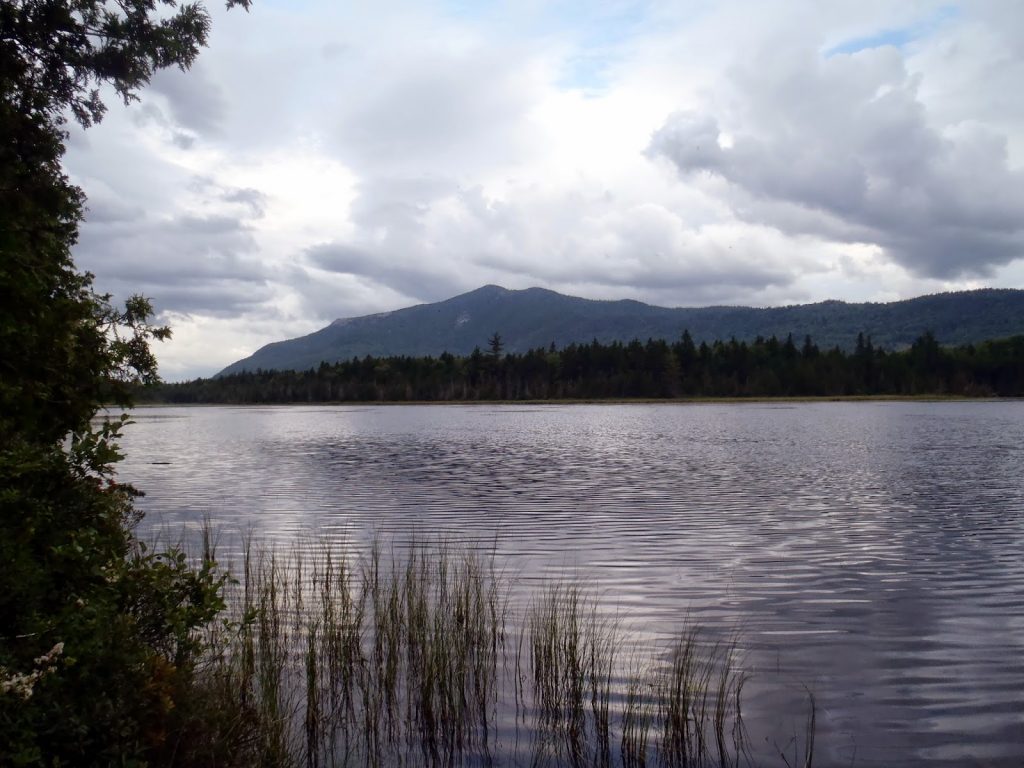 |
| Moxie Mountain rises prominently above the Heald Ponds. |
I recently spent about 6 days hiking mountains in Western Maine which included many which are on the New England 100 Highest List as well as the New England 50 Finest List. Several of them were surprisingly gorgeous, including Mt Moxie, near Bingham, ME. It was probably names for the carbonated beverage,
Moxie, which is as synonymous with Maine as moose and lobster. Opinions on the actual taste of Moxie vary substantially. Regardless of the drink, Moxie Mountain, the nearby
Moxie Bald Mountain, and finally
Moxie Lake are all unquestionably beautiful places. Moxie Mountain itself is rarely climbed although a great trail exists.
Here is my map, complete with driving directions-
While not particularly isolated in terms of sheer distance from centers of population, the area is pretty much off the radar for most. Expect absolutely no cell phone reception (much less 3G) nor anyone else except for loggers. The area is managed by the ubiquitous
Plum Creek Timber Company who owns... well... most of Western Maine. In fact, they are the largest private landowner in the country and own more land than the State of Maryland. Fortunately, for my purposes, the land is pretty open and free so as long as you don't get in the way of any of the loggers. (In fact, I've hiked across Plum Creek land in Oregon, Washington, Michigan and Vermont, probably about as much as I have National Parks). Opinions about Plum Creek and the very active logging in the area vary about as much as opinions about Moxie. We're an opinionated bunch, way up he'yah in Maine.
You can use the map above to get directions to the parking-ish area that is right before the turnoff for the abandoned logging roads. The quality of the roads was pretty good right up until the road that crosses in between the Heald Ponds. Park way off to the side of the road, least you want your vehicle rammed by a logging truck!
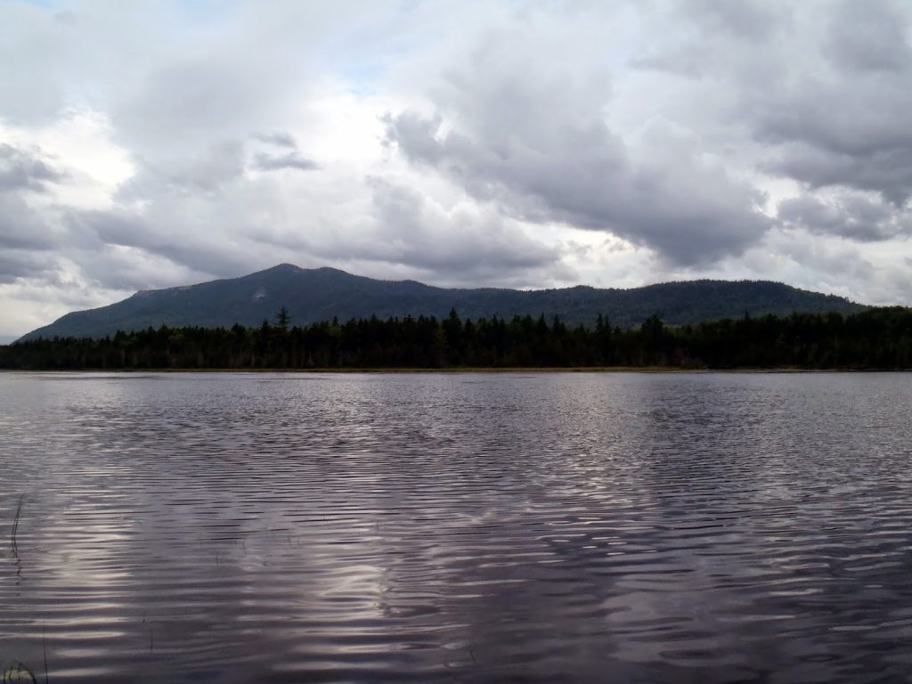 |
| Mt Moxie rises sharply from the Heald Ponds |
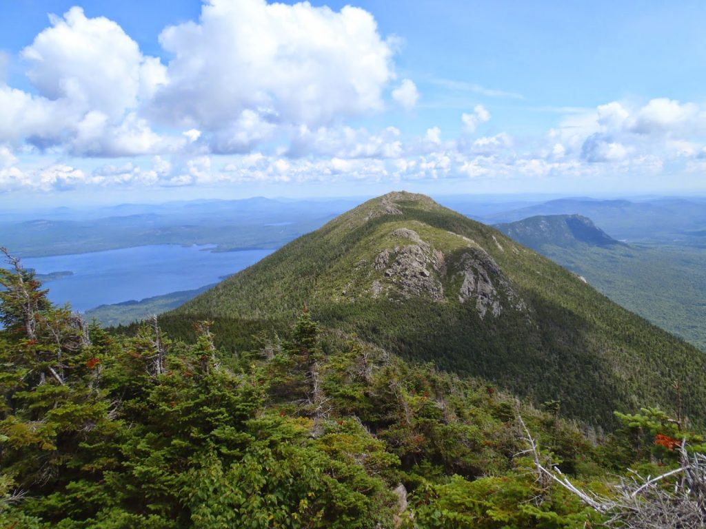 |
| This is a view from Mt Bigelow. Moxie Mountain rises to the left of Avery Peak (center) |
For me and my dinky little low clearance vehicle, the hike began at the road that splits off between the Heald Ponds. I walked just about 1 mile on this road before coming to a cairn marking a decaying logging road with a clear herd path cutting though the long grass. The cairn is evident as of August 2014. From here, I followed the old logging road up past great swaths of cut land until coming to the end of the logged section and the beginning of a very obvious trail. Cairns were infrequent but the road and the trail was easily followed.
Unfortunately, I got nailed by a torrential thunderstorm which pretty much decimated my views from the top. However, the wilderness above the logged area was quite pristine and there were several cliffs that probably have some nice views.
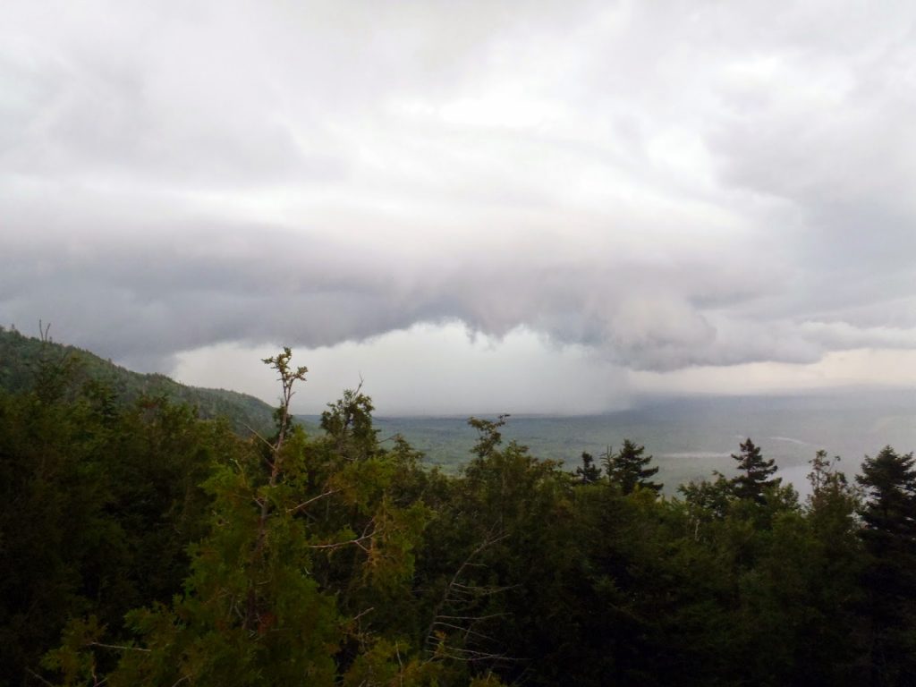 |
| A very large thunderstorm rolled in which made me take shelter in the trees |
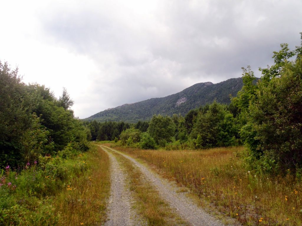 |
| The road is pretty standard at first. Moxie Mountain rises on the right |
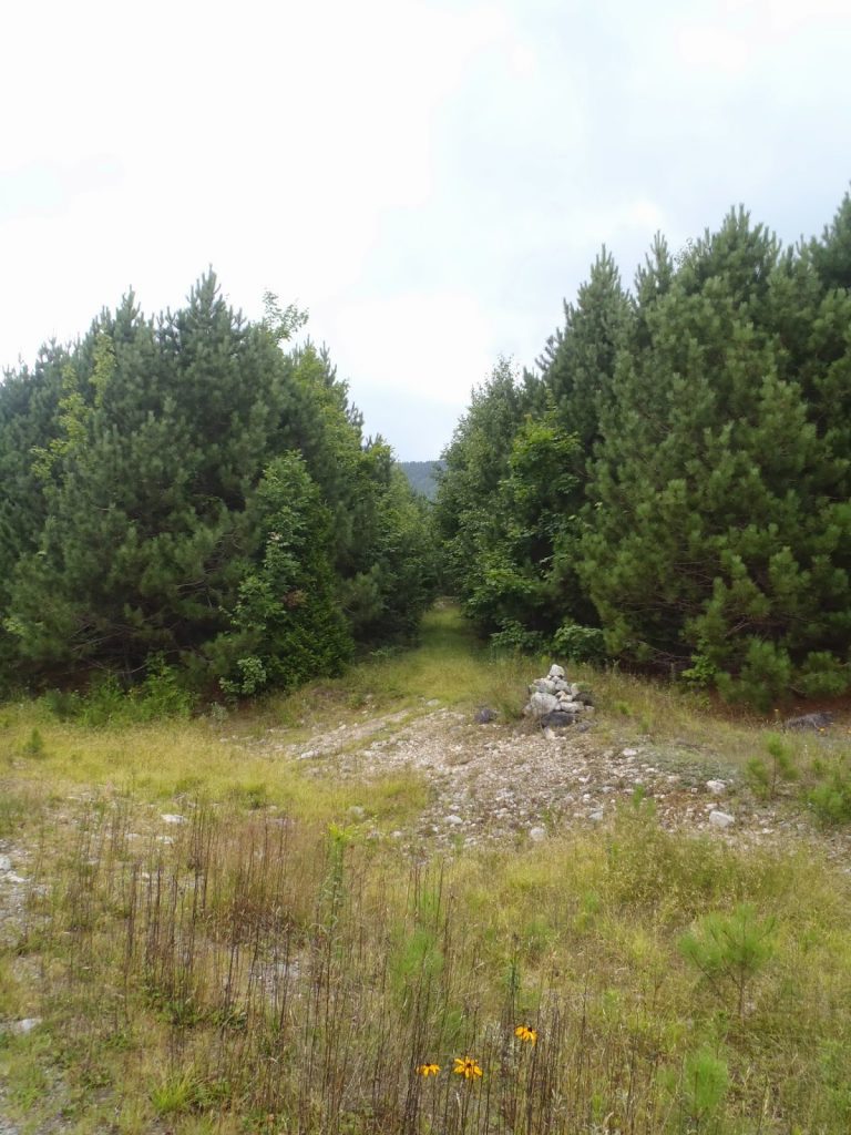 |
| The cairn that marks the turn off for the old logging road and eventually trail |
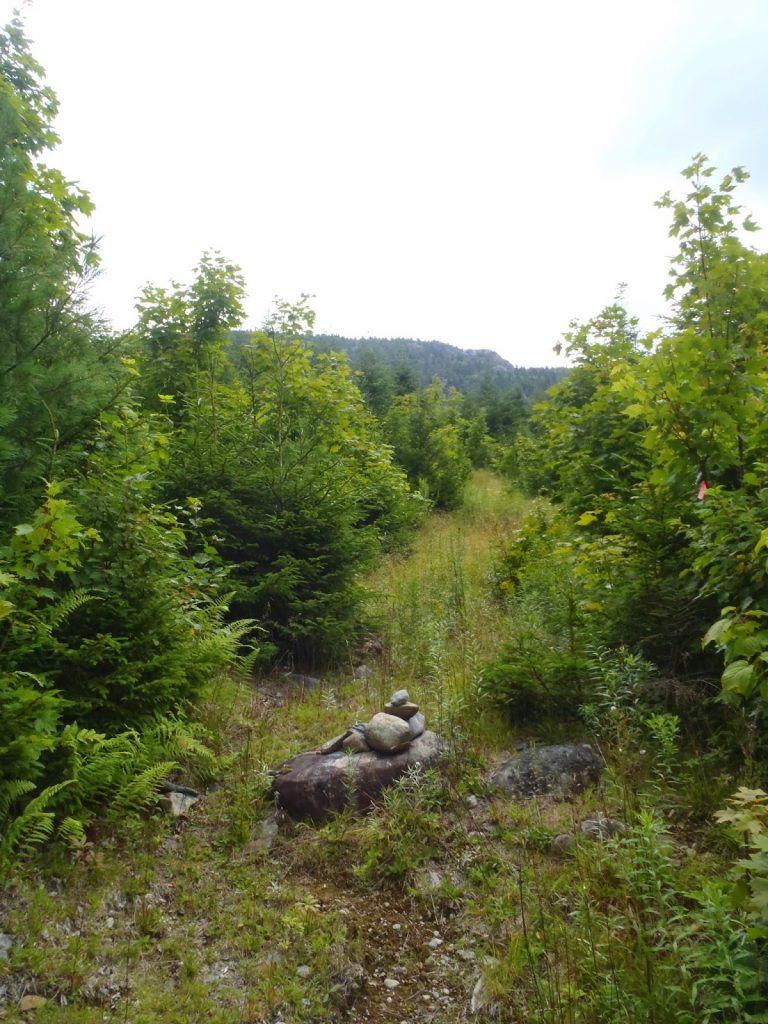 |
| There are infrequent cairns but plenty of accurate hunting tape to mark the route |
So I had no views on the summit, but the potential for views was abundant. Boundary Bald, almost on the Canadian border, was visible for a few seconds during a break in the clouds. Also in view was the eerily vacant
Moscow Air Force Station which appears as a seemingly inexplicable blank area of land which is larger than several football stadiums. Weird.
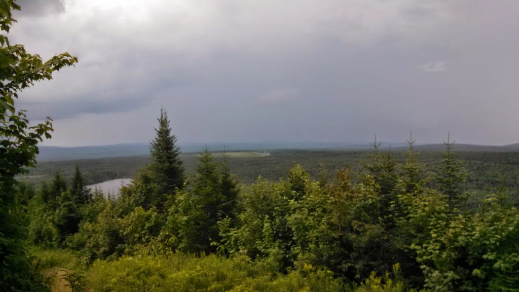 |
| The Moscow Air Force Station is off in the distance. |
I was very surprised at how well marked the trail was- I suppose I was originally expecting this to be somewhat of a herd path or bushwhack. Strangely enough, it was left out of the Maine Mountain Guide which is essentially the bible of Maine mountains.
For those who are counting, Moxie is #50 on New England's 50 Finest Mountains. It is relatively short, by New England Standards, but its isolation and rise from the surrounding land makes it a fine summit with a fine view. It can be easily accomplished in a 1/2 day. Onward to the Bigelow Range!
Read. Plan. Get Out There!


No Comments