


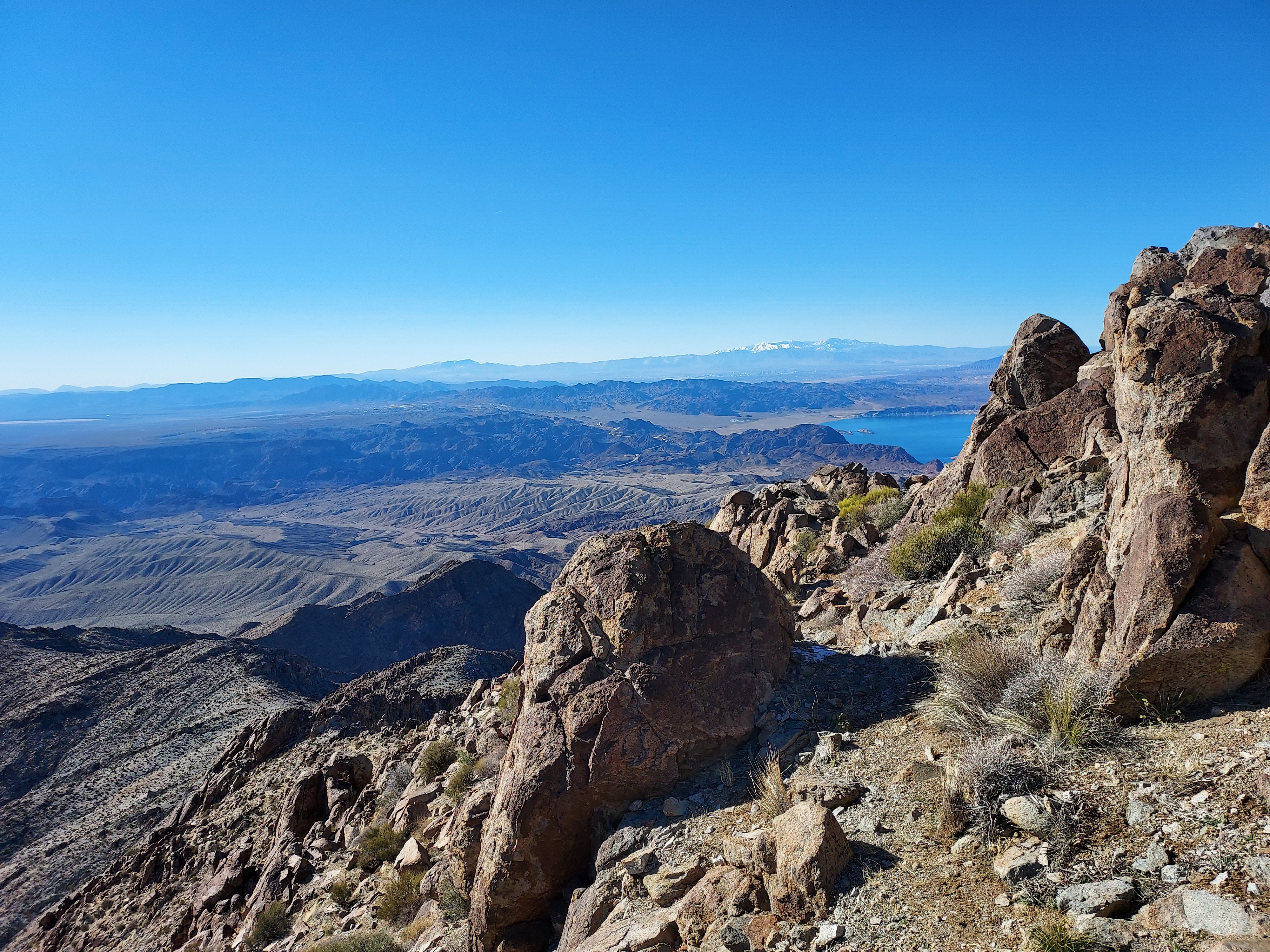
For the past 9 years I've taken a trip to the Southwest to proactively treat wintertime blues. My prior trips included Big Bend, Texas, New Mexico, Arizona and Southern California. This was my first year using Las Vegas as my main staging area. Heavy snow and cold temperatures limited my climbs to strictly desert summits. On my first day I bagged Mt Wilson, an aesthetic summit just across the Arizona border overlooking Lake Mead.
Mt Wilson, Arizona Background and Overview
Mt Wilson is a comparatively low summit (elevation 5,456') by Arizona standards. However it is quite topographically prominent (3,205') making it a peakbagging prize. Located in Lake Mead National Recreation Area, there are a few rough roads that get close to the summit but every route involves off-trail scrambling. It ranks on the following peakbagging lists:
- Las Vegas Mountaineers Classics - #48
- Arizona's 50 Most Topographically Prominent Peaks - #21
- Arizona Wilderness High Points - #54
The most common trailhead is off Black Joe Canyon Road. Especially if you have 2-wheel drive, this is the best bet. Others have climbed Arizona's Mt Wilson via Horse Thief Canyon Road to the north and Wilderness Access Road to the east.
Getting to the trailhead is relatively easy, just 35 minutes south of Las Vegas. Take I-11 towards Hoover Dam. Cross the river and in to Arizona. From the state line, drive 5.4 miles and make a left turn on Black Joe Mine Road (turn lane is thankfully protected). Drive about 100 yards to the end of the pavement and park where you can. I found a nice pull out just over the end of the pavement. The area is a bit funky- I definitely kept all valuables hidden. I saw a few 4x4 drivers here but not much else.
Here's a map of the trailhead and hike:
Trip Report
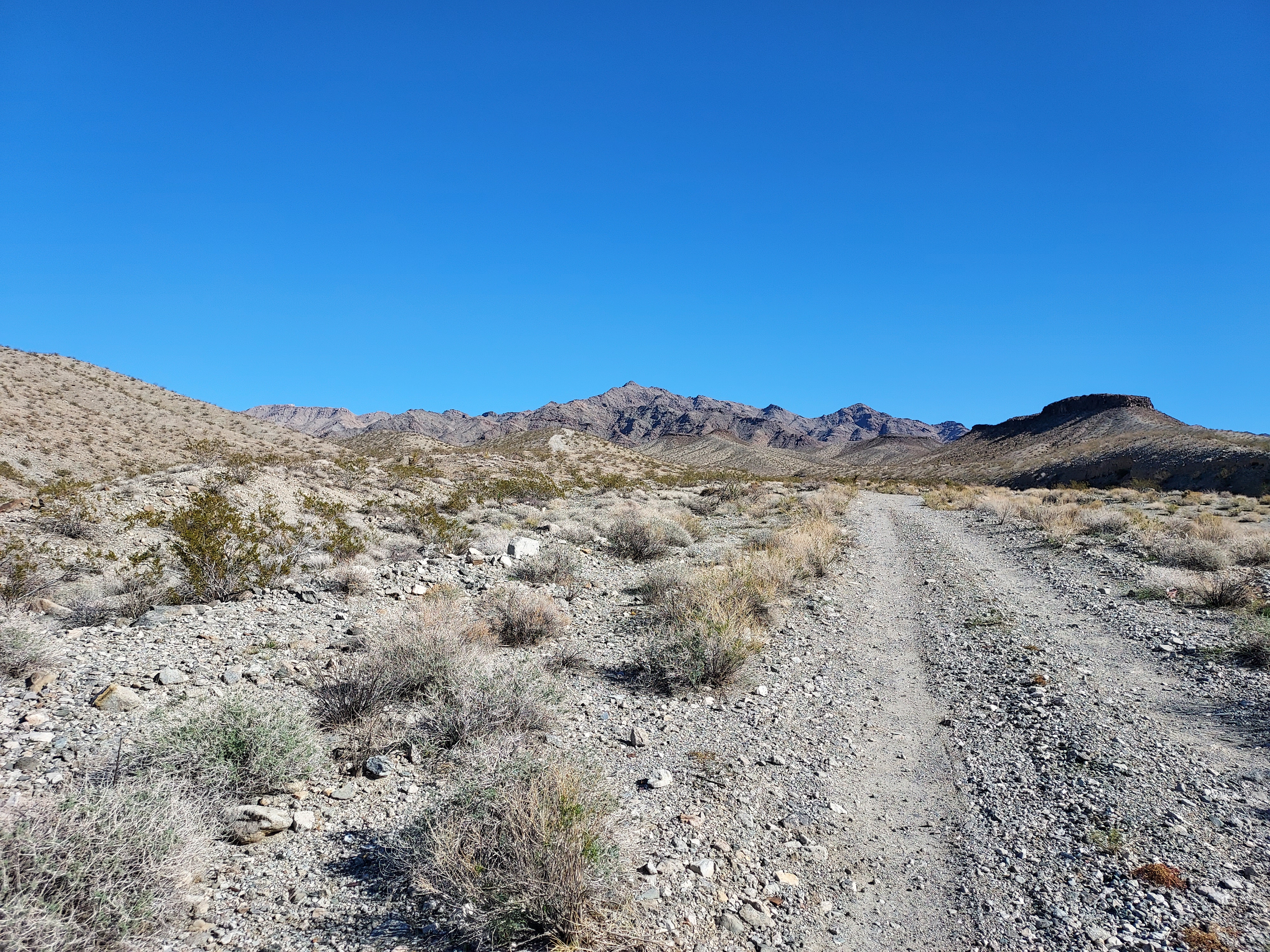
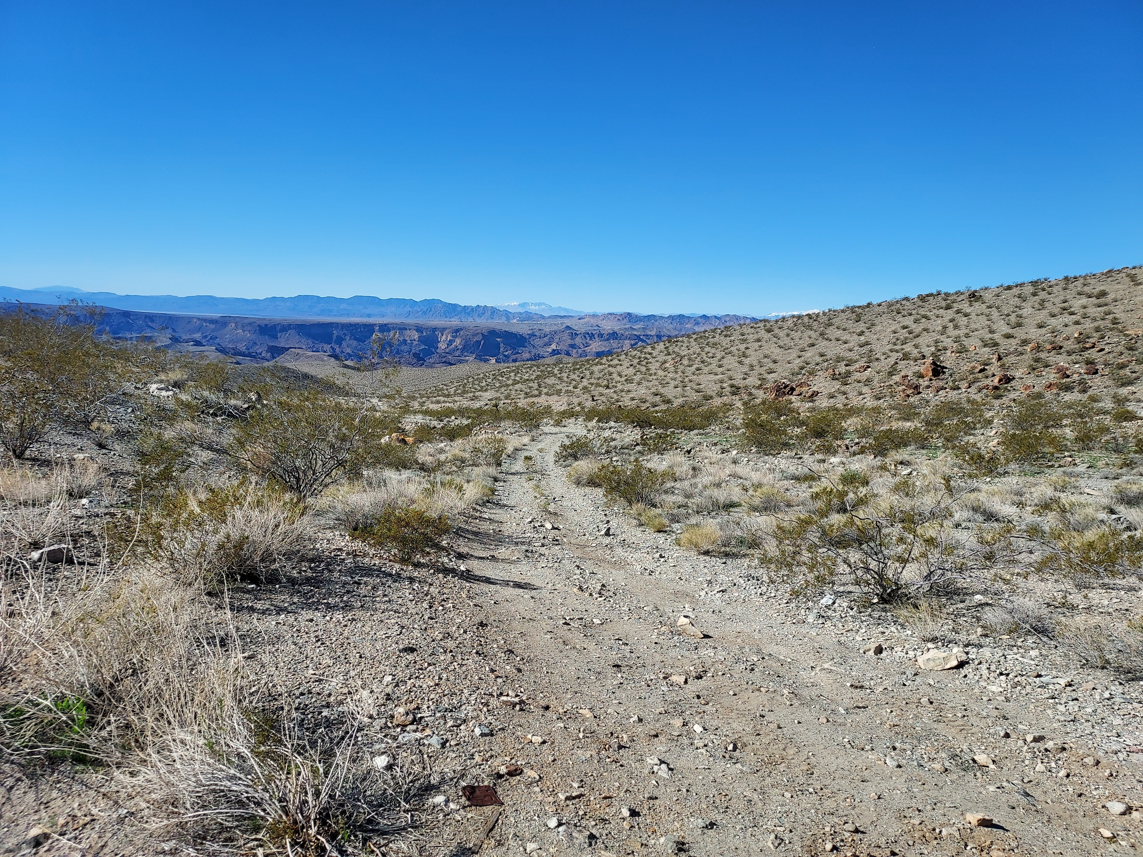
From where I parked, I simply walked the 2.5 miles of dirt road to the 4x4 trailhead. Somebody on peakbagger described the road as heinous and I'd agree. It's rocky, sandy and steep in some sections. I wouldn't have taken my Outback on this road (I was driving a rental van). I covered the distance in no more than 40 minutes.
At a bend in the road, I began my climb up the ridgeline. It was helpful to have a pre-loaded GPS although the ridgeline was obvious from the road. Mt Wilson looked deceptively close throughout the entire trip, a classic adversity of desert peakbagging. The first half a mile and 900' of gain were the steepest; it was straightforward but slow class II climbing. At the top of the first ridgeline, I followed a series of false summits and ridgelines to the summit. At times it was helpful to side hill rather than follow the ridgeline itself to avoid the particularly steep sections.
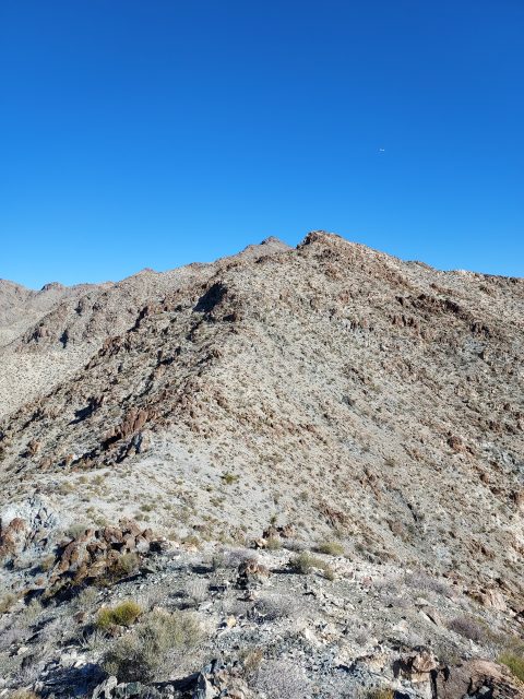
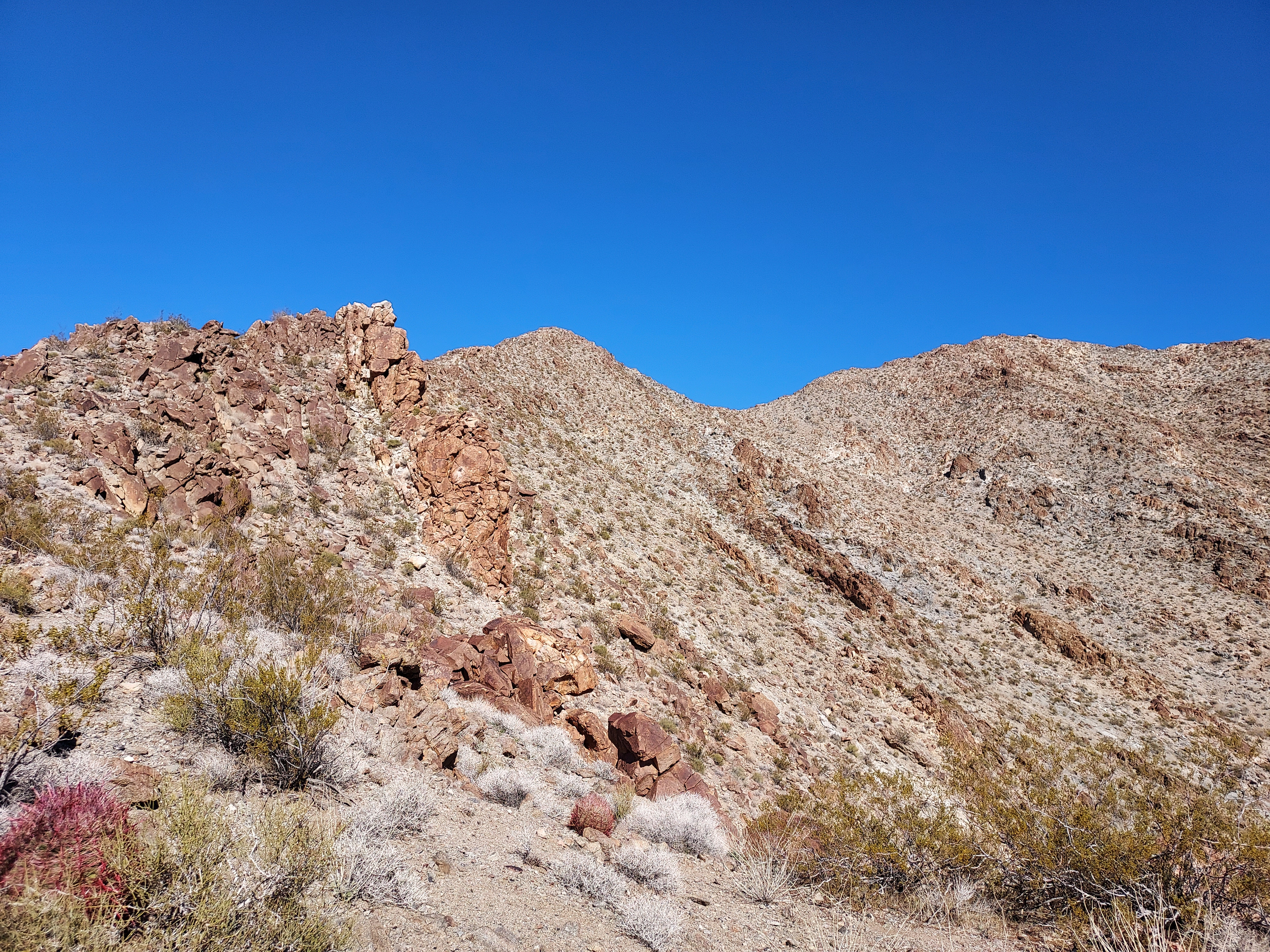
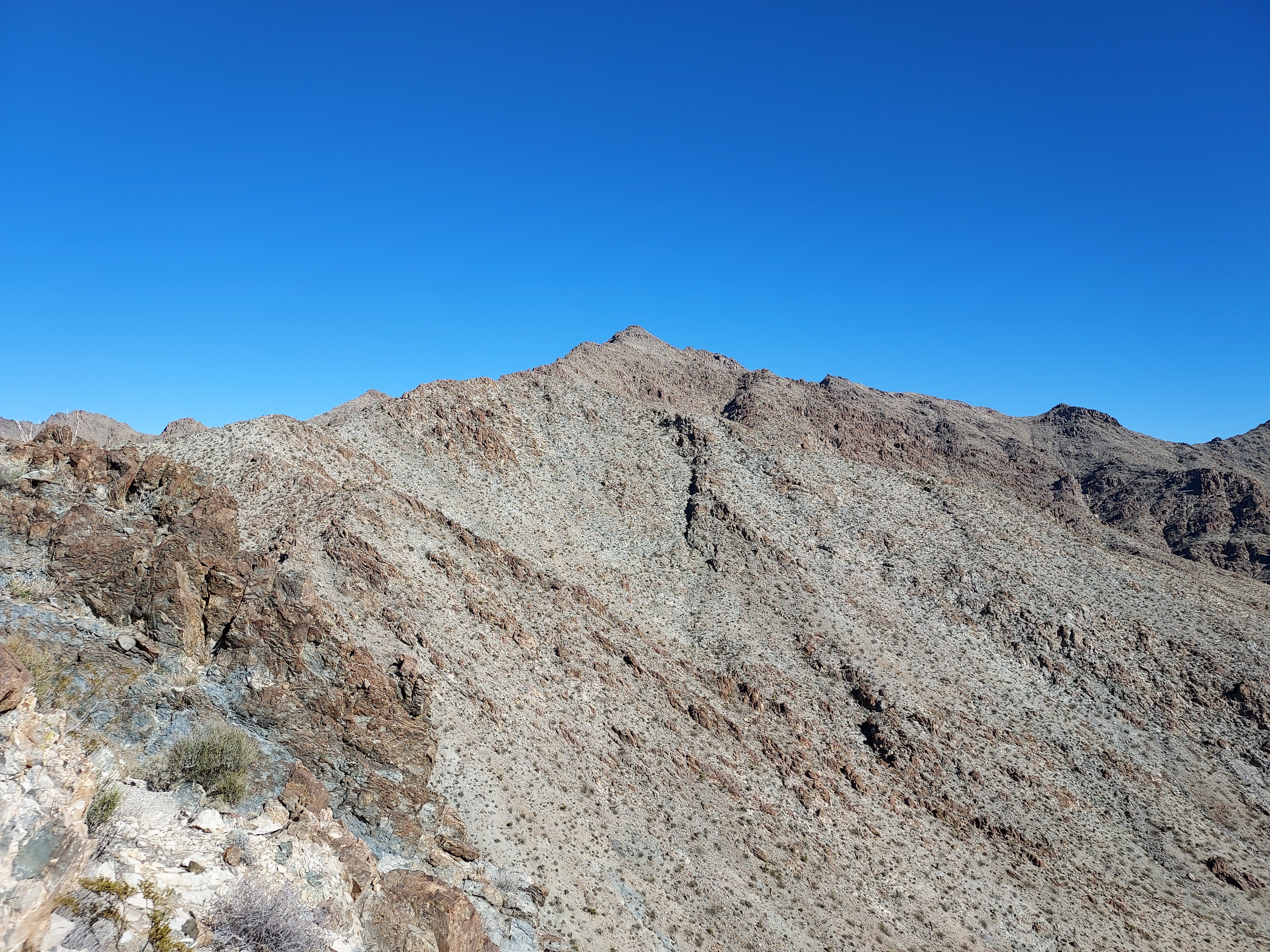
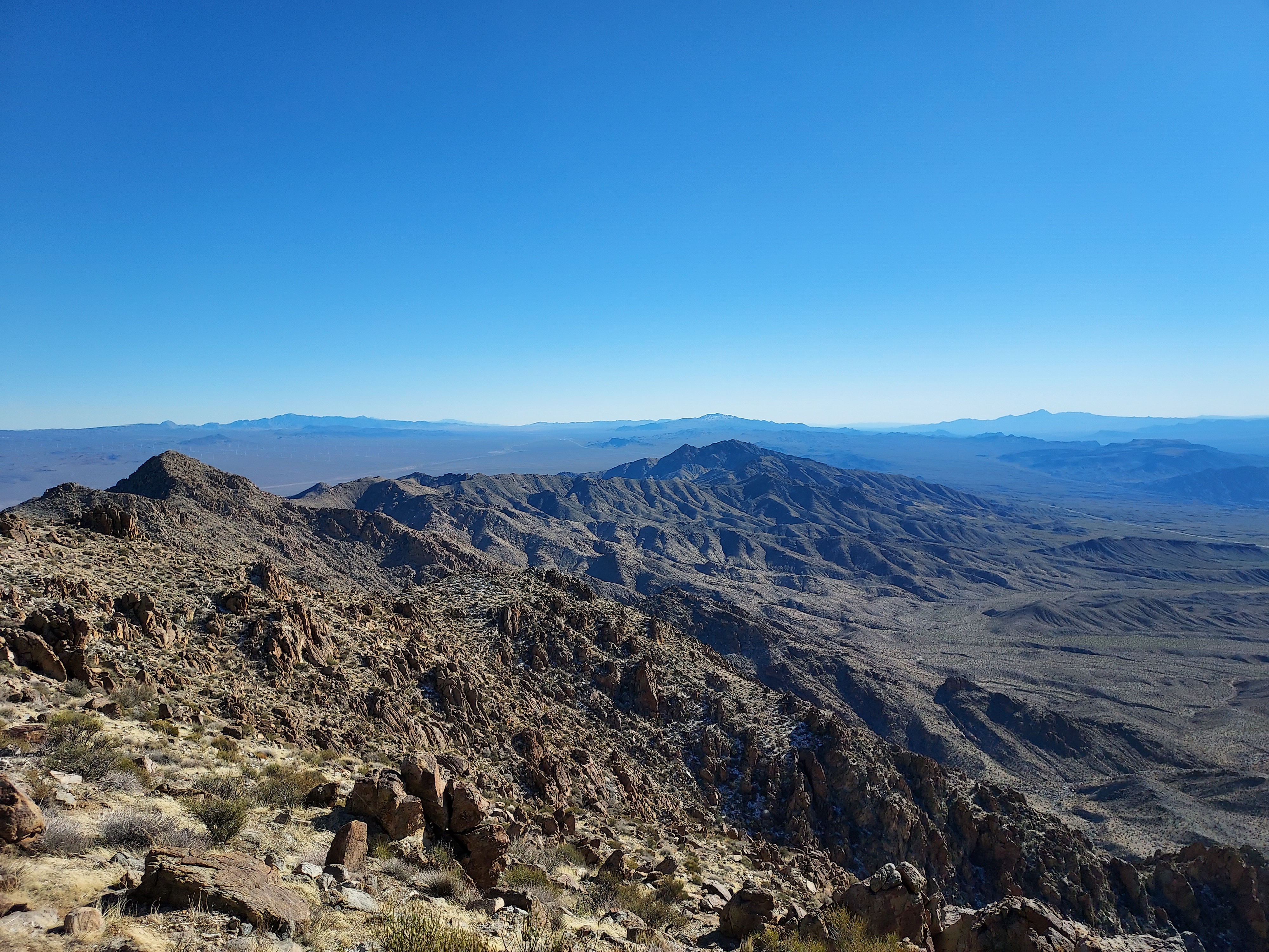
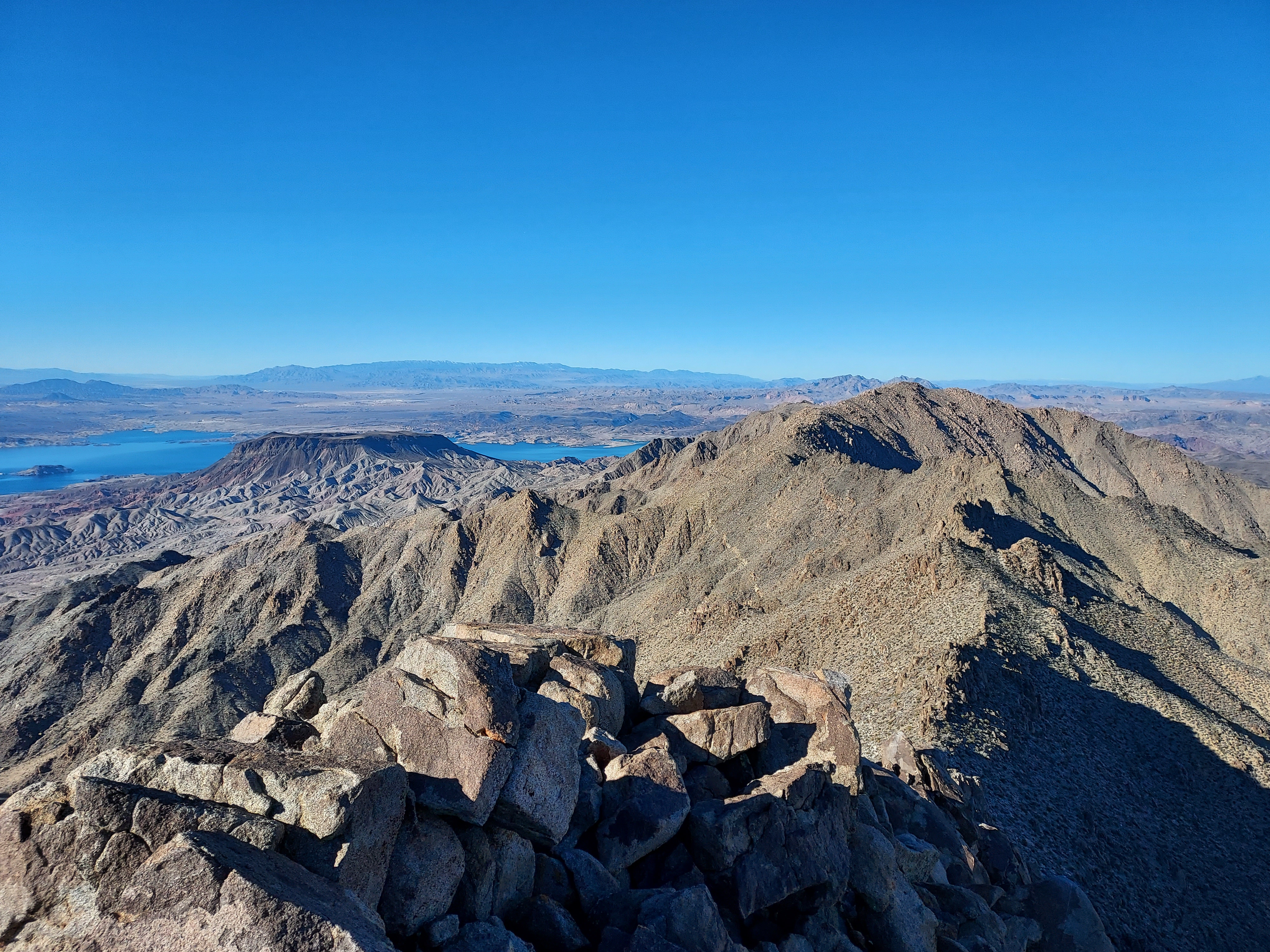
After hopping up and over a few false summits, the last 0.8 miles and 1,000' were mostly pleasant. I had glorious views of Lake Mead and the distant Spring Mountains which were covered in snow. After 3 droughty years, it's nice to see some snow in the mountains again. Even on low Mt Wilson there were patches of snow near the summit.
At the top I found the summit register with no trouble. All the usual names were in the register, I added my own. I enjoyed the sunny but crisp afternoon before descending.
Descent
A few notes about the descent- I accidentally descended down the wrong route (embarrassing). Thinking I'd eventually link up with the road, consultation with my GPS revealed I was too far off track. I had to climb up and over a few ridgelines to get back on track. While I'm glad I realized the error before I got too far down, it all goes to show how confusing desert navigation can be.
Total time was about 5 hours and the distance was 9.8 miles. Its an excellent scramble. I'd happily do that again. From there I drove to Kingman and climbed Mt Hualapai the next day.

No Comments