Forillon National Park is the eastern terminus of the Quebec International Appalachian Trail and the continental Appalachian Mountains. Its a lovely place for hiking, kayaking and old-fashioned beach walks.
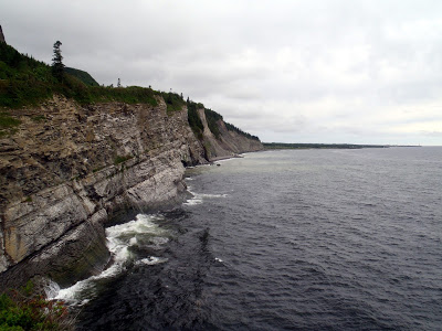
 |
| The edge of the Appalachians at Forillon National Park, Canada |
Previous: Driving the North Coast of the Gaspesie.
After making the drive along the cliffs and fjords of the northern Gaspé, I came to the very edge of the peninsula at
Forillon National Park. This is where the Appalachian Mountains fall below sea level before reemerging on Newfoundland Island. It was somewhat of a monumental occasion to have finally traveled to "Mile 0" of the International Appalachian Trail and the first or last of the continental Appalachians. To continue, I would either have to take a boat to Newfoundland or walk south to Key West, Florida. I didn't have the time today, but it was an intriguing idea...
Forillon National Park is the only park on the peninsula managed by Parks Canada. There are a half dozen other national parks managed by the Province of Quebec. Like all the parks I've been to in Canada, it was well managed, easy to get around and full of natural beauty. Originally I wasn't planning on coming out this far, but I figured I might as well see the end of the peninsula.
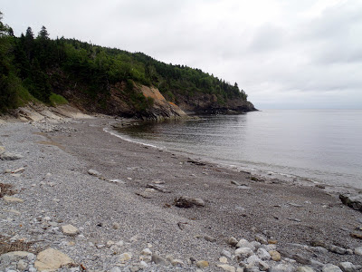
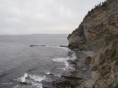
 |
| Beach walk in Forillon National Park |
Forillon was a nice change of scenery from my explorations of the interior of the Gaspe Peninsula. After hiking
Mt Albert and
Mt Jacques-Cartier, high in the alpine plateaus, I was looking forward to hiking along the coast. I decided to start my day off at the North Area where the famous Mont Saint-Alban Tower stands. I parked at Cap-Bon-Ami parking lot and walked down to the beach you see above. It was a dramatic sight to see the cliffs of the cape heading straight down into the ocean. I was here early too so I was the only one walking along the beach. Today was going to be a good day!
From the beach, I began hiking the Mont Saint-Alban trail which steeply ascends the cliffs to the tower. Its about 3.2km round trip distance from the parking lot to the tower and back. Although short in distance, it was very steep! Fortunately there are plenty of lookouts and views along the way. An informative sign told me that fishermen used to walk this way before there was a trail to get from the southern end to the northern end of the peninusla. I can't imagine doing this without a trail!
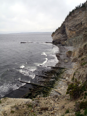
 |
| Birds of the sea were darting in and out of their cliff dwellings as waves crashed below |
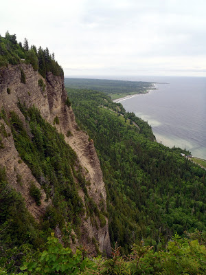 |
| The cliffs of Gaspe |
When I did make it to the tower on Mont Saint-Alban, I was greeted with a panoramic view of the Gaspe Peninsula and Gulf of St. Lawrence. To the north, I could see almost 80km away to Anticosti Island. To the east was the edge of the peninsula which looked like the edge of the world. To the south was the bay and town of Gaspe. The mountain I stood upon was a mere 283m in altitude but I felt as if I was standing on the last (or first) mountain in the world. I could have stood here for hours if the fierce wind hadn't forced me down to warmer temperatures.
I couldn't leave this park without actually traveling to the very easternmost point of the peninsula. It would be a fitting end to the trip!
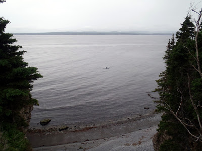
 |
| Another beach to walk in Forillon National Park |
Turning south, I took the road that cut through the mountains and headed to the south area. Parking at Anse-aux-Amérindiens, I took the last 4km of the International Appalachian Trail to Cap-Gaspé. The trail went across the beach and hugged the coastline as it made its way to the end. Once again, I was stopping every 10 meters to take pictures. Eventually I made it to the lighthouse and the official marker for the IAT/SIA. It was almost an emotional moment. From here, the continental Appalachian Mountains begin. There was a replica of the AT marker at Springer Mountain in Georgia. It made me wonder if Benton MacKay would have ever dreamed of his trail crossing international boundaries, waters and even whole oceans one day.
As I was poking around the lighthouse, I noticed there was an additional 0.4km trail which leads to the cliffs above the ocean-
 |
| The END! |
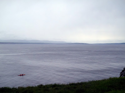
 |
| I saw several kayakers rounding the peninsula |
And I was there. Nowhere else to go but West.
 |
| Kayaking the Gaspe Peninsula |
 |
| I can't wait to come back and kayak here someday... |
As I walked back, I was accompanied by some kayakers. We were both heading back at the same rate and I was excited at the thought of coming back here with a kayak some day. I hope they didn't mind being a part of my photos!
Well I had a long way to travel to get back to Portland, Maine. Spending just one day in Forillon National Park is an insult to the park's beauty; I wished I spent a week there. For all the pictures I took, I probably saw less than 25% of the park. Nevertheless, I headed on route 132 to see a few more spots before getting back stateside Next up- Parc National de l'Île-Bonaventure-et-du-Rocher-Percé!
Next: Hiking Rocher-Percé.
Read. Plan. Get Out There!


No Comments