Hiking Lookout Mountain is a shorter but steep trail with plenty of exposure to the high altitude range

New Mexico’s topography rolls from desert valleys to icy mountain tops in a matter of miles. I spent the previous day wandering the warm
Alamogordo Valley at White Sands and the next day I hiked the cold summit of Lookout Mountain. Though not as tall as the mountains in Northern New Mexico, these mountains are the southernmost summits of their altitude in the country.
The tallest summit of the range is Sierra Blanca- 11,981 ft. Its located on the
Mescalero Apache Tribe lands and permits are required for hiking. However there's no special permit or cost with hiking Lookout Mountain. Here's a hiking map:
Parking and Trailhead
I recommend parking outside of the gate for Ski Apache. Not only is the small lot closer to the trailhead, the gate to Ski Apache closes after 5PM. From here, the hike is fairly straightforward but steep!
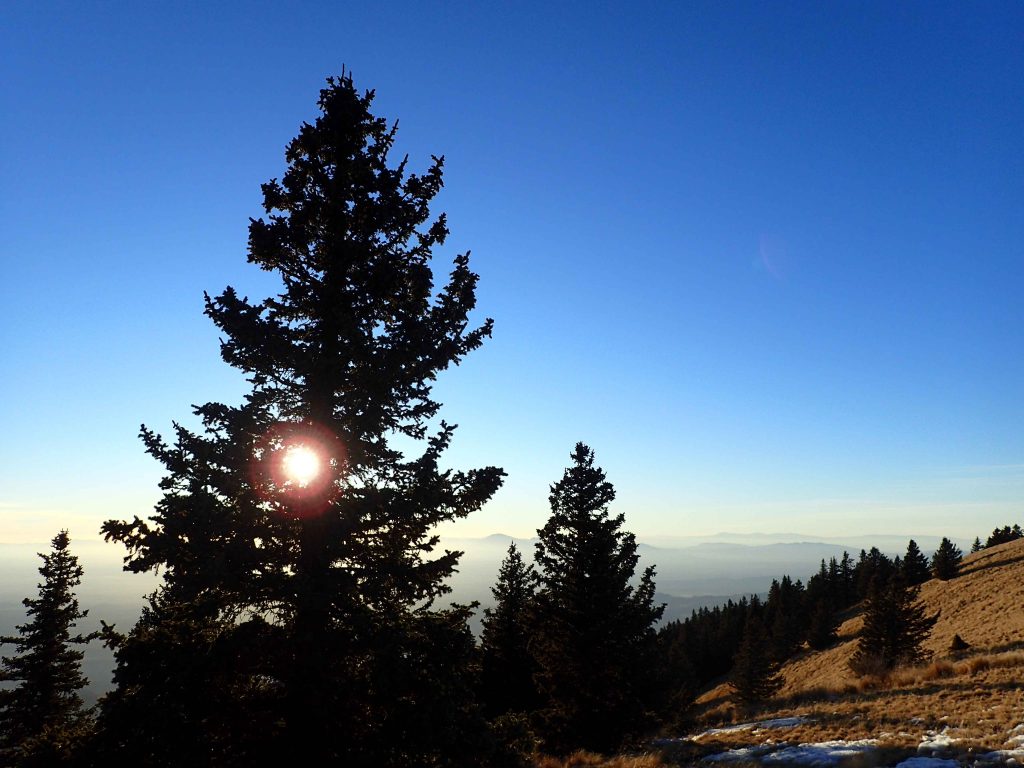
You start by following Trail #15 for roughly a half a mile to the T it makes with Trail #25 (I find the way they number trails to be very confusing). This first section follows a small alpine stream and some fields which are pretty any time of year. Once you hit the "T" bear left or West to stay on Trail #25.
To the Ridgeline
The first half of Trail #25 is not very pretty; a fire ravaged the area not too long ago and the forest is mostly burned. You catch a few open views and vistas along the way but this section is not nearly as beautiful as the ridgeline.
Pay close attention to the most obviously traveled trail through the area. The wildfire obscured a few sections of the trail and caused some dead fall- it's easy to get turned around.
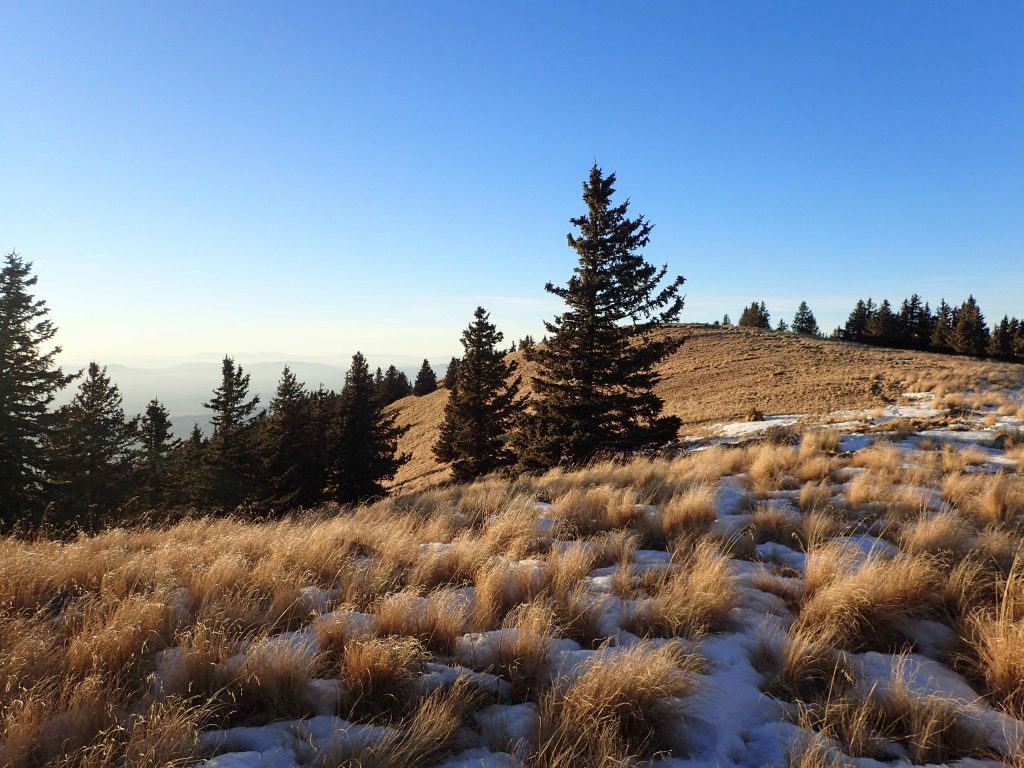
You reach a small saddle above the most severely burned section and its a good spot for snacks or a lunch. From here, the trail dog-legs back towards the tall ridgeline. The switchbacked trail here was also obscure, especially in the winter snows so I relied on orienteering rather than looking for the most obvious route. Once the trail approaches the wilderness boundary, it becomes more obvious.
Ridgeline to Summit
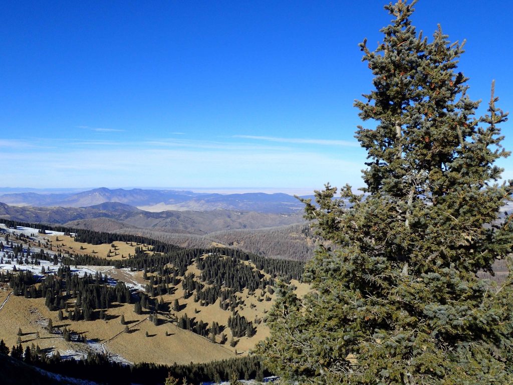
My favorite part of this trail was the ridgeline to the boundary of Ski Apache. This is part of the White Mountain Wilderness area in Lincoln National Forest. It is ever so gorgeous!
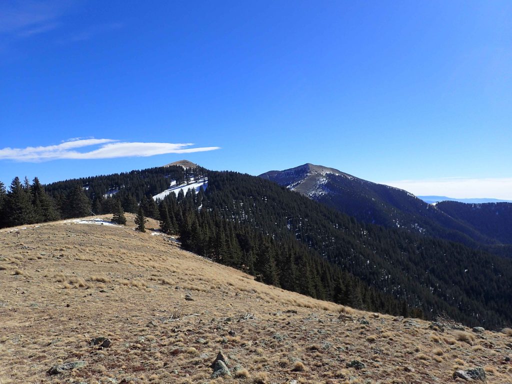
The trail makes another fork here and head South on Trail #78 for Lookout Mountain. I hiked so slowly through here. Alpine meadows and pine forests were such a glorious sight. Plus, I had 50 mile views in every direction- from the foothills of eastern New Mexico to the White Sands in the West.
Eventually the trail hits the boundary of Ski Apache and it becomes pedestrian. I found the trail difficult to follow here too but as long as I stayed on a path that gained elevation, it wasn't that bad.
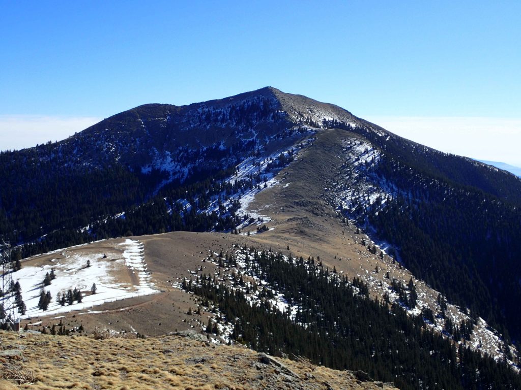
Lookout Mountain's summit has a wind barrier and excellent views. To the South is Sierra Blanca which is a little taller but I assume it has the same view. You can make a look out of the hike but I didn't have a permit to hike on the reservation so I just came back down the same way.
Scratching the Surface
Like so many of my trips, I just make a big list of things I want to come back for. Lincoln National Forest is massive and I had to pass up a lot of hikes. I wanted to stay in Ruidoso and see Ruidoso Downs as well; the Kentucky Derby of Quarter Horse Racing. But that'll have to wait for my next adventure- that evening I headed towards Albuquerque!


No Comments