This is an easily climbed mountain close to the PCT and the highest mountain of the Sierra Nevada North of the Sonora Pass.
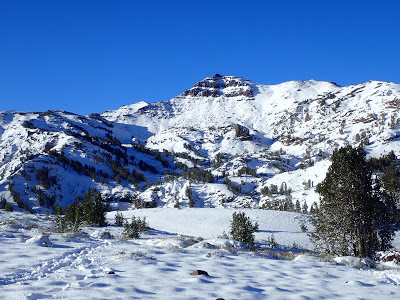
 |
| Looking at Sonora Mountain from near the Pass. This was taken on the second day of Fall! |
Man does it ever feel good to have the Sierras so close to me again! Not since I was in high school have I had these beautiful mountains right in my backyard. I have wasted no time in venturing out from the Bay Area to be in this special place.
Though the Sierras are comparatively narrower range to say, the Rockies or the Cascades, they remain quite remote by 21st century standards. Between Lake Tahoe and Yosemite, only four highways actually cross the range and they are only open for about 4-5 months a year. South of Yosemite, no paved roads cross the mountain range for 140 miles. As a wonderful consequence, they remain in pristine condition for exploration.
I've needed to reorient myself to the region. I've decided to focus my recent expeditions to the area around Sonora Pass, crossed by Highway 108 and the second highest pass in California. The PCT crosses at the pass, not to mention probably a hundred other trail-heads and tall summits that can be easily hiked within a day or weekend. My first destination was Sonora Peak.
Sonora Peak is normally quite easy to bag. Its not more than a few miles from the highway and the parking area is easily accessed. The Pacific Crest Trail comes within a mile of the summit and the scrambling route may trigger the nerves of a less experienced hiker but is not too hairy.
Of course, hiking/climbing it in September is a different matter! About 8-12 inches of snow fell on the higher elevations on the first day of fall creating a much more wintry scene-
 |
| Looking towards slopes of Leavitt Peak (not visible) |
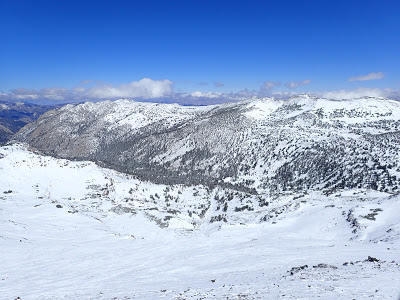
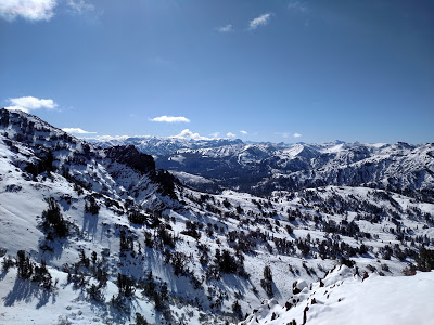 |
| Looking south towards the many high summits of Yosemite National Park |
I've forgotten the unpredictability of the Sierras in the fall. Some days its hotter than July, others its about as cold as December. I can't say I was the best prepared for what I encountered but thankfully I had brought at least a partial armory of winter gear. Forgot the snowshoes and spikes though!
Though the snow was fairly deep in some sections, the Pacific Crest Trail was stomped fairly well. I encountered numerous hunters during my trek- should have brought blaze orange! Fortunately there were no bad encounters. No wildlife either!
The PCT has a comparatively gentle ascent for about 1.6 miles until the "turn-off" for the scrambling route. Essentially it makes a very recognizable hairpin turn just under a prominent arête. The standard ascent of the summit starts here.
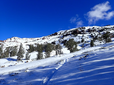 |
| Nicely packed trail, probably mostly hunters this time of year |
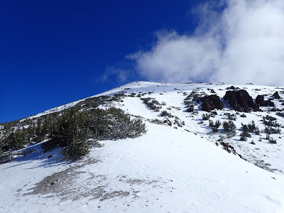 |
| After the first scrambling section, the summit becomes (mostly) visible) |
 |
| Atop the Arete |
The route I took generally hugged the western edge of the arete and there were only a few tricky sections. Most of the trickiness was simply vegetation and deep, wet snow. I didn't slip much in spite of this but I would recommend bringing snowshoes and microspikes or crampons this time of year. In short time I had circled the arete and most of the summit was in view.
Its simple class II scrambling from here. Its a bit exposed in some sections but I really couldn't imagine slipping too far unless it was a profoundly icy day. The going got a little slower as I crossed the 10,000 foot mark and felt the effects of the thin air. There just wasn't enough time for this sea-level bay area guy to acclimate. I slogged on.
Just bellow the true summit, the terrain flattens out to a small snowfield that is probably permanent except in very dry years. The views get exceptionally clear once here and on top of the summit block!
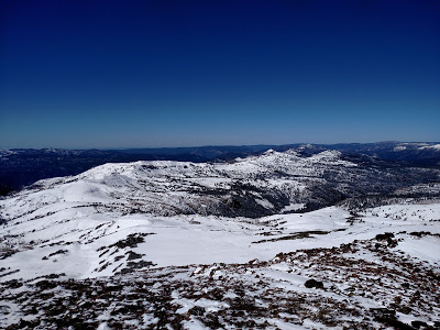 |
| Looking North by Northwest towards Stanislaus Peak |
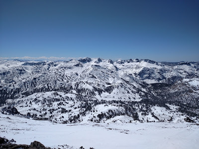 |
| Looking south towards Mt Leavitt, one of the more prominent summits of the area and just a hundred feet higher that the summit I was standing on |
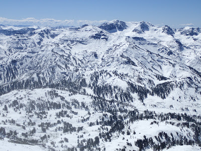
 |
| Western view towards the Little Walker Caldera and the Sweetwater Range; two geologically unique places in California. The Little Walker Caldera probably doesn't look like much from here but its explosive history is evident throughout this part of the state |
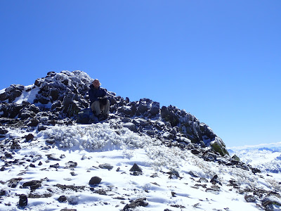 |
| Sonora Peak summit, showings its obvious volcanic origins |
 |
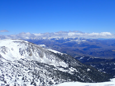
| East fork of the Carson River valley and White Mountain |
 |
| Sonora Pass |
Though I got pretty soaked with wet snow and eventually mud, the effort was well worth the payoff. I'm not really sure what I was originally expecting but I was able to summit in spite of my less-than-stellar preparation. All in all, the hike was roughly 6 miles and I was back at the trailhead before 3 (started at 9). So, even in winter conditions its still a bit of a gentle giant. Can't wait to return to hike the other side, Mt Leavitt, next season!


No Comments