Last week I spent and extended weekend in a much sunnier portion of the country- El Paso, Texas. No visit to the capital of West Texas would be complete without a hike in the Franklin Mountains and Mckelligon Canyon. The rippled, high desert mountains are an outstanding place to hike.
 |
| Trail up South Franklin Mountain |
El Paso is a lovely town for anyone outdoors inclined due to the fact that it has the largest mountain park of any us city.
Franklin Mountains State Park is entirely within El Paso and contains summits between 6,000-7,000 feet. Its a nice respite from the hot desert floor of El Paso and in the winter they can be snow-covered. An abundance of desert flora make for perfect nature hiking.
On this trip I was able to explore much of McKelligon Canyon along with the ridgeline leading to South Franklin Peak. North Franklin Mountain is higher but doesn't have the nice views from the ridgeline nor a chance to see "The Window" natural arch. Here's a hiking map of the area-
As you could probably tell from the map, it does involve a substantial amount of climbing and some areas are legitimate scrambles. Fortunately the park service has installed chains into those sections which help with the climbing. Nevertheless, there are some precipitous drop-offs on several sections which might cause a novice hiker's heart to race.
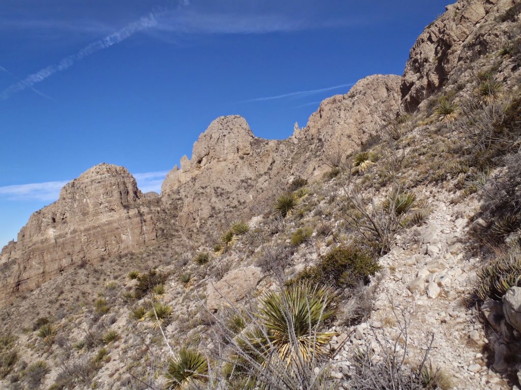
I started at the highest parking area in McKelligon Canyon which is easily accessible to anyone on the east side of El Paso. There's a trailhead which warns of no water nor facilities on the entire hike- bear that in mind, especially in the summer. The trail is poorly marked and there are an abundance of boot-legged side trails that abruptly end. It's more of a route than a trail but some sections are marked with blue dots. I just as well followed my own route to the ridgeline. Along the way I visited the little cave which can be seen from the parking area.
 |
| The trail up McKelligon Canyon with the small cave visible in the center |
 |
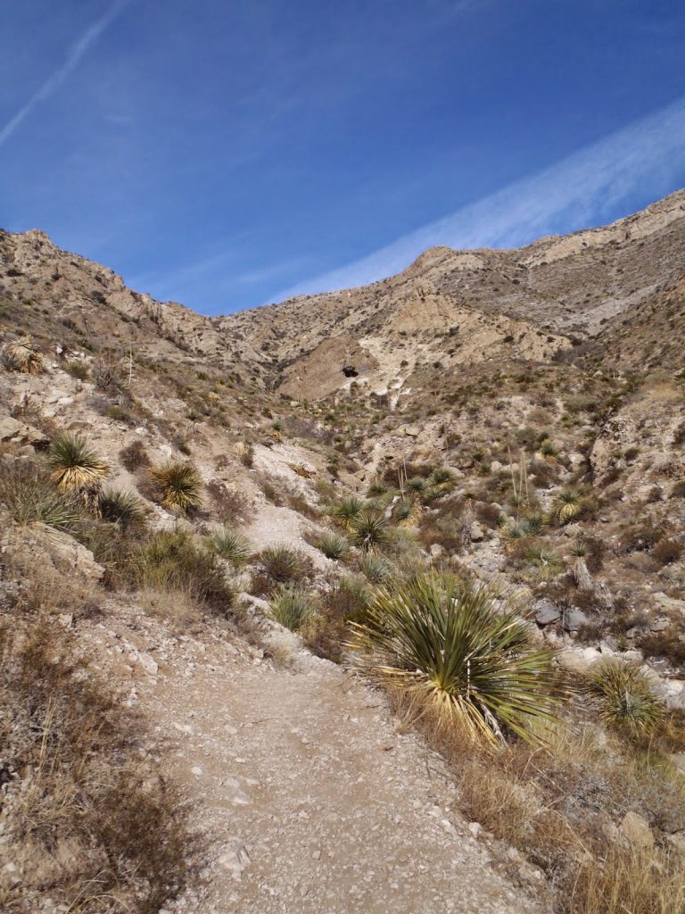
| Looking up the ridgeline. South Franklin is not visible here |
 |
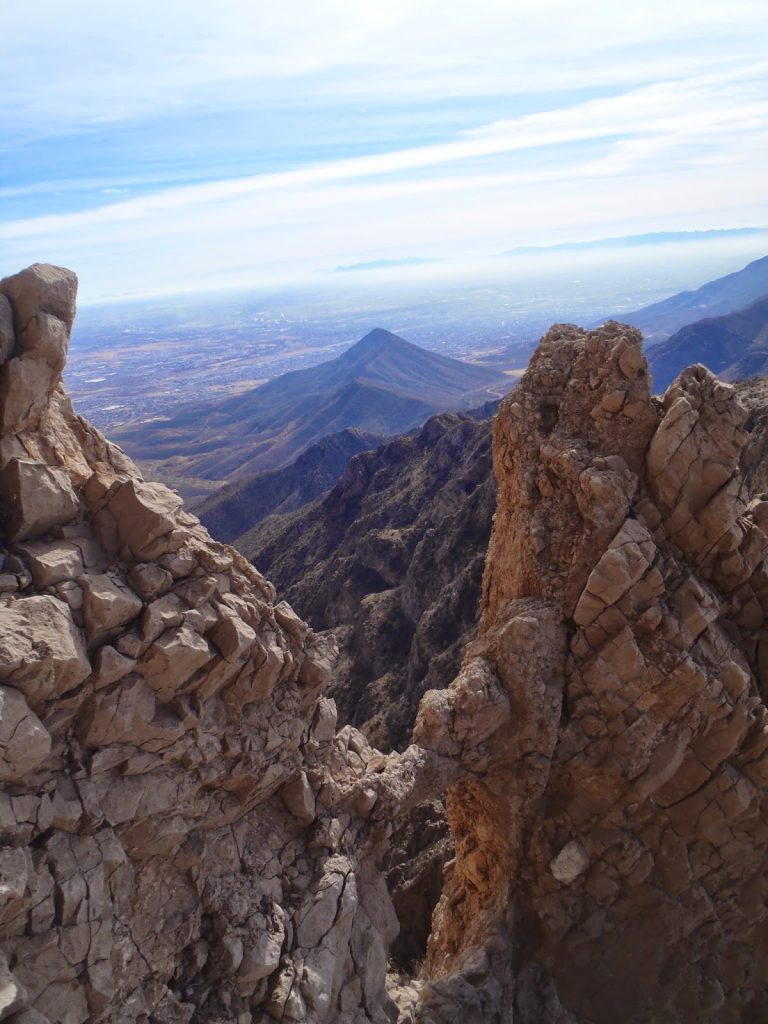
| Looking down on McKelligon Canyon |
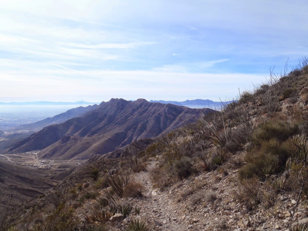
Once at the ridgeline, the view was excellent. El Paso and Juarez have some smog but for the most part I could see nearly every major mountain range in the area. It was a fantastic sight for someone who has been living in Chicago the last 4 months. You could see no further from the "summit" of the Hancock building.
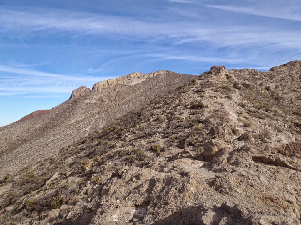
The trail/route generally follows along the ridgeline for most of the way up South Franklin. The short and sparse desert plants make the distance look much shorter but do not be fooled- it is a pretty long ways from the top of the canyon to the true summit. But the views are constant so I enjoyed it!
 |
| Ridgeline above "The Window" |
 |
| "The Window" |
As the trail snakes up the ridgeline, it comes to a knife's-edge like area where the trail just barely cuts into the cliff. This is the section just below the Window where I wish I had my hiking poles. It is steep, narrow and loose- bring a good pair of boots or shoes. The particularly scary sections had chains drilled in to the mountain to help navigate the loose rock.
After the window, the trail pops out just below the summit to a bare and flat plateau. The summit itself is actually quite ugly with a bunch of decrepit radio towers and the chairlift. I preferred the subpeak as it was more natural. Despite the buildings, panoramic views of the northern mountains and New Mexico are abundant. I later learned that this is the furthest south that the Rocky Mountains reach.
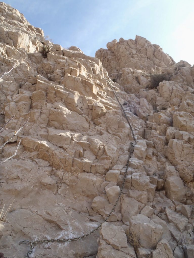 |
| Chains up to the Window |
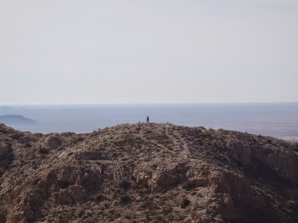 |
| Great views! |
With a car spot, its possible to hike from McKelligon Canyon to the Trans Mountain Road which would be about an equal distance of 6-7 miles. That would be another excellent hike for another day.
North Franklin Mountain, the only peak rising higher than 7,000 feet, is also on the list. The whole range abounds with hiking opportunities.
For now, I simply headed back the same way I came and was careful not to fall off the mountain on those slippery parts. It is easy to get going down the wrong way so carefully retrace your steps. Total time was just over 1/2 a day and I finished in time for lunch at Whataburger.
Read. Plan. Get Out There!


No Comments