


Well I've done the White Mountain Traverse so why not do the Black Mountain Traverse to make things even? This is actually a very doable 11 mile round trip hike which includes 6 summits in the Black Mountains of North Carolina, including the state high point.
Day: 18
Miles: 2,850
So you want to hike the Black Mountains, eh?? This would be the highest point on my entire road trip around the Southeastern States because today I would finally climb the highest Appalachian Mountain! After years and years of climbing stuff in the Whites, Greens, Longfellows and Gaspe Peninsula, I would finally see the point (haha). Mt Mitchell is the easily accessible high point of North Carolina and it is a great drive. Again, I just couldn't do that as a hiker so I had to figure out some other way to get to the summit. Fortunately there's an excellent traverse that runs across the entire Black Mountain Range. I couldn't wait to hit the trail!
The "Black Mountain Traverse" can vary from a nice day hike to a tough 2-3 day backpacking trip depending on how much mileage and bushwhacking you want to do. I settled with what would be a 11 mile hike that wasn't quite as difficult as I thought it would be. In fact, it was downright lovely. The hiking starts at Mt Mitchell State Park. Here's a map to give you an idea-
As you can see from the topographic map, the trail rarely dips below 6,000 feet which saves on the massive up-and-downs that plague other traverse in the range. The summits range from 6,300-6,600' and some of them aren't true summits by the east coast definition (greater than 200' rise between the next highest point). While the Presi Traverse involves some 10,000 feet of gain and loss, the way I did the Black Mountain Traverse was very tame. This is not to say you couldn't turn it in to a total sufferfest by starting lower and further away! Locals do that all the time.
I parked at the ranger station and headed North on the Old Mitchell Trail. Right off the bat there is Mt Halback which is a short bushwhack off the trail. The herd path is easy to see if you're looking for it. At the summit, there is a sign to mark the high point. It should be noted that while this summit makes the South Beyond 6000 List, it fails to meet the 200' of minimum prominence to make it a true summit by East Coast standards. Just a thought.
Moving right along, the trail makes a few dips and curves as it makes its way north to Mt Mitchell. There's actually quite a bit of ups and downs- it is not a straightforward ascent. It is only about 2 miles from the Ranger Station to the summit but it got my heart rate going. Eventually you pop right out on the summit road and make your way to the crowded observation platform. Views are of course excellent.
To the north rises the second tallest feature in North Carolina. Mt Craig is almost the same elevation as Mt Mitchell and far surpasses its taller neighbor in solitude and wilderness. Its funny how when you get just a mile away from a road, the crowds disappear. Oh there were a few backpacker but for the most part I was on my own.
Mt Craig is about a mile from Mt Mitchell. In the next two miles, one can bag both Balsam Cone and Cattail Peak with relative ease. There is a bit of a saddle between Balsam Cone and Craig. There is not much gain and loss between Balsam Cone and Cattail. If you chose to continue on the Black Mountain Crest Trail, the well-named Deep Gap will drop off quite a bit before you come to the three northern summits. For this reason, I went quickly over Balsam Cone and bushwhacked the summit of Cattail before returning. The other three would have to wait for another time.
Cattail was a short and mean bushwhack. There is a summit sign on the trail but this is obviously not the highest point. Don't be fooled by it! The bushwhack goes right into the thick and comes out on a small patch of bare rock. There are no views.
I went back the same way although you can chose to hike the Commissary Trail instead of the crest trail. This leads from Mitchell back to the parking lot and avoids some of the needless elevation gain and loss. At the end, I decided to do the 0.5 mile out-and-back bag of Mt Gibbs which can be done in a half an hour. It involves hiking up the access road to the obvious summit full of radio towers. The summit just northeast is Mt Gibbes and there's a bootlegged trail that leads to the high point from the access road. It starts at the small saddle between the two peaks. Again, it is an easy bag.
Well that's 6 summits in a day! It was a nice enough challenge. I hope I can come back and hike all the sixers some day!
Read. Plan. Get Out There!
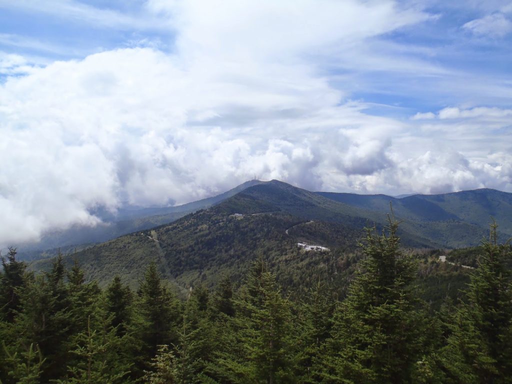 |
| The Black Mountains, as seen from Mt Mitchell |
Miles: 2,850
So you want to hike the Black Mountains, eh?? This would be the highest point on my entire road trip around the Southeastern States because today I would finally climb the highest Appalachian Mountain! After years and years of climbing stuff in the Whites, Greens, Longfellows and Gaspe Peninsula, I would finally see the point (haha). Mt Mitchell is the easily accessible high point of North Carolina and it is a great drive. Again, I just couldn't do that as a hiker so I had to figure out some other way to get to the summit. Fortunately there's an excellent traverse that runs across the entire Black Mountain Range. I couldn't wait to hit the trail!
The "Black Mountain Traverse" can vary from a nice day hike to a tough 2-3 day backpacking trip depending on how much mileage and bushwhacking you want to do. I settled with what would be a 11 mile hike that wasn't quite as difficult as I thought it would be. In fact, it was downright lovely. The hiking starts at Mt Mitchell State Park. Here's a map to give you an idea-
View Black Mountain Traverse including Mt Mitchell in a larger map
As you can see from the topographic map, the trail rarely dips below 6,000 feet which saves on the massive up-and-downs that plague other traverse in the range. The summits range from 6,300-6,600' and some of them aren't true summits by the east coast definition (greater than 200' rise between the next highest point). While the Presi Traverse involves some 10,000 feet of gain and loss, the way I did the Black Mountain Traverse was very tame. This is not to say you couldn't turn it in to a total sufferfest by starting lower and further away! Locals do that all the time.
I parked at the ranger station and headed North on the Old Mitchell Trail. Right off the bat there is Mt Halback which is a short bushwhack off the trail. The herd path is easy to see if you're looking for it. At the summit, there is a sign to mark the high point. It should be noted that while this summit makes the South Beyond 6000 List, it fails to meet the 200' of minimum prominence to make it a true summit by East Coast standards. Just a thought.
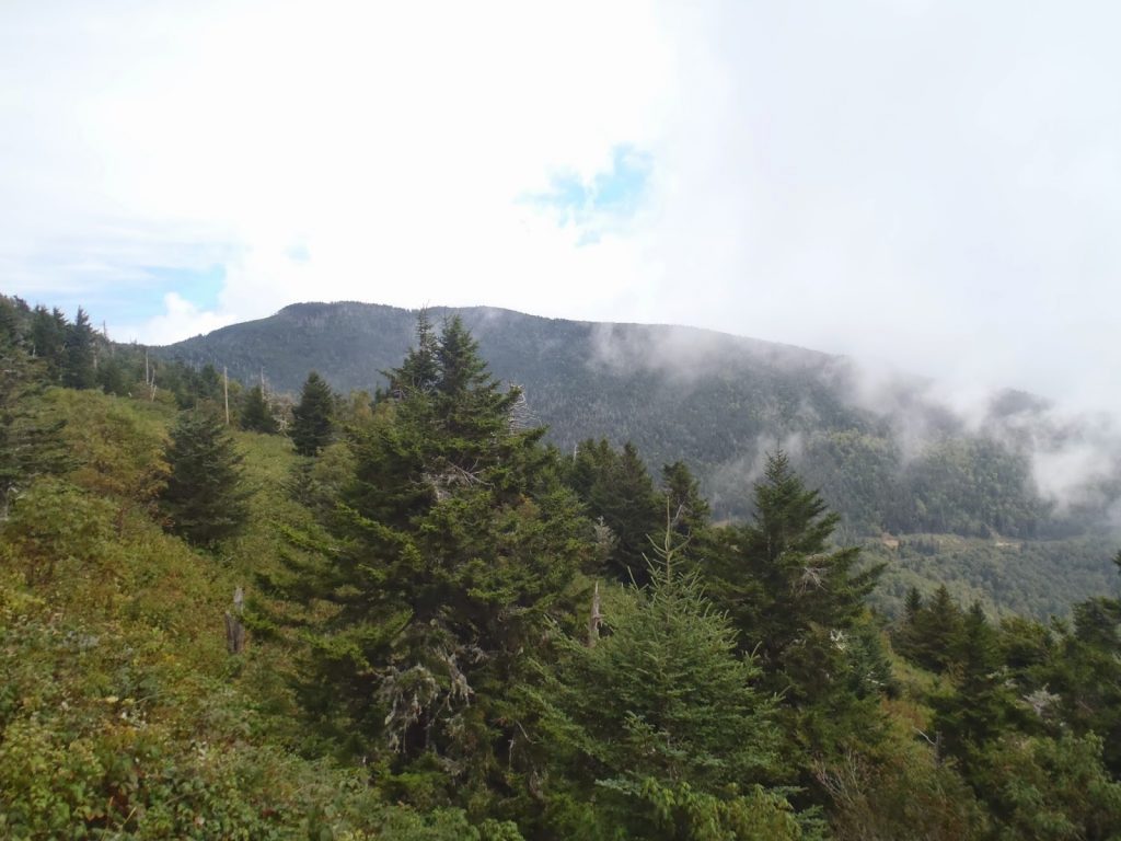 |
| Mitchell rising from the clouds |
To the north rises the second tallest feature in North Carolina. Mt Craig is almost the same elevation as Mt Mitchell and far surpasses its taller neighbor in solitude and wilderness. Its funny how when you get just a mile away from a road, the crowds disappear. Oh there were a few backpacker but for the most part I was on my own.
 |
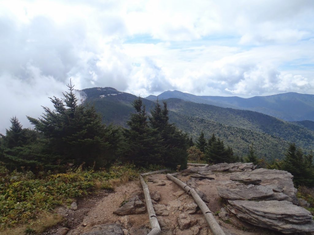
| From Mt Craig, the views are great and the crowds are minimal |
 |
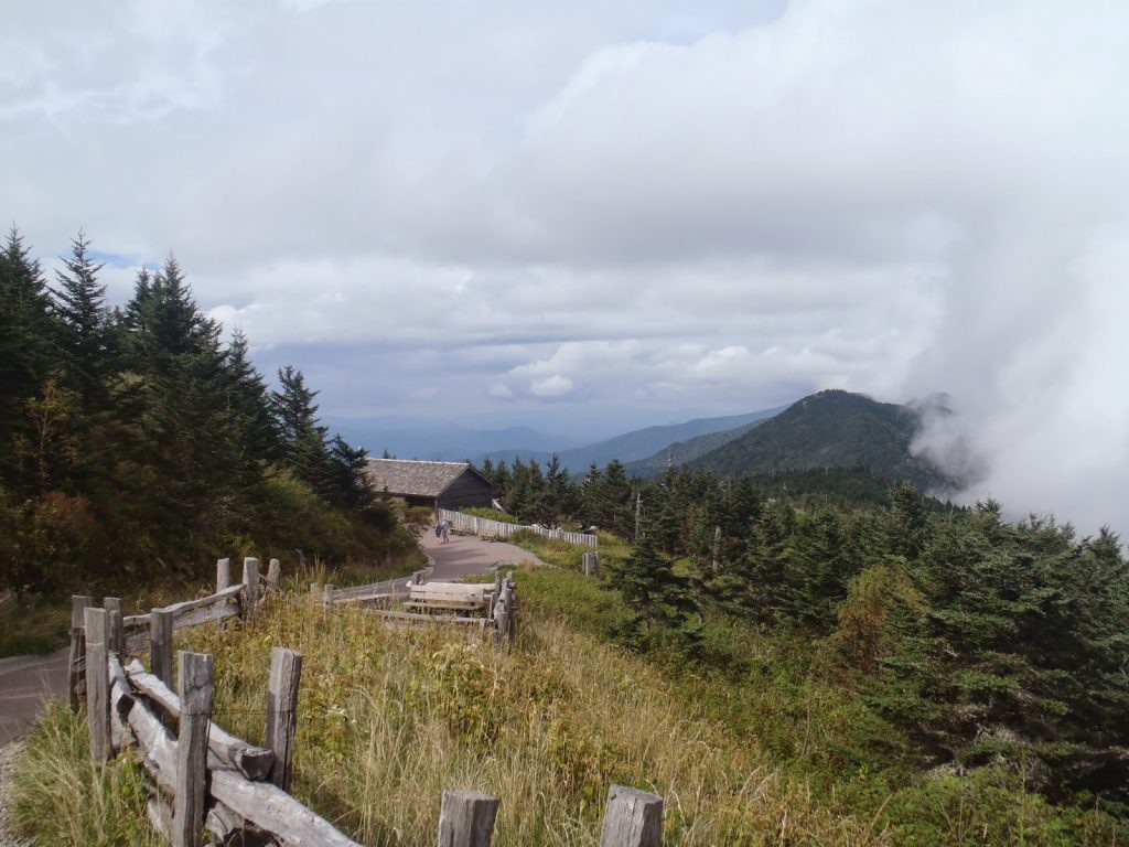
| Looking back at the southern summits of the Black Mountains |
Cattail was a short and mean bushwhack. There is a summit sign on the trail but this is obviously not the highest point. Don't be fooled by it! The bushwhack goes right into the thick and comes out on a small patch of bare rock. There are no views.
 |
| Looking back at the central and northern Black Mountains |
Well that's 6 summits in a day! It was a nice enough challenge. I hope I can come back and hike all the sixers some day!
Read. Plan. Get Out There!

No Comments