Boundary Peak, as it is called, is probably the most bizarre hike on the entire 100 Highest List. Getting there is quite the trip and the preferred method of hiking it is using a combination of ATV trails and walking on the actual international boundary. It is also best approached from the Mt Gosford ZEC located in the Eastern Townships of Quebec.
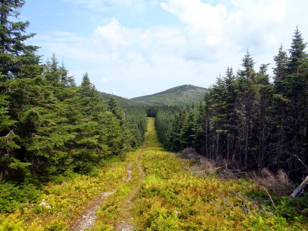 |
| Walking along the international border to the summit of Boundary Peak, ME/QC |
Bring your passport for this one, boys and girls! Boundary Peak, on the actual boundary between Maine and Quebec is the only New England 100 Highest Mountain that is best approached from Canada. It is a peak that hold little importance to anyone but is frequently hiked simply for the novelty of it. As reported by all knowing Wikipedia, Boundary Peak also happens to be the highest mountain on roughly 3,100 miles of the Canada-US border until Montana. Another strange reason to hike this mountain, I suppose!
Boundary Peak, also known as Panther Peak to some locals, can be bushwhacked from the US side (and it is a fierce bushwhack) or it can be hiked relatively painlessly from the Quebec side. So, pick your poison- I chose the easy way. It also allows for the hiker to explore the
Mt Gosford ZEC or the equivalent of a state park in the United States. The highlight of the park is not the border peak but its namesake, Mt Gosford. It would be a shame to come all this way and not hike the park's best mountain. Hiking Gosford in the afternoon after hiking the Border Peak would be a great day of hiking.
Here's a hiking map to help with directions-
Directions can obviously be very confusing, especially if you're not good at the metric system and don't know French.
PapaBear has posted fine directions which I followed to the "T". I personally parked at the first parking area noted above but it probably wouldn't have been too much of a problem to drive all the way to the second. There's a large open area at the second parking area and the trail leaves off from the right.
From there, the trail crosses a stream and comes to a very steep ATV trail with a hunting sign in French. The ATV trail makes a pretty direct climb up to the border and is very clear. Apparently this is one of Quebec's premier moose hunting areas so it wasn't surprising that everything was clearly well traveled. Once you hit the boundary, it is a simple matter of walking the swath.
What a peculiar sight the boundary was. Every 1/2 mile or so there is a boundary monument in concrete with a 2 foot post. Otherwise there's an obvious ATV track going on the Quebec side and just stout vegetation on the right. It was strange and somewhat mysterious. There was no sign of any border patrol but I carried my passport, just in case. There were 2 very large moose blinds and probably 20 salt licks on the way. Again, it was a very odd sight.
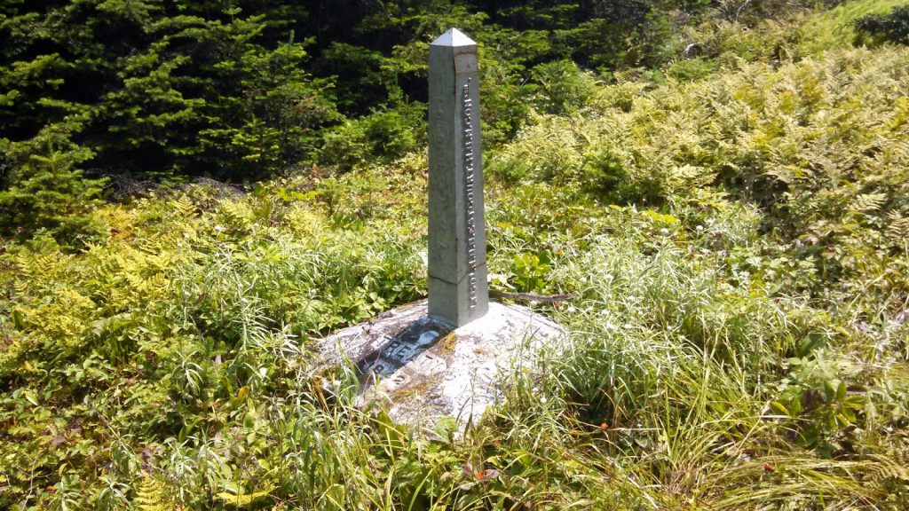 |
| Boundary Monuments |
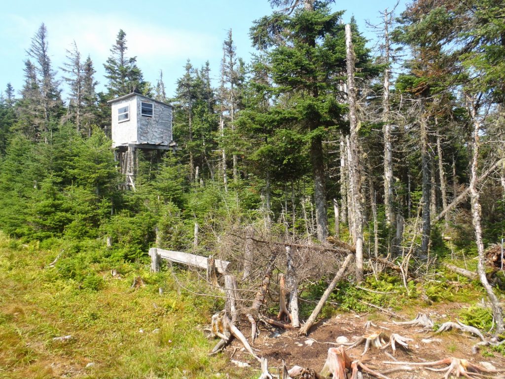 |
| Moose Blind |
You actually have to hike about 3 smaller summits before getting to the true summit. It doesn't take too long, but getting to the boundary itself is only 1/2 the battle. The "summit" has a canister on the American side and it is marked as "Panther Peak". I signed the summit canister and recognized about 1/2 the names. On average, people were saying this was somewhere between #90 and #95 on their 100 highest quest- a testament to the remoteness of this mountain. Some people actually did the extremely difficult bushwhack from Snow Cupsuptic, North Kennebago Divide and White Cap! That's 14 or 15 miles of bushwhacking!
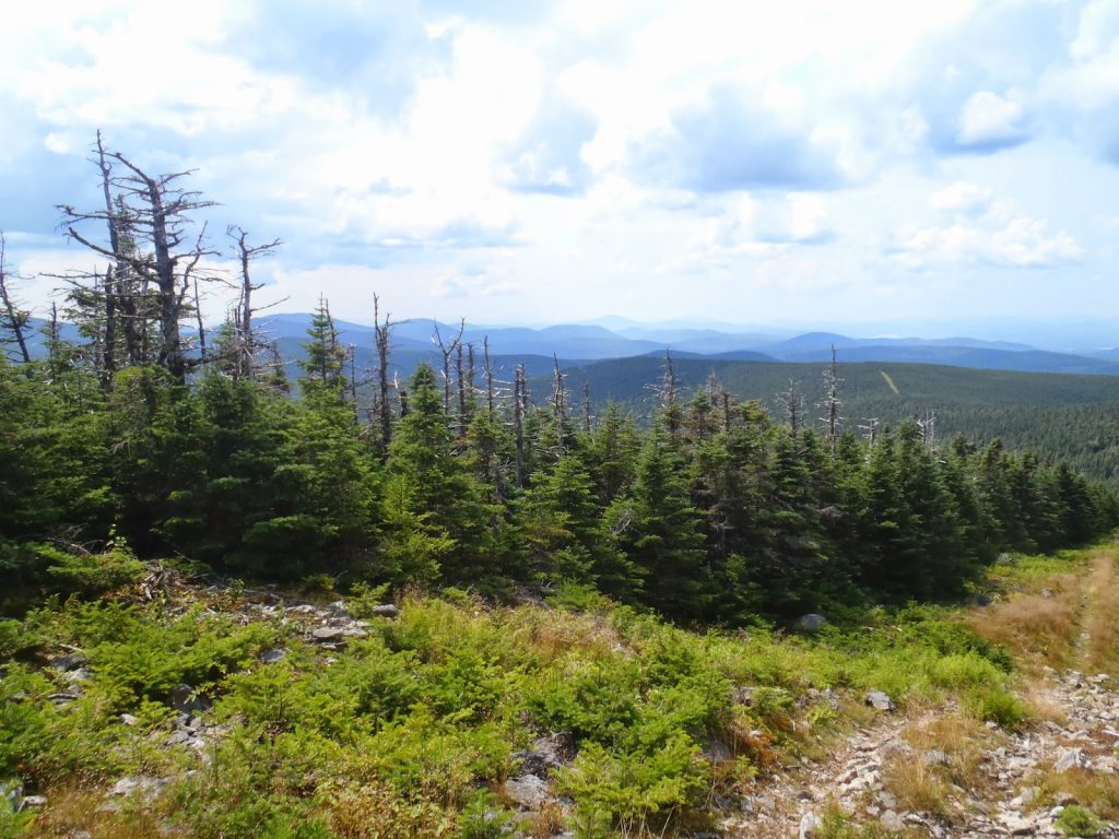
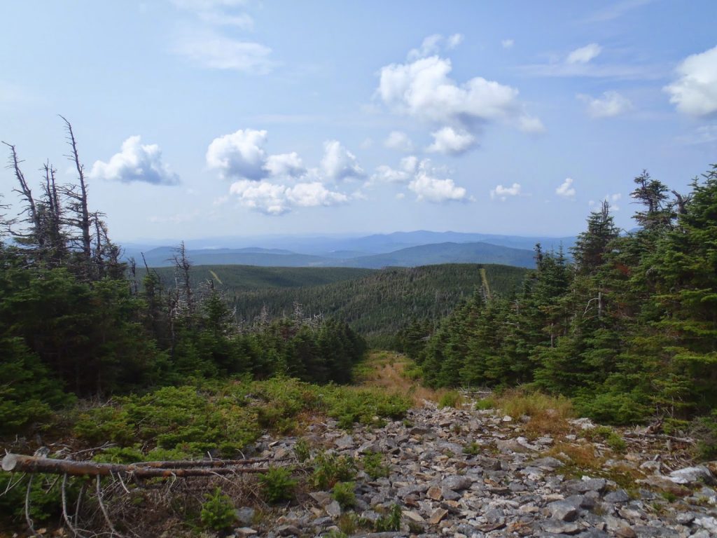
Due to the nature of the boundary swath, there were great views however I later hiked Mt Gosford which had superior views. Again, don't come all the way out here and not hike Mt Gosford.
 |
| Great views! |
 |
| It was strange to be hiking on the international boundary. You couldn't do this in my home state of California! |
 |
| Miles and miles of mountains |
I was down from the mountain before lunch time. This was good news because I was able to hike Mt Gosford before the afternoon thunderstorms. The trailhead is passed on the way to the Boundary trailhead so it wasn't too hard to get back to it.
Read. Plan. Get Out There.


No Comments