


I hiked Mt Kibby on a lovely August afternoon and was treated with a *nearly* 100 mile view from its summit to the summit of Katahdin. As far as I can tell, this is the longest line of sight I've ever had hiking on this coast.
After climbing the nearby Mt Snow, I turned north and headed down a bunch of improved logging roads to the trailhead of Mt Kibby. As others have discovered, the Boundary Mountains of Maine are a pristine wilderness with hundreds of opportunities for adventure. Its mostly just logging roads, ATV and snowmobile trails which permeate the area although the wind farm has made the roads more traveled. The creation of the wind farm, like all hot topics in Maine, created considerable controversy between environmental groups, landowners, residents and outdoorsy types. Regardless of your ideological leanings or feelings, I think we can all chuckle at the fact that Maine seems to have some of the fiercest local politics in the country. The continued debate over the environmental benefits of wind power and its negative impacts of it will probably forever be a topic of substantial debate.
Driving up the access road to the wind turbines was somewhat of an adventure in itself. What was once a barely mapped logging road is now somewhat of a dirt road super highway which is used by outdoor enthusiasts, locals and workers alike. It was weird to see so many vehicles on the trail- there's been other logging roads where I'm confident I could have pitched a tent in broad daylight in the middle of the road and never worry about getting run over.
Here's an area map with driving directions, the trail and the area of the Kibby Mountain Wind Project-
I don't know if it is always this magnificent or if I happened to catch it on a good day, but Mt Kibby was well worth the 2.3 mile hike. I'd certainly do it again. I camped over night at the Chain of Ponds and readied myself for tackling Boundary Peak!
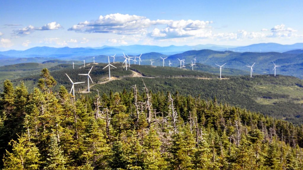 |
| Mt Kibby and the new windfarm |
Driving up the access road to the wind turbines was somewhat of an adventure in itself. What was once a barely mapped logging road is now somewhat of a dirt road super highway which is used by outdoor enthusiasts, locals and workers alike. It was weird to see so many vehicles on the trail- there's been other logging roads where I'm confident I could have pitched a tent in broad daylight in the middle of the road and never worry about getting run over.
Here's an area map with driving directions, the trail and the area of the Kibby Mountain Wind Project-
View Kibby Mountain Hiking Trail in a larger map
As you can see, it takes a long time to get to Kibby Mountain from basically anywhere. However, it is nearby the Chain of Ponds area which is an excellent place to camp overnight.
The Kibby Mountain trail begins off of the access road to some of the wind turbines and the trail/road is not marked. You can park right off to the side of the road but be careful that you don't obstruct the road, even by a centimeter!
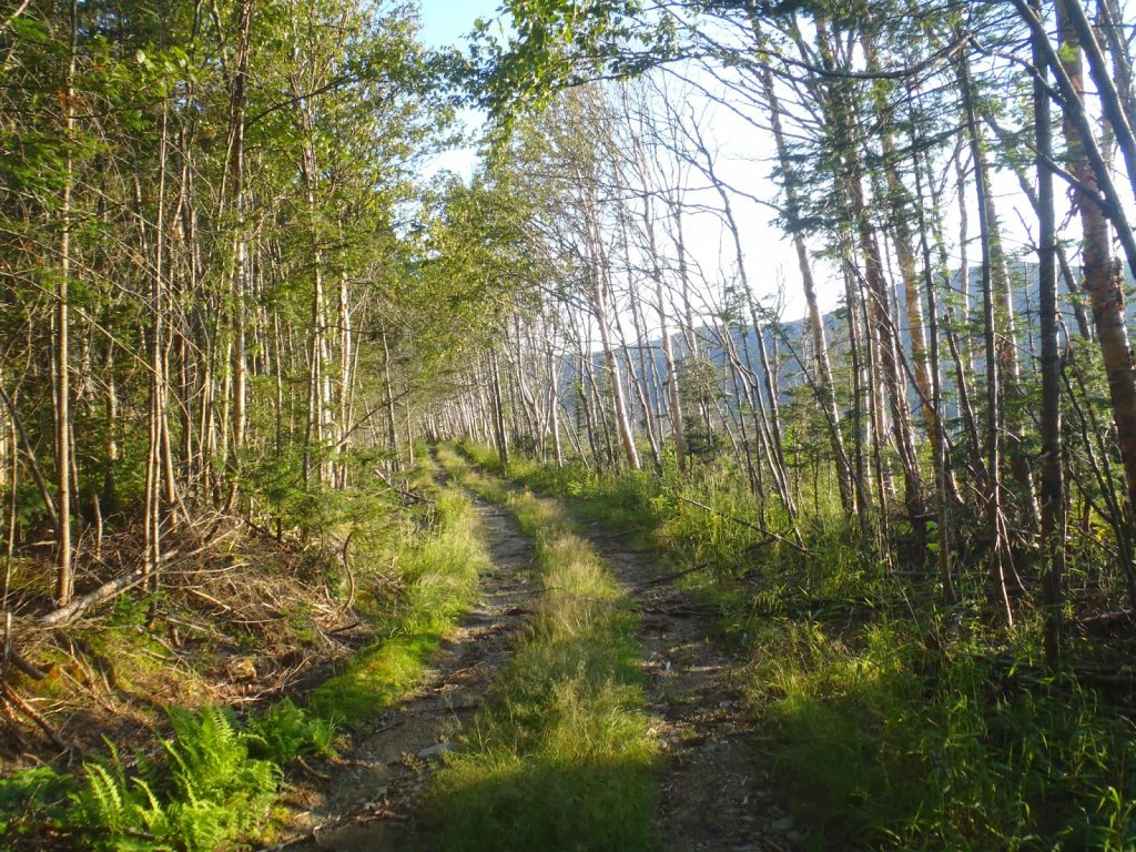 |
| The logging road is actually quite nice |
It is just 2.3 miles to the summit with about 1,100 feet of elevation gain; quite tame, actually. The first 0.9 miles are walking on an old logging road and then a fork appears and you go right. From here, the road narrows to a trail and it is about 1.4 miles to the summit. There aren't any real views until you get to the actual summit and you have to climb and old fire tower. Mind you, the fire tower is ancient and some of the wooden boards have rotted though. The cross beams appear to be in good shape so just stick to those. It is worth the climb because the view is uniquely situated so that you can see nearly every tall mountain in the state-
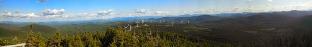 |
| Attempt at a panorama, looking southwest |
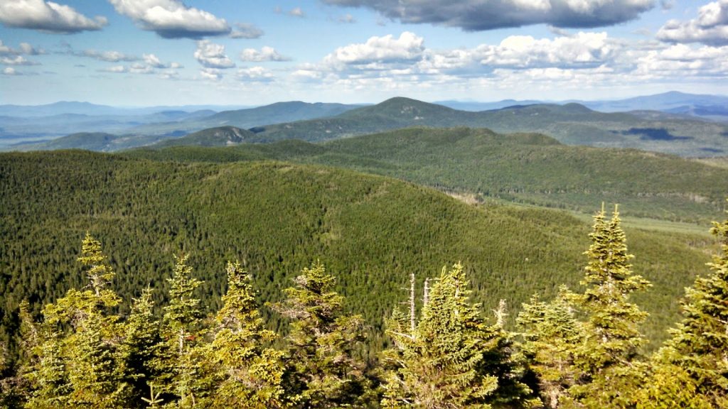 |
| Mt Katahdin can be seen from the summit but is not apparent in this picture without a telephoto lens |
Read. Plan. Get Out There!

No Comments