


Situated between Stratton and Rangeley is East Kennebago Mountain, a tall and isolated summit which makes the New England 100 Highest List. I climbed this in a 1/2 day along with a few other summits in the area.
After spending the night back on the US side of the border, I headed towards Rangeley to hike East Kennebago Mountain. This is a surprisingly prominent ridge that makes the northern half of the valley of the South Branch of the Dead River. I find the Route 16 drive between Rangeley and Stratton through this valley to be one of the finest mountain drives in the state. East Kennebago interested me for that reason. Like nearly every mountain in the area, getting to the "trailhead" involves a creative combination of logging roads and snowmobile trails. As such, I had to use my car, mountain bike and feet to get to the summit!
Here's a rough idea of what I'm talking about-
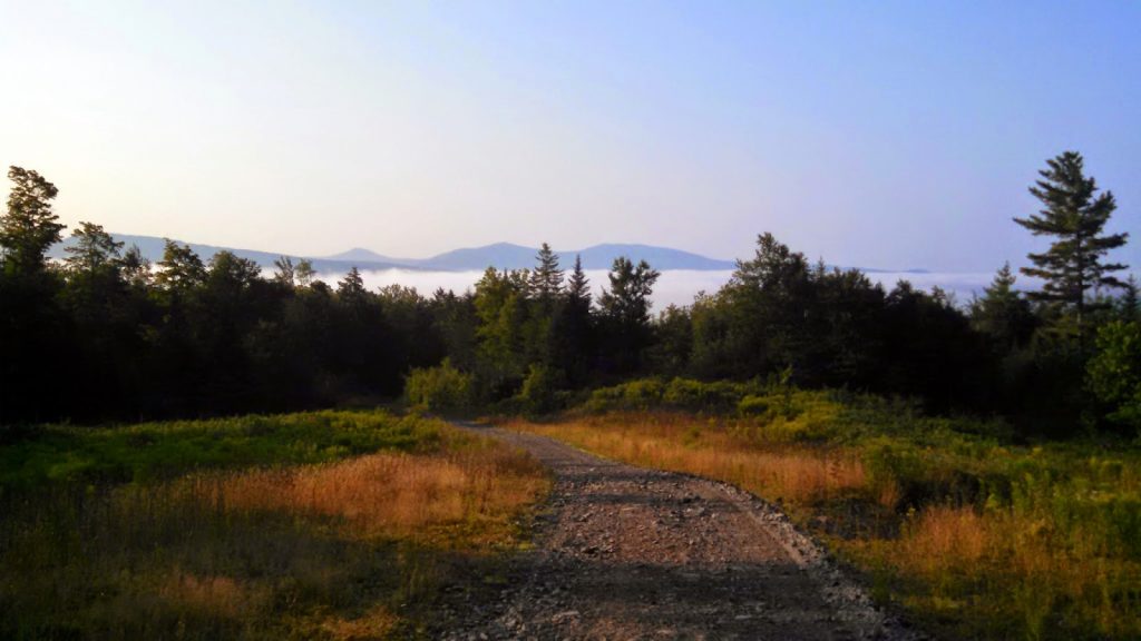 |
| A nice undercast in the valley separating east Kennebago and the Saddleback Range |
Here's a rough idea of what I'm talking about-
View East Kennebago Mountain Hiking Map in a larger map
As always, the Maine Gazetteer was invaluable to getting to the "trailhead". Looking at the map above, I drove the black line which was passable by passenger cars and then biked the brown part to the parking area for high clearance vehicles. I should note that it does follow the strict rules for hiking New England's 100 Highest as I didn't bike further than the highest reachable spot by a high clearance vehicle. As you can see from the satellite view, the parking area is evident.
I took off on foot on the logging road which was very overgrown but there was a clear "herd" path through the long grass that was evident. Clearly many people have hiked this mountain in the same pursuit. The logging road goes though an area of past clearing before getting into the higher woods. At that point is looks almost like a regular trail. Before too long, a few cairns appear on the left which mark the herd path. If you pass them, you will cross the little stream which separates the West summit from the East summit. See the topo map for help.
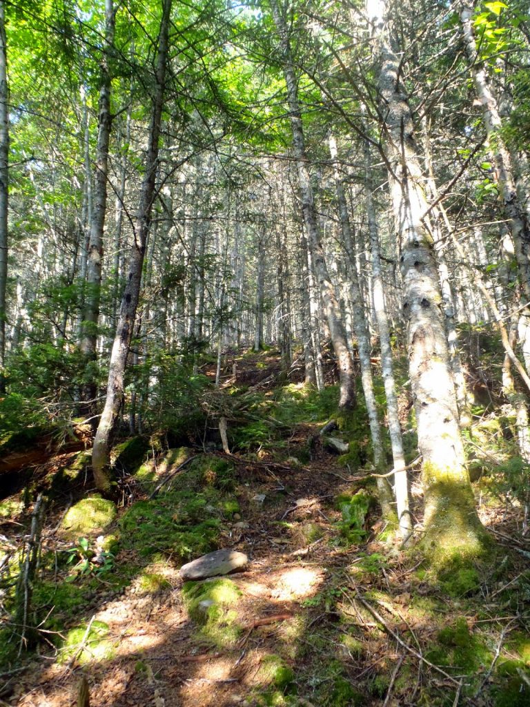 |
| For this mountain, the herd path was as obvious as they come |
 |
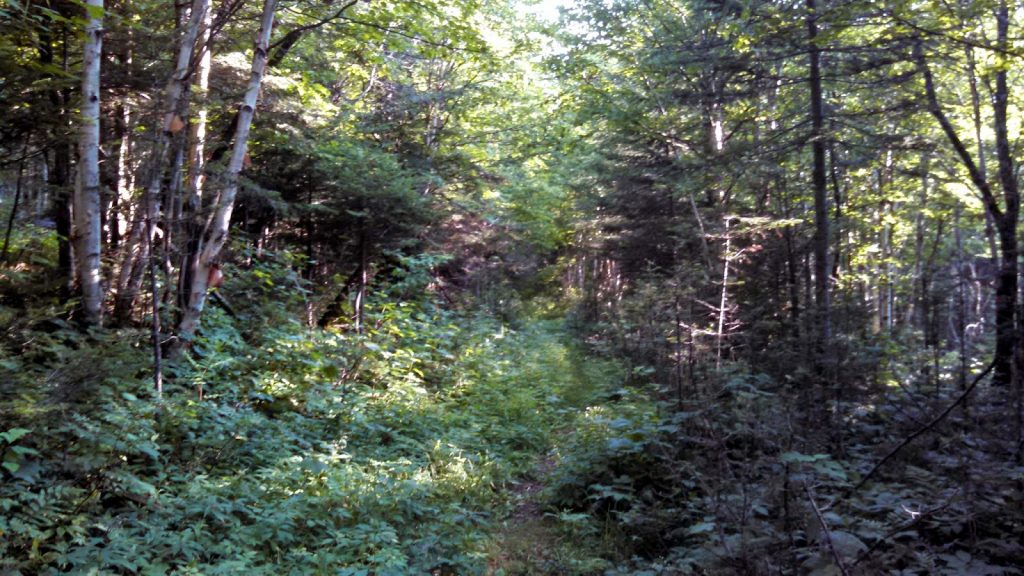
| Walking the "boundary line" |
 |
| The logging road is overgrown but very obvious |
The generally accepted route up the mountain involves hiking along some boundary line which is well marked with yellow blazes and then going straight for the summit once this line makes it to the height of the land. Overall, it was was one of the easiest bushwhacks I've ever done. In fact, it really is just a trail to the summit. Others have reported having trouble with finding the trail, perhaps I'm just used to bushwhacking and following the pretty evident signs of travel.
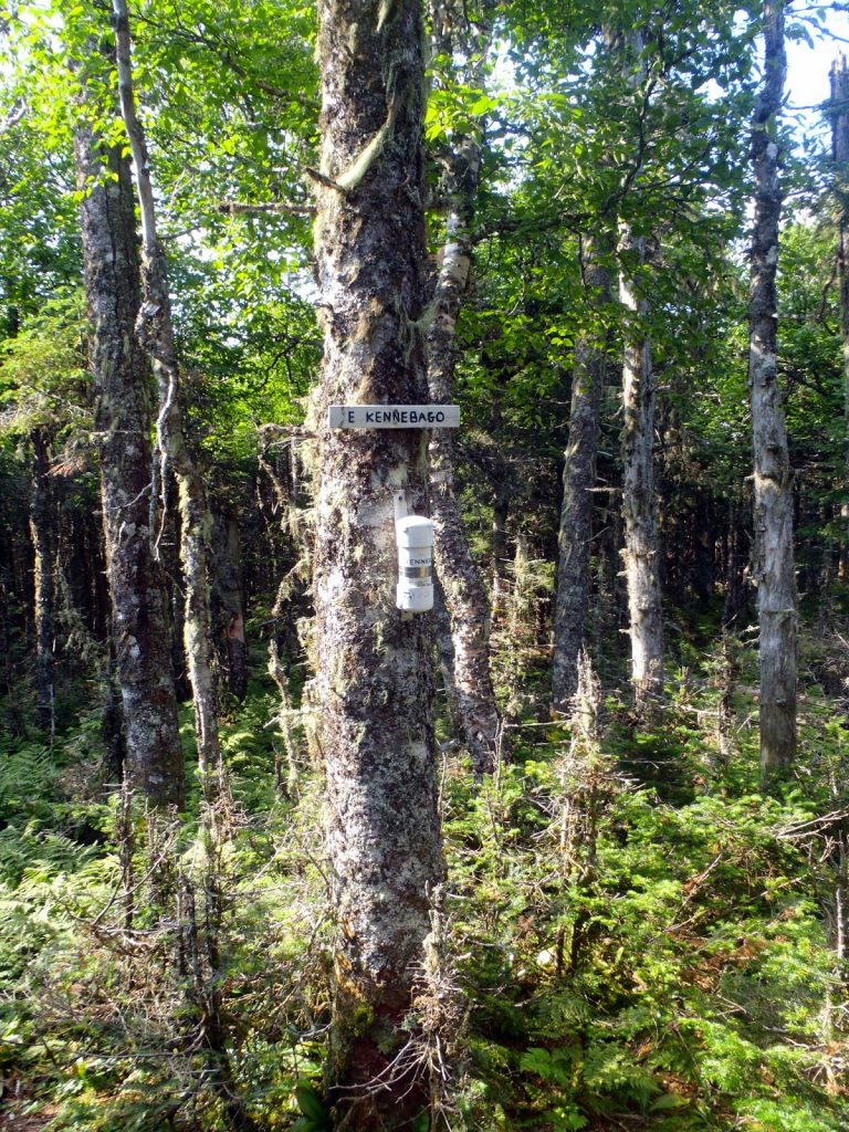
There were many different cairns and bushwhack paths that lead from the logging road towards the summit but the best trail is marked with a cairn on the north side of the trail and an easily-missed yellow stake that could be mistaken for a tree. I missed it on the first pass but with careful lookout, found it on the second pass. After that the "boundary" line or town line was so well marked I hardly had to think about where I was going.
Walking to the height-of-the-land was pretty obvious as was the trail that left the boundary line and headed almost directly up the summit. I was on the top before 1000 after starting at 830. I didn't even have much of a time finding the summit canister-
Overall impressions, it was probably one of the easiest "un-trailed" hikes of NEHH and I'd hardly call this a bushwhack after others that I've done at this point. On average, this mountain is somewhere between #85-#95 on their quest so it is likely that you've done tougher hikes in the past. None the less, it is a great trail though somewhat of an alpine wilderness which makes the journey nice. It can be easily combined with others in the "Rangeley 6-Pack".
That' exactly what I did- headed off the mountain and headed over to White Cap and North Kennebago Divide. I'd be up to #95 before the day was done.
Read. Plan. Get Out There!
 |
| The summit canister faced away from the trail but it wasn't hard to find |
That' exactly what I did- headed off the mountain and headed over to White Cap and North Kennebago Divide. I'd be up to #95 before the day was done.
Read. Plan. Get Out There!

2 Comments
Mikabella
June 9, 2020 @ 13:28
Do you know who owns East Kennebago Mountain?
Quincy Koetz
June 23, 2020 @ 14:01
I’m not entirely sure but I would guess a logging interest probably owns it. To my knowledge there’s no access issues though.