Elephant Mountain is a prominent summit just outside of the Mahoosuc Range in northwestern Maine. Its conspicuous summit is a great view on the nearby lakes and mountains however it was curiously left out of the Appalachian Trail (which skirts only a 1/2 mile from the summit). For peakbaggers, it is a P2K and on the Hundred Highest List.
 |
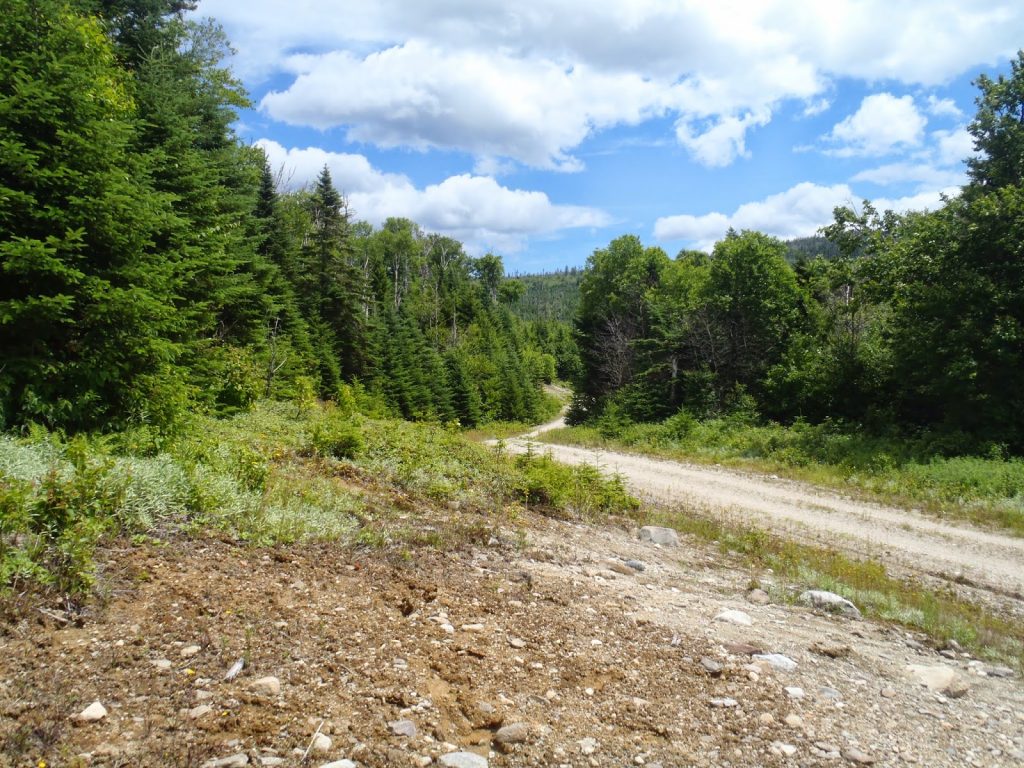
| Elephant Mountain from the logging road |
Not that I'm bitter about this insignificant fact, but why was Elephant Mountain not on the Appalachian Trail? Its a gorgeous summit and its one of the dominating features in the Western Maine Mountains. Perhaps it was to appease the hardcore bushwhack hikers who think that trails ruin a mountain. Oh well.
Elephant Mountain, near the Rangeley Lakes, is 3,772' tall and is in one of my favorite parts of the state. The area has some of the tallest summits and largest lakes in the state which makes for excellent hiking and exploring. It should be noted that this Elephant Mountain should not be confused with the shorter but more famous
Moosehead Elephant Mountain. Its an officially trail-less peak but the route is pretty well-established at this point. A prudent hiker still needs a GPS, map, compass and good orienteering skills to make it to the summit, but it isn't a total bushwhack like several of the other summits on the NEHH list and NEFF list.
Here's my map Note that the route is approximate after the end of the logging road-
It should also be said that there are a few discrepancies between this map and the Maine Gazetteer. Most importantly, you will notice that there are two summits of almost exactly the same altitude, separated by a col that is about 170' below. The Gazetteer notes that the northwestern summit is the true summit while other maps say that the southwestern summit is taller. Who knows which one is actually taller, but the register and summit canister are on the southwestern hump, so if that's more important to you, then don't confuse the two!
Secondly, as shown above, the logging road takes an obvious left there at the beginning. It appears on the Gazetteer map as if you could continue straight up the creek on a dirt road, thus cutting off that big "V" you see on the map but this is not the case. Either this cut-off road is non-existent or it has long-been overgrown, because I saw not a trace of it connecting to Elephant Mountain Rd at a higher elevation. On Google maps satellite view, there does appear to be a faint outline of the older road, but I preferred hiking up Elephant Mountain Road despite the extra mileage.
 |
| Elephant Mountain Road |
From just about anywhere, you will need to drive to Andover, Maine which is a small town North of Bethel/Sunday River Ski Area. South Arm Road will get you to the "trailhead" and it is a paved road which winds through a beautiful section of the Appalachians. The AT crosses this road just before coming to the turn-off for Elephant Mountain Road/Old Country Road. I'd recommend using a GPS because the dirt roads are not signed. At any rate, it was 10.0 miles exactly from Route 120 in Andover to Old County rd./Elephant Mountain Rd.
Its about 2.5 miles up the dirt road to the end where it is impossible to travel further in a truck/car. Most park here, I decided to walk up to this point as I do not have a high-clearance vehicle.
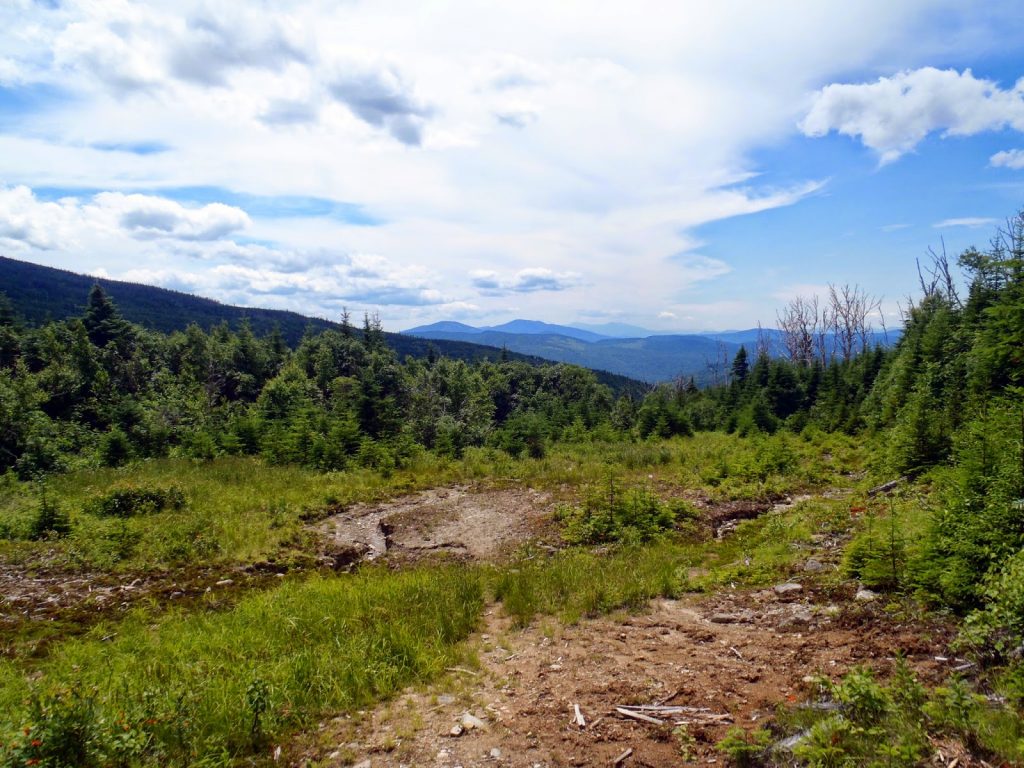 |
| Elephant Mountain has a wooded summit but there are nice views on the road up. |
At this point, there's an obviously abandoned logging road that heads in the general direction of the summit. After about a 10 minute walk, the road ends and there's a conspicuous herd path which is marked with a cairn. Its about 0.7 miles to the summit from here with about a 700' elevation gain. The herd path is generally easy to follow up to the saddle- simply take the path of least resistance. There's a small creek that flows from a swamp in between the two summits which serves as a good point of reference. The herd path never crosses this stream although it parallels it towards the top.
Its a moderately steep but direct climb. Once the swamp is reached between the two summits, its about 0.2 miles to the top. Again, don't mistake the northwestern "summit" for the true summit to the southwest.
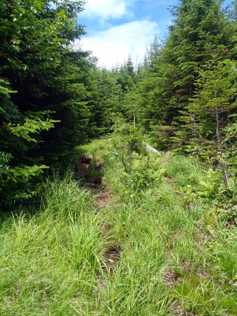 |
| The herd path is pretty obvious, for the most part. |
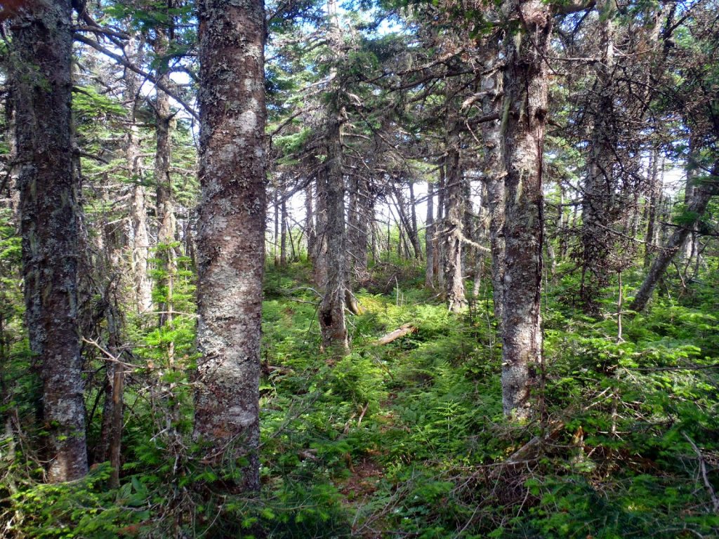 |
| Near the summit |
The last 0.2 miles are a little tricky. Actually, I found an excellent and easy path to the summit but lost it on the way down and got tangled in an endless mess of thick spruce. Oh well. There were fleeting views of Richardson Lake but not much otherwise.
At the top, the summit is marked with a canister and register. It appears that even in the summer, Mt Elephant only sees perhaps two dozen hikers in a month. There wasn't much to see at the summit itself so I headed back down.
 |
| Heading back down the road |
So, all in all, the only real bushwhacking part was the 0.2 miles down from the summit to the saddle when I lost the herd path. Certainly not as difficult as some other New England 'whacks! Otherwise, it was a pretty straightforward walk-up which was easily completed in 1/2 a day. Nearby is the
South Arm Campground which is lovely.
Read. Plan. Get Out There!


No Comments