


Sandwich Dome is a popular "almost-4000-footer" which tops the list of New Hampshire's 52 with a View and makes it on New England's Hundred Highest. It is a mountain that can be hiked from all directions and remains a favorite of the southern White Mountains.
Sandwich Dome is the mountain that was almost a 4,000-footer. Although it just barely misses the completely arbitrary cut-off of British imperial units to make the White Mountain 48 list, it is a nice mountain in its own right. It is also one of the finer peaks in the expansive Sandwich Range Wilderness which also includes great hikes of the Tripyramids, Whiteface and Passaconaway and Mt Chocorua. For these reasons, Sandwich Dome has an impressive view of many of the tall summits of the area as well as Waterville Valley. If you hike it from the valley itself, you can bag Jennings Peak and Noon Peak which are shorter, but also have great views.
I hiked this from the Bennett Street Trail which is a steep ascent from the town of Sandwich. Here is my map-
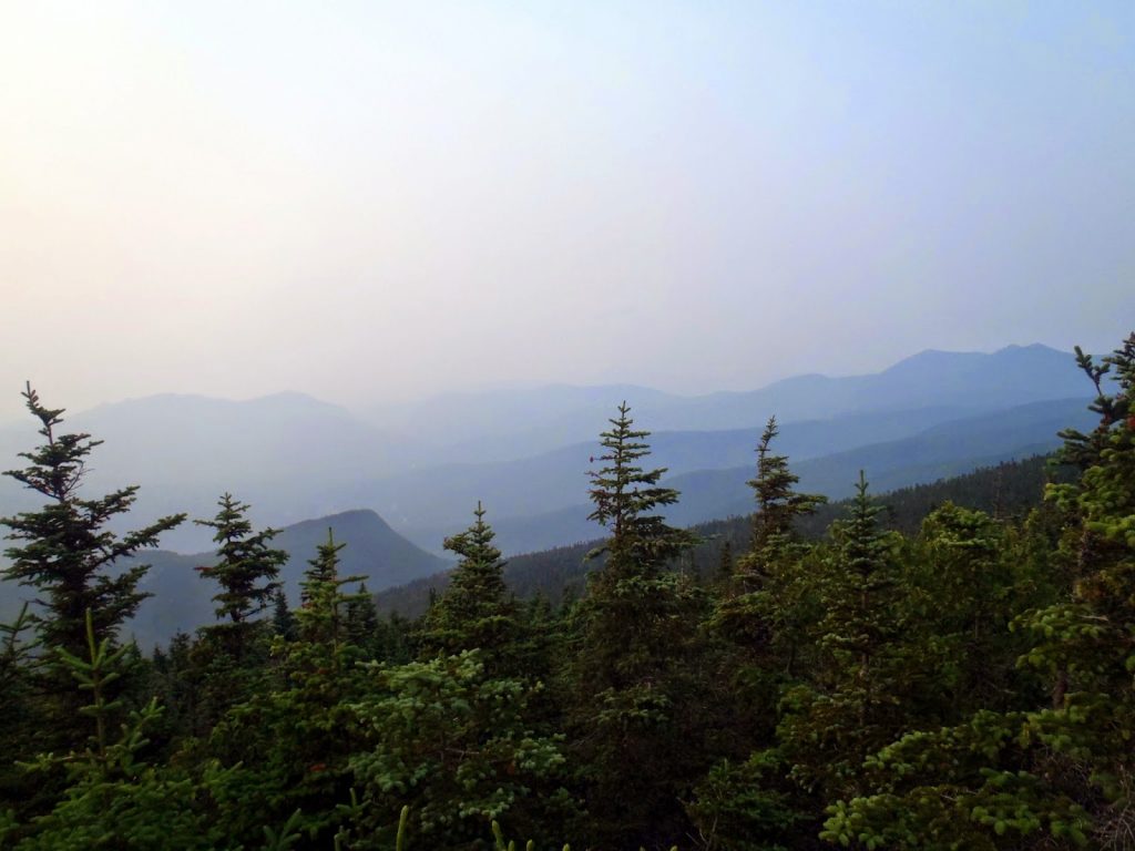 |
| View from the summit of Sandwich Dome, looking down into Waterville Valley |
I hiked this from the Bennett Street Trail which is a steep ascent from the town of Sandwich. Here is my map-
View Hiking Sandwich Dome, New Hampshire in a larger map
The parking area is just before the gate on Bennett Street, which is mostly unpaved. The last 0.2 miles are a little rough, but I got by okay in my sedan. From here, there is a spider-web of trails and old-logging roads which can be confusing, but the trail to the summit is generally well marked.
Its pretty flat or a hardly noticeable ascent for the first 2.1 miles. The trail goes past the gate and past "Jose's Bridge" in the first 0.5 miles before the "Flat Mountain Pond Trail" diverges to the left. To the right, I took the trail that follows the brook for 0.6 miles and then turned left on a side trail that was signed for Sandwich Dome. This trail gained a little elevation over 0.5 miles and intersected with the Flat Mountain Pond Trail again. At this point, there's a *very* faint trail that heads straight up the mountain, called Gleason Trail. After a few hundred yards on the Gleason Trail, it was apparent that it had not been maintained in years and I turned back; I took the flat mountain pond trail another 0.5 miles north to the Bennett Street Trail (again) where it is signed for Sandwich Dome. (If you can't tell, you really need a map for this one!)
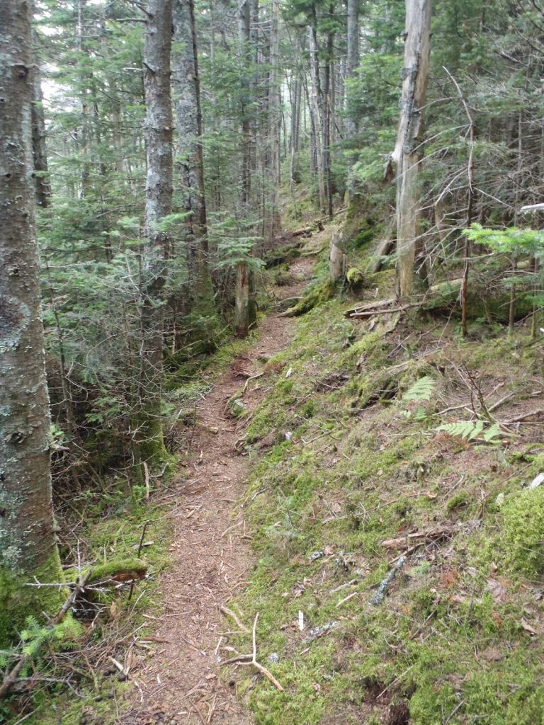 |
| The Bennett Street trail was much easier to follow than the Gleason Trail |
From here, the trail ascends to the summit, rather directly, over the course of 2.4 miles. It gains about 2,000' of elevation in this part. It is steep, but if you've hiked anything else in the White Mountains, you know this is just standard. It does wind though some seemingly old-growth woods which is enjoyable. Numerous water sources cross the trail.
There aren't any views until you're right on top of the summit. Here, the views are mostly west and north facing. Although it was foggy when I hiked Sandwich, many other hikers have put this on their "best views" hikes. To be perfectly honest, I thought the views from the Tripyramids and Osceolas were preferable, but Sandwich Dome was nice too. Your experience may differ.
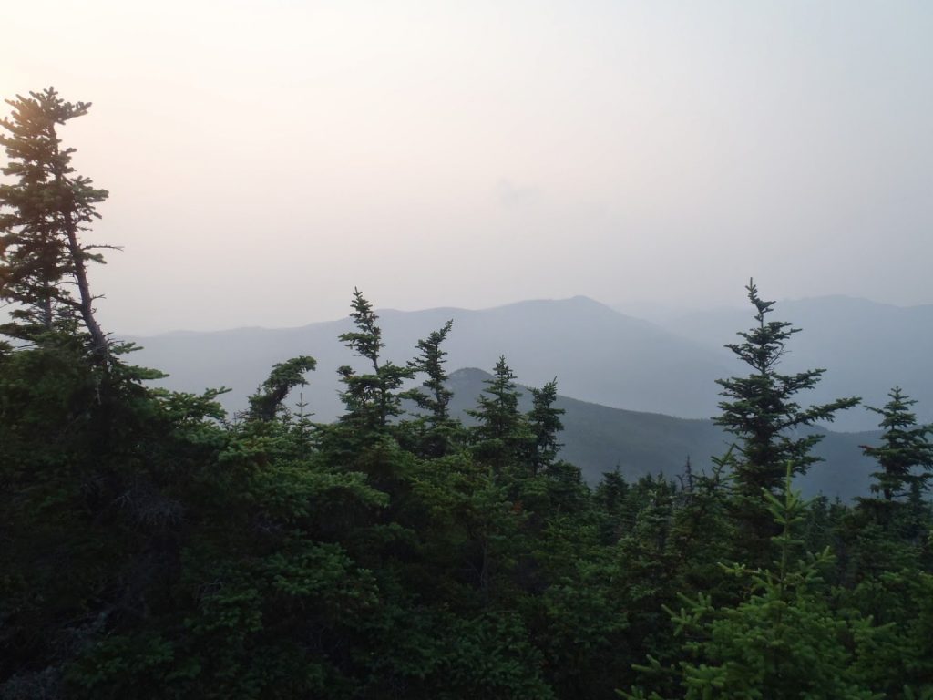 |
| Across a foggy valley! Jennings Peak is the closest point in the foreground. Tecumseh is the mountain in the distance |
This was a pretty straightforward out-and-back hike although probably not the best route up Sandwich Dome. I've heard that most prefer the trek from Drakes Brook up Noon Peak, Jennings Peak and then to the Dome. It is steeper and more of a scramble in some sections but has views going all the way up, as opposed to just at the summit. This option is 8.7 miles in length.
As for me, that's #86 on my New England 100 Highest! Almost there!
Read. Plan. Get Out There!

No Comments