


The hike up to the Nancy Cascades and Nancy Pond is a classic among White Mountain hikes. If you are in to the New England 100 highest peakbagging, you can get the summit of Mt Nancy to make for a perfect day. But all three destinations are excellent on their own.
 |
| The view from the outlet of Nancy Pond is one of the best in the range |
As you might be able to tell, I'm on a 100 highest kick right now. Its been pretty fun- I've been traveling all around new and old places which I've overlooked in previous adventures. One of these frequently-overlooked-by-4kers places is the Nancy Ponds and Cascades area which includes a lovely section of the Pemigewasset Wilderness. Mt Nancy is #74 on the list of New England's 100 Highest Mountains.
Here's my map-
Here's my map-
View Nancy Peak, Pond and Cascades Trail in a larger map
The trailhead is right off of Crawford Notch Road (Rt 302) just past the turnoff for Sawyer River Rd and just before Notchland Inn if you're coming from North Conway. It is simply known as "Nancy Pond Trailhead". There's capacity for about 8 cars so get there early if you're coming on a weekend!
So, one way distances are as follows- 2.4 miles to Nancy Cascades, 3.5 miles to Nancy Pond, 4.3 miles to Norcross Pond (the best view on the hike) and 5 miles to the summit of Mt Nancy. The trail is great all the way to Norcross Pond.
The first 2.4 miles to Nancy Cascades are relatively tame by WMNF standards and the combination of shade with nearby water makes for a great hike in itself. The Nancy Cascades are gorgeous and certainly comparable to Ripley and Arethusa Falls, nearby.
 |
| Nancy Cascades |
Obviously the Nancy Cascades were an excellent spot for lunch. I would rank the falls as one of the top 10 in New England.
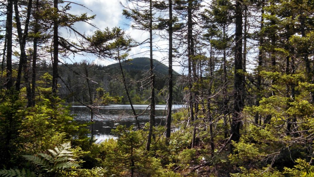
Continuing upwards, the trail begins to gain substantial elevation in 1.1 miles as it rises to the 3,121' Nancy Pond. This was a more difficult section but there was merciful shade. Nancy Pond itself is more swamp-like than a pond but it is pleasant. Norcross Pond, just 0.8 miles further, was the real treat though. There were about a dozen excellent photo opportunities, including the looming mountains of the Pemi Wilderness rising over the lake's outlet. Mt Anderson rose sharply from the lake's southwestern shore and the alpine flora was lush. I spent a considerable amount of time relaxing here.
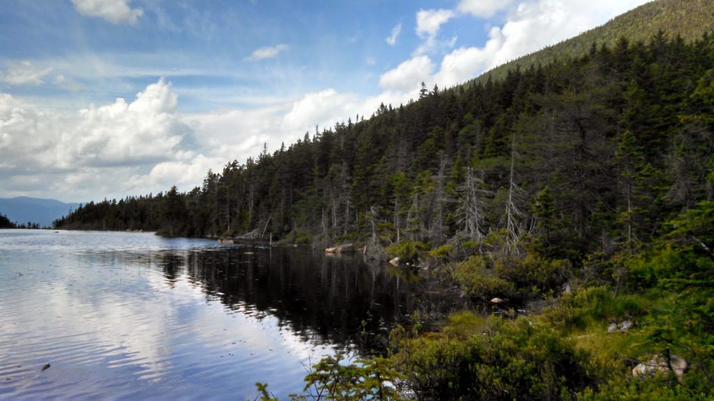 |
| Mt Nancy rising from Norcross Pond |
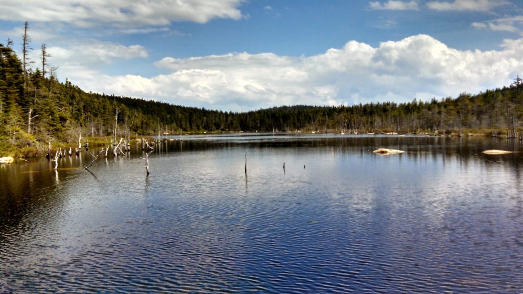 |
| Norcross Pond exemplifies a New England alpine pond |
 |
| Mt Anderson |
 |
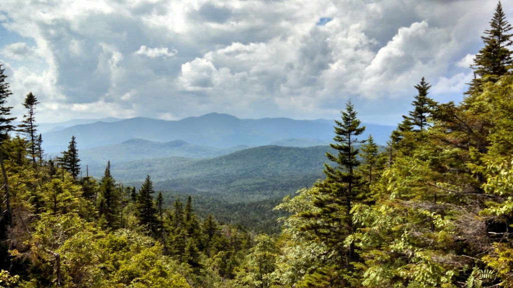
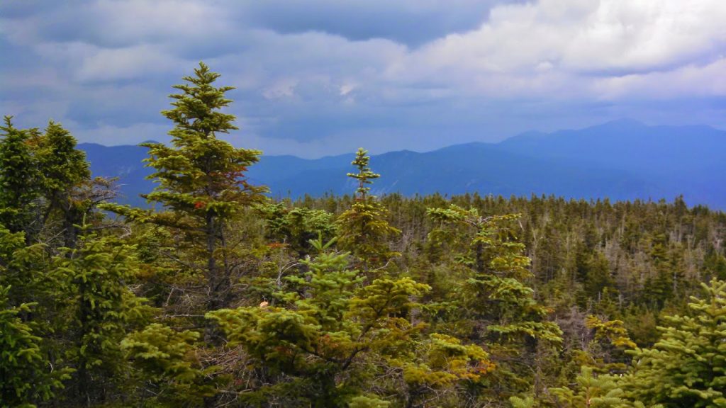
| Mountains of the central Pemi rising in the distance |
The Northwestern outlet of Norcross Pond is where the herd path up Mt Nancy begins. It is marked by a small cairn and is very obvious. There used to be signs that said "this is an unmaintained trail" but those have been removed. Regardless, the herd path was easy to follow for the whole 0.7 miles up the summit. As you can tell from the topo map, it is a very steep ascent.
Mt Nancy's summit has an excellent view of the Presidential Range and Crawford Notch. Most of the New England 100 Highest are simply wooded slopes with no views but Mt Nancy was a nice exception. I didn't find a summit register, but there was a little sign. Overall, it was an easy summit considering its on the "trail-less peaks" list.
 |
| Summit of Mt Nancy |
Coming down from the summit, I spent more time at Norcross Pond. I wished I could have spent the night up here; I bet the stars were gorgeous. However, thunderstorms were moving in so I had to make a quick descent.
That wasn't too bad for a 100 highest mountain! Again, most of them have no views or difficult bushwhacks! Even if the idea of hiking the 100 highest is silly to you, the cascades and alpine lakes will make the hike worthwhile.
Read. Plan. Get Out There!

No Comments