While hoards of tenderfoots are out trying their hand at mountaineering on Mt Shasta, Mt Eddy retains its wilderness and solitude just miles away. It certainly has one of the finest views in Northern California.
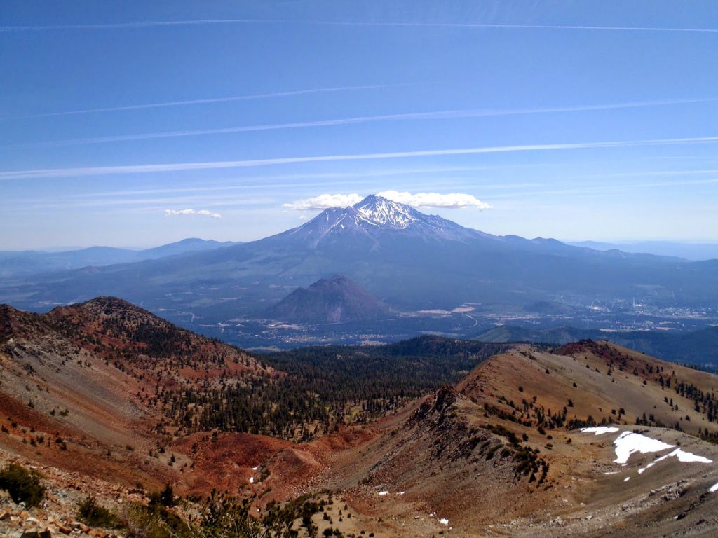 |
| Classic view of Mt Shasta from Mt Eddy, California |
This last weekend I had the fortunate opportunity to return to Northern California. It was wonderful to be back in my "homeland". Of course, no trip to Nor Cal would be complete without a hike! I headed north for the spectacular summit of Mt Eddy which is one of the state's great mountains.
Early summer is an excellent time of year to head up to the northern ranges of the state. The day was very pleasant. Indeed, it was cool at the start- 50 degrees! But the temperature barely went above 70 throughout the day; perfect weather for hiking. After having lived in New England for the last 3 years, I'm not used to dependably perfect weather.
Here's the map of the hike via Deadfall Lakes-
Overall, the Deadfall Lakes is a spectacular hike and not too difficult in the way of California hiking. It is 10 miles total when hiking round-trip with roughly 2,000 feet of elevation gain. The trailhead is at the crest of National Forest Route 17, mapped above. This is a somewhat rough but paved mountain road which winds its way deep into the Eddys and connects Route 3 to Interstate 5. You can get directions through the map above. Four-wheel drive is not needed to get to the trailhead in the summer although I doubt it is maintained in the winter. The drive itself was lovely.
Starting at roughly 6,900ft, the trail has views nearly the entire way to the summit. It was so nice to be in Northern California again! There's this very distinct smell of a dusty trail, red fir in the sun mixed with alpine air which is difficult to explain but quintessentially Northern California. Anybody who's hiked here knows exactly what I mean.
 |
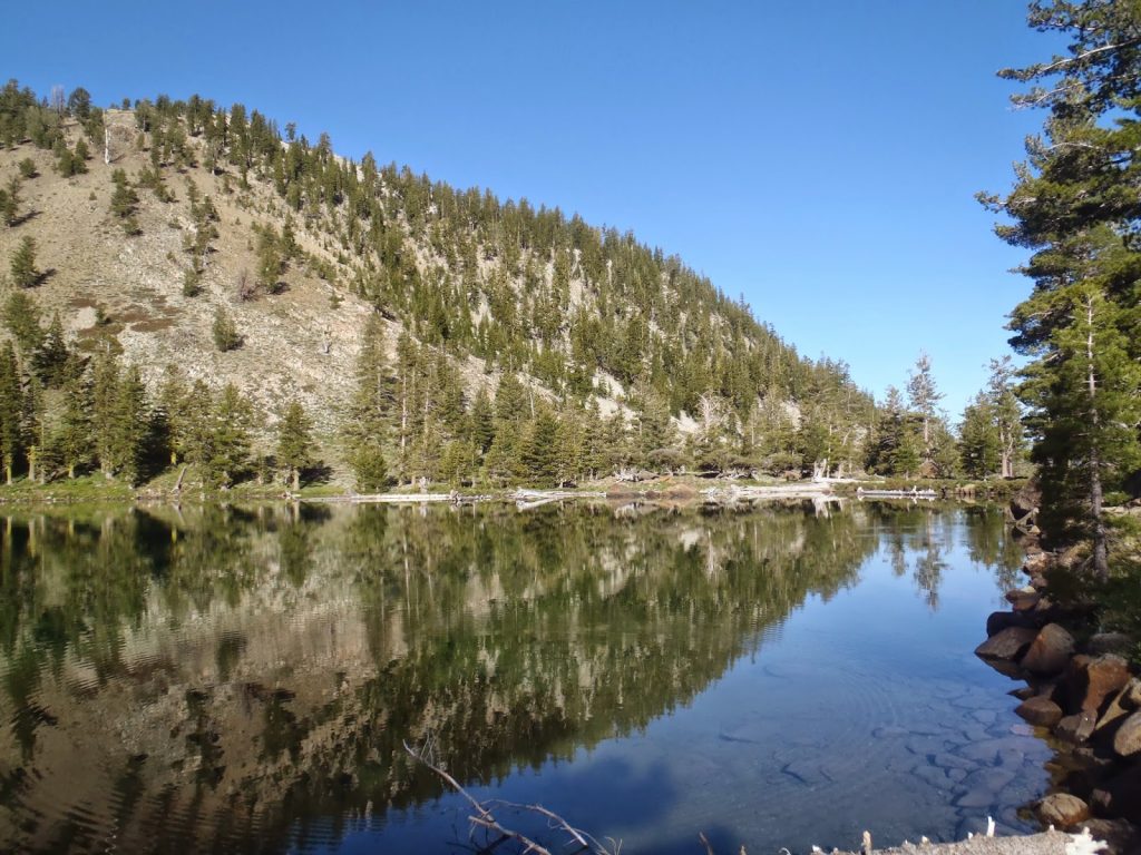
| The classic "mirrored lake" look of the Deadfall Lakes makes the hike even more appealing |
The Pacific Crest Trail is the first part of the hike and its quite pleasant. The trail gently ascends and winds around an arm of Mt Eddy for about 3 miles until the Deadfall Lakes. There's ample shade throughout the lower section which is nice when you're making your way down in the hot afternoon sun. Deer were abundant as well as stout, colorful wildflowers. To the west were the distinctive granite slopes of the Trinity Alps-
 |
| The Trinity Alps off in the distance |
Once at the Deadfall Lakes, there are ample opportunities for pictures and relaxing. By themselves, the Deadfall Lakes are a great hike- if the summit proves to be too difficult for the day, don't worry.
The trail begins to get steep past the first major lake of the area. Again, the views are phenomenal which makes the ascent worthwhile. A few tarns are along the trail too which are a peculiar scene themselves.
Eventually, the last of the Deadfall Lakes appears as does the towering Mt Eddy headwall. There's a nice alpine meadow just below the headwall which is very photographic.
 |
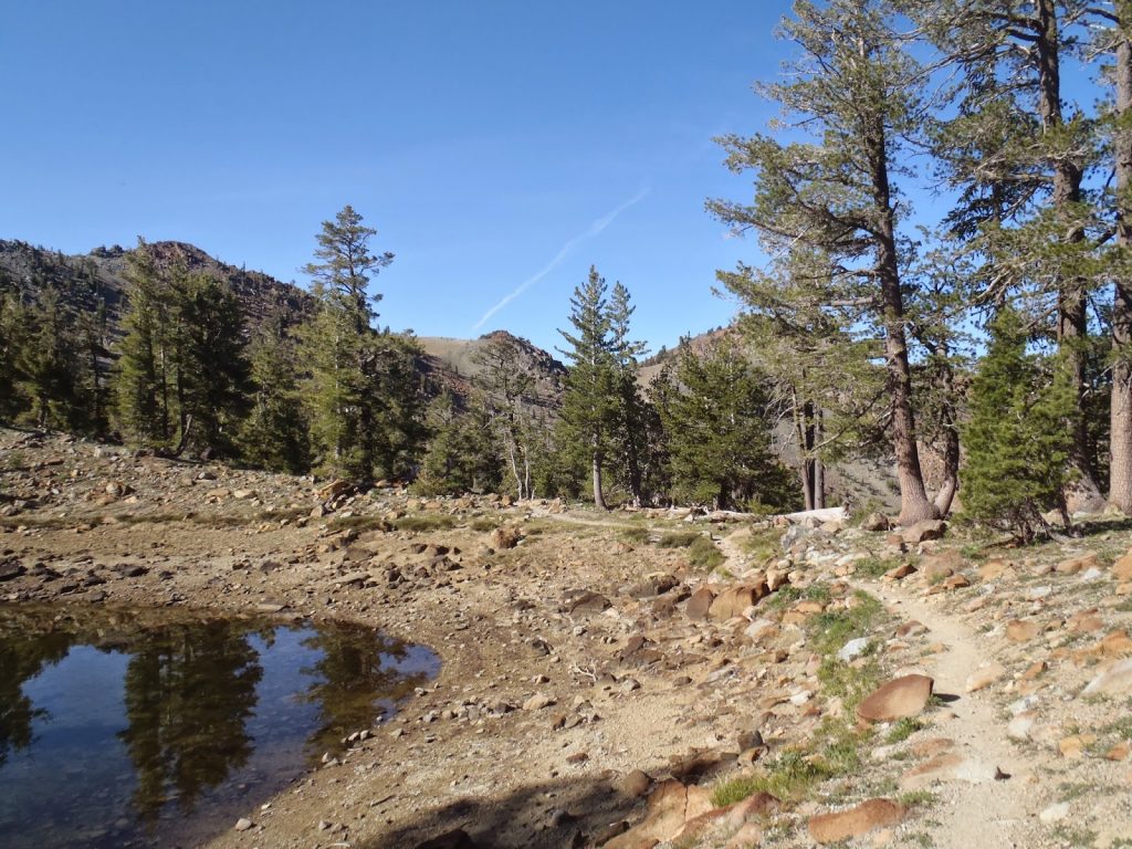
| First Deadfall Lake |
 |
| Tarn and the Mt Eddy Trail |
 |
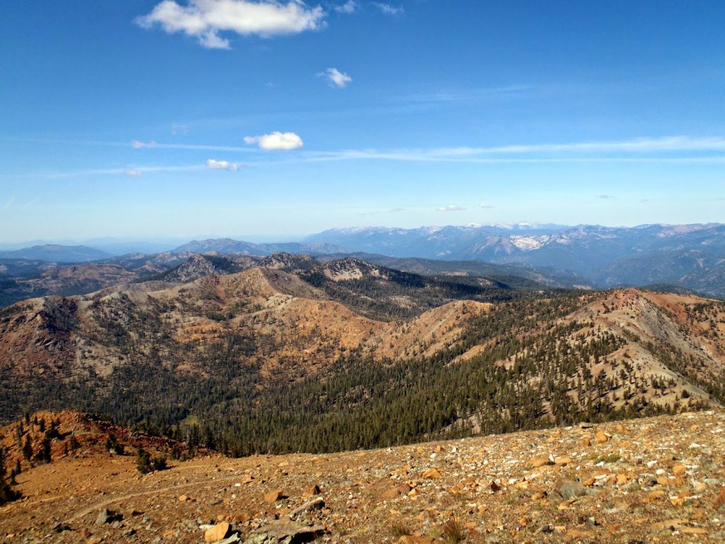
| Glorious views of the trail |
Do you ever have one of those hikes or days where you just can't take a bad picture? That was basically how my hike went.
The trail comes within a thousand vertical feet of the summit and begins some merciful switchbacks. Out east, we don't have such things! However Mt Lassen, the Castle Craigs and the very southern Cascades all come in to view as the trail rounds the southern flank of the summit. Finally, Mt Shasta comes in to view and the summit is there.
Even in late June, large patches of snow persisted near the summit. They don't impend the trail, but it was a great way to cool off. I continued on past the summit ridgeline to get some better pictures of Mt Shasta. Once again, it was hard to take a bad picture-
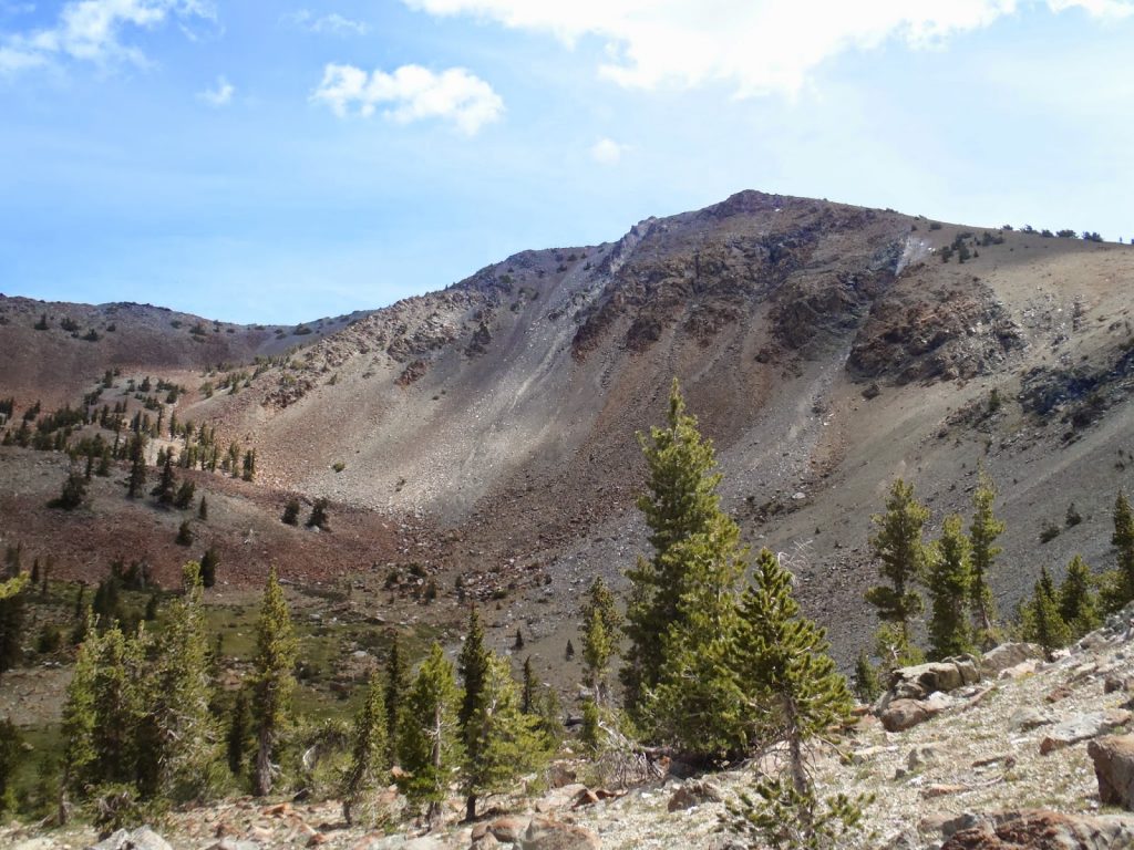 |
| Mt Eddy's western headwall |
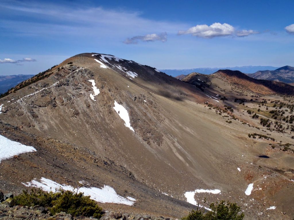 |
| Mt Eddy from the eastern ridge |
 |
| Great view of Mt Shasta from the summit |
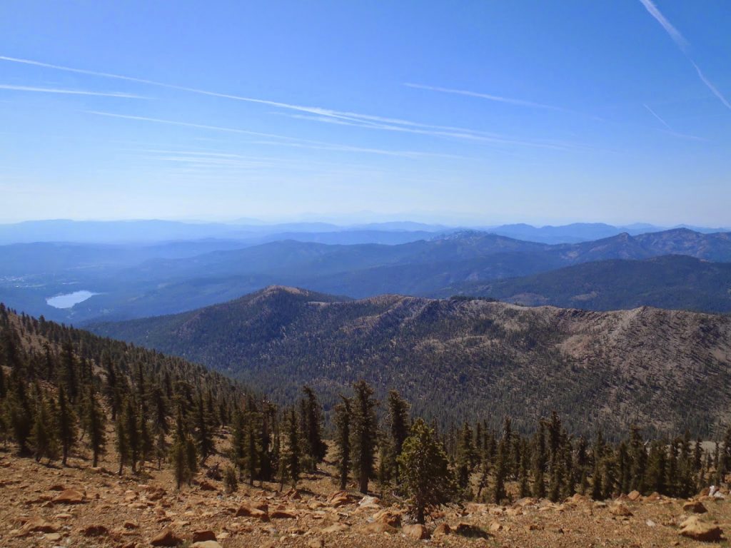 |
| View of Mt Lassen in the very distant center. The castle craigs are just right of center in the second ridgeline |
 |
| Mt Shasta, Shastina and the small butte in the foreground is Black Butte |
What a wonderful way to experience Northern California for a day. For a 10 mile hike, it was very pleasant. I'd hike it again in an instant. For now, I'm headed back to Maine, but I hope it isn't too long before I make it back out here again.
Read. Plan. Get Out There!


No Comments