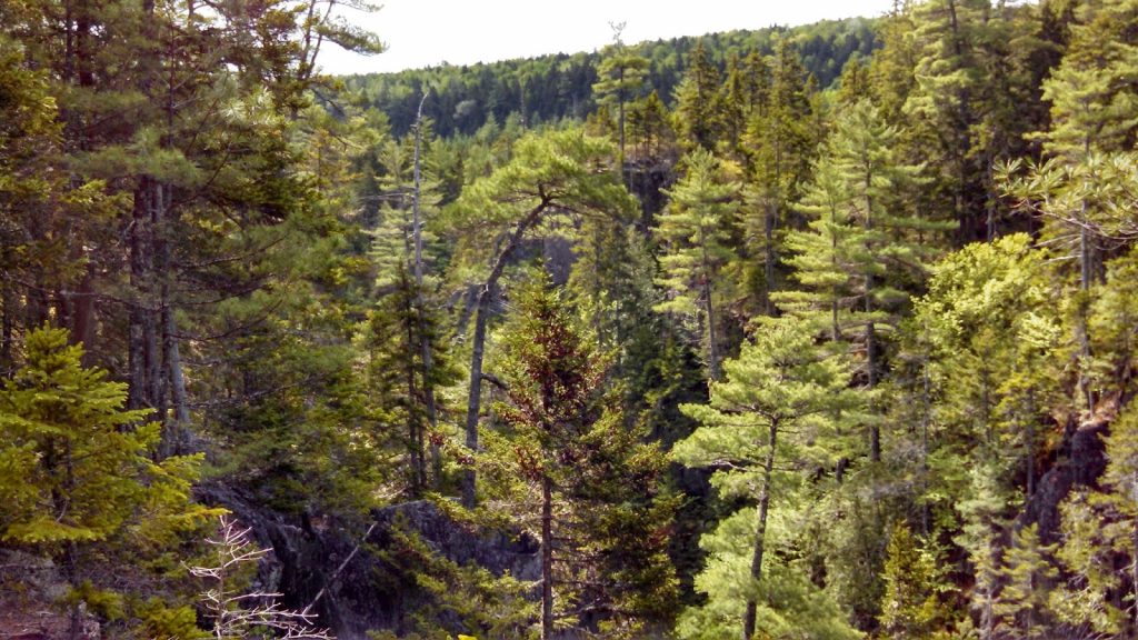
Gulf Hagas is a gorge on the West Branch of the Pleasant River that is known as the Grand Canyon of Maine. While it isn't completely off the radar, its isolation and distance from any major areas of population allows it to retain some of its wilderness and wonder.
 |
| Gulf Hagas, Maine |
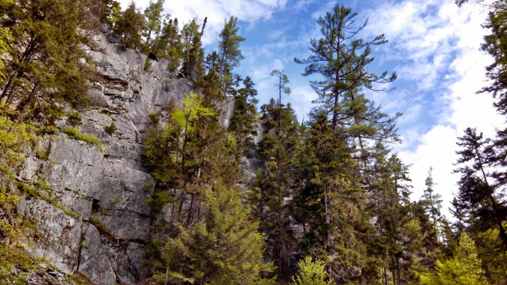
The last four days spent in the North Maine Woods have been like a vacation from civilization. While not a national park, the Great North Woods are equally full of wilderness and natural wonder. As a matter of fact, I actually consider this area to be better than Baxter State Park. One of my first destinations on this trip was the famous Gulf Hagas which is the Grand Canyon of Maine.
Of all the adventures I had in the Maine North Woods, this was perhaps the most well-traveled and well known. Gulf Hagas isn't exactly a secret, but it is an elusive destination for most. This is because it is located well off the beaten path, even for Mainers. I described it to some friends as being between Millinocket and Greenville, somewhere along some active logging roads. Most the hoards of hikers who travel this far are headed to Baxter State Park. You don't stumble upon Gulf Hagas- its somewhere you have to want to get to.
Here's a map with trails-
You might be aware that its located in the "
100-mile Wilderness", the famous last stretch of the Appalachian Trail which is considered some of the most challenging on the 2,100 mile trail. In my experience of this state, I'd say its a bit of a misnomer; certainly its wild compared to the rest of the AT, but the wilderness is mid-range by Maine standards (a veritable highway by PCT standards). Nevertheless, there ain't no visitor centers, gas stations or pavement (but there is spotty 3G).
Getting to Gulf Hagas is, however, not just a matter of plugging in an address on your car's GPS. Its located North of Bangor, near-ish Dover-Foxcroft. From the tiny town of Milo, Maine, I drove 12.6 miles North on Route 11 to the turn-off for
Katahdin Iron Works/Jo Mary Unit of the Maine North Woods. The turn-off is marked and look for a sign that says Katahdin Iron Works/Gulf Hagas. Here, the pavement abruptly ends but the road is certainly passable by most any car. Its 6.5 miles on this well-traveled gravel road to the KIJM Gate where you pay a $7 fee if you're a resident or $12 for non-residents. Camping is highly recommended at just $10/night. Continue on this relatively well-graded road for 6.4 miles to the parking lot of Gulf Hagas. It can hold perhaps 15 cars? It fills up very quickly on busy summer weekends but I went on a Tuesday and had the entire canyon to myself.
 |
| Hiking Gulf Hagas |
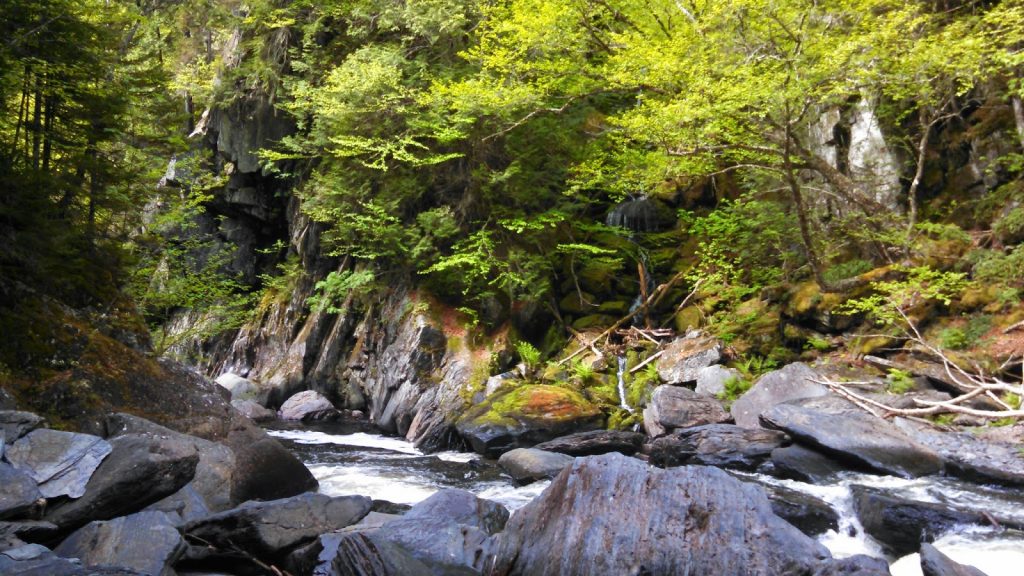
Well, now the actual adventure begins! The trail starts off with a short 0.2 mile stroll through the woods and crosses the river. Its a pretty straightforward ford but its still about 150 feet of knee to thigh-deep wading. The trail then joins the Appalachian Trail for 0.8 miles. After this, there's the junction where the Appalachian Trail continues north up the mountain while the Gulf Hagas trail continues on. After crossing the river above Screw Auger Falls, the trail forks- turning South (left) takes you along the best of Gulf Hagas while turning west (right) takes you on what will eventually be the return route. Most people elect to hike the Gulf as a loop, heading south at the junction and taking the trail that parallels the gulf and then returning on the Pleasant River Tote Trail which is much easier. Whatever your pleasure, its 3.0 miles along the Gulf Hagas Trail to the Head of the Gulf and then 2.2 miles on the Tote Road Trail back to the turn-off.
Total round-trip distance is about 8.0 miles. It took me roughly 6 hours.
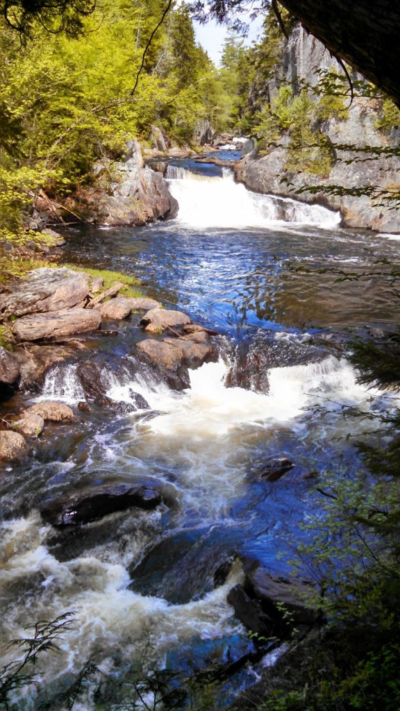
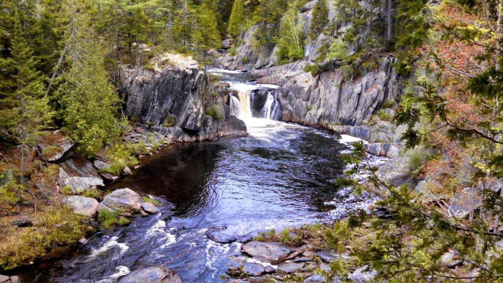
Now the fun begins! The trail immediately passes by Screw Auger Falls-
 |
| Screw Auger Falls |
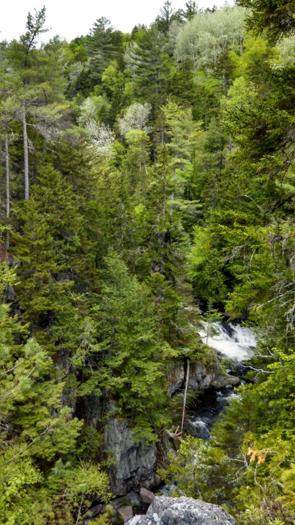
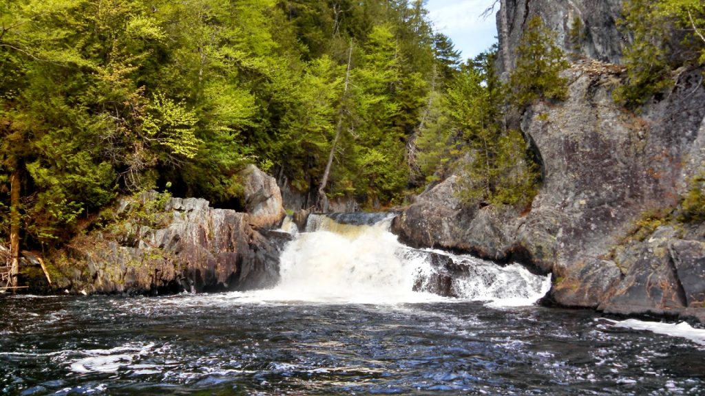
Screw Auger Falls was a great start but the trail continues onward as the canyon walls close in. I suppose the real reason that this hike is said to take 5-7 hours is because the sights are so gorgeous and you don't want to miss a single thing.
Some noteworthy parts of the trail were-
 |
| Near Cole's Corner |
 |
| One of the few sections where it is possible to climb down to the river- shows the depth of the canyon |
 |
| Smaller cascades |
 |
| Down at the bottom |
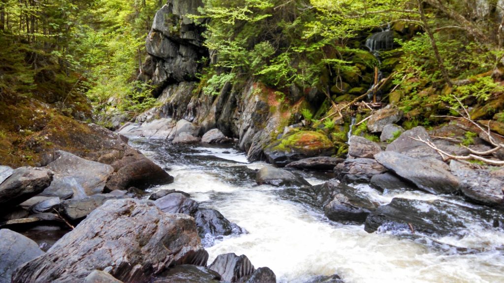
The beginning of the trail passed by Hammond Street Pitch which was a narrow section where the trail runs along the rim and it gives the hiker a chance to appreciate the depth of the Canyon. Further up the river, the trail goes by Cole's Corner which our "Big Bend" of our Grand Canyon.
Next stop was "Jaws", perhaps the narrowest section of the canyon-
 |
| "Jaws" |
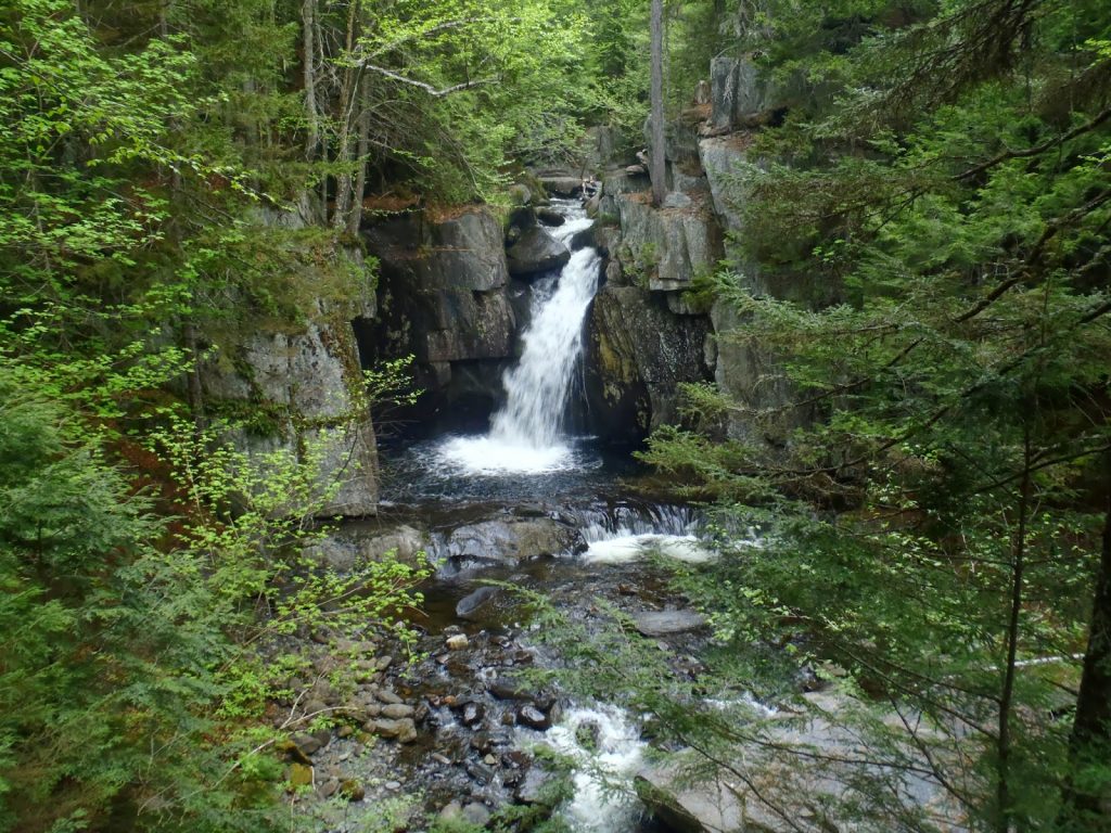
Views just kept getting better. Buttermilk and Billings Falls were quintessentially Maine-
 |
| Billings Falls |
 |
| More falls |
 |
| How Maine does a canyon! |
 |
| Love the reflections |
 |
| From the rim |
 |
| Last Look! |
The trail eventually makes it to the Head of the Gulf which is where multiple streams converge to plunge down the canyon. The
Upper Gulf Parking Area is another option for starting your hike which makes it slightly longer in length but provides essentially the same hike from a different parking lot.
It should be said that although the views on the Gulf Trail are phenomenal, it is a very rugged hike with lots of ups and downs. I ended up taking the 2.2 mile Tote Road Trail back to Screw Auger Falls to shorten my time a little- this trail is an easy and direct route back. From here, its just a hike back along the Appalachian Trail to the river turn-off to get back to the parking lot.
Well what a way to start my time in the Maine North Woods! As it turns out, this would be the easiest of my hikes- the others were either more remote or more of a bushwhack. Regardless, I'm happy I finally saw this special part of Maine.
Read. Plan. Get Out There!


No Comments