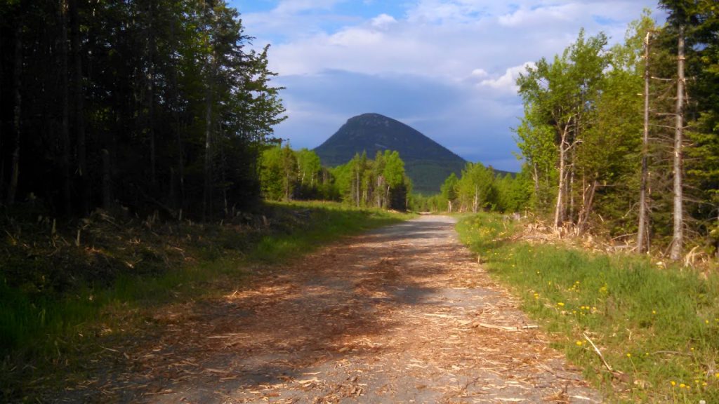
Big Spencer Mountain is a massive wall of volcanic rock that stands isolated from other mountains on the north end of Moosehead Lake. Its a difficult hike but certainly worth it for the views of northern Maine and innumerable moose.
 |
| Big Spencer Mountain almost looks like a still wave |
Continuing with my explorations of the Maine North Woods, I rambled to the far side of Moosehead Lake for some further hiking. Big Spencer Mountain, in particular, has intrigued me since I moved to Maine. On a topographic map, it shoots directly from the flatter land around Moosehead lake. Along with its twin, Little Spencer, this mountain is a very clear example of Maine's volcanic origins. This rhyolite fin is part of a larger ridgeline that extends from Flagstaff Lake (reservoir) to Grand Lake Matagamon in Baxter State Park. I'm no geologist, but I do believe that Big Spencer shares similar origins to other famous mountains in Maine such as
Mt Coburn, Mt Kineo and the
Traveler Group of BSP (but unrelated to Katahdin). Perhaps now that I'm done with graduate school, I can pursue an amateur interest in geology? Maine would be a great place for it. I wonder if all hiker/climbers are naturally drawn to geology.
Regardless of the origins of Big Spencer, it is a beautiful hike.
Here's my map-
Big Spencer Mountain is remote, even by Maine standards. Much of the northeastern quarter of the state is dedicated to active logging; I saw several logging trucks and recently cut areas. Always give plenty of room to the logging trucks- they are on the move! You probably don't need a 4x4 to get to the parking area under Big Spencer but I took a mountain bike just in case. The road becomes progressively more difficult as you get closer to the mountain. At any rate, you can find directions by using the map above- Its 19 miles of paved road and another 14.1 on logging roads. The parking area is clearly marked.
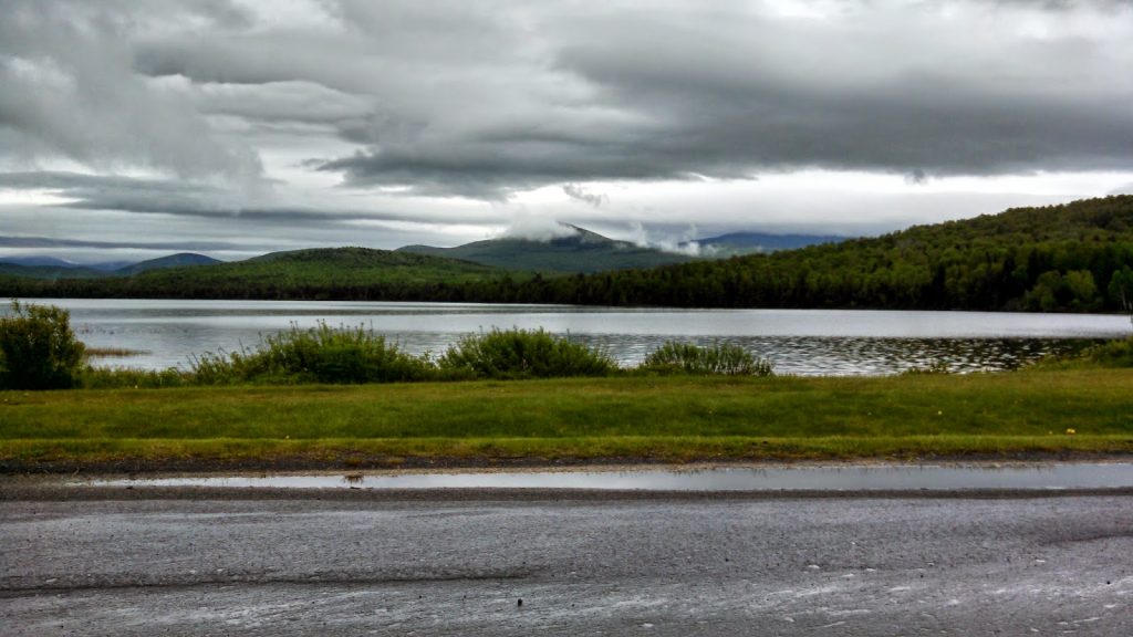 |
| First Roach Pond and Kokadjo |
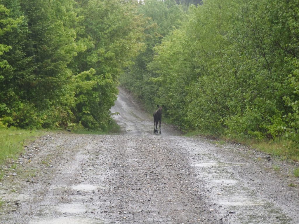 |
| Moose were as common as squirrels |
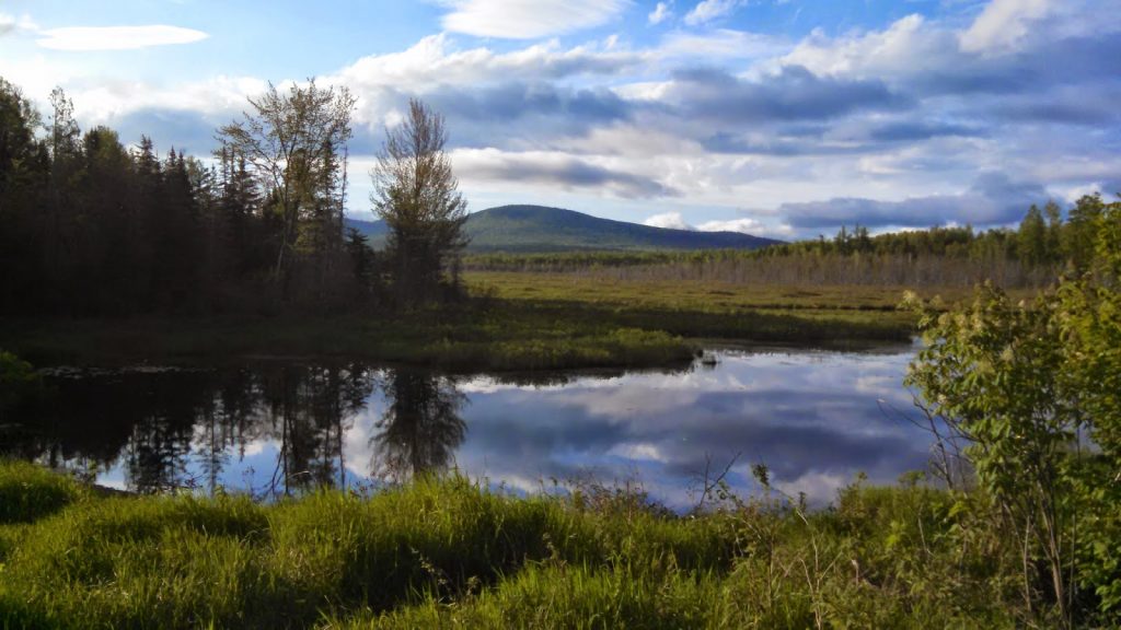 |
| Maine North Woods |
Once you arrive at the parking area, its a fairly straightforward 2.0 miles to the false summit of Big Spencer. I say false summit, because the true summit is somewhere to the southwest of the large clearing where the fire tower used to be. Unfortunately, this part is neither marked nor trailed- it is a good old-fashioned bushwhack.
Papa Bear's trip report proved to be invaluable.
Its about 1 mile from the parking lot to the old cabin area where a fire warden used to live. The cabin was torn down in 2012 and only a clearing remains. Past the clearing, the trail is actually drowned in a small beaver pond- you have to skirt around it to get back to the true trail. From here it is a very steep ascent to the summit. There are some old ladders in some places to help negotiate the class II-III scrambles. Make no mistake; it is hands-and-feet climbing in some places.
The false summit has some nice views, to be sure, but its somewhat lessened by the recent construction of solar panels and communications towers. There was also a
fire here that has left much of the summit bare. How unfortunate.
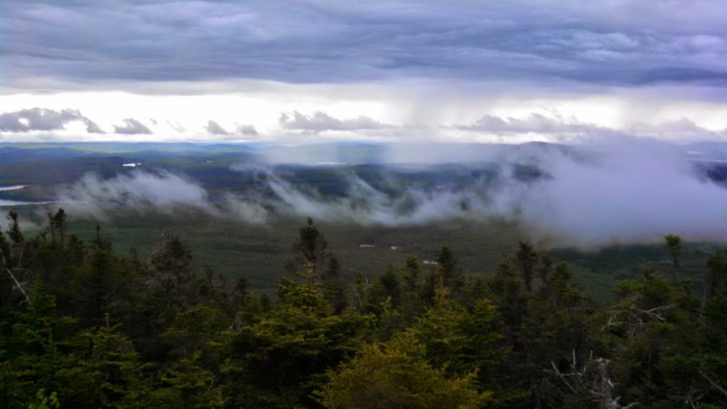 |
| Storm moving in as I summited |
 |
| Lobster Lake |
 |
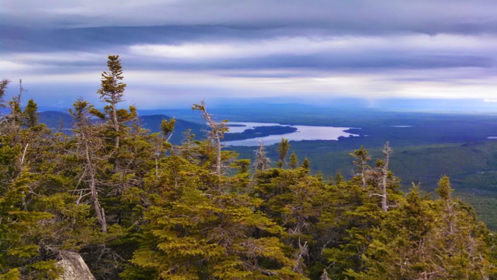
| Lily Bay and Baker Mountains with First Roach Pond |
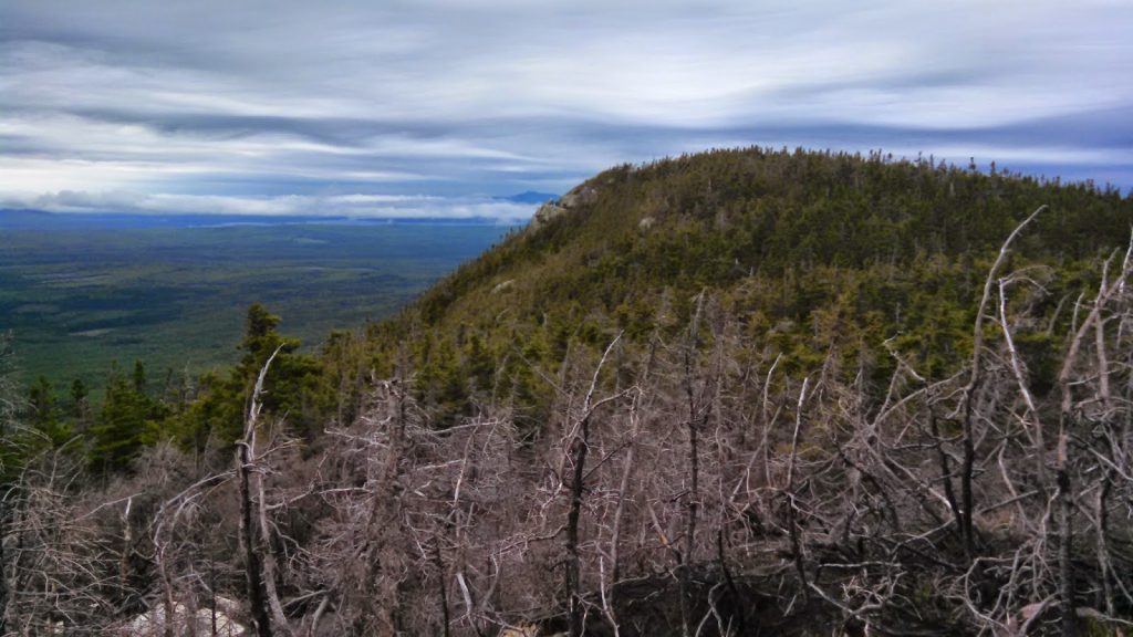 |
| As you can tell, the true summit is slightly higher than the place where the trail ends |
Now there was still the matter of finding the summit- it was going to be tough. Its only between 0.2 and 0.3 miles to the summit from here, but as I've learned from past bushwhacks (including Mt Baker), that can be an eternity. However I would be disappointed to come all this way and not summit, however possible that might be. I plunged ahead
It probably took a good 30-40 minutes of up-and-down whacking and searching to find the summit canister but I discovered that it wasn't too far away from the ledges you see in the center of the picture above. Nevertheless, it was lots of searching and doubling back. Some other hikers have noted that this might not be the true summit and if you look at a topographic map, its possible that there is a higher point on this very dense ridgeline.
Well I'll say this- the canister I found had less than 20 names in it and it was pretty much every name in the Who's Who of Peakbagging, including Mr Packard-
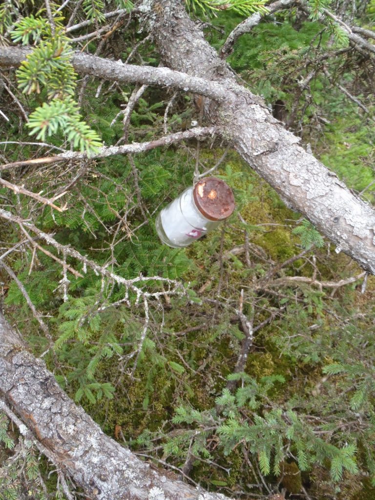 |
| Not much of a register, glad I found it! |
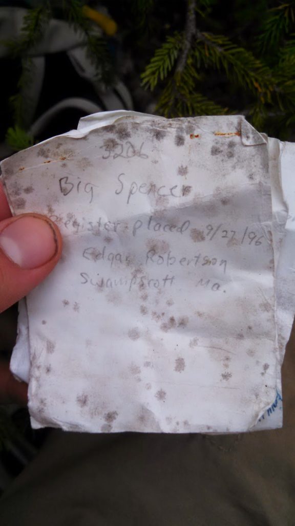 |
| Placed in 1996 |
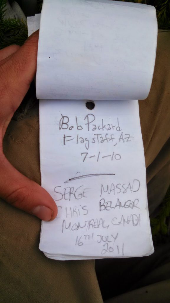 |
| The Tiger Woods of peakbagging |
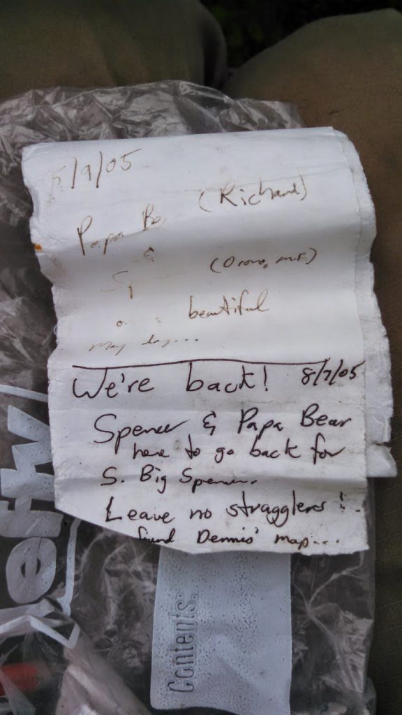 |
| The gentleman who's trip report provided guidance for this trip |
I have to say, it was pretty neat to see some famous-in-the-world-of-peakbagging names on the short list. The funny thing was most of the folks who signed the register noted they were headed to the summit of
Southwest Big Spencer, in attempts to climb all the 450ish 3,000 footers in the state. Wow, I've barely climbed the 4,000 footers... some peakbagger I turned out to be.
I inched my way back to the false summit and made it in about the same time- 40 minutes. It was a rough whack but I made it just as it started to rain.
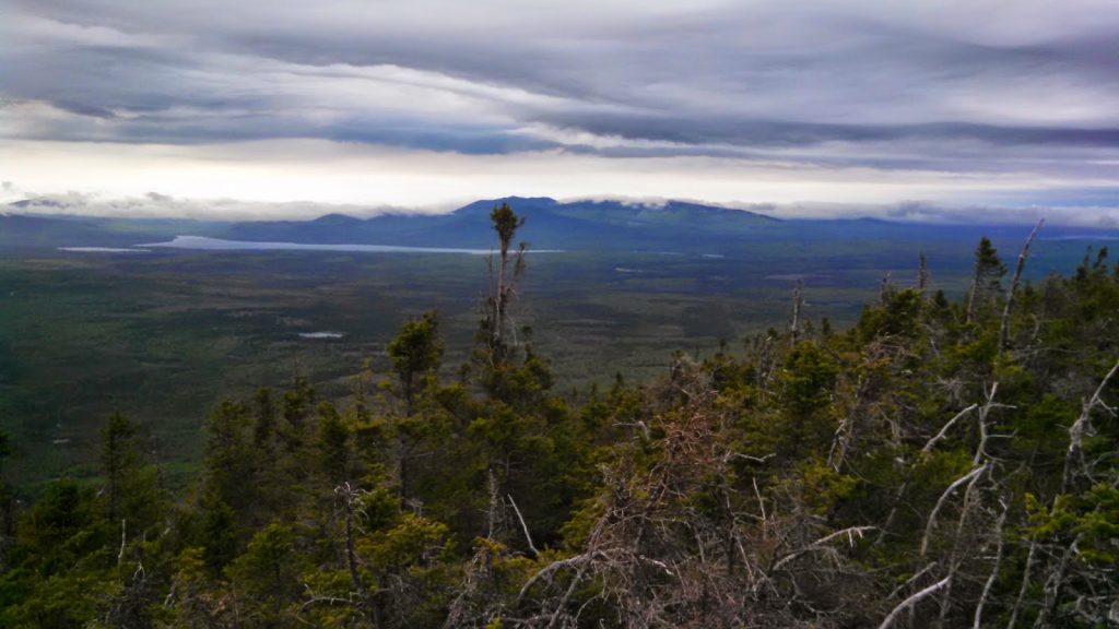
Back on the summit, I enjoyed the view a little while longer. It is a unique view although you can't see Moosehead. However Little Spencer (Big Spencer's volcanic twin), Lobster Lake, the massive Chesuncook Lake, Ragged Lake, the Roach Ponds and all of the 100 mile wilderness were clearly visible. Katahdin was not clearly visible today. Nevertheless, a view like this could not be had anywhere else in the state... except for maybe
Little Spencer.
Wow! Only 8 more to go on New England's 50 Finest!
Read. Plan. Get Out There!


No Comments