


The Baldface Range is a favorite of those who like hiking tall, barren summits without the crowds that are often seen on the 4,000 footers. The wintertime made this hike that much more enjoyable.
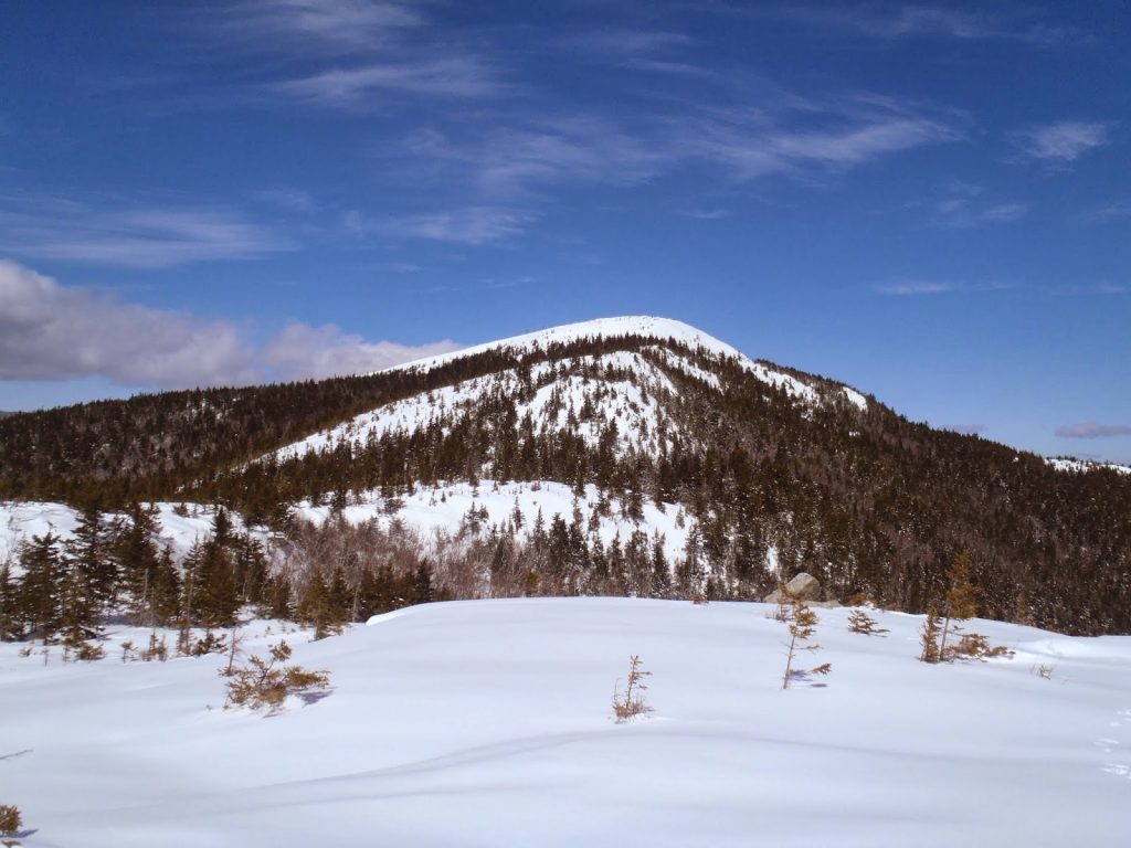
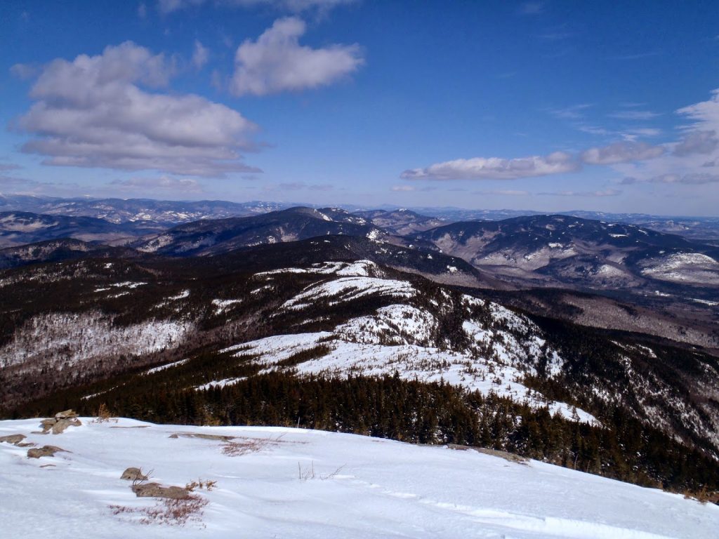 |
| The Baldface Range, late winter |
Every time I feel the winter time blues, I'm always refreshed by a day spent out in the mountains. Winter is a wonderful and unappreciated season. Even I can fall into the trap of constantly counting down the days until spring. However, once I get out and hike or climb in the Whites, the opposite happens- I start counting the precious opportunities I have to get out and enjoy the wilderness alone and unencumbered by any company. On this frigid late March day, I experienced this once again in the Baldface Range.
On many occasions, I've been told and read that the Baldface Range is one of the best ranges of the White Mountains. The hikes are hard enough to keep down the causal day hikers and far enough away from anything to be on most people's radar. In the summer it can be popular but not nearly as much as most 4kers in NH. They're significantly lower than the four and five thousand foot mountains further west but tall enough to have an alpine feel. If you were to ask any person who's hiked more than 48 mountains in New Hampshire what their favorite hikes were, Baldface would almost always make the top 5. (me included)
Here's a general map-
View Baldface Range Loop in a larger map
Evan's Notch straddles the Maine-New Hampshire border and is traversed by Route 113 in both Maine and New Hampshire. It is one of those paved roads with more potholes than asphalt, especially this time of year. In the winter, the high stretch past Bricket Place is closed and gated. The Baldface Parking Lot is open and plowed throughout the winter. I actually tried hiking this in late December last time and unfortunately did not make it up the slabs- too much snow. However both times I've visited in the winter, I was the only car in the parking lot when I started.
The loop is 10 miles in length and involves about 3,500ft of elevation gain.
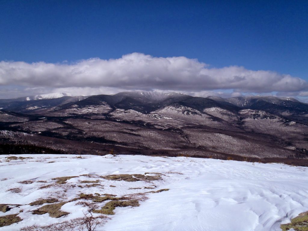
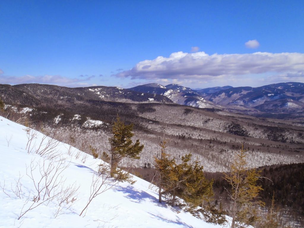 |
| Just above treeline on South Baldface, looking north towards the Royce Mountains and Speckled Mountain |
Unlike the typical me who absurdly hits trailhead at 10:30am, I actually got a respectable start on the Baldface Loop at 7:30. The temperature was about 20F and there was a steady 20mph wind. Even for the White Mountains, this was a pretty cold March day. The trail starts out pleasantly enough with a flat wander through the woods for 0.7 miles until coming to the junction between North and South Baldface. I elected to hike South Baldface first as I'd rather be going up the tricky slabs than coming down. The trail was not exactly cut but it was easy enough to follow in snowshoes.
From the junction to the Baldface Shelter, its a steady 1.8 miles of climbing from 700' to 2,000'. While not particularly interesting, the walk through the woods was nice. The Baldface Lean-To is a good decision making point on the trail- from here its a very steep 1,000' climb in 0.7 miles. In winter or summer, this is a serious affair.
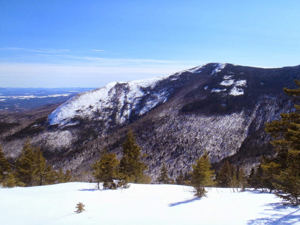 |
| The ridgeline viewed from Bicknell Ridge- good perspective on the steepness of the climb |
This was the point I was turned around at in late December- I was post-holing in snowshoes up to my hips and the crevasses were still open. This time, I was able to glide over the ledges and crevasses but it wasn't easy. The snow was too deep for microspikes or crampons but going up in snowshoes was quite uncomfortable. Its very exposed; I would have preferred to have a mountaineering ice axe next time. But I plowed onwards. It probably took a good hour to make it up that 0.7 mile section. Nevertheless, it was nice to experience some semi-mountaineering at such a low elevation!
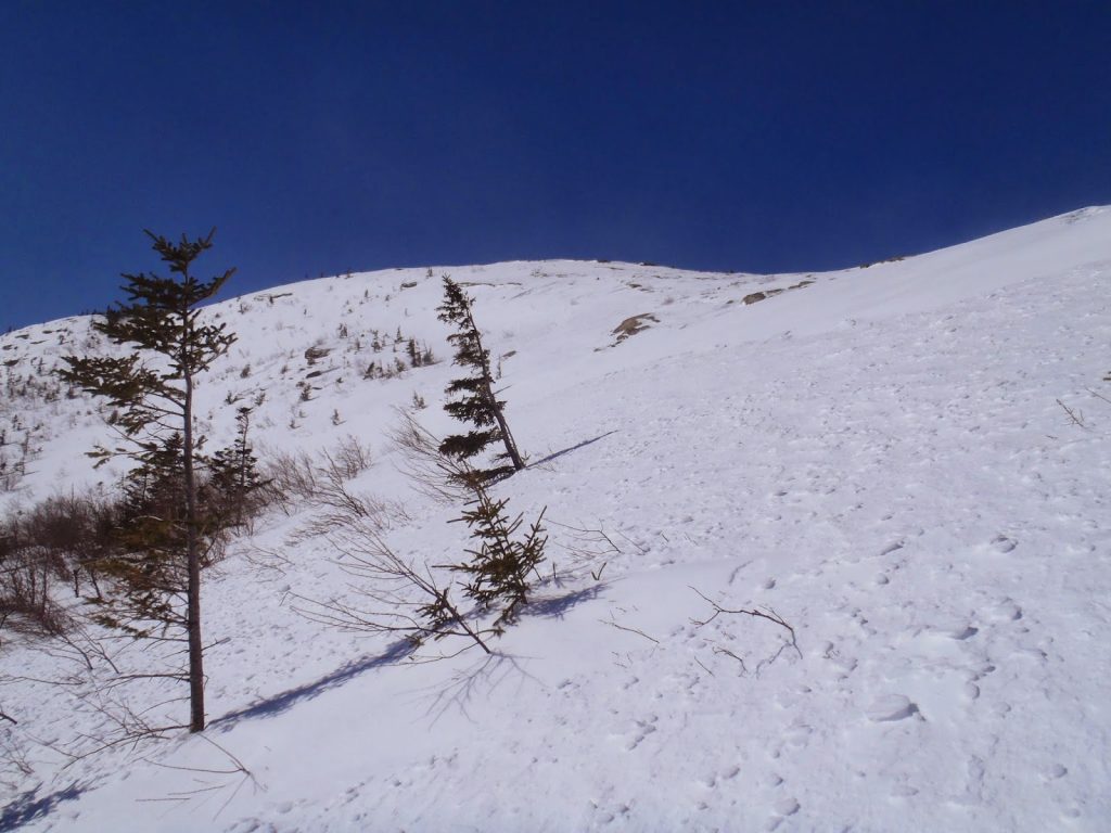 |
| Looking up towards the steep ridgeline |
 |
| Getting there! |
Eventually the ridgeline flattens out and comes to the turnoff to Eastman Mountain and Baldface Knob which are good hikes in themselves. However I still had another 500 feet of climbing yet! The section between the turnoff the the summit of South Baldface has great views and is slightly less steep than the previous section. At about 10:30, I was on the summit of South Baldface.
Its funny how when you read a hiking topographic map, you tend to focus on the ascent and descent and often forget about what might be in the col between the two mountains. Between South and North Baldface are multiple saddles and plenty of difficult up-and-downs. Of course, I entirely glazed over this on my planning. Standing on the summit of South Baldface (which is scarcely 50 feet shorter than the summit of North Baldface), I realized I had a long way to go-
 |
| Looking at what I had to cover to get to the summit of North Baldface |
As is the case with all winter trips, the col is often where there is the most snow. Today was no exception and I confess that there were multiple profanities uttered as I trudged through hip-deep powder on my way to North Baldface. There are several very steep and tricky sections which may be more obvious in the summer. Route finding was difficult- there were occasional cairns and yellow blazes but for the most part I was on my own. It looked so simple on the map...
It is 1.2 miles to the summit of North Baldface from South Baldface and this probably took about as long as the ascent from the parking lot to the south summit took. Take this in to account!
 |
| Saddle between the Baldfaces |
On the summit of North Baldface, the wind actually died down and I killed some time looking at the ocean of mountains around me. To the west, the Carter Range rose out of the Valley of the Wild River. Just beyond were the bare, white summits of the Presidentials. Moosilauke, the Franconia Ridge, the Mahoosucks, Ossipees, Pleasant Mountain, and the Caribou-Speckled Mountain Wilderness created a perfect winter panorama. I was overcome with nostalgia seeing some 50 mountains I've climbed that could be seen from this point. Every one of them was a challenge and a story to tell. The scene erased any reservations I had about this long winter.
It was difficult to come down. The often quoted Lionel Terray line came to mind-
"On this proud and beautiful mountain we have lived hours of fraternal, warm and exalting nobility. Here for a few days we have ceased to be slaves and have really been men. It is hard to return to servitude."
 |
| The Valley of the Wild River, Carter Range and Presidentials |
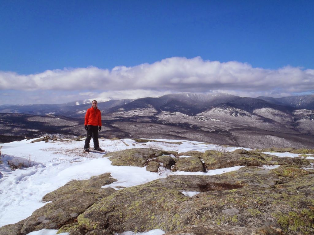 |
| Selfie! |
Coming down from North Baldface presented further challenges. Again, it was very steep, powedery and with a few saddles and knobs. It was 0.9 miles to the turnoff for Bicknell Ridge. Eagle Crag is just another 0.3 miles ahead but it was getting late so I missed out on this other view. However its a good option for those who hike to the summit of Bicknell Ridge and don't want to continue onward to North Baldface.
The final 2.5 miles down Bicknell Ridge back to the turnoff for South Baldface were a nice end to the hike. There were several windows through the trees which provided a good view of Charles Ravine and the South Baldface Ridge. I was a bit surprised I actually made it up the ridge in snowshoes!
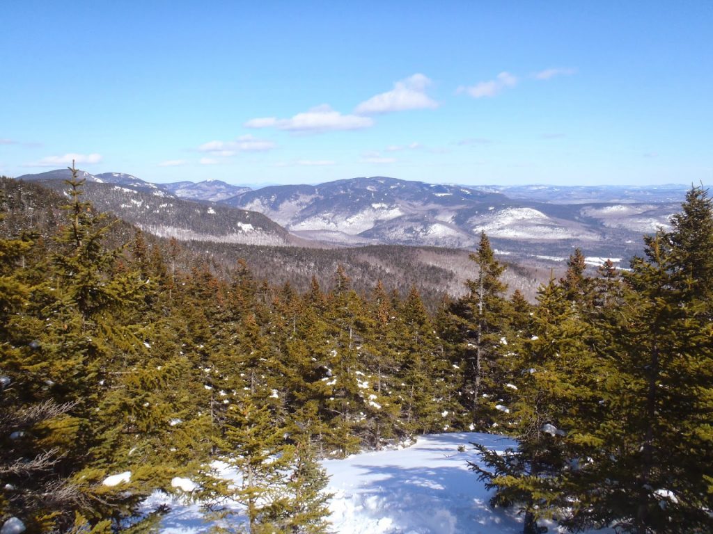 |
| Final View! |
I made it back to the car at about 5:00PM which wasn't bad time for a winter loop. I would say that was one of the most enjoyable but difficult winter hikes I've done in New Hampshire. Hopefully I can return in the summer!
The Evan's Notch area has several outstanding hikes other than the Baldface Loop which includes the Blueberry-Speckled Mountain, East and West Royce, Caribou Mountain, Eastman Mountain and Mount Meader. Had I a world in time, I would have spent the week hiking all of these beautiful mountains. Another day, another time...
Read. Plan. Get Out There!

No Comments