Biking and hiking through the Maine North Woods to another lost summit with panoramic views.
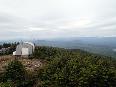 |
| Coburn Mountain in Northern Maine |
This post is a *little* overdue but I liked this summit so much I decided to post about it in January. Over the summer and fall, I sure had a great taste of everything North Woods when I was hiking up in the Jackman and Forks areas! I got to run the Kennebec River Gorge with
Magic Falls Rafting and I was able to hike a couple summits in the area. The Maine North Woods are so much different from the rest of New England with their lonely summits and hiking trails. While the White Mountains are full of hikers, I hardly ever run into another soul when hiking up here. Its a different experience. On this occasion, I wanted to hike Coburn Mountain which is the highest summit between Sugarloaf and Katahdin in Maine.
Here's a general map of the area with the multiple options for summiting:
As you might be able to tell, Mt Coburn is way the heck out there, even by Maine standards. The "trailhead" is enchanted mountain road and you can either park here or drive up to the old ski area parking lot. (
at some point in time, this area was a ski resort). Given its remoteness, it is surprising to know that the area is well-maintained by the
Coburn Summit Riders who keep a snowmobile trail open in the winter. Its also maintained for
ATV riders. By their reports and my observations, it is the highest mountain legally accessible to snowmobilers and ATVers in the Northeast. Not bad for a mountain out in the middle of nowhere!
As for us hikers, the summit has excellent views and is certainly worth the drive.
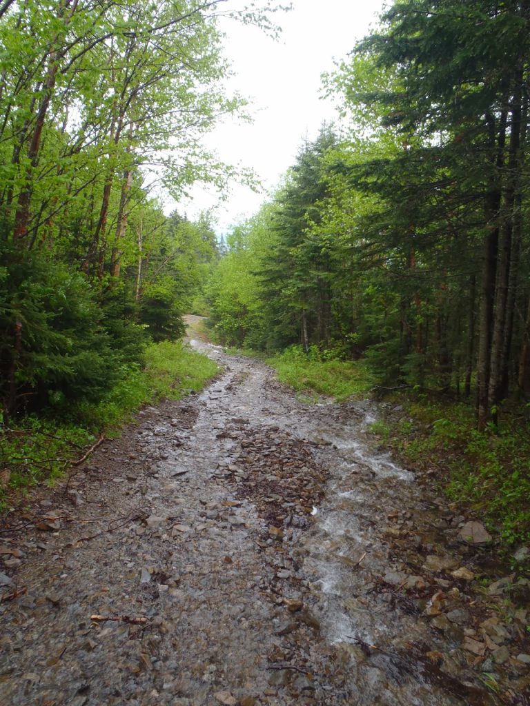 |
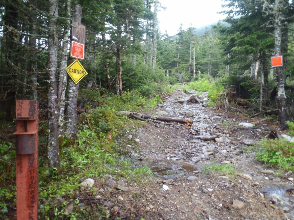
| Much of the trail is on old ATV roads |
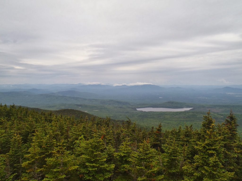 |
| Classic view of the North Woods |
Like all hikes in the North Woods, the Maine Gazetteer is an essential because much of the hike is along the endless network of unmarked logging roads. The Gazetteer is usually up to date in new roads and the removal of old roads but its good to keep a compass and perhaps even a USGS topo-map as well. Be aware that many of these logging roads are still active so if you see a truck coming, pull over and given them PLENTY OF ROOM!
Oh did I mention I saw a bear and two moose on this hike? Its as Maine as it gets.
You can either park off to the side of Enchanted Mountain Road or drive all the way to the old ski area parking lot. Its actually quite substantial and surprisingly bare considering there hasn't been a ski resort here for over 50 years. Unless you have an ATV or a serious 4x4, I'd recommend traveling no further in your vehicle.
At the obvious parking area, head on to the unmarked logging road to the right and in less than 2/10ths of a mile you'll see an ATV road veer off to the left. This is a shorter method of getting to the top. Continue up this road for about 1 mile until you come to the "top" of the ski resort.
 |
| A clear area which used to the be the "summit" of the ski area |
At the "ski area summit" you can see the true summit of Mt Coburn which is a little misleading. There's a gated road just past the clearing which was gated in the summer but may not be in the winter. This is the snowmobile/ATV trail to the summit. While you can certainly take this to the top, there's a shorter, more direct hiking option as well. It is just a few hundred yards past the gate and I tried marking it with a larger cairn. This is a herd path, not really a trail so be aware.
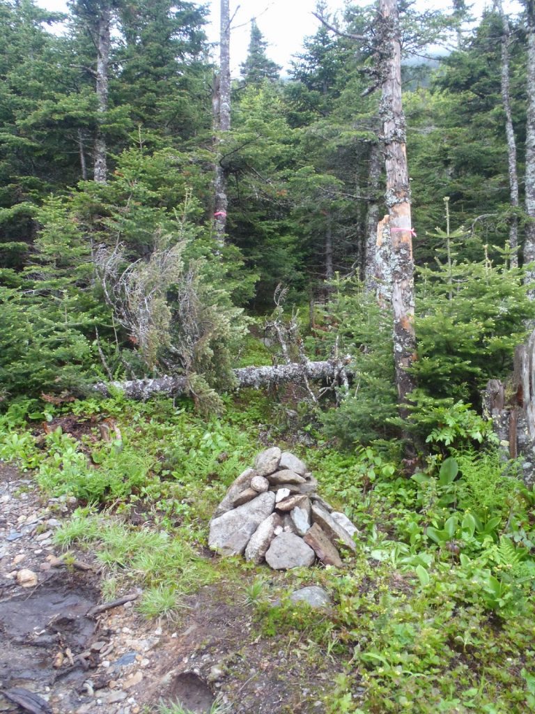 |
| I'm no experienced cairn-maker but this was as good as I could do |
 |
| Here's the little gate- the hiking trail is just beyond on the right. |
Getting to the summit from here is not exactly a long trek but it involves quite a bit of meandering through scrub and following an occasional trail. It was not difficult to follow but it wasn't clear either. Eventually you just pop right out on the summit and have views for 50 miles.
There's a little viewing platform at the summit which is open all year.
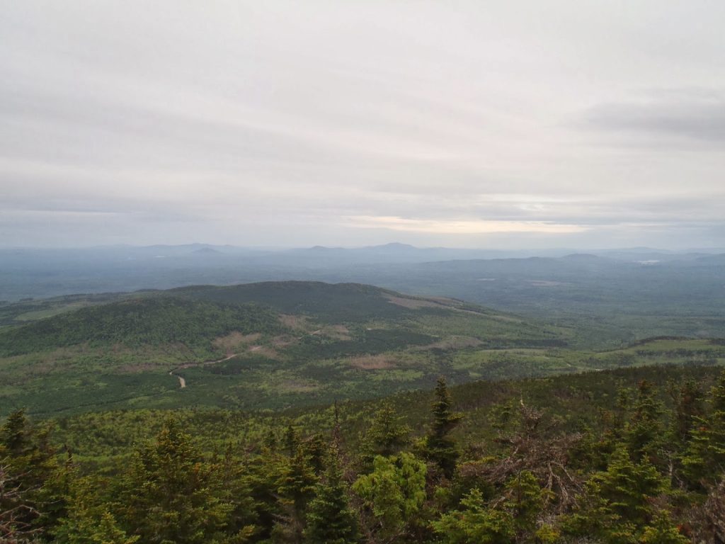 |
| Views from the top! |
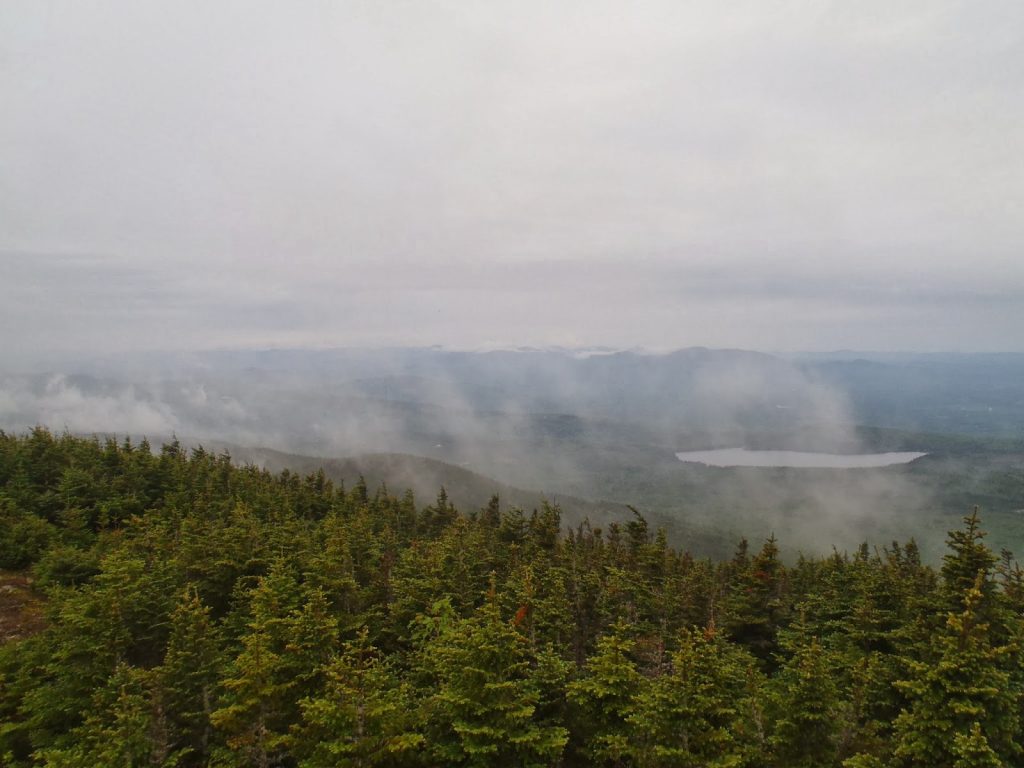 |
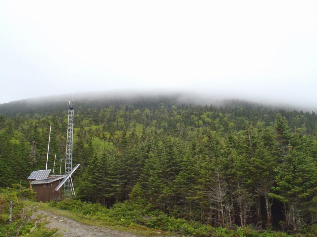
| A bit of fog made for some serenity on the summit |
 |
| The summit of Coburn from the ski area summit |
It was a great hike! Easily accomplished in a 1/2 day with a moderate amount of navigational skills. Coburn certainly deserves its place among New England's 50 Finest!
Read. Plan. Get Out There!


No Comments