


On the second day I kayaked across the mouths of several of Maine's largest rivers including the Kennebec, Boothbay Harbor and rounded the infamous Pemaquid Point.
This is part of a series of posts of my 200 mile kayaking trip up the coast of Maine by the Maine Island Trail. Previously: Kayaking across Casco Bay
After camping out at the edge of Casco Bay, I headed for the
next leg; The huge western river outlets and Boothbay harbor. I had some
formidable obstacles this day. First I had to round the exposed point of Phippsburg
where there are many submerged rocks and currents. Next I had to cross the
mouth of the mighty Kennebec which dumps much of the water from the northern
Appalachians. Finally there was the even more exposed Pemaquid Point which
guards the entrance to Muscongus Bay. I had my work cut out for me today.
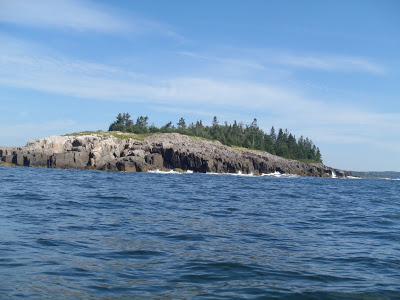 |
| Near the mouth of the Kennebec where the currents pick up |
As most mariners know, the morning is the best time to cover
greater distances before the afternoon brings stronger winds and currents. This
was true when I was kayaking the Channel Islands of California and its true out
here in Maine. As soon as the sun was up, I packed my camp and hit the water. I
rounded Phippsburg without too much trouble but given my timing, I would be
hitting the even more dangerous Pemaquid Point late afternoon. There was just
no avoiding it; at times I would have to be tacking tough sections at tough
times.
View Day 2: Casco Bay to Muscongus Bay in a larger map
On the other hand, I would be tackling the mouth of the
Kennebeck at a perfect time- slack tide and early morning. The Kennebec River
is one of the more formidable rivers of New England and holds so many memories
for me and Maine. Its watershed stretches all the way to the Canadian border.
Moosehead Lake serves as its headwaters. At 40 miles wide and 10 miles long, it
is the largest alpine lake in New England. I did a weekend kayak trip of it in
late November last year and barely saw a quarter of Maine’s greatest lake. From
here, it jogs through some ponds and shoots down the Kennebec River gorge with
vicious force. I remember whitewater rafting those icy waters in June when
torrential rains and high water made the swollen river like a roller-coaster We
took out at the forks where the equally wild Dead River meets the Kennebec. From
here, the rapids are calmer as it passes by some of Maine’s famous mill towns
of Waterville and Skowhegan and eventually Augusta. If I turned north, it would
be possible for me to paddle all the way to the capital, 40 miles inland.
After the capital, the Kennebec flows into Merrymeeting Bay
where 5 other rivers meet. The Androscoggin River flows straight down from Mt
Washington and is every bit as historical and vital to the economy of Maine. With
the water of six rivers all running down to the ocean at the mouth of the
Kennebec and Shepscot Bay, I try to maintain focus on my technique and
surroundings.
I don’t mean to belabor the details of the Kennebec, I’m
just point out that this is a crossing of the Rubicon. I feel more nervousness
than I do excitement.
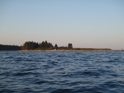
 |
| Reid State Park after crossing the Kennebec's mouth |
It’s a long crossing. It is only about a half a mile but the
cross current makes it a struggle. I use a few of the islands in at the mouth
for cover and rest. Eventually I feel another palpable change in the currents
and I know I’ve made it. It was such a profound feeling to be entering and exiting
the mouth of the river- difficult to explain.
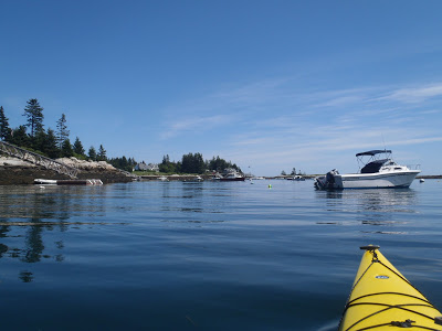
 |
| Classic coastal Maine |
Sheepscot Bay is directly adjacent to Reid State Park and
Georgetown Island. This is a larger bay and also serves as the mouth for the
Sheepscot River and part of the Kennebec. Further upstream, some of the water
from the Kennebec shoots through narrow corridors known as “Upper Hell Gate”
and “Lower Hell Gate”. Not a good place for a kayaker on his own. Sheepscot Bay
ends up being relatively flat and current-less for me but at several points
there are reefs and submerged rocks which create standing waves and breakers.
Once again I am forced to be staring at my charts more than anything else. Off
to my left, the little swell I just floated over increased to four times its
height and breaks over a patch of water that was flat a minute ago. Such is the
way of the “drowned coast”
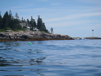
 |
| The small harbor at the edge of Southport Island |
Things become a little duller after this and I am thankful.
I roll right by Southport Island and Boothbay Harbor, wishing I had the time to
dock and stroll around. At some point in the planning I was thinking that I
would have time to stop in every little town along the way and poke around. I
find I have no time to waste; weather this good can turn fowl quickly in Maine.
Pemaquid Point is off in the distance and I’m rounding it
when the wind and weather are the worst. Its not bad in the grand scheme of
Maine weather but it will be a wild point for sure. I’m paddling towards the
south to get around the point and many submerged rocks is against the wind. The
Pemaquid Point Lighthouse is a famous scene depicted on Maine’s State Quarter. This
is just one more iconic landmark of Maine that I have the fortune to see from
the ocean. Once I round the point and begin paddling north, I ride the currents
and watch the tourists on the shore. This is undoubtedly another strange scene
to see a lone kayaker in a cowboy hat 300 yards off the coast fighting currents
while hundreds of tourists idle away at the lighthouse.
 |
| Having an island all to myself feels so luxurious |
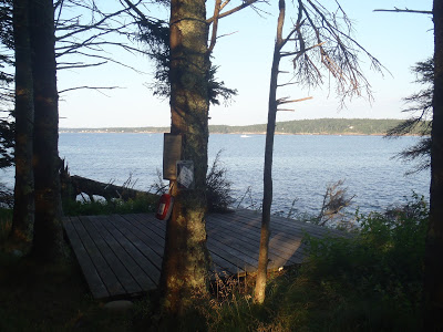 |
| I didn't always have a nice tent platform so this was also another luxury |

No Comments