


This is part 1 of 9 of my road trip along the International Appalachian Trail through Maine, New Brunswick and Quebec. Mt Chase is a 2,415ft (736m) tall summit located east of Mt Katahdin and stands as the tallest point on the trail between Katahdin and the international border.
Mt Chase is where this adventure begins! After leaving Portland and getting my plans straight for this trip, I set off for some summits! I decided to start this adventure at Mt Chase because it is a prominent summit just east of Katahdin and Baxter State Park. Its supposedly a gorgeous summit too although I happened to climb it in the fog and rain. Nevertheless, this is one of the first summits on the trail and a great place overlooking Aroostook County and Baxter.
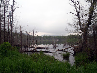
Mt Chase was interesting compared to the rest of the International Appalachian Trail- the trail was more overgrown and not as well maintained as it was in other areas. I also didn't see the familiar IAT/SIA blazes which were ubiquitous through the rest of the trail. Maybe I wasn't on the true trail, but the summit was. Here's a general map of what I hiked-
 |
| Hiking Mt Chase on the International Appalachian Trail |
Mt Chase was interesting compared to the rest of the International Appalachian Trail- the trail was more overgrown and not as well maintained as it was in other areas. I also didn't see the familiar IAT/SIA blazes which were ubiquitous through the rest of the trail. Maybe I wasn't on the true trail, but the summit was. Here's a general map of what I hiked-
View Mt Chase Hike, International Appalachian Trail in a larger map
Again, Mt Chase is off the beaten path so don't expect any road signs or obvious directions. From exit 264 on the I-95 freeway, drive 16 miles north through a few small towns and to "Mountain Road" which is marked but easy to miss. From here, I parked and biked in- I don't have the clearance for most of these roads. Regardless, you head about 2.5 miles down this road and past many logging road turn offs. Eventually this road turns into a genuine ATV trail and just keep going until you come to a small clearing. There will be a small, easy to miss sign marking the trail for Mt Chase. Its not hard to miss if you're looking for it but again, don't expect much!
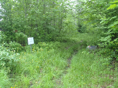 |
| The Mt Chase Trail |
The trail was not entirely difficult to follow but it wasn't well marked either. There were many herd paths and moose trails veering off the route which made it confusing at times. However with a simple map and GPS it was easy to follow. It was a steep but enjoyable hike through the woods. Eventually I hit a flatter section and saw this haunted looking cabin-
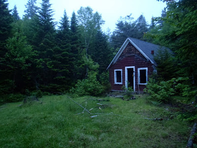 |
| Small, broken down cabin on the trail |
It was unfortunate that it was so foggy on this day as I heard the summit has some fantastic views. As I climbed higher, the fog closed in and by the time I hiked over the bare summit, there was just nothing to see but fog. I'm glad I made it to the summit because it seems like a fitting place to start this IAT exploration, but I would like to come back when it is sunnier. Nevertheless, I got a pretty creepy summit picture with the fog!
All said and done, the hike was somewhere around 4 miles, out-and-back and it took about 2.5 hours total.
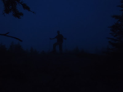 |
| Here I am... on the summit in the fog! |
After talking up the International Appalachian Trail so much, I suppose this is an unceremonious way to begin. The trail did get more and more magnificent as I traveled further North. So while there are no inspiring views or great pictures from this little hike, it is still a good place to start. The next day, I headed to the scenic summit of Mars Hill for a fantastic sunrise. The IAT was just getting started
Next: Hiking Mars Hill Maine and America's First Sunrise
Next: Hiking Mars Hill Maine and America's First Sunrise
Read. Plan. Get Out There!

No Comments