The Ossipee Mountains of New Hampshire are a smaller range often overshadowed by the White Mountains to the North. This range has its own complex of hiking trails and has some excellent views of the Whites and Lake Winnipesaukee.
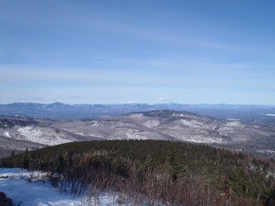 |
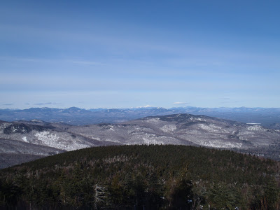
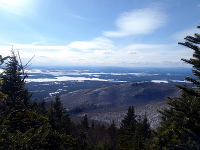
| The Summit of Mt Shaw has a commanding view of the White Mountains |
I know I'm probably the only person in Maine to ever say this, but thank goodness we finally have gotten some respectable winter weather and temperatures! Nothing ruins my day more than 45 degree days in January. MLK 2013 has brought with it a deep freeze as temperatures have plunged into the zeros and below zeros. Perfect hiking weather, right?
Mt Shaw is probably the closest summit to the place I live in Maine and I needed just a half day to bag this one. The whole Ossipee Mountains Region has always intrigued me because on a topographic map, it looks like New Hampshire's pimple. Seriously though, its almost a perfect circle and significantly separate from the White Mountains. Zoom out and see for yourself!
There is a somewhat organized network of trails which crosses through the region and snowmobilers can cross the summit as well. I wouldn't be surprised if it's one of the higher summits accessible by snowmobile. The most direct trail up Mt Shaw crosses over publically accessible private land before entering the
Castle in the Clouds Complex. The parking area is quite small and unmarked. I've marked it on the map above- its off of 171 in Tuftonboro. Its just before Sodom Road and a small bridge. If you're coming from the East and you start seeing signs for the Castle in the Clouds attraction, you've missed it. I missed it on the first pass!
Be warned, the parking lot has enough room for 3 cars at best. From here, there is an unmarked but well traveled trail that parallels the stream falling from Mt Shaw. Its slightly ambiguous in some sections, but even in the dead of winter, I was able to follow it to the summit.
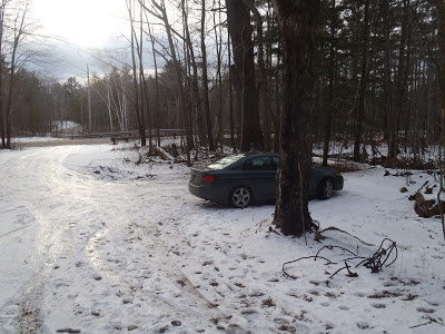 |
| The unmarked parking lot. |
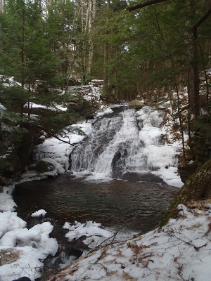 |
| The trail follows the stream for the most part. It certainly makes the steep ascent more scenic! |
 |
| Frozen stream |
The total distance is about 7.5 miles including Black Snout. This was a very enjoyable trail, all the way to the summit. Sometimes trails in New Hampshire can just seem murderously steep without any views but this wasn't one of them! I found the ascent to be delightful. There was one notably difficult crossing of the stream which took a little bushwacking to find a place where the ice was thick enough to cross. In the summer I'm sure it's not a problem but in the winter I had to be creative. Otherwise it was a straightforward ascent.
The trail comes to a "T" about a mile from the summit. This section is clearly marked and you just need to hang a right. After a short, flat section, it comes to another "T"- to the left is the trail to Mt Shaw and to the right is the trail to Black Snout. Both have excellent views and you might as well hit them both while you're there. The route to the high point is partially snowmobile trails so be careful. Otherwise it is straightforward and the summit has a complete panorama of the Whites. You can see nearly every major summit from this point!
 |
| Mt Washington is clearly visible in the center of the picture! |
 |
| Frozen Lake Winnipesaukee from the summit of Black Snout |
Its tempting to descend directly from Mt Shaw but Black Snout is not to be missed. Its only a slightly shorter summit and it has an equally amazing view of the southern mountains and Lake Winnipesaukee. Both summits had some of the best views in the state!
For a 7.5 mile hike, this was about as good as it gets!
Read. Plan. Get Out There!


No Comments