"Westernmost spot in contiguous America"
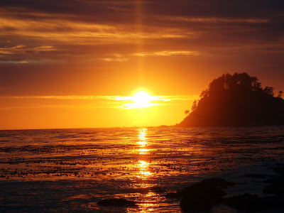 |
| Last sunset in America, Cape Alava Washington |
It only makes sense that after posting about America's first sunset that I should inform you about its last! Cape Alava is the westernmost spot of mainland in the contiguous United States. The sunset here is gorgeous as it sets upon the Olympic Coast of Washington. This place actually requires a longer hike through the temperate rain forest of the peninsula. So, if you have seen America's first sunrise, head out here and see its last!
Where is the westernmost point in America?
It is much more difficult to pinpoint the exact westernmost point on the Pacific coast. The coasts of northern California, southern Oregon and northern Washington are at essentially the same longitudes. While Oregon and Washington are said to have the "westernmost point" in the lower 48, the westernmost city in America is Eureka, California. So, its actually somewhat of a debate amongst geographers as to what' the true westernmost point.
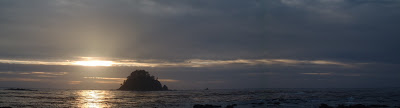 |
| Panorama of Cape Alava |
Cape Alava is generally accepted as the westernmost point in America however at high tide it is at the same longitude as Cape Flattery. Cape Flattery, the northwestern tip of the Olympic Peninsula is the most northwesterly point of the lower 48 states. Cape Blanco comes very close to being westernmost, but this is not accepted by most geographers or the US Geological Survey.
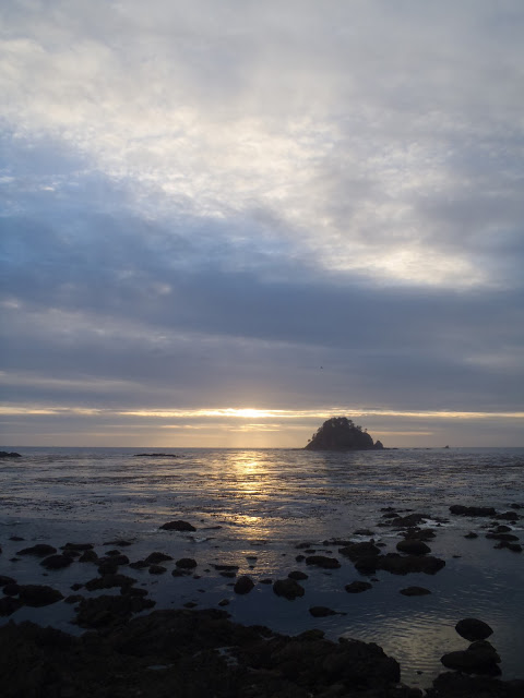 |
| Sunset on Cape Alava |
Hiking Cape Alava
Cape Alava can be reached by traveling to Ozette, Washington on the Olympic Peninsula. This seashore is managed by Olympic National Park and there is a visitor center at the trail head. The trail itself is very straightforward and is 3.3 miles to the sea. From the ranger station, you cross a small bridge over the river and turn right at the nearby fork. This is the Cape Alava trail and it is almost entirely on wooden boardwalk planks. The hike itself gives you a very good impression of the vast and lush forests that cover the peninsula. By the scientific definition, this is a true temperate rain forest.
 |
| The coastline of Cape Alava |
After 3.3 miles, you pop right out on the coast and can see several campsites. A small trail goes to the right to take you to the campsites and Cape Alava. As you pass the campsites you will come across a sign marking the entrance to Ozette Indian Village Archaeological Site and the Indian reservation. From here, its pretty obvious, simply go to the water and you are west! There are several large stony points that make the scene very picturesque.
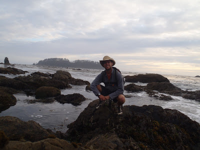 |
| Only a month earlier, I was at the easternmost point in America! |
My Extreme Point Adventures
If you've read my last blog post on West Quoddy Head (
https://quincykoetz.com/2011/02/west-quoddy-head-maine-americas-firs/), you might have picked up on my most recent adventure goal. I'm now trying to travel to all the "extreme points" of America. This includes the northernmost and southernmost points in the lower 48 as well. I hope to someday travel to the Northwest Angle of Minnesota and Key West, Florida which would make my adventure complete. Also, in case you were interested, Point Loma, California, is the most southwesterly point in America. Of course, if you include Alaska, Hawaii and outlying territories then this becomes a much more challenging affair. Onward!
Read. Plan. Get Out There!


4 Comments
btr1976
October 5, 2011 @ 18:00
I found your post while researching the most extreme points of the US. I too have been on a trek to visit the most extreme spots of the lower 48! I have been to Lubec Maine and Key West. And this spring I will be near Bellingham, Wa, so I am hoping to reach the westernmost point. Do you recall if there was a geographical marker in the area that depicts the area as the westernmost point? I like to have photographic evidence!
Joe
October 15, 2011 @ 15:51
Hello! I did not see any marker that depicted the westernmost point, but that might be because it is technically on an indian reservation. It definitely is the westernmost point though!
Have you made it to the Northernmost point up in the Northwestern Angle of Minnesota?
fazal ameen
February 12, 2016 @ 12:31
Thank you for such a well written article. It’s full of insightful information and entertaining descriptions. Your point of view is the best among many.
Point of Americas
Quincy Koetz
February 20, 2016 @ 16:29
You're welcome! Still one of my favorite places for a sunset in the western US!